Monday, November 9, 2015

The Militant's Pacific Electric Archaeology Map

P to tha E, yo.
So how was your Summer? You might have watched the hottest blockbusters, attended some awesome outdoor concerts or spent some time at the beach...

...But The Militant hardly did any of those things.

Now, you may to may not know that The Militant has written things like his insanely popular Epic CicLAvia Tour posts, of which he has done for every single CicLAvia route in the last five years. And he has also dedicated an entire week of special posts to places like Long Beach or the San Gabriel Valley (Okay, he didn't do an entire week for the SGV, but he owes you 626ers another one, he promises!). He has even done posts throughout September 2011 dedicated to our native people, flora and fauna.

The Militant has spent the past five months hard at work on his most epic of epic works ever. His passion project, if you will. Something he's shed a lot of blood, sweat and tears over (but mostly gas, TAP card value, pedal power, hiking mileage and solitary reading): An interactive map detailing all of the existing remnants of the Pacific Electric Railway.

This is not the map you're looking for. You can hardly read it :P
Now, if you don't know what the Pacific Electric is, then you might as well close the browser window right now. But just in case you've suffered amnesia, the Pacific Electric was the 1,100-mile rail transit system that spanned across Southern California before the era of freeways. Its legendary "Big Red Cars," as their trains were affectionately known round these here parts, not only transported people, but played an unprecedented role in So Cal's population, economy, culture, growth and human geography. For the sake of reference, The Militant will use the terms "Pacific Electric," "PE" and "Red Cars" interchangeably. As a corporate entity, the Pacific Electric lasted from 1901 to 1953. But the rail system and infrastructure that comprised the PE stretched to as far back as the 1880s, and the Red Cars themselves, though no longer painted red, rolled on our local rails until 1961. And even today's Metro Rail system, unfairly compared to its older and much more expansive predecessor, is still, by all intents and purposes, a direct descendant of the PE (more on this later).

Throughout this week, The Militant will be doing posts on various aspects of the PE that you may or may not have known before, including some things that will totally change the way you see Los Angeles, like forever.

For now, though, let's get to that map.

The Pacific Electric was perhaps the main reason The Militant Angeleno became a Militant Angeleno in the first place (after seeing an article in the old Los Angeles Reader in the late 1980s). After learning gradually about locations where remnant tracks or stations remained, he had always wanted to create a list or map -- as comprehensive as possible -- with their exact locations.

The advent of Google's Google Maps changed the game, and this playa wanted to throw down.

And so, ladies and gentlemen, natives and transplants, here it is, at long last: The Militant Angeleno's Pacific Electric Archaeology Map [cue the John Williams score]:


The full-size version of The Militant Angeleno's Pacific Electric Archaeology Map can be seen here so you can inevitably add it to your Bookmarks (you know you want to):


How To Use This Map
This is an interactive Google Map, which means you can click, drag, and zoom using your navigational device of choice. The Militant highly recommends you zoom in as close as possible, as some icon locations are directly next to each other, and might not be visible in the zoomed-out views of the map.

The map features various elements: Track and Track Remnants, Stations and Depots, Infrastructure, Electric Power Substations, Public Art, Surviving Red Cars and the PE Lines themselves. Click on the icon representing each of them and a pop-up window featuring a photograph of the location (Virtually all visited and taken by The Militant himself unless otherwise specified) which features the address and a description.  Think of all of Southern California as a living Pacific Electric museum, and this is your guide to the exhibits. And this map is by no means a passive virtual coffee table pictorial. The Militant encourages -- no -- commands you to go out and visit these locations yourself, to see with your own eyes and experience the ghosts of the Pacific Electric first-hand (and sure, The Militant doesn't mind at all if you take PE selfies (please hashtag #PacificElectric though).

Track and Track Remnants 
Click on the purple track icon to view the locations of known remaining Pacific Electric track. Many of them are still peeking out of the pavement in the street, some are hardly visible. But some tracks are fully intact. A great deal of the track is abandoned, though several miles of former PE track have been re-purposed as freight track and is still in use. The thing about railroad track is that the rails themselves, when still in use, are replaced over time. Often times, the rails have the year that the steel was forged embossed on the rails themselves. But the wooden ties the rails sit on could be originals from the PE era, though they themselves can also be easily replaced. The Militant used his best judgment according to research and the visual condition of the tracks. All of the track sections on the map represent the ones still existing from the PE era. Removed or fully-covered track is not represented. A number of streets still have PE track buried in the pavement (Hollywood Boulevard, The Militant is looking at you), but unless at least the tops of the rails can be seen, they do not qualify for inclusion in the map.

Stations and Depots
Click on the circular Pacific Electric logo icon to see the two dozen station structures, ranging from large buildings, to depots, to simple passenger shelters, still in existence. Some have been moved from their original location, but as long as they still exist, their present location is listed on the map (their original location is listed in their description). Some have been preserved to their original look, but others have been re-purposed as restaurants or other businesses. In many cases, historical plaques and some sort of historical designation can be found on or near these remaining structures, as they are still proud elements of the histories of their respective communities.

Infrastructure
Click on the black bridge icon to see the over 40 extant bridges, foundations, abutments, bridge supports, tunnel portals and non-station structures from the Pacific Electric. Some of these are obvious sights, easily seen from a street, such as Torrance's iconic El Prado Bridge, but many of them are quite off the beaten path, such as various bridges over the Los Angeles, San Gabriel and Santa Ana rivers (in those cases, they are accessible from bike trails). You may or may not have seen some of these structures before and have never known they were PE artifacts! Note that the PE also ran a bus system called Motor Coach Lines. Though some of their structures are still existing as well, The Militant did not include them in this map (Rail bias, yeah).

Electric Power Substations
Click on the red lightning bolt icon to see the 10 remaining electric power substations. The substations were buildings that housed the transformer systems that took electricity from the regional Southern California Edison or Los Angeles DWP power grid and converted the juice to the 600 or 1200 volts that fed the overhead wires to power the Red Cars. They literally put the "Electric" in "Pacific Electric." And since they were all built in the early decades of the 1900s, they are far more architecturally ornate than their modern-day, utilitarian Metro Rail counterparts (which are also much smaller due to advances in technology).

Public Art
Click on the artist's palette to view the many PE-related public art installations scattered around the Southland. Though not a part of the Pacific Electric per se,  the legend and legacy of the PE has inspired artists throughout Southern California to create murals, sculptures and other art installations that were inspired by or pay homage to the iconic Big Red Cars. Most of these pieces were created in the 21st century -- indicative of both the importance of public art in today's world, as well as the historic and cultural stature of the PE. Nearly all of these art pieces pay homage to the PE lines that ran in the exact location or in the vicinity that the artwork is located in. Mural-wise, many of the pieces were done by three artists: Atwater Village's Rafael Escamilla, Long Beach's Jose M. Loza and Art Mortimer, who painted period-piece murals in the coastal and inland extremes of the PE system. The PE-inspired public art is a key element in conveying the history of our old transportation system.

Surviving Red Cars
Click on the red trolley car icon to see where over 40 remaining Red Cars can still be found, in some form, in Southern California. Most of the beloved Red Cars, upon the system's decline, were either sold off to transit systems overseas (such as Buenos Aires, Argentina and Cairo, Egypt), or unceremoniously buried at sea off the coast to create artificial reefs. But some Red Cars still survive. Most can not only be seen but can be ridden at Perris' Orange Empire Railway Museum, and a few are scattered around Southern California as historical display items, or even re-purposed as buildings. The two replica Red Cars that ran in the recently-closed San Pedro Waterfront Red Car line are included, as they did run on an original PE route and virtually carry PE DNA through their dimensions and functions. However, the little Red Cars that run around Disney's California Adventure theme park in Anaheim, though a heartwarming Disney-fied tribute, are not included in this section, as they did not run on any original PE line, nor are they accurate replicas of original cars. They are included in the "Public Art" category, though.

The Lines
Click on the red lines on the map to see exactly where the PE passenger routes went (there were also PE freight lines, many of which shared track with corporate parent Southern Pacific, but those are not listed on the map, and likewise the PE's Motor Coach Lines bus network is not part of this map). Another thing that must be mentioned is the separate-but-related Los Angeles Railway (LARy) system (a.k.a. The Yellow Cars), also founded by Huntington. Those lines were not included on this map (Sit tight, folks, The Militant might make his own map for the LARy one day). Many historic maps of the PE exist, but none give the exact locations of the routes. This map was meant to get Southern Californians to understand were exactly the lines ran. You might live or work right near, or even along a former Red Car line and have never even known it! The lines were meant to represent all of the locations where the PE's tracks ran at one time or another. Keep in mind that not all of the lines existed all at once -- some lines were shut down as early as the 1920s. Also, most of the lines on the map are a comprehensive representation of the entire route. The PE network used trunk lines that were shares by multiple routes, which then branched out into various destinations. The full route is listed in the description. This was perhaps the most research-intensive part of this map-making process. The Militant used the Electric Railway Historical Society of Southern California's PE website, Harry Marnell's PE line pages, Abandoned Rails.com, various PE books, the maps archive at the Los Angeles Central Library and the 1981 Caltrans Inventory of Pacific Electric Routes (thank you Dorothy Peyton Grey Metro Library!) as main sources of information.

You can also view larger-sized photos, plus additional pics at The Militant's Photobucket site:
http://s24.photobucket.com/user/militantangeleno/library/Pacific%20Electric%20Map?sort=3&page=0

So there it is, take it. If you happen to find any errors, or know of another location where PE artifacts can be found that have not been included in this map, please contact The Militant ASAP at militantangeleno@gmail.com.

Wednesday, October 28, 2015

#SaveThriftyIceCream


The biggest financial news headline on Tuesday was the announcement that the Chicago-based Walgreens drugstore giant will be buying its rival, Rite Aid Corporation for $17.2 billion.

Now for most people in the United States, that simply meant another corporate acquisition. But for those of us here in the West Coast, specifically Southern California, that meant the future of our beloved Thrifty Ice Cream was in question.

Now if you're too young, or too new to these here parts, here's a little 'splainin'.

Thrifty Ice Cream is the last vestige of the Los Angeles-based Thrifty Drug and Discount Stores, which was purchased by  the Pennsylvania-based Rite Aid Corporation back in 1996. Back then, the biggest concern was also the fate of the beloved award-winning ice cream, made locally in El Monte and sold by the cone and by the pint in Thrifty counters, as well as in prepackaged form in the stores' frozen goods section.

The ice cream was -- and still is -- a part of Southern California life (as well as West Coast life, as Thrifty stores stretched to Arizona, Nevada, Idaho, Oregon and elsewhere in the Golden State), originally conceived as a way to attract more customers into its discount stores.

The Thrifty (though many a local used the possessive-but-not-correct possessive form "Thrifty's") chain was a local institution, which started in Downtown Los Angeles by the Borun Brothers in 1919, becoming Thrifty Drug and Discount Stores in 1935. The chain grew, particularly in the post-war era as suburbanization flourished throughout Southern California. The stores were initially drug stores, but they sold other types of merchandise, from clothing to toys to sporting goods. In fact, they very much resemble today's Target stores, albeit in a smaller footprint (though Target itself has recently announced some smaller-sized urban stores opening in the near future -- what comes around, goes around).  In the early '70s, Thrifty even purchased Big 5 Sporting Goods. Thrifty was the king of the world as far as drugstores were concerned. The only other drugstore playaz in town were Sav-On Drugs, Longs Drugs (both of which were assimilated into the CVS borg in 2007) and much smaller dealios like Horton & Converse (which still exist today).


The Militant grew up close to one unspecified Thrifty store. They had everything. He got Star Wars figures, board games and even his first stamp collecting kit there. They even sold bikes and baseball gloves. Before Militant Papa took the family out to fishing trips to Long Beach or the Salton Sea (before it got nasty), he not only bought his rods, line and bait there, but his fishing license as well.

Things changed in the 1990s, though, as pharmacies -- the mainstay of Thrifty stores since its inception -- were being more integrated into supermarkets and department stores. Thrifty also took a hit during the 1992 Riots as many of its stores were burned, looted or vandalized.

Ultimately, the beloved ice cream was retained by Rite Aid and turned into a subsidiary, as the new corporate ownership understood the cultural and nostalgic value of the frozen treats (though they make you pay for your double scoop of Rocky Road at the regular check-out counter).

Now, we're faced with a new corporate acquisition, and through the Rite Aid brand will remain for the foreseeable future, we still want to tell our Chicago-based drugstore corporate overlords (who might not even know of the existence of Thrifty Ice Cream) that they can do what they want with the Rite Aid brand per se, but keep our beloved Thrifty Ice Cream.

Now there is some hope: Walgreen's purchased NYC drugstore chain Duane Reade in 2010 and the Big Apple is full of Walgreens-owned, DR-branded drugstores. Maybe, just maybe, they could possibly take things to the next level even revive the Thrifty Drug brand like dinosaur DNA encapsulated in molasses, but knowing full well how other local institutions have been treated by their own Chicago-based corporate overlords, don't hold your breath.

In the not-so-distant future, there will only be two: Walgreens and CVS (of course, many intersections already sport those two chains across the street from each other). All we're saying, oh mighty Walgreens Corporation, is this: You keep our Thrifty Ice Cream and we won't shop at CVS. It's as simple as that. Deal?

In the meantime, let's use the power of social media and shame let Walgreens know what one of the largest consumer markets in the country wants: Tweet to @walgreens #SaveThriftyIceCream (or RT The Militant's tweet), or let them know on their Facebook page!

Saturday, October 24, 2015

6TH STREET (BRIDGE)...WE LOVE IT!


A vision of the future on the past and present.
On Saturday, the 6th Street Viaduct got some major love with a big-ass farewell shindig on the bridge itself in the form of the 6h Street Bridge Festival. Most of you were there so The Militant will spare the big explanation. But it was hosted by Los Angeles City Councilman Jose Huizar (who never sounded more amp'ed up, and had some cool live music performances, culminating with a free concert set by Los Angeles' very own WAR. The bridge will be closed on the first week of 2016, so make your last visits now!

The bridge was immortalized in art.
Lowrider heaven. Just to let you know you're in The Eastside.
Los Angeles' contribution to funk music, the band WAR, playing all of their hits (though they skipped "The World is a Ghetto").
LED lighting and a smartphone-bearing crowd. What could look more early 21st Century than this?
Fireworks end the night. But the bridge will remain for the rest of the year.

Wednesday, October 14, 2015

The Militant's Epic Militant CicLAvia Tour 3.5!!!!


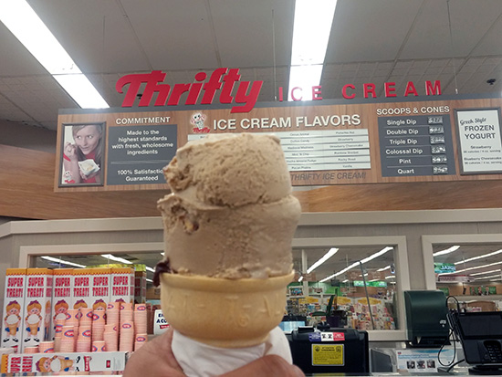
A certain state/local agency believes that the first 5 years of a child's life is crucial for its development and eventual success and well-being later in life. Our little youngster CicLAvia is now old enough for Kindergarten and during its first 5 years of life, it's taken us all over Los Angeles from Venice Beach to East Los Angeles, from North Hollywood down to South Central (and even Pasadena as well). Our little kindergartener has been well-loved by Angelenos, and well-cared for by its parents and godparents. Since it was born, it even has younger siblings born in places like San Diego and Long Beach. So, this child is off to a very happy start in life, and like every happy youngster, never fails to make us all smile. Happy 5 years, little CicLAvia!

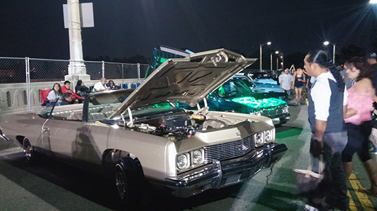
As you may or may not know, The Militant has been doing these local CicLAvia guides ever since the second CicLAvia in April 2011. Though this "Heart of L.A." ride -- the 15th iteration of CicLAvia since it be can in 2010 -- runs through some very familiar territory, especially for you veteran CicLAvians (all you 15-timers, let's hear ya!), this is a City that's known for change, and even in the past 5 years, certain places have changed with a look towards the future. This Epic Militant CicLAvia Tour guide also reflects that, with a few updated locations added to the route, including a couple sites that will never look the same again.

To celebrate 5 years of CicLAvia, The Militant invites you to comment or tweet (Hashtag #EpicCicLAviaTour) some of your favorite memories from the past 5 years.

Happy CicLAvia and STAY MILITANT!

1. Hollenbeck Park
1892
4th and St. Louis streets, Boyle Heights

John Edward Hollenbeck was a rich dude in the late 19th century who founded the First National Bank of Los Angeles (more on this later) and purchased parcels of land in Downtown, the San Gabriel Valley and the Eastside, where he made his home. Hollenbeck was also credited with the creation of what is now called Exposition Park. His sister married his friend, James George Bell, who founded...Yep, you guessed it! After Hollenbeck's death in 1885, his widow, Elizabeth, donated a 21-acre parcel of land, which was essentially their front yard, to the City. One of the Los Angeles’ oldest parks, it was established in 1892 and continues to function today.

2. Hollenbeck Palms (Site of the Hollenbeck Residence)
1896
573 S. Boyle Ave, Boyle Heights

Take a quick detour from the CicLAvia route on 4th street and head down Boyle Ave a block and a half south. On the site of this retirement facility, which directly dates back to the Hollenbecks' involvement, John and Elizabeth Hollenbeck made their home. The original Hollenbeck residence had a room built for the care of John's elderly father. After John's death, Elizabeth donated land she owned across the street (since visually separated from Boyle Ave in the 1950s due to construction of the 5 Freeway) for Hollenbeck Park and, in another act of philanthropy, created the Hollenbeck Home for The Aged on her property in 1896, offering free board and care for the residents for the rest of their lives. After Elizabeth's death in 1918, the Hollenbeck Trust operated the elderly home (modernized in 1985), and continue to run it today.

3. 6th Street Viaduct
1932
6th Street (visible from the 4th Street Viaduct) at the Los Angeles River, Downtown

While on the 4th Street Viaduct, pause for a moment (when you're not pausing to take that group selfie with the Downtown skyline in the background), point your eyes due south and take a good look at your bridge's cousin, the 6th Street Viaduct, with its trademark double arches. This will most likely be the last time you'll see it in its present form.

In 2007, engineers discovered that the 3,500-foot concrete connection between Downtown and Boyle Heights had a condition since it was first built called Alkali-Silica Reaction, which meant that the high alkali content in the source material in the concrete causes a chemical reaction to weaken it, rendering the bridge extremely vulnerable to collapse during a stressful event such as an earthquake.  The City of Los Angeles will shut down the bridge in November and begin demolition work for its 
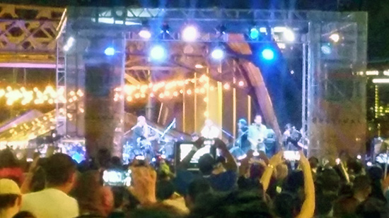
21st century-style replacement -- but not before throwing a big-ass concert and street party (bridge party?) next Saturday.

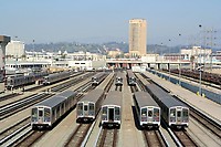
4. Metro Division 20 subway car yard and site of old Santa Fe LaGrande Station
1992 / 1893
320 S. Santa Fe Ave (visible from the 4th Street Viaduct), Arts District

Take a break from riding/walking/skateboarding/pogo-sticking/etc. and take a glance off the north side of the bridge from the west bank of the River. This facility is where the 104 Italian-built subway cars of the Metro Red and Purple line cars are stored, repaired, serviced and cleaned. This was also the temporary storage and repair site of the Angels Flight railway cars after the fateful 2001 accident. The Militant actually visited this facility back in May 1992.

The subway cars are also serviced on the site of the old Santa Fe Railway La Grande Station (hence the name of the street) that was on Santa Fe and 2nd. Built in 1893, it was precisely where midwestern transplants arrived in Los Angeles after paying their $1 train ticket from Chicago. In 1933, the landmark dome was damaged by the Long Beach Earthquake and subsequently removed. In 1939, it was rendered obsolete by the opening of the new Los Angeles Union Passenger Terminal a few blocks north.

5. Site of Southern Pacific Arcade Station
1888-1914
4th and Alameda streets, Downtown Los Angeles

Before there was a Union Station, there were various rail passenger terminals in Los Angeles, many of them just a short distance from the Los Angeles River. On what currently stands as a large shopping mall, this was the original site of the Southern Pacific Railroad’s Arcade Station which served passengers up until 100 years ago. A popular landmark of this station was a young palm tree, which was moved a century ago to Exposition Park where it stands today, much taller, in front of the Los Angeles Memorial Coliseum. Unfortunately for indie rock fans, the Arcade Station was not devastated by a Fire, but was dismantled and replaced by a new station, the Central Station, located one block south.

6. Metro 1st St /Central Station Site
2020
1st Street and Central Avenue, Little Tokyo

Up until last year, this lot was home to the popular Señor Fish taco joint (formerly the site of '70s-'80s punk venue Atomic Cafe) and Weiland Brewery Restaurant (which opened replacement locations in Echo Park and Uptown Long Beach, respectively). Both buildings were demolished in early 2014 to make room for this new Metro subway station for the Regional Connector Transit project, which, upon opening by 2020, will merge three light rail lines into two and allow passengers to ride from East Los Angeles to Santa Monica and from Azusa to Long Beach, without a transfer to the Red/Purple lines. This new station will replace the surface-level Little Tokyo/Arts District station across the street.

7. Site of Quaker Dairy, Original Little Tokyo Restaurant
1890
304 E. 1st St., Little Tokyo
On the southeast corner of 1st and San Pedro streets once stood the Quaker Dairy, a restaurant started on this site in 1890 by Sanshichi Akita, an immigrant from Japan. Though preceded five years earlier by another restaurant on First St (location unknown), this is the oldest traceable location of a Little Tokyo business. By the end of the 19th century, there were over 16 Japanese-owned restaurants in this stretch of 1st Street, creating what we know as Little Tokyo.

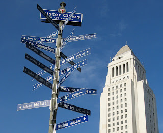
8. Los Angeles Sister Cities Monument
1987
1st and Main streets, Downtown

On the northeast corner of 1st and Main streets stands a pole bearing signs (in the "Blue Blade" style, no less) for every one of Los Angeles' 25 Sister Cities, each pointing towards their location. The signs range from Lusaka, Zambia (the farthest sister city, 10,017 miles) to Vancouver, Canada (the nearest, 1,081 miles) and everywhere in between. Nagoya, Japan is Los Angeles' oldest sister city (1959); Yerevan, Armenia is the newest (2007). Los Angeles, an Olympic host city (1932, 1984) also has that in common with sister cities Athens (1896, 2004), Berlin (1936), Mexico City (1968) and Vancouver (2010). Okay, the Militant is just filling up this paragraph with mindless trivia.

9. Los Angeles Police Administration Building
2009
100 W. 1st St, Downtown

Having opened less than two years ago, there's nothing really historic about this building, but do stop and take a picture of City Hall's reflection from the facade's glass panel. It's like, the thing to do!


[NOTE: If going on the northern leg to Chinatown, skip down to 21.]


10. Site of the Wilcox Building, First National Bank
1896
2nd and Spring streets, Downtown

Remember Mr. Hollenbeck? He be makin' serious bank! Oh wait, he literally did. As was mentioned, he founded a bank called the First National Bank of Los Angeles, which made its original home here on the southeast corner of 2nd and Spring in what once stood the Wilcox Building. Check this out: First National Bank merged with the Farmers and Merchants Bank to become the Security-First National Bank, which became Security Pacific National Bank (1967), and was eventually purchased by Bank of America in the 1990s. 

11. Site of Hollenbeck Hotel & Metro 2nd St/Broadway Station Site
1884/2020
2nd and Spring streets, Downtown

Man, this Hollenbeck dude got around! We're not quite through with him yet. Directly across Spring Street from the bank stood the Hollenbeck Hotel, a pretty swanky, bougie inn back in the day. He owned not just the hotel, the entire block the hotel stood on (He sooo money!). As more hotels were being built in Downtown, this one eventually lost ground to its competitors and was demolished in 1933. The site has been a parking lot for the past several decades, but is currently the construction site for the upcoming Metro Rail Regional Connector Transit Project 2nd/Broadway Station, one of three new light rail subway stations coming to Downtown in 2020.

12. Broadway-Spring Arcade Building
1924
541 S. Spring St, Downtown

This unique building is actually three, opened in 1924 on the site of Mercantile Place, a 40-foot street cut between 5th and 6th streets connecting Broadway and Spring. Mercantile Place was a popular shopping and gathering locale in the early 1900s. Having fallen into decay by the 1970s, it was recently renovated and is now famous for, of all things, vendors selling rock band t-shirts. It also becomes an artistic venue during the DTLA ArtWalk. And The Militant probably doesn't need to mention that this building is home to the DTLA Guisado's.

13. Site of Original Ralphs Supermarket
1873
6th and Spring streets, Downtown

Before the Hotel Hayward building was built in 1905, George A. Ralphs (see, that's why there's no apostrophe) and his brother Walter B. started the Ralphs Bros. Grocers on the southwest corner of 6th and Spring. Their company still continues to this day, and in 2007, the company that started in DTLA returned to the area after some 50 years.

14. St. Vincent Court
1868
St. Vincent Ct and 7th Street, Downtown

You'd hardly knew it was there, but this alley nestled between Broadway and Hill (blink and you'll miss it!), with its decorative brick pavement and European decor, seemingly belongs to another world. Originally the site of a Catholic college that was the predecessor of today's Loyola Marymount University, today it's a unique food court featuring Armenian and Middle Eastern eateries. The Militant calls it, "Littler Armenia." Check out this Militant Angeleno post on St. Vincent Court from 2008 for more info!

15. The Bloc (Formerly Broadway Plaza/Macy's Plaza)
1973
7th Street between Flower and Hope streets, Downtown

A poster child for change in Downtown, this shopping center, originally built in 1973 and designed by Charles Luckman & Associates as the first suburban-style mall in DTLA combined an indoor (though massively truncated) indoor galleria, a hotel and a 32-story office building. Initially known as Broadway Plaza, named after the old upscale Southern California department store anchor tenant, its name was changed to Macy's Plaza in 1996 after The Broadway merged with the NYC-based equivalent Macy's. Its blocky, street-unfriendly design was derided by many, especially in an era where the outdoor mall format pioneered by Santa Monica's Third Street Promenade, and Rick Caruso's faux-urban monstrosities (and more recently, the newly-opened The Village at Westfield Topanga),  so in 2013 it was re-conceptualized as "The Bloc" and currently stands as a work-in-progress, (which will also feature a direct entrance to the 7th Street/Metro Center subway station). Expect its 2016 grand opening to feature a big-ass Bloc party (The Militant made a funny, hardy har har...).

16. Wilshire Grand Center Site
2017
Wilshire and Figueroa (SW corner), Downtown

What's with all this construction going on here?

Previously the site of the Wilshire Grand Hotel, and formerly (in reverse chronological order) the Omni Hotel, Los Angeles Hilton, Statler Hilton and Statler Hotel, on this site will rise the Wilshire Grand Center, Los Angeles' (and the West's -- suck on it, Salesforce Tower SF!) tallest building at 73 stories and 1,100 feet (kinda sorta, there's a spire, you see...). It will also be Los Angeles' only modern skyscraper without a flat roof, which will house Wilshire Grand Hotel 2.0 and a bunch of shops and condos. The building will also have a "sky lobby" up at the top and will be the first skyscraper anywhere to sport a mohawk.

In February 2014, this construction site earned a Guinness World Record as the longest continuous concrete pour for its foundation structure.

17. City View Lofts/Young's Market Company Building
1924
1610 w. 7th St., Pico-Union

Ever wondered what's the deal with this 4-story Italian Renaissance-style building? It was built in 1924 as a liquor warehouse and original headquarters for Young's Market Company, which still operates today as the largest liquor distributor in the West. This building features actual marble columns and a decorative frieze made of terra cotta. The company, in the roaring, pre-depression 1920s, just felt like it. The building was looted and burned in the 1992 Riots and was rehabbed in 1997 to become the City View lofts. The building is in the National Register of Historic Places.

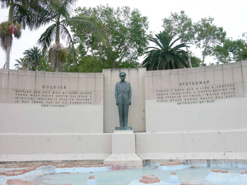
18. Gen. Douglas MacArthur Monument
1955
Southeast corner of MacArthur Park, Westlake

It's sort of strange how a monument to the park's namesake seems almost invisible (Gen John Pershing, MacArthur's WWI counterpart, could totally identify). In fact, most people don't know it's even there, but on the southeast shore of the lake is a dormant memorial fountain featuring a statue of the WWII general overlooking a model of the Pacific theatre (no, not that one) where he led allied forces to eventual victory. It was designed and built in 1955 by Roger Noble Burnham, who previously sculpted the Tommy Trojan statue on the USC campus and taught at the Otis Art School, formerly located nearby.

19. The Spheres at MacArthur Park
2015
MacArthur Park Lake, Westlake

This public art installation by Santa Monica-based nonprofit Portraits of Hope, is one of several projects the organization has done nationwide as a form of creative therapy to benefit seriously ill and disabled children. Nearly 3,000 vinyl spheres, decorated by Portraits of Hope volunteers, were placed in the water (each anchored by a sack of rocks and rope) starting in August, and were originally intended to stay until the end of September. But fortunately, just for you CicLAvians, the installation will remain in time for Sunday, so get your floating ball selfie action on!

20. Gen. Harrison Gray Otis Statue
1920
Northeast corner of Wilshire and Park View, Westlake

Gen. Otis is perhaps the most visible statue at the park, which predates MacArthur's WWII service. This general served in the Spanish-American and Philippine-American wars, and also fought as a Union soldier in the Civil War. But in Los Angeles, he is most known for being the founder, owner and publisher of the Los Angeles Times.

So why is he here? His Wilshire Blvd mansion, called The Bivouac, was located across the street, was later donated to Los Angeles County and became the original campus of Otis Art Institute. It's thought that his statue is pointing to the site of the Elks Lodge, but he's probably just pointing to his old house.

Northern Leg (To Chinatown):


21. Federal Courthouse Site
2016
145 S. Broadway, Downtown

That big-ass hole in the ground by 1st and Broadway has been here for, like, forever. But it was once the site of the Junipero Serra State Office Building, which was damaged in the 1994 Northridge Earthquake and abandoned and demolished in 1998. Right now,  it’s the construction site for a 10-story, 400-foot-tall U.S. Federal Courthouse building (don't we already have a few of those?), designed by Skidmore Owings and Merrill, which will open in 2016.


22. Grand Park
1960, 2012
Open space between Grand Avenue and Spring Street, Downtown

Grand Park isn't really a new park, but a renovation and re-branding of what used to be the Los Angeles County Mall.  Since then, it's become Los Angeles' new town square, hosting everything from concerts, to festivals, to weekend movie screenings, to holiday programs, to just a place where kids can splash around in the fountain. The Militant was there on its opening day back in July 2012!

23. Hall Of Justice
1926
Temple Street and Broadway, Downtown

No, you won't find Superman or any of the Super Friends here.  But this building, the oldest surviving government building in the Los Angeles Civic Center, was built in the mid-1920s as the original Los Angeles County Courthouse and Central Jail (which once housed the likes of Busy Siegel, Sirhan Sirhan and Charles Manson), as well as the headquarters for the Sheriff's Office, the District Attorney and the County Coroner. This Beaux Arts-style building was designed by Allied Architects Association, an all-star team of local architects put together to design publicly-funded buildings. At the moment, its facade is covered in scaffolding and tarp, as part of a major renovation project to modernize the facilities and repair damage from the 1994 Northridge Earthquake. It recently re-opened as a LEED Gold Certified building (gotta be sustainable, y'all), and the Sheriff's and District Attorney's offices will return.

24. Site of Los Angeles' French Quarter
c. 1830s-1960s
Aliso Street and Arcadia Street, Downtown

Beleive it or non, Los Angeles had a French ethnic enclave, called The French Quarter. Before today's Hollywood Freeway trench and nearby parking lots was a bustling community of Franco-American businesses and institutions. When Frenchman Jean-Louis Vignes bought up land on the Yangna village site a few blocks east on Aliso Street, he essentially became the anchor of our French community. In 1912, businessman Marius Taix opened the Champ D'Or Hotel on Commercial Street and then opened his namesake restaurant in the same building in 1927. But the most famous constibution to our French Quarter was Philippe Mathieu's restaurant, which opened in various locations in the area. In 1918, his restaurant on 246 Aliso Street gave birth to The French Dip sandwich. But urban development (and cultural assimilation by the community) destroyed the French Quarter. In 1951, Philippe's moved a few blocks north to their present location on Alameda Street due to Hollywood Freeway construction, and Monsieur Taix's restaurant moved a decade later to Echo Park.

25. Chinatown Gateway Monument
2001
Broadway and Cesar E. Chavez. Avenue, Chinatown

Designed to be the symbolic entrance to Los Angeles' Chinatown District, The Chinatown Gateway Monument, a.k.a. the Twin Dragon Towers Gateway, depicts two dragons grabbing at a central pearl, which symbolizes luck, prosperity, and longevity. The 25-foot-tall structure was put up in 2001 and occasionally emanates steam coming from the dragons' mouths. Unlike Anglo dragons, the creatures in Chinese folklore are the good guys, meant to scare away evil spirits.

26.  Buu Dien
c. 1990s
642 N. Broadway (Facing New High St, south of Ord), Chinatown

If you're ever in some TV trivia contest on your way to being a millionaire and the host asks you, "What is the Militant Angeleno's favorite Vietnamese banh mi place west of the Los Angeles River?" you won't need to call a lifeline, because the answer is Buu Dien. When the Militant has only $4 in his pocket and wants to get a meal in Downtown, this is his go-to joint. A literal hole in the wall in every regard, this place serves bomb-ass (do people still use that phrase) Viet sammiches for less than $3 a pop. And the bread is awesome. And nice and warm. Plus they also serve up spring rolls, desserts, pastries, Vietnamese coffee and pho (never had it here yet, but The Militant's favorite pho WOTLAR is Pho 79 just up the street). People complain about parking in his micro-mini mall, but this is CicLAvia!

27. Capitol Milling Co.
1883
1231 N. Spring St, Chinatown

One of the last visible vestiges of Los Angeles' agricultural industry, this family-owned flour mill operated from 1831 to 1997, before moving its operation to a much larger facility in Colton. The facility that still stands today was built in 1883. The mill supplied flour to clients such as Ralphs, Foix French Bakery and La Brea Bakery. In 1999, the family-owned operation was purchased by industry giant Con-Agra Co.


The historic building, built even before the railroads arrived in Los Angeles, still has a horse-tethering ring, back to the days when grain was hauled by horse carriage from farms in the San Fernando Valley.

28. Old (New?) Chinatown Central Plaza
1937
Gin Ling Way between Broadway and Hill, Chintown

The new northern terminus of CicLAvia is no stranger to public events; it was made for them. In the Summer it hosted three very popular Chinatown Summer Nights events. But don't let the "Old Chinatown" neon sign fool you -- This is actually Los Angeles' new Chinatown, which dates back to the 1930s. The real Old Chinatown was several blocks south, where a thriving community of Cantonese-speaking immigrants

lived near the river, north of Aliso Street. Of course, they were kicked out in the early '30s to make room for Union Station. So they moved a few blocks north, in the former Little Italy, and they've been there ever since. Well, not really, since some of them moved east to the San Gabriel Valley and were supplemented with Mandarin-speaking immigrants from Taiwan and Mainland China. But you get the idea.

Monday, September 28, 2015

The Village, People: The Militant Takes On The Village at Westfield Topanga


Ah, the shopping mall. The grand cathedral of consumerism. Like the hamburger and surfing, it wasn’t invented in Los Angeles, but we created the archetype by which it is widely known, as well as an entire culture built around it.

The brand-spanking-new The Village at Westfield Topanga, which opened on September 17, is the latest rookie drafted onto the Southland shopping mall roster. Though technically, it’s an outdoor-centric extension of the existing Westifeld Topanga mall, which stands on the other side of Victory Boulevard.

It’s perhaps one of the few outdoor malls that are not a product of one Rick Caruso (shouting at the sky, shaking fist in the air: “CARUSOOOOOOOOO!!”), although Caruso deserves the credit and/or blame for making them the de facto standard for the modern So Cal shopping center. Instead, this one is owned by the great Australian shopping mall megaconglomerate, Westfield, which runs yet another shopping center directly to the south, the Westfield Promenade.

The Militant decided to take a nice long ride on the Metro Orange Line to Warner Center and check this mutha out.

Located in Woodland Hills' Warner Center district (a.k.a. "The Downtown of The Valley," although The Militant thinks the much-more centralized and pedestrian-oriented Van Nuys is more deserving of that title), named so due to the area (including the land The Village now sits on) once belonging to one of the Warner Brothers (no, it wasn't Wakko or Yakko) as a horse ranch from the 1940s to the 1960s.

The Village's design is very SFV: Low-rise (the tallest building is two stories, not including the parking structure, of course), sprawling, and the architecture harkens back to the agricultural and light industrial structures which where once common in the Valley landscape. The ivory-colored facades look a bit odd, though -- one would assume that every store was either a Banana Republic or Sees Candies.

The SFV backyard aesthetic of The Village at Westfield Topanga's street furniture.
But it's also a very 21st-century setup: Aside from the outdoorsy feel, the place is abound with native and drought-tolerant plants -- no expanses of manicured green grass anywhere in sight (save for  artificial turf). The folksy "street furniture" resembles the type of furniture one would find in a San Fernando Valley backyard. And there are elements of appropriated urban hipsteresque accoutrements: Randomly-placed "little library" book kiosks, bocce ball enclosure, doggie treat/dog waste bar receptacles, and yes, a designated space for food trucks. The drinking fountains even have water bottle dispensers (which have digital counters; The Militant's water bottle was the 970th and 974th bottle filled at this particular dispenser), and he's even heard of a large rainwater capture cistern on the property. Very cool. But The Village succeeds in integrating the outdoor food commons of the Costco (long the hallmark of big box shopping center suburbia) into its outdoor mall layout.

"Look honey, food trucks! I think we should try some of those exotic soft tacos!"
But here's what totally blew The Militant away, and made this otherwise average outdoor mall worthy of mention on This Here Blog: The public art incorporated into the shopping center is very...militant.

It kind of hit him as The Militant walked the long stretch of Owensmouth Avenue after alighting from his Orange Line bus, trying to find out where exactly this new-fangled "Village" place was. He was ready to ask the few people walking along the street where it was when he spotted a large parking structure in the distance and finally saw "The Village at Westfield Topanga" sign on the corner of Owensmouth and Victory (which was a long-ass walk, he'll get to that later).

A dirt hiking trail beckons the militant along the northern (Victory Blvd) side of The Village at Westfield Topanga!
Walking westward on Victory, he saw the dirt hiking path that ran parallel to the sidewalk. Almost luring The Militant in to chose the dirt path option than the sanitary concrete option. So hiking path it was. And then he saw it.

It was a large billboard-sized mural, depicting a very natural San Fernando Valley 300 years ago, with  labeled images of the native flora and fauna of the SFV done in great detail, centered around the he Los Angeles River, depicted in its once-naked glory.

A section of the one of the very militant natural history murals at The Village by artist Elkpen
And then he saw another, which focused on the human history of the San Fernando Valley, depicting a cast of characters from Tongva medicine woman Toypurina (though she was actually a San Gabriel Valley gal), Father Juan Crespi, Isaac Van Nuys, William Mulholland to Amelia Earhart. There's even a little Red Car (labeled "Red Car") in the mural.  Yet another mural explains the importance and relationship of water, and even educates the public on what a watershed is.

"Our thinking about The River is evolving."
Like, whoa.

These murals, which were placed on the outside wall of the new Woodland Hills Costco (part of The Village shopping complex) were done by local muralist Elkpen (a.k.a. Christian Kasperkovitz), who is known for her nature-centric murals with a decidedly educational/awareness bent (see her "Birds of Hollywood" mural on Fountain Avenue). Elkpen's Los Angeles River/SFV History murals are part of a project called "Meet Connect Become" which explores the murals' subject matter in deeper perspective through the medium of the Internet (YOU NEED TO VISIT THIS WEBSITE! THIS IS AN ORDER! http://meetconnectbecome.com/home.html).

In addition, Westfield partnered with UCLA's School of Arts and Architecture for some of The Village's other public arts pieces.

Nova Jiang's "Red Car" sculpture at The Village.

As if The Militant wasn't already blown away by those Elkpen murals, on the Topanga Canyon side, hanging above the 2nd floor rafters above the main plaza was a sculpture of a Pacific Electric Red Car, depicted as an oversized plastic model kit. Very clever. The sculpture was done by UCLA Art school alum Nova Jiang, and a stylized map of the Pacific Electric system (with the San Fernando Valley stops emphasized) dons the wall on the floor below (surrounding the beverage vending machines).

This is like...wow.

The Militant didn't really buy anything at the stores but he was hankering for an ice cream on this 90-degree So Cal Early Autumn night. He found it at Sloan's, which looked exactly like a 6 year-old girl's candy store fantasyland, and a place The Militant would probably feel embarrassed to be in, but dude...it's ice cream, so he got himself a waffle cone full o' dat.

After consuming his cone, he wandered about the rest of The Village. There was a kids' play area, a KCSN-FM studio storefront (no one was inside, the station seemed to be on auto-pilot), and a "trolley" that transports shoppers to the larger Westfield mall on the other side of Victory.

While walking along the Topanga Canyon side of the complex, he spotted this:

From Crate & Barrel to the Los Angeles River.
It's a good mile hike to the Los Angeles River's headwaters on Owensmouth, but props to Westfield for taking this whole Los Angeles River thing seriously. This is amazing.

Now, since The Village has a hiking path along its western and northern perimeter, and they hope to have people hike in the oppressive heat of the San Fernando Valley, you'd think they'd want to make it more transit-friendly. The Village is equidistant from both the Metro Orange Line's Canoga and Warner Center stations (0.7 mile), but who wants to walk nearly a mile when it's 95 degrees outside? Perhaps it might be prudent to have an additional Orange Line station at Owensmouth and Victory, or at least get those cheesy Westfield trolley buses to serve the Orange Line terminus at Warner Center.

But the place is still new, and some of its businesses, most specifically its eateries, are still not yet ready for primetime at the time of this writing (they will be by this weekend). It's just another outdoor mall, really. But do check out those public art pieces. Hopefully people will pay attention and appreciate their Valley on a more deeper level.


Saturday, August 15, 2015

Ask The Militant: Alsace and Alla That

Whatup, readers! The Militant is proud to debut what may or may not be the first installment of a new feature of The Militant Angeleno blog called, "Ask The Militant," an interactive post where interested readers query The Militant himself on their questions about Los Angeles.

First off, The Militant thought he first did this a long time ago, but after searching the blog archives, he probably didn't after all. See, people ask him questions all the time and he keeps promising to reply to them via a blog post. Guess it never happened after all.

Anyways, no time like the present, right? This particular question was originally asked back in 2012, but it wasn't until doing research on an upcoming epic Pacific Electric project recently that this email popped back into The Militant's consciousness and he finally had a definitive answer. So without much ado, [drum roll] Tun-ta-ru-run! At long last, heere is "Ask The Militant!"

Hello Militant Angeleno,

Relatively short time reader of your blog - only been following for the past [couple years] or so. I know you're interested in finding hidden/lost things in Los Angeles, and there are a few little L.A. mysteries in my area myself that I've been trying to figure out, but without much success. I thought you might enjoy trying to figure them out since you seem to be pretty good at it.

The first are mystery towns of "Alla" and "Alsace" that appear on Google Maps:


These also have corresponding entries in Wikipeadia, but with no information:
Alsace: http://en.wikipedia.org/wiki/Alsace,_California
Alla: http://en.wikipedia.org/wiki/Alla,_California

Pretty boring, but then you get into abandoned rails in LA and you start seeing these names as stations on routes.


Here is mention of Alla and Alasce on the Inglewood Line: http://www.erha.org/pewil.htm
Here is mention of Alla on the Culver to Alla line: http://www.abandonedrails.com/Culver_Junction_to_Alla
And here they are both mentioned again on the inglewood line: http://www.abandonedrails.com/Inglewood_Branch

Additionally, there is a park called Glen Alla Park right in the area: http://www.laparks.org/dos/parks/facility/glenAllaPk.htm

So the questions are, were these simply just stations? Were they small towns that didn't end up making it that were annexed by LA or other cities? Who was Glen Alla and why are there things named after him? And where does the name Alasce come from?

Anyways, I hope you find this interesting enough to look into, and even more hopefully you can find out some information about it. I think it would be a great post for your blog.

Cheers,
Joe Nascenzi
Playa Vista

Whatup Joe!

Thanks for emailing The Militant. First off, he apologizes for taking so long to respond. But hey, it's new to the readers of this blog!

The reason why you find these obscure names in Google Maps is because Google initially populated the maps using multiple map data sources, including historical and old railroad survey maps. As Google Maps became more commonly used, certain places got updated due to user feedback. So for "Alla" and "Alsace," they likely used this historical data to put in names of areas, that have been unknowingly long been out of use.

Anyways, "Alla," as you may or may not have found out already, is short for "Glen Alla." The name "Glen Alla" is not of a person, but a valley in County Donegal, in north Ireland.

Back then, that part of the Westside was basically nothing but marshes and wetlands (the Marina didn't even exist until the 1950s), but if there was something, like the few scattered houses and farms, there was a need to give the surrounding vicinity a name. Naming places after where the property owner came from was popular, like Los Angeles Harbor founder Phineas Banning naming Wilmington after his Delaware hometown. Don't know who exactly named it "Glen Alla," but it most likely was an Irishman (nope, not William Mulholland; he was an Eastside vato) who owned some land out there.

Alla Road street sign (Hey look, it's a 1985 Trapezoid Style!) in Del Rey.

The Pacific Electric Railway made an "Alla" a passenger stop and a junction, right where their Inglewood and Redondo-Del Rey lines met, approximately where Alla Road and Culver Boulevard intersect today. When the old PE right-of-way in the middle of Culver Boulevard was converted into a bicycle path in the late 1990s, the old rail property, which was sold by the Southern Pacific Railroad to the Los Angeles County Transportation Commission (now part of Metro), was referred to as the PE "Alla Branch."

Glen Alla Park, with the Del Rey Farmers' Market on Friday afternoons.
Today, "Alla" is now considered part of the Los Angeles city neighborhood of Del Rey, home of Glen Alla Park and its Del Rey Certified Farmers' Market on Friday afternoons from 2 to 7 p.m.

"Alsace" is also a European location, named after a region in northeastern FranceLouis Mesmer (1829-1900), an early American-era Los Angeles land pioneer was a man who came from the Alsace region of France and first worked here as a baker, later making money in real estate, most notably owning the old U. S. Hotel which once stood on 170 N. Main Street in Downtown Los Angeles (It's now the area between City Hall East and the old Parker Center), and playing a key role in the construction of the St. Vibiana Cathedral (now the Vibiana event center). He also bought land in what is now around the West Los Angeles/Culver City/Del Rey area. He was one of the people who first envisioned building a port near the Playa Del Rey/Ballona delta area, which eventually became realized as Marina Del Rey, nearly a century later.

Mesmer City, the town that never was.

In the 1920s, a developer had large plans for a failed project called "Mesmer City" in that area, and a street named "Mesmer Avenue" remains there, west of the 405.

The area you found as "Alsace" is directly adjacent (west) of this "Mesmer City" development. In fact, on the Pacific Electric's Inglewood Line, heading east, it was the stop after Alla and before Mesmer. So it's safe to assume "Alsace" was named by Louis Mesmer, perhaps because the broad plain surrounding Ballona Creek might have resembled the Rhine River plain of his homeland.

Alsace in 1972, when Hughes Airport stood there.

In 1940, 20th century tycoon Howard Hughes purchased 380 acres of the wetland area known as Alsace to build the privately-owned Hughes Airport for his Hughes Aircraft company. Famous former Long Beach resident, the Spruce Goose airplane, was built on those grounds.


Alsace in 2015 (Jefferson Blvd, looking east). Louis Mesmer would like totally trip.

Today. historic Alsace is now Playa Vista (where you live now!), the planned residential and commercial community that was developed in 2002 along the westernmost stretch of Jefferson Boulevard.

So now you know! You can now say that you're a proud resident of Alsace!

Stay Militant!
MA

If you have a historical, cultural, current curiosity or any sort of question regarding Los Angeles people, places or things, shoot The Militant Angeleno an email at militantangeleno [at] gmail [dot] com (make sure you put "Ask The Militant" in the Subject: line) and he may or may not answer you!