Friday, August 12, 2016

The Militant's Epic Militant CicLAvia Tour XVIII!


Interactive map! Click here for larger version!


Welcome to CicLAvia XVIII, the third CicLAvia in 2016! Our Epic CicLAvia Tour returns to iconic Wilshire Boulevard for the first time since April, 2014, but this time it's a little, uh. Not As Epic - in size at least. But it's for good reason -- Metro is diggin' on Wilshire again for the new extension of the Metro Purple Line subway, which will take a while.  Now why the fine folks at CicLAvia didn't do a re-route up Western for a block and run a parallel route west on 6th Street, ending at Fairfax is beyond The Militant's control, but hey. that only means it's Cut-And-Paste time for this edition of the Epic CicLAvia Tour post, which he decided to slap together and do a quickie update for continuity's sake. Enjoy CicLAvia on Sunday. You may or may not see The Militant on the streets!

1. One Wilshire Building/Wilshire Bookend Palm Trees
1966
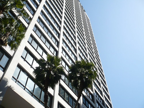
624 S. Grand Ave, Downtown

Built during the first wave of modern skyscrapers following the repeal of Los Angeles' building height limit laws, this building, designed by architectural rockstars Skidmore, Owings and Merrill (who also went on to craft Chicago's Sears Tower, among many others) stood for most of its life as the address of legal and financial institutions. After a renovation in 1992, this building is now the location of CoreSite, a major data colocation center, which carries the primary Internet connections for Los Angeles (without this building, you can't read this!)

Take note of the row of palm trees, planted here in the 1970s: They are meant to evoke the end of Wilshire Boulevard, as on the opposite end, at Santa Monica's Ocean Avenue, 16 miles from here, you will also find a row of palm trees.


2. Wilshire Grand Center
2017
Wilshire and Figueroa (SW corner), Downtown

On this site is currently rising the new Wilshire Grand Center, Los Angeles' (and the West's -- suck on it, Transbay Tower SF!) tallest building at 73 stories and 1,100 feet (kinda sorta, there's a spire, you see...). It will also be Los Angeles' only modern skyscraper without a flat roof and will house Wilshire Grand Hotel 2.0 and a bunch of shops and condos.

The building will also have a "sky lobby" up at the top and will be the first skyscraper anywhere to sport a mohawk, which is being built at this moment!

The current construction site was the location of "The Big Pour" - which lasted from February 15 -16, 2014, where 21,200 cubic yards (81 million pounds) of concrete were continuously poured - earning it a Guinness World Record for that feat.

Before the skyscaper, the site was home of the Wilshire Grand Hotel, formerly (in reverse chronological order) the Omni Hotel, Los Angeles Hilton, Statler Hilton and Statler Hotel.


3. L.A. Prime Matter Sculpture
1991
Wilshire and Figueroa (NW corner), Downtown

Wilshire is full of awesome-looking public art. Here's one relatively-recent sculpture right at the northwest corner of Wilshire and Figueroa. Designed by the late Venice-based artist Eric Orr, who had a penchant for utilizing elemental themes in his art, L.A. Prime Matter features twin 32-foot bronze columns that feature water sliding down its faces, and during random moments, FIRE emanates from the middle channels of the columns! The effect is total bad-ass, and its bad-assnes is magnified at night.

The sculpture, though, has been out of service since Fall of last year, where it has been undergoing a restoration project, which will be completed later this year. Once finished, the flames will go off every hour on the hour. Now that is bad-ass.

4. Site of George Shatto Residence/Good Samaritan Hospital
1891
Wilshire Blvd and Lucas Ave, Downtown

Before it was named Wilshire Boulevard, it was once called Orange Street, and on the corner of Orange and Lucas was a Queen Anne-style mansion belonging to George Shatto, a real estate developer who first developed Catalina Island and the city of Avalon. If you read the Epic CicLAvia Tour 4.0 post, his name is brought up as one of the famous Angelenos buried (in a rather ornate pyramid) at Angelus Rosedale Cemetery.

But check this out! Take a look at the picture above, and pay close attention to the masonry wall going uphill that fronts Lucas Avenue. Now, on CicLAvia Sunday, look at the exact same spot, on the northwest corner of the intersection. The house is gone, but the original wall still remains!

Good Samaritan Hospital, which was founded in 1885 and moved to the current site in 1911, is also the birthplace of many native Angelenos, including mayor Eric Garcetti.

5. Los Angeles Teachers (a.k.a. 'Stand And Deliver') Mural
1997
Wilshire and Alvarado, Westlake

Art imitates life imitating art imitating life in this mural by popular Salvadoreño American muralist Hector Ponce depicting actor Edward James Olmos, who portrayed Garfield High School math teacher Jaime Escalante in the 1988 movie Stand and Deliverstanding next to the real-life Escalante, and delivering a mural that's part-Hollywood, part-Los Angeles, part-Latino pride, part Eastside pride and if the Internet were as accessible back in 1988 as it is today, would make one epic photo meme. And it's painted behind the 1926 Westlake Theatre, which is slated for renovation into a community-baed performance arts venue sometime soon. Celebrate the 25th anniversary of Stand and Deliver by having the ganas to stop by.

6. Gen. Harrison Gray Otis Statue
1920
Wilshire Blvd and Park View Ave, MacArthur Park

Gen. Otis is perhaps the most visible statue at the park, which predates MacArthur's WWII service. This general served in the Spanish-American and Philippine-American wars, and also fought as a Union soldier in the Civil War. But in Los Angeles, he is most known for being the founder, owner and publisher of the Los Angeles Times. So why is he here? His Wilshire Blvd mansion, called The Bivouac, was located across the street, was later donated to Los Angeles County and became the original campus of Otis Art Institute. It's thought that his statue is pointing to the site of the Elks Lodge, but he's probably just pointing to his old house. 


7. Bryson Apartment Building
1913
2701 Wilshire Blvd, MacArthur Park

This 10-story Beaux Arts apartment building, built 100 years ago, was the 20th century precursor to today's fancy modern 21-century high-rise residential developments. Built by developer Hugh W. Bryson, it was built in a part of Los Angeles that was known at the time as "the west side" (let's not open that can of worms right now, okay?). It was one of Los Angeles' most luxurious apartment buildings, and had a large neon sign at the roof (characteristic of these kinds of developments back then). Several Raymond Chandler books reference The Bryson. The 110,000 square-foot building is also part of the National Register of Historic Places and a Los Angeles Historic-Cultural Monument.

8. Lafayette Park
1899
Wilshire Blvd and LaFayette Park Place, LaFayette Park

Clara Shatto, the widow of George Shatto (remember him?) donated 35 acres of her land to the City of Los Angeles in 1899, which was once oil wells and tar pits. Her late husband wanted it turned into a city park, and so it became Sunset Park, which existed for 19 years before the locals wanted it renamed to honor the 18th-century Frenchman who was a hero in both the American and French revolutions. Gotta give LaFayette park some props for living so long in the shadow of its more famous neighbor, MacArthur (Westlake) Park.


9. Bullocks Wilshire/Southwestern Law School
1929
3050 Wilshire Blvd

Perhaps one of the most iconic examples of Art-Deco architecture in Los Angeles, this former Bullocks Department Store was designed with a tower to resemble a New York-style skyscraper in then-unabashedly low-rise Los Angeles. It was the epitome of shopping in style in its heyday, with its own rear parking lot and other auto-centric amenities. It ultimately fell victim to the 1992 Los Angeles Riots and was closed down the next year. In 1994, the nearby Southwestern School of Law bought the building and incorporated it into its campus, restoring much of the Roaring 1920s Art Deco aesthetics.

10. Shatto Place
c. 1880s
Wilshire Blvd and Shatto Pl, Koreatown

Gee, we can't get seem to get away from that George Shatto guy, can we? George and Clara owned a plot of land here on this street, which was once home to some of the most beautiful mansions in Los Angeles at the time. Although Clara sold the land in 1904, George stipulated that all properties on the street maintain the character of the exquisite homes there, which was challenged several times until the late 1920s, when the homes started to be demolished in favor of more modern commercial development.

11. "The Vermont" Highrise Apartment Development
2014
Wilshire Blvd and Vermont Ave., Koreatown

This 30- and 25- story highrise mixed-use apartment development is called "The Vermont" by J.H. Snyder Co. which opened in 2014. It's Metro-accessible, and it has a friggin' Pizza Rev, but who the hell can afford the rents for this place?

12. Consulate Row
Various locations along Wilshire Blvd between Vermont and Crenshaw

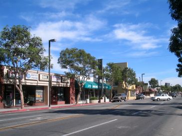
Some 62 countries have consular offices in the Los Angeles area and 41 of them have addresses on Wilshire Boulevard. Proximity to various foreign financial institutions on Wilshire, as well as nearby Hancock Park, where many consul-generals have traditionally resided, are the main reasons for such a high concentration of consulates on this stretch of Wilshire. The consulate offices for Bangladesh, Bolivia, El Salvador, Ethiopia, Guatemala, Honduras, Indonesia, South Korea, Nicaragua, Peru, The Philippines, Sri Lanka and Taiwan are all located on Wilshire between Vermont and Crenshaw. Many of them display their national flags in front of their respective office buildings. How many can you spot during CicLAvia?

13. Gaylord Apartments
1924
3355 Wilshire Blvd

Though the building's prominent neon sign has been source of many a snicker by immature junior high school kids, this building represents some serious history. It was named after Wilshire Boulevard's namesake, Henry Gaylord Wilshire, who was known as a wealthy real estate developer and outspoken socialist (Does that make sense?), who donated a 35-acre strip of barley fields to the City of Los Angeles on the condition that it would be free from railroads or trucking. The building itself is a 13-story Italian Renaissance-style apartment building that actor John Barrymore (a.k.a. Drew's grandpa) and then-presidential candidate Richard Nixon once called home.

14. Brown Derby Site
1926
3427 and 3377 Wilshire Blvd

The now-defunct "The Brown Derby" local chain of restaurants were synonymous with Hollywood glitz and glamour. The Wilshire Boulevard location was the first of four (the others were in Hollywood, Beverly Hills and Los Feliz). In close proximity to The Ambassador Hotel and its Cocoanut Grove swing/jazz club, this was the original hipster joint back in the day, only back then the hipsters were actually cool and looked good. In 1937 the building was moved across the street and closed in 1975. In 1980, a shopping center was built on the site and the iconic dome structure was incorporated into the shopping center that exists today. It's situated on the third floor, above The Boiling Crab seafood restaurant. It's something to ponder on while you wait 90 minutes for your table.

Note that the pictures for #13 and #14 connect vertically - that's the Gaylord Apartments behind the Brown Derby!
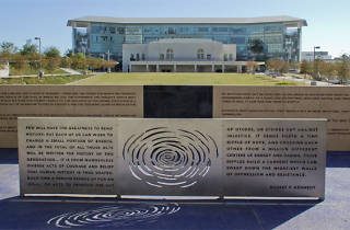
15. Robert F. Kennedy Inspiration Park/Ambassador Hotel Site
2010
Wilshire Blvd between Catalina Street and Mariposa Avenue

The Militant wrote a post in 2010 about this unique public space dedicated to Sen. Robert F. Kennedy, who was assassinated just yards away at the Ambassador Hotel, which was demolished in 2005 and where the LAUSD's sprawling and costly  RFK Community Schools campus now stands. There's Kennedy quotes on public art installations and benches for you to chill on. There's also speakers playing recordings of some of the jazz music that was performed at the hotel's famed Cocoanut Grove swing and jazz club.

On April 18-19, the school campus will host the first-ever K-Town Night Market with food, vendors and live entertainment.


16. Wiltern Theatre/Pellissier Building
1931
Wilshire Blvd and Western Avenue (duh...), Koreatown

The 12-story structure, designed by Stiles O. Clements, is Los Angeles' emerald-green temple to all that is Art Deco. Originally operating as the "Warner Theatre" (Specifically the Western Avenue location of Warner Bros. chain of movie theaters; The Warner Theatre in San Pedro is another example), The Wiltern (named so since 1935) has seen many cycles of decay and rebirth, most recently in the 1980s, when preservationists renovated the theatre to a performing arts venue. The contemporary Wiltern Theatre has been operating since 1985.


STOP! That's it folks. The route ends here. It goes no further. Maybe you can spend your extra time on this route walking up and down the street and playing some Pokemon GO (The Militant has heard there's a Scyther nest at Lafayette Park).

Wednesday, May 11, 2016

The Militant's Epic Militant CicLAvia Tour XVII!


View larger map here!

The 17th CicLAvia is upon us this Sunday, and it takes us to Watts and the historically industrial cities of southeaster Los Angeles county. First off, for those who haven't been to the area before, this map might not make sense; only a quarter of the route falls within the city of Los Angeles, but it made a lot more sense once you see that it ties together several pedestrian-oriented retail corridors: Pacific Boulevard in Huntington Park, South Gate's Tweedy Mile and Lynwood's Plaza Mexico shopping center. And unlike the last CicLAvia in the San Fernando Valley, this one is accessible by both the Metro Blue (Firestone and 103rd St stations) and Green (Long Beach Blvd station lines.

The Militant visited the area last weekend for his Militant research and discovered this region is the land of historic movie theatres, formerly the home of several large industries (which, though have been gone for over 30 years, their effect on the area is long-lasting) and a local burger chain called Bobo's Hamburgers. But there are other great places to eat along the route, as you'll see below.

The Militant creates these guides to give the CicLAvian a deeper understanding of the history and the living community along these streets, so if you learned something (or have something to add), please share in the comments below or share via a tweet.

You know you've been waiting for it, so here's The Militant's Epic Militant CicLAvia Tour XVII!

1. California Theatre
1925
6528 Pacific Blvd, Huntingron Park

This CicLAvia route is full of historic theatre buildings, and the first stop on the Epic CicLAvia Tour is definitely one of them. Built in 1925 as the 1,500-seat Fox California Theatre, it was designed by architects George Lindley and Charles Selkirk, who also designed Glendale's Alex Theatre. The cinema screened Fox pictures from the 1920s on. In the 1980s, the cinema became a three-plex, and later became a two-screener, finally closing in 2006.

2. Eastern Columbia Building
c. 1930s
6604 Pacific Blvd, Huntington Park

Most of you are familiar with the emerald-colored Eastern-Columbia Outfitting Company's onetime flagship store building in Downtown Los Angeles along Broadway, but the California store chain also had a location right here in Huntington Park. And like its famous Downtown mother, this one had a pyramid-shaped roof and a clock. Today, the building houses a jewelry store and a clothing outlet.


3. Warner Theatre
1930
6714 Pacific Blvd, Huntington Park

This next historic theatre was built in 1930 as part of the cinema chain owned by Warner Bros. Pictures to showcase their latest releases (which included the Warner Beverly Hills, San Pedro's Warner Grand Theatre and the Warner (now Wiltern) on Wilshire. Architect B. Marcus Priteca, who also designed the San Pedro and Beverly Hills Warner theatres, as well as Hollywood's Pantages Theatre, drew up this 1,468-seat movie palace, which eventually became part of the Pacific Theatres chain. In the 1980s, the cinema became a two-plex, specializing in peliculas en Español, eventually closing down in the 1990s. In the 21st century, there has been a move to restore the theatre to its former glory, especially after the city of Huntington Park designated it a historic building, but the current owner has adaptively reused the venue as a retail space.

4.  Underground Arcade
C. 1980s
6901 Pacific Blvd, Huntington Park

Deep within the recesses of Huntington Park lies a subterranean arcade, usually open from 11 a.m. yo midnight every night that offers unlimited play of its video, pinball and billiard games for just $3 ($2 after 6 p.m.). Yeah the place is all tagged up, maybe 20% of the video games don't work, and you wouldn't want to go near the restrooms, but there's no place like it anywhere in Southern California (props to Erick Huerta @ElRandomHero for the tip).

5. Los Angeles Railway Right of Way
1920-1963
Pacific Blvd, Huntington Park

The northern leg of Sunday's CicLAvia route was once traversed by the Yellow Cars of the Los Angeles Railway, our more urban-centric streetcar system of the early half of the 20th century. The Los Angeles Railway's "J" line ran from Jefferson Park in the west through Downtown Los Angeles and down into Huntington Park, The line terminated a few blocks from here, turning east on Florence Avenue before zig-zaging south again on Seville Avenue down to Santa Ana Street. The line ran from 1920 to 1963 and was one of the last Yellow Car lines in operation.

6. Bobo's Hamburgers
7300 Pacific Blvd, Walnut Park

In the mood for a burger round these here parts? You might want to forego an In-N-Out, a Fatburger or any burger joint using a variant of the name "Tom" for one of the Bobo's Hamburgers (no, not Bob's Burgers) locations, which are native to this area. The family-run chain opened in 1975 and in addition to this location on Pacific Blvd, you can find two other Bobo's Hamburgers on this CicLAvia route on 2709 E. Firestone in South Gate, 1220 E. Firestone in South Los Angeles, and one just a few blocks east of Long Beach Blvd, on 3390 Imperial Highway in Lynwood. This is Bobo's Country. You cannot escape the wrath of Bobo's Hamburgers.

NOTE: If heading west on Firestone Avenue, skip to #18.

7. Elizabeth Bakery
1977
8903 Long Beach Blvd, South Gate

At this first junction of CicLAvia legs at Long Beach Blvd and Firestone Ave is this South Gate institution that has been baking up cakes, bread, pan dulce and pastries since 1977. In addition to baked goods, they also sell bionicos, juice, raspados, sandwiches, tamales, and also will bake whole turkeys to order during the holiday season.

8. Teatro Los Piños (Vogue Theatre)
1937
8903 Long Beach Blvd, South Gate

This Art Moderne-style cinema, originally called the Vogue Theatre (strike a pose) was built in 1937 and designed by celebrated and prolific architect S. Charles Lee, who designed 250 theatres in the Los Angeles area, and also crafted the Los Angeles Theatre and Tower Theatre on Broadway in DTLA, The venue, now known as Teatro Los Pinos still functions as an active teatro today, hosting concerts, comedy shows and occasional movie screenings.

9. Site of General Motors South Gate Assembly
1936
2720 Tweedy Blvd, South Gate

Much like the last CicLAvia in Panorama City, South Gate's economy largely revolved around a General Motors automobile factory, which employed as many as 4,000 workers and operated from 1936 to 1982, churning out Buicks, Oldsmobiles and Pontiacs throughout much of its history. There were also two other auto factories in the area - a Studebaker plant in Vernon and a Willy-Overland facility in Maywood. After the 1960s, the GM factory made Chervrolets and Cadillacs before closing down for good in 1982 due to lower American car sales and air quality concerns. The site was later razed and is now the site of the LAUSD's South East High School complex.

NOTE: If heading east on Tweedy Blvd, please skip to #14.

10. Sushinaloa
2013
10350 Long Beach Blvd, Lynwood

Imagine if there were a food truck out there on the streets that sold Mexican-style fusion sushi. Now imagine that there's no food truck but an actual brick-and-mortar eatery in Lynwood, right along the CicLAvia route, no less. Enter Sushinaloa, the best Mexican-Japanese fusion in the Los Angeles area since Fernando Valenzuela met Hideo Nomo. But apparently Sinaloan-style sushi is an actual thing, and The Almighty Jonathan Gold has given this place his imprimatur, so, hit up this place before everyone else does.

11. Plaza Mexico
2004
3100 E Imperial Hwy

This massive suburban-style retail center is a re-creation of Mexican plazas (sort of like the Plaza del Valle (from the March CicLAvia) on steroids), with a layout inspired by the ancient city of Monte Alban, is part-outdoor mall, part-tourist attraction. And in a total So Cal twist, the owners of the mall are San Gabriel Valley-based Korean real estate developers. Donald and Min Chae owned the former Lynwood Marketplace and Lynwood Town Center and, dictated by demographics and dollars, decided in 2001 to invest $20 million into transforming their shopping centers into a Mexican-themed marketplace.

12. Pacific Electric Lynwood Depot
1917
3780 Martin Luther King Jr Blvd, Lynwood

Originally built in 1917 on 11453 Long Beach Blvd to serve the Pacific Electric Railway's Santa Ana Line, the Mission Revival-style station was moved in the 1980s and later restored to make way for construction of the 105 Freeway. Now the offices of the Greater Lynwood Chamber of Commerce. Contains plaque dedicating building to former Lynwood mayor John D. Byork.

13.  Weird Al Yankovic's Childhood Home
3636 Burton Ave, Lynwood

A short bike ride south of the CicLAvia route will take you to the childhood home of Lynwood's greatest product, parody rocker "Weird Al" Yankovic. This video confirms that he grew up in this modest home next to Lynwood Middle School on Burton Avenue, where he lived here from 1959 to the early '70s, when he went off to college at Cal Poly San Luis Obispo. It was here where he started to learn the accordion, after a door to door salesman offered music lessons to a six year-old Alfred Yankovic. And the rest is music history. Note: This is a private residence, please do not bother the current occupants.

14. Tweedy Mile
Tweedy Blvd between State St and Hunt Ave, South Gate

The city of South Gate, as you might remember, was named after the South Gate Gardens of the old Cudahy Ranch. The old downtown of South Gate evolved into Tweedy Mile, the main drag of the town, featuring shops, restaurants, entertainment venues and civic and cultural institutions. The street was named after the Tweedy Family, headed by patriarch R.D. Tweedy, who came here from Illinois in 1852. The family soon owned about 2,000 acres in the area. Tweedy Mile is also home to the city's two biggest annual events, the Tweedy Mile Classic Car Show in March and the Tweedy Mile Festival in June.

15. Allen Theatre
1924
3809 Tweedy Blvd, South Gate

Yet another historic cinema along the CicLAvia route, this single-screen 673-seat movie house opened as the Garden Theatre (a reference to the old Home Gardens tract it was located on) in 1924, and was remodeled in 1936 when it was renamed the South Gate Theatre. In the 1940s, it was purchased by the Allen Brothers, who ran several cinemas in the area. It was showing films until the 1980s, and later became a live music venue. It was closed in 2007, but recently undergone renovation, and some of the South Gate locals have told The Militant that the theatre will re-open this October as an arts venue. Even better, the Allen will give a sneak preview this Sunday and reportedly be open during CicLAvia with live music performances!

16. South Gate Veteran's Memorial Fountain
1954
Tweedy Blvd and Walnut Ave, South Gate

Located on the south end of South Gate Park, this memorial fountain, originally dedicated to South Gate's World War II and Korean War vets, and later dedicated to veterans of all wars since, features an eternal flame (how cool), while a memorial marker lists the names of local vets. Also of note is the U.S. Army M60A3 Patton tank on display, located a few yards west of the fountain.

17. Legacy High School Complex
2012
5225 Tweedy Blvd, South Gate

The eastern terminus of Sunday's CicLAvia route is along the campus of the Los Angeles Unified School District's Legacy High School Complex, which opened in 2012 after a quarter century of planning. Originally the site of a pesticide factory and other heavy industrial properties, the 36-acre plot of land was the center of controversy as the ground was heavily contaminated, mirroring the LAUSD's more (in)famous toxic campus project site, the Belmont Learning Complex just west of Downtown Los Angeles.  It took an entire decade and $22 million to excavate the land 30 feet deep and import uncontaminated soil into its place to build the school campus.

18. Firestone Tire & Rubber Factory
1927
2525 Firestone Blvd, South Gate

One of South Gate's largest industries was this Firestone Tire and Rubber factor, built on a former 40-acre bean field y along Firestone Ave (hence the street name) between Alameda Street and Santa Fe Avenue. Company owner Harvey Firestone (no, not Harvey Fierstein) made the first tire himself, which rolled out of the assembly line on June 15, 1928. The Firestone factory was also followed up in the region by other large tire factories, such as Goodyear and Uniroyal, and for a time Los Angeles was the largest tire-producing region in America. The plant closed down in 1980 when the plant's 2,000 workers were laid off. Coupled with the GM plant's closure in 1982, that ended an era of heavy industry in the city of South Gate. But unlike the GM plant, the Firestone tire factory's building still stands today (East Los Angeles College has been eyeing it as a satellite campus).

19. Alameda Corridor
2002
Along South Alameda Street

Adjacent to Alameda Street is a set of below-grade freight railroad tracks -- both the street and the tracks form the Alameda Corridor, a ground transportation system opened in 2002 that allows trucks and trains to easily access the Ports of Los Angeles and Long Beach -- important gateways for importing and exporting for not just Southern California, but the entire United States. Toys from China and cellphones from Korea pass through the Alameda Corridor in the form of intermodal shipping containers en route to Chicago or other U.S. destinations. The corridor began construction in 1997 as a way to consolidate the Union Pacific and BNSF railroads onto a unified, high-capacity, mostly grade-separated track to and from the port area. North of here, the tracks run directly to railroad yards southeast of Downtown Los Angeles.

20. Col. Leon H. Washington Park
8908 S. Maie Avenue, South Los Angeles

There are many parks that line the Blue Line route, but this one is unique for two reasons. As you head southbound and depart the Firestone Station, look immediately to your right and you'll see a park and recreation center. It's a Los Angeles County-run park called Colonel Leon H. Washington Park, named after the founder of the Los Angeles Sentinel newspaper (originally called The Eastside Shopper), the city's premier publication in the black community. The other reason is that the rec center here is a popular spot for NBA stars such as Kobe Bryant, Lebron James, Kevin Durant and others to play pick-up games and compete in the Nike-sponsored Drew League, a weekend summertime program where the biggest stars in basketball play with and against locals from the community.


21. Ted Watkins Memorial Park
Dedicated 1995
1335 E. 103rd Street, Watts

Originally built in the 1930s to memorialize Western actor Will Rogers, this 28-acre Los Angeles County park was re-named in 1995 after the late Ted Watkins, a local community activist and the founder of the Watts Labor Community Action Committee, which he started in 1965, just months before the Watts Riots. The aftermath of the rebellion heightened the purpose of his nonprofit agency, which dealt with social services, community development and empowerment for the Watts area. The park also features a youth baseball field built by the Los Angeles Dodgers, a newly-built community swimming pool and gym with basketball courts.

22. Hawkins House of Burgers
1939
11603 Slater St, Watts

Forget those lame-ass newbie overpriced East Coast transplant burgers. Forget even In-N-Out, Tommy's or Fatburger. You might even need to forget Bobo's. Because Hawkins House of Burgers might just be the king of them all. The Hawkins family has been operating malt shops, markets and this eatery since 1939 (though the current hamburger business opened in the mid-1980s). They make all their burgers to order, use fresh angus beef, real smoked bacon (none of that supermarket stuff) and fresh ingredients, all at real decent, unpretentious prices.  You might have to wait as long as 20 minutes, but it's all worth it. Hawkins House of Burgers is perhaps the biggest institution in Watts after Simon Rodia's steel towers, and some of the burger stacks are probably just as tall.

23. Pacific Electric Watts Depot
1904
1686 E. 103rd Street, Watts

Adjacent to the Blue Line's 103rd St/Watts Towers station is a mustard-colored building that was once the Pacific Electric's Watts depot. A popular stop along the old PE Long Beach Line, the building survived not only the PE's abandonment, but was the only wooden structure that was not set on fire during the 1965 Watts Riots. After a renovation project in the 1980s, the Watts Station has functioned since 1989 as a Los Angeles Department of Water and Power customer service center.

24. Watts Towers
1921
1727 E. 107th St, Watts

You all know the story by now: Italian immigrant Sabato "Simon" Rodia collects scrap reinforced steel bars (using the adjacent Pacific Electric Santa Ana Line tracks as a fulcrum to bend them) and other found scrap material from rocks to broken glass to bottle caps, and builds 17 structures on his property over a period of 33 years. Then in 1955, he up and left for Northern California and never came back. Now that you know the story, see them up close for yourself. You don't deserve to call yourself an Angeleno if you've never visited the Watts Towers before.

25. Locol Watts
2016
1950 E. 103td St, Watts

LocoL, the affordable healthy fast food venture from Roy Choi and Daniel Patterson, opened here in January and had lines around the block. Things have settled down since them (The Militant ate here last Saturday and was the only one inside when he ordered), but no doubt the joint's proximity to CicLAvia would no doubt start those lines up again. Get your Burgs, Foldies and Yotchays and wash it down with some Apple Line agua fresca.

Enjoy CicLAvia, see you or not see you on the streets this Sunday and STAY MILITANT!

Friday, May 6, 2016

Erotic City (The Epic Militant Prince Map of Los Angeles)

 
View larger map here.

Dearly beloved...

We R gathered here to salute this man called Prince Rogers Nelson, who left this life 4 the afterworld on April 21. Though he's undoubtedly associated with being a proud hardcore native of Minneapolis, Prince has left his mark on the City of Angels as well, even briefly claiming residence here in 2006.

Prince also associated himself with a few Los Angeles-area natives in his career: Revolution band member, keyboardist Lisa Coleman is a native Angelena (and half-Mexican). And protege and "Purple Rain" co-star Apollonia Kotero was born and raised in Santa Monica.


In tribute 2 a major icon of The Militant's generation (an unspecified generation lettered somewhere between W and Y), on the day that this city throws a public memorial event at City Hall, The Militant has decided to make another one of his Epic maps, this time saluting Prince. Sure, you would expect such a map to be made by The Militant Minneapolitan, but it's not like this town doesn't love purple things originally from Minnesota.

This map contains movie and video shoot locations, recording studios, his onetime residence in the hills above West Hollywood and every single one of the concert venues he ever graced the stage on in this town. After all, this town gave made literally made him a star. Did you know that Prince played his first concert outside of Minneapolis right here in Los Angeles?

He no doubt played at all the major concert venues in town, with The Forum being the place he played in the most, having graced the stage 23 times there. Prince was also a man ahead of his time, realizing the potential of Downtown Los Angeles, where he not only shot music videos and films here, but opened a night club in DTLA, just eight months after the Los Angeles Riots.

CLICK HERE TO VIEW THE EPIC MILITANT PRINCE MAP OF LOS ANGELES!

Wednesday, March 2, 2016

The Militant's Epic CicLAvia Tour XVI!


Interactive map! Click and drag to navigate. Larger map here!

It may be technically winter, but CicLAvia season has begun! We're now here in 2016 for the 16th-ever CicLAvia. This time around we return to the 818, albeit much more northeast to and through the communities of Panorama City, Arleta and Pacoima (which, if you're a longtime reader of This Here Blog, is Tongva for "Place of Running Water").

This is also the first CicLAvia in a truly suburban setting, the first CicLAvia that is not directly accessible by any of the Metro Rail lines (tsk tsk tsk...shame...), the first CicLAvia to cross an active mainline railroad track (be watchful at San Fernando Road, folks - you all wanna live to go to the next CicLAvia, right?) and the farthest from Downtown Los Angeles (18.4 miles away).

Now, being mostly suburban, The Militant thought this route would just have like less than 10 points of interest. But digging deeper into the community history, and making an unspecified number of Militant reconnaissance missions to the northeast SFV, The Militant came up with 20 - count 'em - TWENTY points of interest on or around the CicLAvia route (He could have gone with 22 but, The Militant does this stuff for free, so don't push it, K?)!

You'll also notice that The Militant has abandoned his old arbitrary CicLAvia route version numbering system, just because it's a pain in the ass to keep track of, so from here on out, he'll go Super Bowl/Olympics on y'allz and use Roman numerals. So get ready for sweet XVI!

Now before we begin, The Militant would like to name the Official Theme Song of the XVIth CicLAvia (You may or may not get a personal hug or high-five from The Militant if he hears you blast this song from your mobile sound system on Sunday):


Read on, and you'll see why. Come on, let's go!
 
1. The Plant/Site of GM Van Nuys Assembly
2003/1947
7876 Van Nuys Blvd, Van Nuys

This ginormous, sprawling car-oriented shopping center on the east side of Van Nuys Boulevard where one can catch a movie, buy some hardware or satisfy their "IN-N-OUT URGE" originally began its life as a large General Motors automotive plant (hence the name), pumping out Chevrolet trucks, other Chevy auto models, Buicks, Oldsmobiles and Pontiacs for nearly half a century, built mostly by residents who lived nearby, before closing down in 1992 to satisfy AQMD requirements. The plant was torn down six years later and Los Angeles City Councilman Marvin Braude resurrected the site into the ginormous shopping center in 2003. GM still operates a testing facility east of the stores. The Militant may or may not have written part of this blog post at the Starbucks (his cup may or may nor have read, "Milton").

2. Kaiser Permanente Panorama City Medical Center
1962
13651 Willard St, Panorama City

Another major employer that made Panorama City is Kaiser Permanente's Panorama City Medical Center. Though it opened in 1962, it was envisioned as far back as 1948 when industrialist Henry Kaiser developed his residential neighborhood (more on this later), and a large plot of land by Roscoe and Woodman was set aside for the construction of a hospital.

3. Site of Van Nuys Drive-In/Vista Middle School
1948
15040 Roscoe Blvd, Van Nuys

In the post-war area, not only did the Panorama City community flourish with homes, shopping and industry, but what more appropriate way to take your shiny new Chevy made down the street to watch a drive-in movie? In the SFV, the Drive-In was king, but every king's reign comes to an end. The Van Nuys Drive-In was the last drive-in theater in The Valley, eventually sporting three screens (in 1983) with a capacity for nearly 900 cars. The drive-in closed for good in 1992 and was demolished in 1998. The property was purchased by the LAUSD, which built Vista Middle School on the site in the early 2000s.

4. Panorama Mall
1955
8401 Van Nuys Blvd, Panorama City

When it comes to shopping centers in the San Fernando Valley, North Hollywood's Valley Plaza might have been the pioneer, the Topanga Plaza might be the first enclosed mall (1964) and the Sherman Oaks Galleria might get credit for being ground zero of 1980s "Valley Girl" culture, but Panorama Mall deserves its own induction in the 818 Mall of Fame. It was part of Kaiser and Burns' plan for Pano to surround their hood with commerce and industry, as a place, unlike the regional shopping center behemoths of the time, where residents can simply walk to not have to drive very far to. Upon its opening as "Panorama City Shopping Center," it sported The Valley's flagship Broadway department store. It also housed Orbach's, Robinson's, and Montgomery Ward. In the mid-1960s, the shopping center focused on the indoor mall format. Having endured the decades, Panorama Mall was given a long-overdue internal remodeling a few years ago and now sports over 50 stores.

5. Chase on Chase
2009 (Built 1965)
8450 Van Nuys Blvd (corner Chase St - get it?), Panorama City

You would think that this location would be the product of some clever marketing. But corporations don't think that way. Rather, it was a matter of happenstance. Originally established as a Home Savings of America in 1965, it went under the guise of Washington Mutual in 1998 until WaMu was eaten up by J. P. Morgan Chase Bank a decade later. As fate would have it, this Chase Bank is on the corner of Van Nuys Boulevard and none other than Chase Street. You can't make this stuff up, folks. Now if there was ever a high-speed chase that ended up here, The Militant would explode.

6. Plaza del Valle
2000
8610 Van Nuys Blvd, Panorama City

Plaza del Valle (Plaza of the Valley), originally built in the 1970s as a strip mall is an outdoor shopping court, nestled behind the nondescript storefronts on the east side of Van Nuys Blvd between Chase and Parthenia streets (and the perfect counterpoint to the mostly-indoor Panorama Mall down the block), was heavily influenced by Downtown's Olvera Street. The old strip mall was re-imagined and re-built in 2000 by its non-Latino developers to serve Pano's growing Latino community. The complex features retail shops and stalls, eateries, fountains and an entertainment stage.


7. Pacific Electric San Fernando Valley Right of Way
1913
Van Nuys Blvd at Parthenia St, Panorama City

Now that The Militant made his epic Pacific Electric Archaeology Map and detailed where every passenger Red Car line went in Southern California, you all should know by now that Van Nuys Boulevard used to be a PE right of way (and if you didn't, then THE MILITANT IS DISAPPOINTED IN YOU!) So you wouldn't be surprised at all that the westward sweeping curve on Parthenia Street is where the line, which reached this part of The Valley in 1913, diverges from Van Nuys Blvd and continues westward, then northward again to San Fernando.  Due to the rising costs of maintaining and operating the line (and not because of some silly Roger Rabbit Judge Doom conspiracy), it was partially shut down in 1938 (years before the supposed conspiracy happened, BTW...but no matter how many facts get shown in your face, you still continue to believe it, right? RIGHT?) up to Sherman Way, and the entire SFV line was closed in 192 (y'allz should have that memorized by now...).

8. Kaiser Homes
1948
Area bordered by Van Nuys Blvd, Osborne St, Woodman Ave & Roscoe Blvd, Panorama City

Whatup, homes? There's a bunch of them here east of Van Nuys Blvd here in Pano. When World War II was winding down in 1945, real estate developer Fritz B. Burns and industrialist Henry J. Kaiser purchased 400 acres of former dairy farms and alfalfa fiels for $1 million to build their own planned residential community consisting of affordable, pre-fab, single-story homes on winding streets to break up the SFV grid monotony. They built it, and they came.A General Motors factory set up shop down the street, space was reserved for a future hospital, and nearby breweries and aerospace companies also generated employment centers. A large shopping center was built, and Mr. Burns (no, not that one) brought his own personal reindeer to the Panorama Mall to delight shoppers each holiday season (and also found it an opportunity to market some houses to them). Of course, back then in the era of discriminatory housing covenants, you had to be white (and purely white, to be exact) to own these homes, a practice that was in place until the Civil Rights Act was passed in 1968. Today, the majority of residents who live in the former Kaiser Homes development are non-white and primarily of immigrant background -- predominantly Latino, as well as Filipino and Thai, providing the proverbial middle finger of justice extended to the legacy Burns and Kaiser.

9. Marty McFly House
1985 (Built c. 1950s)
9303 Roslyndale Avenue, Arleta

Months after Marty McFly traveled into the future, it couldn't be more appropo to take a short detour from the CicLAvia route southeast down Canterbury Ave, left on Kagel Canyon and right on Roslyndale to see the very house which portrayed the McFly family residence in the "Back to the Future" movie saga.  NOTE: This is a private residence, please do not bother the current occupants, and please refrain from shouting, "HELLO, MC FLY?!" outside.
 
10. Back to the Future "Lyon Estates" Location
1985
Sandusky Ave at Kagel Canyon Street, Arleta

And if you haven't felt enough of The Power of Love yet, head back onto Kagel Canyon, turn right and stop at the intersection of Sandusky Avenue to see the very street where Marty McFly skateboarded down in the first "Back to the Future" film. It don't take money, don't take fame, don't need no credit card to ride this train (well, unless you're talking about a TAP card...).

11. Pacoima Mural Mile
2012

Van Nuys Blvd between Arleta Ave and Bradley St

Spurred by a local need to increase community pride and aesthetics, several local artists painted murals along the Van Nuys Blvd corridor in Pacoima and thus was born Pacoima Mural Mile. Famous native Ritchie Valens (more on him later) is a popular subject on these walls, as well as cultural icons from Frida Kahlo to La Virgen de Guadalupe to Danny Trejo. Think of this as an Epic CicLAvia tour within an Epic CicLAvia Tour! View the Pacoima Mural Mile map here: http://www.muralmile.org/#!/zoom/csgz/coq6

12. Ritchie Valens House
1947

13428 Remington St, Pacoima

This was the house that '50s rock star and Pacoima native Ritchie Valens purchased for his mother, Concepcion Reyes, in 1958 from the proceeds of his newfound "La Bamba" fame, and was also his final residence until The Day The Music Died on February 3, 1959. NOTE: This is a private residence, please do not bother the current occupants, and please refrain from shouting, "RITCHIEEEEEEEEEEEEE!" outside. 

13. Ritchie Valens Park
1994
10731 Laurel Canyon Blvd, Pacoima

The former Paxton Park, re-dedicated in 1994 to Pacoima's most famous native in order to spur community pride, Ritchie Valens Park isn't just a patch of grass with a famous person's name on the sign, it features a skate park, a baseball diamond, basketball courts, a swimming pool and a children's playground with historical and interpretive displays highlighting the life of the local Mexican American rocker, whose life was tragically cut short at the age of 17 on a Wisconsin plane crash. Weeeeeeeeeeeeell come on, let's go, let's go, go, everybody...to this nice little detour not too far away from the main CicLAvia route.  

14. Metroink Antelope Valley Line/CA High Speed Rail Corridor
1876
Van Nuys Blvd at San Fernando Rd, Pacoima

This is the very first time a CicLAvia route will cross an active mainline railroad track, so please do not ignore the warning lights, bells and gates! These tracks were originally built in 1876 by the Southern Pacific Railroad to connect Los Angeles to Saugus, where continuing lines on to Ventura and the Antelope Valley were built. In the early 1990s, it was taken over by the Southern California Regional Rail Authority, otherwise known as Metrolink, for a commuter rail line from Union Station to Santa Clarita, which opened in October 1992. But on January 17, 1994, the earth shook violently and the 5/14 freeway interchange collapsed. To facilitate commuters coming in from the Antelope Valley during the post-Northridge Earthquake period, the line was extended to Lancaster (which wasn't planned to be built until 2004 at the earliest under normal circumstances) thanks to FEMA funds and was opened IN ONE WEEK. In the near (or distant) future, running parallel to the existing railroad tracks will be the proposed California High Speed Rail system from San Francisco to Los Angeles (...which may or may not get built).


15. Tresierras Supermarket
1956
13156 Van Nuys Blvd, Pacoima


Established in San Fernando in 1944 to serve the growing Mexican American community in the area by Francisco and Pilar Tresierras while two of their sons served in World War II, and operating from this very location for 60 straight years, Tresierras Supermarket is a full-service
Latino supermarket featuring produce, dry goods, a carniceria and an in-house tortilleria. It's one of the long-time anchors of Pacoima's Latino community, serving local residents for generations. And we're quite sure that Ritchie Valens himself shopped here back in the day.
 
16. San Fernando Gardens
1942
10995 Lehigh Ave, Pacoima

This public housing project next to the northern terminus of the CicLAvia route features 448 apartments built in the World War II era by the Housing Authority of the City of Los Angeles. It was built to house workers from the Lockheed aircraft factory in Burbank (though it's pretty far from Burbank -- no freeway and no PE line back n the day) and was unique in that it was racially integrated, and comprised the largest African American community in the San Fernando Valley at the time.
  
17. Ritchie Valens' Childhood Home
c. 1940s
13058 Filmore St, Pacoima

Though Ritchie Valens' birthplace is unknown, this was the very house where he spent most of his childhood in (after living briefly with an uncle in Santa Monica as a kid). At the age of 9, he taught himself how to play guitar at this very house and took it to Pacoima Jr. High School where he performed for his classmates and joined a local band, The Silhouettes as their singer, until he was discovered by record label owner Bob Keane, and the rest was history.

Duuuuude. The 4.2-mile CicLAvia route is kinda short. Let's go a little farther, shall we? Continue on Van Nuys and make a right on Foothill...

18. Discovery Cube Los Angeles
2014 (Built 2007)
11800 Foothill Blvd, Lake View Terrace

The de-facto successor to the nbow-defunct Childrens Museum of Los Angeles, which operated out of the Civic Center for most of its 20-year existence, this building was originally built in 2007 to house an expanded version of the museum. but after the nonprofit went bankrupt in 2009, this building sat as a white elephant on the corner of Foothill and Osborne for seven years, until the City entered a partnership with Santa Ana's Discovery Science Center and operated the intended Children's Museum site as "Discovery Cube Los Angeles" in 2014. But despite the museum's corner location, it's a horribly pedestrian-unfriendly experience just getting to the dang place, where one has to enter through the Hansen Dam Recreation Area's main entrance on Osborne Street, and drive some distance before entering the Discovery Cube parking lot. Whatup with that?

19. Site of Rodney King Beating
1991

Foothill Blvd, east of Osborne St, Lake View Terrace

Twenty-five years ago this week at this very spot (just behind the Discovery Cube building on Foothill) was where African American motorist Rodney King was beaten by four mostly-white LAPD officers after a brief freeway chase (they didn't televise those things back then). But they did televise the grainy VHS handicam video (no smartphones back then, kids) that was shot by local resident George Holliday, who lived in the apartments on the north side of Foothill. The beating, after airing on KTLA a few days later, sparked outrage in the city's African American community and called to attention the issue and history of police brutality. The acquittal of the four cops over a year later triggered the largest riots in Los Angeles' history.
   
20. Hansen Dam
1940
11770 Foothill Blvd, Lake View Terrace

Built in response to the Great Los Angeles Flood of 1938 that caused catastrophic flooding near the Los Angeles River in The Valley, the City tapped the U.S. Army Corps of Engineers to build a 2 mile-long, 97 foot-high flood control dam on the site of Homer and Marie Hansen's horse ranch (apparently you get naming rights in exchange for eminent domain). It's designed to contain and control runoff from the San Gabriel Mountains, entering the dam area from Bug Tujunga Canyon, where water ultimately enters the Los Angeles River via the Tujunga Wash (and millions of gallons of water just get wasted in the ocean...). But the area, which also sports a large park and recreation area, can also be a part of Los Angeles' water future as the area sits on a large aquifer. The LADWP has long-term plans to clean up the SFV aquifer in the future to allow more harvesting of local groundwater (which currently comprises 10-15 percent of our city's water source), and open the possibility of stored or recycled water.

Oh yeah, if you made it this far, DO NOT PASS UP THE OPPORTUNITY to ride your bike on the dam itself (there's a dedicated bike path)!

Happy CicLAvia and STAY MILITANT!