Saturday, December 7, 2019

The Militant's Epic CicLAvia Tour XXXIV!!!!


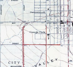
Click here for larger map!

The 2019 CicLAvia Season has come to an end, and the sixth and final (and 34th ever) open streets course runs through the west San Fernando Valley, this time running on an all-new alignment along perhaps the most boring-shaped CicLAvia route evar (Dude, it's literally a straight line running exactly five miles...), and The Militant was thinking of putting down like half a dozen points of interest on this here Epic CicLAvia Tour guide and calling it a day, but nooooo....Like a Transformer, there's always more than meets the eye when it comes to Los Angeles history, and this route is no exception. Most of you know your SFV history: It was largely open agricultural land, in came the Pacific Electric in the 1910s, selling land tracts, and after World War II - KABOOM - a suburb was born.  The result is 14 points of interest on for this Sunday's CicLAvia route, which is expected to be cold chillin', but not rainy (we hope). But always remember, The Sun Always Shines On CicLAvia, and no matter how overcast the day is, El Sol always finds a way to make a cameo appearance. So here we go (better late than never), and as always...See you or not see you on the streets!
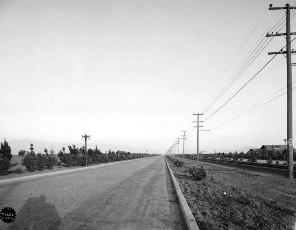
1. Sherman Way
1911
Sherman Way, Reseda

Named after railroad executive Moses Hazeltine Sherman (you should be familiar with that name from the "Meet The Hollywoods" CicLAvia), who was responsible for bringing his Los Angeles & Pacific Railway (later merged into the Pacific Electric Railway) into the San Fernando Valley. The street was originally a zig-zagging $500,000 grand boulevard built in 1911 along the Red Car right-of-way, stretching from North Hollywood, running west along what is now Chandler Blvd, then north along what is now Van Nuys Blvd, and west along the current Sherman Way. As the SFV farmland gave way to (sub)urbanization and the street grid, Sherman Way was re-aligned and extended eastward as a straight thoroughfare in the 1920s.

2. Site of Sherman Square Roller Rink
1969-2001
18430 Sherman Way, Reseda

In the 1970s and 1980s, this was The Center of the Universe for many Valley youth: A roller rink during the skating heyday of the '70s (and on Monday nights, the Skataway club, a weekly private hangout for celebrities such as Cher and Jack Nicholson), and also hosted a roller hockey league and a bowling alley. Towards the '90s, the venue hosted computer shows during the weekends, but was also plagued by gang activity. It was razed in 2001 and replaced by the current Walgreen's pharmacy.

3. Site of Chuck Landis' Country Club
1980-2000
18419 Sherman Way, Reseda

Originally built as a Sav-On Drugs store, Los Angeles nightclub entrepreneur Chuck Landis bought the property in 1979 and converted it to a 1,000-seat concert venue originally intended for country music acts. But the burgeoning local punk, new wave and heavy metal acts of the early 1980s found an ideal venue - artists such as Motley Crue, the Red Hot Chili Peppers, The Bangles, Jackson Browne and Guns N Roses played here in their early years, as well as established acts like B.B. King, The Beach Boys, James Brown, Prince and Tom Petty and the Heartbreakers. U2 played their very first concert in Los Angeles here in 1981. In the mid-'80s, the venue also hosted boxing matches. It petered out in the 1990s and is now the Restauracion Reseda Church.


4. Reseda Theatre
1948
18447 Sherman Way, Reseda

The beginnings of the Sherman Way/Reseda intersection becoming the entertainment capital of Reseda started as far back as the 1940s when this S. Charles Lee (You'll recognize his name as architect of many other historic theatres in these Epic CicLAvia Tour guides)-designed Streamline Moderne cinema showed double features to the nearby newly-developed residential community. The theatre closed in 1988, but it gained some notoriety in the 1997 film "Boogie Nights" and is planned to be resurrected as a Laemmle multiscreen cinema.

5. Reseda Vietnamese District
c. 1980s
Near Sherman Way & Reseda Blvd, Reseda

Thought Westminster and Garden Grove are most synonymous with the Vietnamese community in Southern California, the largest concentration Viet Americans in the 818 is located right here in Reseda. This mile-long stretch of Sherman Way is home to several Vietnamese eateries, including Pho 999 (7255 Reseda Blvd), Pho So (7231 Reseda Blvd), Luc Huyen Cam Cafe (18541 Sherman Way), Sandwich Express (18575 Sherman Way), Vinh Loy Tofu and Bun Bo Hue (18625 Sherman Way).
There are also many more businesses, cultural institutions, organizations and houses of worship with a two-mile radius of Sherman and Reseda.

6. Aliso Canyon Wash
Sherman Way between Crebs and Wilbur avenues, Reseda

One of the Los Angeles River's many tributaries, this seasonal wash carries stormwater from Aliso Canyon (yep, that Aliso Canyon) up past Porter Ranch, running due south and joining the Los Angeles River near Yolanda Avenue.

7. Los Angeles Jewish Home
1952
19308 Sherman Way, Reseda

Like many Jewish institutions in Los Angeles, this senior living and health care facility originated in Boyle Heights in 1916, expanding to the SFV in the late 1940s. It's one of three campuses of the Los Angeles Jewish Home - the other nearby on Victory Blvd and another in Playa Vista. This campus, known as the Grancell Village Campus, is home to 1,000 seniors. Wonder if the residents know that the 1952 Spanish Colonial Revival structure on Sherman and Tampa was originally the Lorenzen Mortuary? 

8. Platt Office Building
1981
19725 Sherman Way

Conceived by carpenter Dennis Platt and designed by T.W. Layman, this office building built in the 1980s (but meant to look like it was made in the 1880s) contains remnants from the Queen Anne-style Little Sisters of the Poor Rest Home originally located in Boyle Heights and various parts from Victorian homes in Bunker Hill, combined with re-created architectural sections.


9. Site of the Weeks Poultry Colony
1923-1934
Area bordered by Winnetka Ave, Leadwell St, Oso Ave and Lanark St, Winnetka

Charles Weeks was a Midwesterner who moved to California in 1904 and in 1916 established a utopian poultry farming community named Runnymead in Santa Clara County where families lived on one-acre farms and sustainably raised chickens and eggs, and through that, would establish ideal social structures. In 1923 he moved south to the farming community of Owensmouth in the San Fernando Valley and established a similar colony here known as the Weeks Poultry Colony. The Great Depression put the idealistic colony to an end, and Weeks moved to Florida where he lived the rest of his life until his death in the 1960s. The colony is long-gone, but Weeks left his mark on the community which still exists today: The area is now known as Winnetka, named by the remaining colony members after Weeks' Illinois hometown, Runnymede Street and park were named after Weeks' original Nor Cal colony, and nearby Independence Avenue originated from his poultry colony marketing pitch, "One Acre and Independence."

10. Browns Canyon Wash
Sherman Way between Cozycroft and Lurline avenues, Winnetka

Another Los Angeles River tributary runs under Sherman Way, originating in Browns Canyon in the Santa Susana Mountains. It joins The River just west of Mason Avenue.

11. Canoga Park Antique Row
Sherman Way between Canoga and Owensmouth avenues, Canoga Park

This half mile-long stretch of Sherman Way contains at least eight stores selling antiques and collectibles, including Red's Antiques (7221 Canoga Ave), Alabama Antiques and Collectibles (7209 Alabama Ave), Galeano's Treasures (7207 Alabama Ave), Retro Relics Etcetera (21501 Sherman Way), Antique Store Canoga Park (21507 Sherman Way), Sherway Jewelry & Loan (21514 Sherman Way), Old Friends Antiques & Restoration (21517 Sherman Way) and Canoga Vintage and Collectibles (21619 Sherman Way).
12. The Source of the Los Angeles River
Owensmouth Avenue, south of Bassett Street, Canoga Park

Take a short ride down Owensmouth Avenue to see where The Los Angeles River officially begins, at the confluence of Bell Creek (pictured right), which flows down from the Simi Hills, and Arroyo Calabasas (pictured left), which flows down from the north side of the Santa Monica Mountains. Together they become the Los Angeles River, flowing 51 miles eastward then southward into Long Beach Harbor. 

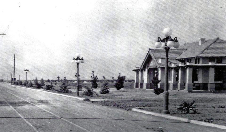
13. Site of the Pacific Electric Owensmouth Station
1912
Sherman Way and Topanga Canyon Blvd, Canoga Park

On the northwest corner of this intersection stood the Pacific Electric's Owensmouth (Canoga Park) depot. Built in the days when land companies were promising access to Owens Valley water via the upcoming Los Angeles Aqueduct (despite the fact that its terminus was some 20 miles to the northeast), the area eventually adopted the name of a nearby Southern Pacific Railroad depot, itself named after Canoga, NY. The U.S. Postal Service insisted on adding the word "Park" to lessen confusion with its original East Coast namesake. The Pacific Electric was a Craftsman-style structure that outlived its tenure as a Red Car depot when service ended in 1938. Unfortunately, it burned down in a fire in 1994.

14. Carlson Circle/Proposed PE Extension
c. 1910
Sherman Way at Carlson Circle

At the southeast corner of Sherman Way and Shoup Avenue is a street called Carlson Circle - a cartographic curiosity that stood out to The Militant. Back in the day, before the SFV conformed to an absolute grid, Sherman Way curved down using this quarter-circular thoroughfare and merged with Shoup Avenue (which, like Sherman Way, was also named after a Pacific Electric Railway executive -- Paul Shoup). The circle also had some connection to the Red Cars: Although there was never track laid on it, it was part of a onetime 1910 proposal to extend the Owensmouth streetcar line to what is now Valley Circle. So who was Carlson? Hugo Carlson was an immigrant from Sweden who settled in Owensmouth in 1912 and was one of the town's pioneers. He owned a 55-acre farm in the area that grew beans and tomatoes, was an active member of the local chamber of commerce and was also instrumental in supporting efforts to build flood control channels in the area. He died in 1958. His old farm, just inside of his eponymous Circle, is now home to the posh Canoga Lakes condo community.

BONUS: And since we've seen some #lasnow on our mountains lately, here's a flashback to 1957 when it snowed in the Canoga Park/Woodland Hills area, just south of Sunday's CicLAvia route. This is Topanga Canyon Blvd at Ventura Blvd:


Friday, October 4, 2019

The Militant's Epic Militant CicLAvia Tour XXXIII!!!


Interactive map! Click here for larger map.


The fifth CicLAvia of 2019 and the 33rd edition of Los Angeles' premier open streets event is here.
The October CicLAvias are normally a certain version of the classic "Heart of L.A." route. Almost every CicLAvia route is unique, but this is the the third time the event has used a duplicate route - this course is exactly the same as the October 2016 "Heart of L.A." alignment (The other two are the first and second CicLAvias (October 2010 and April 2011) and the June 2013 and April 2014 "Iconic Wilshire Boulevard" routes). So this Epic CicLAvia Tour guide is more or less a re-run of what The Militant has written before. But he's posting this anyway so that maybe if you are already familiar with the points of interest (Some of you have memorized these entries, right?), you can impress other CicLAvians with your (Militant-enabled) knowledge of the route!

This route is supposedly a partnership with the ongoing UCLA 100 Centennial celebration. But since it neither goes through Westwood nor the original site of the campus on Vermont Avenue (now Los Angeles City College), the route itself has very little relevance to the university. And UCLA's connection to the original location of the California State Normal School (i.e. the educational institution that became the educational institution that became UCLA), located at the current site of the Los Angeles Public Library's Central Library, is reeeeeeeeaaaallly stretching it. And furthermore, it's not even on the CicLAvia route. But there will be a number of UCLA-related events going on along the route this Sunday, and hey, it's a sweet sponsorship to ensure this event takes place. As someone who may or may not be a UCLA alum, The Militant may or may not be proud of the UCLA-centric theme of this CicLAvia, so he may or may not check them out. 

As usual, see you or not see you on the streets on Sunday!

1. Eastside Luv
2006 (Built 1940)
1835 E. 1st St, Boyle Heights

One of The Militant's favorite hangouts in the Eastside, this bar, started by a bunch of friends who grew up in nearby City Terrace, took over the former Metropolitan bar eight years ago and updated it to a more contemporary Eastside-style flavor. Don't call it gentrification, call it gentefication.

2. Mariachi Plaza
1889
1st St and Boyle Ave, Boyle Heights

This is the new town square for Boyle Heights, anchored by the historic 1889 Boyle Hotel on the historic Cummings Block, where Mariachi musicians have been hanging out to get picked up for since the 1930s. The Kiosko, or bandstand, that sits in the plaza is actually not that historic. It was given as a gift from the Mexican state of Jalisco, who literally shipped it over in 1998 where it was assembled in place. But it only gets used once a year for the Santa Cecilia Festival around every November 21. The plaza is also home of the Metro Gold Line station of the same name, which opened in 2009. The unique lending library Libros Schmibros relocated here in 2011. This place could warrant a Militant blog post in itself -- no, an entire week of posts! Don't miss the Farmers Market events there every Friday and Sunday!

3. Simon Gless Farmhouse
1887
131 S. Boyle Ave., Boyle Heights

Back in the totally radical '80s...That's the 1880s, Boyle Heights was an open, rural area and French Basque immigrant Simon Francois Gless built a Queen Anne style house on his sheepherding farm at this location. Today, the house is a City Historic Cultural Monument and is a home that's rented out to -- Mariachi musicians! Just a few blocks west of here is Gless Street, and you might have heard of Simon's great-granddaughter -- actress Sharon Gless, who starred in the series Cagney and Lacey, which aired a century after her arrière-grand-père first settled in Boyle Heights.

4. Keiro Retirement Home/Jewish Home For The Aging
1974/1916
325 S. Boyle Ave, Boyle Heights

With Boyle Heights being a historically Jewish and Japanese community, how's this for an ultimate Boyle Heights institution? This property was originally built in 1916 as the Jewish Home for the Aging (now operating in Reseda), and in 1974, the Keiro Senior Health Care organization, basically their Japanese American counterpart. With the Hollenbeck Palms retirement home just down the street (and site of the John Edward Hollenbeck Estate, remember?) Boyle is a popular corridor for Senior Livin.'

5. Neighborhood Music School
1947 (Built 1890s)
358 S. Boyle Ave, Boyle Heights

The Neighborhood Music School is exactly what it is. But it's also a Boyle Heights institution. Originally founded over 100 years ago when it was located on Mozart Street (orchestral rimshot), the school moved to this Victorian home in 1947 where it still offers music lessons to local youth and the public can drop by on weekends to attend free recital concerts.

6. Metro Division 20 Subway Car Yard & Site of Old Santa Fe LaGrande Station
1992 / 1893
320 S. Santa Fe Ave (visible from the 4th Street Viaduct), Arts District

Take a break from riding/walking/skateboarding/pogo-sticking/etc. and take a glance off the north side of the bridge from the west bank of the River. This facility is where the 104 Italian-built subway cars of the Metro Red and Purple line cars are stored, repaired, serviced and cleaned. This was also the temporary storage and repair site of the Angels Flight railway cars after the fateful 2001 accident. The Militant actually visited this facility back in May 1992.

The subway cars are also serviced on the site of the old Santa Fe Railway La Grande Station (hence the name of the street) that was on Santa Fe and 2nd. Built in 1893, it was precisely where midwestern transplants arrived in Los Angeles after paying their $1 train ticket from Chicago. In 1933, the landmark dome was damaged by the Long Beach Earthquake and subsequently removed. In 1939, it was rendered obsolete by the opening of the new Los Angeles Union Passenger Terminal a few blocks north.

7. Metro 1st St /Central Station Site
2023
1st Street and Central Avenue, Little Tokyo

Prior to 2014, this lot was home to the popular Señor Fish taco joint (formerly the site of '70s-'80s punk venue Atomic Cafe) and Weiland Brewery Restaurant (which opened replacement locations in Echo Park and Uptown Long Beach, respectively). Both buildings were demolished in  to make room for this new Metro subway station for the  Regional Connector project, a new subway under Downtown Los Angeles that will re-align three light rail lines into two and provide continuous, transfer-free service from Azusa to Long Beach and East Los Angeles to Santa Monica. Although Little Tokyo already has a Gold Line station just yards away, that will be demolished and the station replaced with a new underground facility where the current construction activity exists. It's rather fascinating, and it's one way Little Tokyo will more resemble Big Tokyo.  The businesses around the station have been impacted by construction, so make sure you support them, not only during CicLAvia but after!
8. Site of Quaker Dairy, Original Little Tokyo Restaurant
1890
304 E. 1st St., Little Tokyo
On the southeast corner of 1st and San Pedro streets once stood the Quaker Dairy, a restaurant started on this site in 1890 by Sanshichi Akita, an immigrant from Japan. Though preceded five years earlier by another restaurant on First St (location unknown), this is the oldest traceable location of a Little Tokyo business. By the end of the 19th century, there were over 16 Japanese-owned restaurants in this stretch of 1st Street, creating what we know as Little Tokyo.
9. Los Angeles Sister Cities Monument
1987
1st and Main streets, Downtown

On the northeast corner of 1st and Main streets stands a pole bearing signs (in the "Blue Blade" style, no less) for every one of Los Angeles' 25 Sister Cities, each pointing towards their location. The signs range from Lusaka, Zambia (the farthest sister city, 10,017 miles) to Vancouver, Canada (the nearest, 1,081 miles) and everywhere in between. Nagoya, Japan is Los Angeles' oldest sister city (1959); Yerevan, Armenia is the newest (2007). Los Angeles, an Olympic host city (1932, 1984) also has that in common with sister cities Athens (1896, 2004), Berlin (1936), Mexico City (1968) and Vancouver (2010). Okay, the Militant is just filling up this paragraph with mindless trivia.

10. U.S. Federal Courthouse
2016
145 S. Broadway, Downtown
This big glass cube that is responsible for blocking your view of the Downtown Los Angeles skyline from Grand Park used to be a hole in the ground was once the site of the Junipero Serra State Office Building, which was damaged in the 1994 Northridge Earthquake and abandoned and demolished in 1998. This 10-story, 400-foot-tall U.S. Federal Courthouse building (don't we already have a few of those?), designed by Skidmore Owings and Merrill, opened in 2016. Do check out the embossed bald eagle situated over the main entrance on 1st Street.

11. Site of 1910 Los Angeles Times Bombing
1910
Northeast corner of Broadway and 1st Street, Downtown

This longtime empty lot, previously identified in this CicLAvia tour as the foundation of a state office building condemned after the 1971 Sylmar Earthquake has some additional history. It was recently dissevered to be the location of the 1910 bombing of the (then) Los Angeles Times building, which happened 104 years ago this week. The dynamite bombing was discovered to have been the work of Ortie McManigal and brothers John and James McNamara, all affiliated with the Iron Workers Union,  in what was meant to protest the newspaper's staunchly anti-union practices. 21 people died when the 16 sticks of dynamite exploded just outside the building at 1:07 a.m. on October 1, 1910, the explosion was exacerbated by natural gas lines which blew up a large section of the building. The Times since built a new building in its place, and later relocated across 1st Street to its current location. Today, the lot is being readied for an expansion of Grand Park.
NAVIGATIONAL NOTE: 
• If heading north to Chinatown, skip to #21.

12. Bradbury Building
1893
304 S. Broadway, Downtown

A building that's famously meh on the outside, but OMG from the inside, this building has been featured in movies from Chinatown to Blade Runner to 500 Days of Summer. Designed by Sumner Hunt and modified by George Wyman, this 5-story structure was designed to look like the 21st century from 19th century eyes. Despite the ahead-of-its-time design, this building has nothing to do with sci-fi author Ray Bradbury, but was named after developer and 1800s rich dude Lewis Bradbury.

13. Biddy Mason Park
1991
331 S. Spring St (entrance on Broadway), Downtown

Born as a slave in Georgia over 200 years ago, Bridget "Biddy" Mason was a renaissance woman of her time. Having followed Mormon settlers west, she gained her freedom when California became a slavery-free Union state. As a nurse, she founded the first child care center in Los Angeles and later became a lucrative property owner and philanthropist, having founded the First AME Church, now a major institution in Los Angeles' African American community. She died in 1891 and was buried at ...Evergreen Cemetery (which you might have also seen earlier...see how things all tie together?). A century after her passing, this mini-park in DTLA, on the site of her house, was built and dedicated.

14. Broadway-Spring Arcade Building
1924
541 S. Spring St, Downtown

This unique building is actually three, opened in 1924 on the site of Mercantile Place, a 40-foot street cut between 5th and 6th streets connecting Broadway and Spring. Mercantile Place was a popular shopping and gathering locale in the early 1900s. Having fallen into decay by the 1970s, it was recently renovated and is now famous for, of all things, vendors selling rock band t-shirts. It also becomes an artistic venue during the DTLA ArtWalk. And The Militant probably doesn't need to mention that this building is home to the DTLA Guisado's.

15. St. Vincent Court
1868
St. Vincent Ct and 7th Street, Downtown

You'd hardly knew it was there, but this alley nestled between Broadway and Hill (blink and you'll miss it!), with its decorative brick pavement and European decor, seemingly belongs to another world. Originally the site of a Catholic college that was the predecessor of today's Loyola Marymount University, today it's a unique food court featuring Armenian and Middle Eastern eateries. The Militant calls it, "Littler Armenia." Check out this Militant Angeleno post on St. Vincent Court from 2008 for more info!
16. Diamonds Theatre (Warner Theatre & Original Pantages Theatre)
1920
401 W. 7th Street, Downtown
This jewelry retail mart is actually a re-purposed theatre that was the original Pantages Theatre (remember from the last CicLAvia?) opened in 1920 by Greek American entertainment magnate Alexander Pantages for Vaudeville productions. Designed by B. Marcus Priteca (who also designed today's Pantages Theatre in Hollywood), it was sold in 1929 and eventually became the Warner Theatre, screening motion pictures from the WB during the days when the movie studios ran their own theatres. The theatre closed down in 1975 and became a jewelry mart in 1978.

17. The Bloc (Formerly Broadway Plaza/Macy's Plaza)
1973
7th Street between Flower and Hope streets, Downtown

A poster child for change in Downtown, this shopping center, originally built in 1973 and designed by Charles Luckman & Associates as the first suburban-style mall in DTLA combined an indoor (though massively truncated) indoor galleria, a hotel and a 32-story office building. Initially known as Broadway Plaza, named after the old upscale Southern California department store anchor tenant, its name was changed to Macy's Plaza in 1996 after The Broadway merged with the NYC-based equivalent Macy's. Its blocky, street-unfriendly design was derided by many, especially in an era where the outdoor mall format pioneered by Santa Monica's Third Street Promenade, and Rick Caruso's faux-urban monstrosities (and more recently, the newly-opened The Village at Westfield Topanga),  so in 2013 it was re-conceptualized as "The Bloc" and currently stands as a work-in-progress, (which also features a direct entrance to the 7th Street/Metro Center subway station).
18. Wilshire Grand Center
2017
900 Wilshire Blvd, Downtown

On this site rises the new Wilshire Grand Center, Los Angeles' (and the West's -- suck on it, Transbay Tower SF!) tallest building at 73 stories and 1,100 feet (kinda sorta, there's a spire, you see...). Opened in June 2017, it is the city's only modern skyscraper without a flat roof, the only Los Angeles building since Hollywood's Capitol Records tower in 1956 to feature a spire, the first skyscraper anywhere to sport a mohawk, and it also has its own irreverent Twitter account. ;) Owned by Korean Air (hence the red and blue taeguk LED logo), the tower houses the 900-room Hotel Intercontinental with its 70th-floor Sky Lobby and the unique Spire 73 skybar, with wonderful views of the south and west (the sunset vista from here is not to be missed). The building's construction site was the location of "The Big Pour" - which lasted from February 15 -16, 2014, where 21,200 cubic yards (81 million pounds) of concrete for the tower's foundation were continuously poured - earning it a Guinness World Record for that feat. Before the skyscaper, the site was home of the Wilshire Grand Hotel, formerly (in reverse chronological order) the Omni Hotel, Los Angeles Hilton, Statler Hilton and Statler Hotel.

19. City View Lofts/Young's Market Company Building
1924
1610 w. 7th St., Pico-Union

Ever wondered what's the deal with this 4-story Italian Renaissance-style building? It was built in 1924 as a liquor warehouse and original headquarters for Young's Market Company, which still operates today as the largest liquor distributor in the West. This building features actual marble columns and a decorative frieze made of terra cotta. The company, in the roaring, pre-depression 1920s, just felt like it. The building was looted and burned in the 1992 Riots and was rehabbed in 1997 to become the City View lofts. The building is in the National Register of Historic Places.

20. Gen. Douglas MacArthur Monument
1955
Southeast corner of MacArthur Park, Westlake

It's sort of strange how a monument to the park's namesake seems almost invisible (Gen John Pershing, MacArthur's WWI counterpart, could totally identify). In fact, most people don't know it's even there, but on the southeast shore of the lake is a dormant memorial fountain featuring a statue of the WWII general overlooking a model of the Pacific theatre (no, not that one) where he led allied forces to eventual victory. It was designed and built in 1955 by Roger Noble Burnham, who previously sculpted the Tommy Trojan statue on the USC campus and taught at the Otis Art School, formerly located nearby.

• North Spur to Chinatown

21. Site of Court Flight
1904 (demolished 1943)
Broadway between Temple and Hill streets, Downtown

With Angels Flight fiiiiiiiiiinally up and running again (fingers crossed), it's time to pay tribute to the city's other funicular, its cousin to the northeast, Court Flight. Built in 1904, it went up the northern end of Bunker Hill and was next to a former road called Court Street, hence its name. Even shorter than its more famous cousin at 200 feet, it ran steeper at a height of 200 feet. It was burned by a fire in 1943 and never reconstructed. The hill was eventually chipped away. The north side of the stairways going up to the Court of Flags (wonder if that was intentional there) in today's Grand Park is the precise location of ol' Courty.
22. Hall Of Justice
1926
Temple Street and Broadway, Downtown

No, you won't find Superman or any of the Super Friends here.  But this building, the oldest surviving government building in the Los Angeles Civic Center, was built in the mid-1920s as the original Los Angeles County Courthouse and Central Jail (which once housed the likes of Busy Siegel, Sirhan Sirhan and Charles Manson), as well as the headquarters for the Sheriff's Office, the District Attorney and the County Coroner. This Beaux Arts-style building was designed by Allied Architects Association, an all-star team of local architects put together to design publicly-funded buildings. The building is currently undergoing a major renovation project to modernize the facilities and repair damage from the 1994 Northridge Earthquake. It re-opened in 2015 as a LEED Gold Certified building (gotta be sustainable, y'all) with the return of the Sheriff's and District Attorney's offices.

23. Fort Moore Pioneer Memorial
1957
451 N. Hill St, Downtown

Way, way, waaaaay back before we had tall building and freeways, Downtown Los Angeles (well Los Angeles, period back then) had a bunch of hills, Bunker Hill being the most famed one. There was also Fort Hill, the site of a Mexican-American War encampment. On July 4, 1847 the facility was called Fort Moore (and the hill Fort Moore Hill), after Captain Benjamin D. Moore of the U.S. 1st Dragoons regiment, who was killed six months earlier in a battle near San Diego. The 1st Dragoons and the Mormon Batallion established the new fort and raised the U.S. flag during the first-ever observed Independence Day in Los Angeles. This event was immortalized in a bas-relief stone monument made in the 1950s. Speaking of forts, the very street you're riding (or walking, or skating, or scootering, or stand-up-paddling, or pogo-sticking) was once called "Fort Street," which inevitably led to directional problems some six blocks south of here. The monument also includes a fountain, which was shut off in 1977...due to the drought at the time.

So where's the actual hill, you ask? It was bulldozed away in the late 1940s to make room for the 101 Freeway (is this a recurring theme for this CicLAvia or what?!)

24. Chinatown Gateway Monument
2001
Broadway and Cesar E. Chavez. Avenue, Chinatown

Designed to be the symbolic entrance to Los Angeles' Chinatown District, The Chinatown Gateway Monument, a.k.a. the Twin Dragon Towers Gateway, depicts two dragons grabbing at a central pearl, which symbolizes luck, prosperity, and longevity. The 25-foot-tall structure was put up in 2001 and occasionally emanates steam coming from the dragons' mouths. Unlike Anglo dragons, the creatures in Chinese folklore are the good guys, meant to scare away evil spirits.

25.  Buu Dien
c. 1990s
642 N. Broadway (Facing New High St, south of Ord), Chinatown

If you're ever in some TV trivia contest on your way to being a millionaire and the host asks you, "What is the Militant Angeleno's favorite Vietnamese banh mi place West Of The Los Angeles River (WOTLAR)?" you won't need to call a lifeline, because the answer is Buu Dien. When the Militant has only $4 in his pocket and wants to get a meal in Downtown, this is his go-to joint. A literal hole in the wall in every regard, this place serves bomb-ass (do people still use that phrase) Viet sammiches for less than $3 a pop. And the bread is awesome. And nice and warm. Plus they also serve up spring rolls, desserts, pastries, Vietnamese coffee and pho (never had it here yet, but The Militant's favorite pho WOTLAR is Pho 79 just up the street). People complain about parking in his micro-mini mall, but this is CicLAvia!

26. Capitol Milling Co.
1883
1231 N. Spring St, Chinatown

One of the last visible vestiges of Los Angeles' agricultural industry, this family-owned flour mill operated from 1831 to 1997, before moving its operation to a much larger facility in Colton. The facility that still stands today was built in 1883. The mill supplied flour to clients such as Ralphs, Foix French Bakery and La Brea Bakery. In 1999, the family-owned operation was purchased by industry giant Con-Agra Co.
The historic building, built even before the railroads arrived in Los Angeles, still has a horse-tethering ring, back to the days when grain was hauled by horse carriage from farms in the San Fernando Valley. The property is currently being adaptively reused into retail and creative office space.

27. Old (New?) Chinatown Central Plaza
1937
Gin Ling Way between Broadway and Hill, Chintown

The new northern terminus of CicLAvia is no stranger to public events; it was made for them. In the Summer it hosted three very popular Chinatown Summer Nights events. But don't let the "Old Chinatown" neon sign fool you -- This is actually Los Angeles' new Chinatown, which dates back to the 1930s. The real Old Chinatown was several blocks south, where a thriving community of Cantonese-speaking immigrants lived near the river, north of Aliso Street. Of course, they were kicked out in the early '30s to make room for Union Station. So they moved a few blocks north, in the former Little Italy, and they've been there ever since. Well, not really, since some of them moved east to the San Gabriel Valley and were supplemented with Mandarin-speaking immigrants from Taiwan and Mainland China. But you get the idea.

Happy CicLAvia, Los Angeles! Enjoy and STAY MILITANT!

Friday, August 16, 2019

The Militant's Epic Militant CicLAvia Tour XXXII!!


Click for larger map!

The fourth of six CicLAvias in 2019 and the 32nd iteration of Los Angeles' showcase open streets event takes place this Sunday, 8/18. Though unfortunately not in the San Fernando Valley, as the date would otherwise dictate, but on the other side of The Hill, with a 6-mile course linking the ethnically diverse East Hollywood with the star-studded central Hollywood and the prideful and design-conscious West Hollywood. Dubbed by CicLAvia's organizers as "Meet The Hollywoods" (Can they try to find better names of events without using the word "meet" or "meets"? The Militant is willing to help them out in that department - seriously -- email him), The organizers challenge CicLAvians to re-discover neighborhoods they may or may not already know. The Militant, too, wants people to re-discover the communities along every CicLAvia route: There have been 31 unique routes during the entire history of CicLAvia so far (the first two events had the same course), and The Militant Angeleno has tirelessly [takes, long deep breath] taken time out of his militant and extramilitant life to share with you his intimate knowledge of secret and unique points of interest.

If you're familiar with The Militant's Epic CicLAvia Tour guides, you'll know that a lot of the points of interest are connected with another in some way, and this one is no exception. Our CicLAvia tour begins in a triangle formed by local streets, and as you will see, you'll see that pattern repeats itself all the way to the opposite end of the route!

So here goes the CicLAvia guide for this Sunday. As always, see you or not see you on the streets!


1. Vermont Triangle
1911
Hollywood Blvd, Vermont Ave & Prospect Ave, East Hollywood

A year after the town of Hollywood voted to be annexed by Los Angeles in 1910, the Pacific Electric Railway extended its tracks from Sunset Boulevard to Hollywood Blvd. This triangular space, formed by Hollywood, Vermont and Prospect Avenue (the former moniker of Hollywood Blvd that retains its name eastward of the triangle), became a popular Red Car stop until service here ended in 1954. It maintained its use as a transportation facility, becoming not only a bus stop, but also a taxi layover zone. It became a de facto green space up until the early 21st century, where it turned into a popular locale for homeless encampments, despite the city's efforts to landscape it into a beautified public space.

2. Hollyhock House
1921
4800 Hollywood Blvd, East Hollywood

The former residence of oil heiress, proto-feminist, patron of the arts and cultural influencer Aline Barnsdall (pronounced "barns-doll," not "barns-dale"), it was built in 1921 and designed by none other than Frank Lloyd MF'ing Wright. Named after Barnsdall's favorite flower (which forms a design motif around the building), it was borne from much bickering and head-clashing between the architect and client due to the home not being built to her tastes and cost overruns. In 1926 she up and left, sort of, donating the house and most of the property sitting on Olive Hill to the City of Los Angeles for artistic and recreational purposes. Although, she did live in a now-demolished residence on the west side of the park for the last two decades of her life. Last month, Hollyhock House was designated as a UNESCO World Heritage Site - the first such in Los Angeles.

3. Mosque Shopping Center/Calmos Gas Station
1923
4982 Hollywood Blvd, East Hollywood

This unassuming L-shaped shopping center on Hollywood and Alexandria sports a pair of towering minarets on top of its roof. Was it a mosque at one time? Was this home of an Islamic community in the past? Actually, no. they're the last vestiges of Calmos Auto Service Center, a gas station built in 1923 that became part of Union Oil's 76 chain. Its architecture reflects the whole Arab/Egyptian aesthetic fetish/appropriation thing back in the '20s, a decade which was marked by the 1921 Rudolph Valentino film, "The Sheik" and the 1922 discovery of King Tut's tomb. As seen in the historic 1924 photo, the dome of the "mosque" was a now-demolished structure that housed the area for the gas pumps.


1969
1615 N. Alexandria Ave., Little Armenia

This K-12 Armenian private school, affiliated with the St. Garabed  Armenian Apostolic Church across the street, is one of the biggest cultural anchors in Little Armenia. Named after its founders, not only is it the alma mater of 3/4ths of the rock band System Of A Down, but its relatively-new library building was designed to resemble Noah's Ark, as it was believed the ark landed in Mt. Ararat, the highest mountain in ancient Armenia and an iconic cultural landmark for the country. The school will be celebrating its 50th anniversary this week on Tuesday, August 20.

5. Thai Spirit House
1992
5321 Hollywood Blvd, Thai Town

Just to the right of the driveway of the Thailand Plaza shopping center, across from the Buddha shrine, is one of the most tucked-away curiosities in the Hollywood area. Known by the uninitiated as a "doll house," this miniature Siam-style abode serves as a cultural function to the nearby Silom market and the former Thai restaurant on the premises: Known as a "spirit house," it is built away from a business to ward away evil or mischievous spirits by leading them to an alternate location (plus water/fruit offerings) so their bad juju doesn't affect you.

6. Thai Town Gateway Statues
2007
5448 Hollywood Blvd, Thai Town

This pair of bronze statues on pedestals towering over Hollywood Boulevard function as the gateway of Thai Town. First installed in 2007 and the subject of The Militant's first ever blog post, it depicts a figure known as an apsonsi, a half-angel, half-lion creature from Thai mythology, chosen for its attributes as a protector. The statues were made in Thailand and flown from Bangkok, which, like Los Angeles, is also known as "The City of Angels."
Another pair of statues were installed near Normandie Avenue in 2012.

7. Mayer Building
1928
5504 Hollywood Blvd, East Hollywood

This four-story, Art Deco edifice, also known as the Hollywood Western Building, was designed by S. Charles Lee, who also happened to design many a structure featured in The Militant's Epic CicLAvia Tour guides. Named after its developer Louis B. Mayer (as in Metro Goldwyn Mayer) it served as the first home of the Motion Picture Academy of America (a.k.a. The Ratings People) and Central Casting. More recently, it serves as the local field office of U.S. Congressman Adam Schiff. Be on the look out for one of them trolley wire support rings, still embedded into the side of the building!

8. Hollywood Pantages Theatre
1930
Hollywood Blvd, Hollywood

Opened in 1930, this was actually the second theatre in Los Angeles bearing the Pantages name (the first one, still standing on 7th and Hill streets, opened a decade earlier and was renamed the Warner Theatre in 1929). This was also the last theater built bearing the name of vaudeville promoter Alexander Pantages, who ran a chain of 84 theaters across North America back in the day. The iconic Art Deco venue designed by B. Marcus Priteca (who also drew up the DTLA Pantages, as well as other theaters) actually functioned as a cinema for most of its history until 1977 when it ran the Broadway musical Bubbling Brown Sugar and the rest is Jazz Hands history. But did you know that the building constructed nearly 90 years ago is actually incomplete? It was originally supposed to stand 12 stories tall with offices. There have been recent proposals to complete the structure.

9. Hollywood Brown Derby Site/Metro Bike Hub
1929-1985/2017
1628 N. Vine St, Hollywood

Did you know that Metro's Hollywood Bike Hub facility, which opened in 2017, stands on the very site of the Hollywood Brown Derby restaurant? This was the second location of the legendary local restaurant chain, which began on Wilshire Boulevard. Back in the Hollywood Heyday of the first half of the 20th century, it was like the lunch and dining hotspot for famous film stars and industry moguls. But perhaps the biggest star associated with the Hollywood Brown Derby was the Cobb Salad, invented here circa 1937. Named after Brown Derby co-owner Robert Cobb, it was an improvised mish-mash of leftover salad ingredients, either made for theater mogul Sid Grauman or by Cobb himself as a late-night meal (depending on which version of the legend). The restaurant closed down in 1985 and the iconic Mediterranean-style structure was burned in a fire two years later. It was finally demolished in the mid-1990s after the Northridge Earthquake.

10. Capitol Records Building/Hollywood Jazz Mural
1956
1750 N. Vine St, Hollywood

You may or may not already know that the Capitol Records building is: a) The world's first circular office building (designed by Louis Naidorf of Welton Becket associates -- the same architectural firm that designed the Dorothy Chandler Pavilion; b) Designed like a stack of records; and c) The FAA warning light atop its spire spells "HOLLYWOOD" in Morse Code. What you probably didn't know was that Capitol Records, founded in 1942, was the first major record label headquartered in the West Coast, and that the building was largely financed by the profits made from its premier artist at the time, Nat King Cole. Also, this is one of two skyscrapers in Los Angeles with a spire, the second being the Wilshire Grand Center. And speaking of Nat King Cole, Capitol's classic crooner is depicted front and center in the 88 foot-wide mural facing the building's south parking lot, "Hollywood Jazz, 1948-1972" by African American muralist (and Lynwood native) Richard Wyatt, Jr. painted in 1990 and restored in 2011. If you're into the Walk of Fame stars, all four members of The Beatles, as well as Tejana singer Selena, have their pavement honors in front of the building.

11. 'Once Upon A Time in Hollywood' Filming Locations
2018
Hollywood Blvd between Vine Street and Cherokee Avenue

Location scenes from the 2019 Quentin Tarantino film, "Once Upon A Time In Hollywood" were filmed in summer and winter 2018 on The Boulevard between Vine Street and Cherokee Avenue, which itself became an actor, dressed in late-1960s period signs, ads and aesthetic. The 1923 Guaranty Building on 6331 Hollywood Blvd (now the L.Ron Hubbard Museum) got a retro-look as a Bank of America branch. And up Ivar Street, Joseph's Cafe (1775 Ivar) stood in for the iconic West Hollywood nightclub Pandora's Box.

12. Janes House (Oldest House in Hollywood)
1903
6541 Hollywood Blvd, Hollywood

At the far end of this collection of restaurants and bars stands the oldest extant house in Hollywood -- a Queen Anne/Dutch Colonial Revival abode built in 1903 developed by none other than H.J. Whitley himself (as in the dude who founded Hollywood in 1886). It was owned by members of the Janes family from Illinois for some 80 years and also functioned as a small private school (attended by the children of celebrities) until the mid-1920s. In 1985, the house was moved several yards north to its current location and the Hollywood-facing part of the property was developed. Today it functions as a 1920s-themed speakeasy bar called No Vacancy at Hotel Juniper.

13. Grauman's Egyptian Theatre
1922
6706 Hollywood Blvd, Hollywood

Built in 1922 by cinema mogul Sid Grauman, this was his first venue in Hollywood after opening the Million Dollar Theatre in Downtown Los Angeles. Designed by the team of Gabriel Meyer and Philip Holler (who also designed The Egyptian's younger and more famous sister down the street, The Grauman's Chinese Theatre), it was inspired by the popular "Egypt-mania" sweeping the world following the 1922 discovery of King Tut's tomb. From the 1970s to the 1990s it ran under the Mann Theatres chain (The Militant saw "Return of the Jedi" here during opening weekend in 1983), and was sold to American Cinematheque in 1996, re-opening two years later after a major renovation. It may or may not be purchased by Netflix.

14. Hollywood High School
1903
1521 N. Highland Ave, Hollywood

Originally founded in 1903 as a two-room school a few blocks north above a Masonic Lodge the same year the town of Hollywood was in incorporated, the campus moved to its current location a year later. In the 1920s, its mascot, The Sheik, was named after the hit 1921 Rudolph Valentino movie of the same name. Since then it has boasted a large number of famous alumni, such as Los Angeles Times publisher Norman Chandler (Class of 1917), actress Carole Lombard (1923),  "Looney Tunes" animator Chuck Jones (1930), actress Lana Turner (1936), "People's Court" judge Joseph Wapner (1937), actor Mickey Rooney (1938), actress Judy Garland (1940), Secretary of State Warren Christopher (1940),  actor James Garner (1944), actress/comedian Carol Burnett (1951), actor/singer Ricky Nelson (1958), actor John Ritter (1966), actor Laurence Fishburne (1980), actress Sarah Jessica Parker (1983) and R&B singer Brandy (1996). A large mural outside the school's auditorium depicts famous alums as well as other celebrities.

15. Highland Avenue
1900
Highland Avenue, Hollywood

Highland Avenue was not named after the Scottish Highlands, nor any other geography or topography, but in memory of a local woman named Highland Price. Her best friend and neighbor, Mary Penman Moll, who lived where the Hollywood Roosevelt Hotel now stands, donated a strip of property to be built as a road. She named it in memory of Price, who passed away at the time and was the first person interred at Hollywood (now Hollywood Forever) Cemetery in 1900. The street became an important north-south thoroughfare, especially one connecting directly with the San Fernando Valley via the Cahuenga Pass. From 1911 to 1952, it carried the Pacific Electric Railway lines between Los Angeles and the SFV.


16. Formosa Cafe/PE Red Car 913
1925
7156 Santa Monica Blvd, West Hollywood

This iconic restaurant, bar and Hollywood hangout (just across the street from the Samuel Goldwyn Studio) opened in 1925 by former boxer Jimmy Bernstein, who used an old Pacific Electric Red Car. The adjoining building was built in 1939. In the 1940s, Hong Kong-born chef Lem Quon was hired to cook at the Formosa and later became Bernstein's business partner, taking over ownership after his death in 1976. Quon died in 1993, with family members taking over ownership afterward. Threatened with demolition several times, the Formosa persevered. It was featured in the 1990s movies "L.A. Confidential" and "Swingers." In the 2010s decade, after various remodeling and re-remodeling, it was purchased by the 1933 Group in 2017 and re-opened this year with the Red Car (#913, in full view on Formosa Avenue) re-painted and the establishment restored to its Golden Era charm.

17. Crescent Heights Triangle/Quint Cutoff
1900
Santa Monica Blvd & Crescent Heights Blvd, West Hollywood

Have you ever wondered why there's a "triangle" at the corner of Santa Monica and Crescent Heights boulevards? It's a remaining vestige of a half-mile railroad line known as the Quint Cutoff built in 1900 connecting a rock quarry west of Laurel Canyon with the railroad tracks along Santa Monica Boulevard. The "triangle" section is known in railroad terms as a "wye," which enables a locomotive to reverse direction without the use of a turntable. Another "wye" was built at the opposite end of the line where it meets Sunset Boulevard. The Pacific Electric Railway briefly took over this railroad line in 1911 until it was dismantled shortly after that year, but the alignment of the "wye" tracks on both ends were built into the modern street grid.

18. Plummer Park
1937
7377 Santa Monica Blvd, West Hollywood

In 1874, Anglo-Mexican couple Capt. John and Maria Cecila Plummer purchased a ranch formerly part of Rancho La Brea (bounded by present-day Santa Monica Blvd, La Brea Ave, Fountain Ave & Gardner St) to raise their sons Juan and Eugenio and grow vegetables to sell to residents of nearby Los Angeles. The Plummers were good friends with the Leonis family, who had a ranch of their own way over the hill in present-day Calabasas. After John and Maria died, the ranch was divided and plots sold off, with Los Angeles County purchasing a large portion in 1937 to use as a public park, with new facilities being built as part of FDR's Works Progress Administration projects. Eugenio lived in the 1877 family house until his death in 1943. The Plummer House was the oldest house in Hollywood until it was moved in 1983 to the grounds of the Leonis Adobe in Calabasas, whereby the 1903 Janes House (See #12) took the crown as the oldest Hollywood home.

19. Sal Guarriello Veterans' Memorial
2003
Santa Monica Blvd & Holloway Dr

Salvatore "Sal" Guarriello was an Italian American WeHo resident who was best known as serving on the West Hollywood City Council from 1990 to 2009, and served as mayor four times during that tenure. During World War II, he served in the U.S. Army as a combat medic in Italy and established the West Hollywood Veterans' Memorial in Holloway Park in 2003. After his death in 2009, the City of West Hollywood re-dedicated their civic veterans' monument as the Sal Guarriello Veterans' Memorial in honor of its most respected veteran and civic official.

20. Site of La Cienega Lanes/Flippers Roller Boogie Palace
1946-1981
8491 Santa Monica Blvd, West Hollywood

What stands as a CVS Pharmacy with a concave facade was a popular youth recreational venue for various generations. In 1946, TV host Art Linkletter established Art Linkletter's La Cienega Lanes bowling alley, becoming a popular place to roll strikes during the golden era of bowling in the post-World War II era. From 1979 to 1981, the alley became Flippers Roller Boogie Palace, a popular roller skating rink and music venue during the influential post-disco new wave/punk era of Los Angeles. Local bands like The Plimsouls, Berlin and the Go-Gos, as well as up-and-coming popular acts like The Talking Heads and Prince performed there. In 1984, the building became the Esprit clothing flagship store.

21. Site of Pacific Electric Sherman Yard/Pacific Design Center
1896-1954; 1975

West Hollywood was originally known as Sherman, named after Moses Hazeltine Sherman, land developer and railroad executive (Yes, the SFV's Sherman Way and Hazeltine Ave were named after him) who co-founded the Los Angeles Pacific Railway, linking Santa Monica with Los Angeles. The area on the former Rancho La Brea land that sat midway between the two cities was chosen as the site of a railroad yard, and a settlement named after Sherman developed around it. In 1925, the town on unincorporated Los Angeles County land chose to re-name itself "West Hollywood" to closer associate with Tinseltown. Because it was on County land, and thus patrolled by the Sheriff's Department, it began to attract gay and lesbian residents during the Prohibition Era due to the Los Angeles Police Department's frequent raids of gay and lesbian establishments in Los Angeles city (whereas the Sheriff's Department was much more tolerant). The Los Angeles Pacific Railway became part of the Pacific Electric Railway starting in 1911, and the yard became the main facility for its Western District, until the last Red Car in the area rolled in 1954. Southern Pacific freight trains took over the tracks on Santa Monica Boulevard, though not as frequently, and in 1974, the yard was demolished to make room for the sprawling Pacific Design Center, which opened the year later. The PDC was designed by Argentinian architect Cesar Pelli, who passed away one month ago.

22. Norma Triangle
Santa Monica Blvd/Doheny Dr/Sunset Bl-Holloway Dr, West Hollywood

Our CicLAvia tour begins with one triangle, and ends with another: The right-triangle formed by Doheny Drive, Sunset Boulevard/Holloway Drive and Santa Monica Boulevard features one of West Hollywood's biggest residential and commercial districts. Norma Triangle was named not after actress Norma Talmadge, but after the wife or child of a Los Angeles Pacific Railroad executive during the area's days as Sherman, as many streets were named at the time. Featuring the famed Sunset Strip on its north side, and the LGBT-oriented "Boys Town" nightclub district on the south, the area also includes the former residence and studio of architect Lloyd Wright (son of Hollyhock House designer (See #2) Frank Lloyd MF'ing Wright, and who also assisted designing Barnsdall residence himself - see how things tie together on these CicLAvia guides?) on 858 N. Doheny Drive.

Happy CicLAvia on Sunday! Don't forget to share this guide with a friend!