
Interactive map! Click here for larger view.
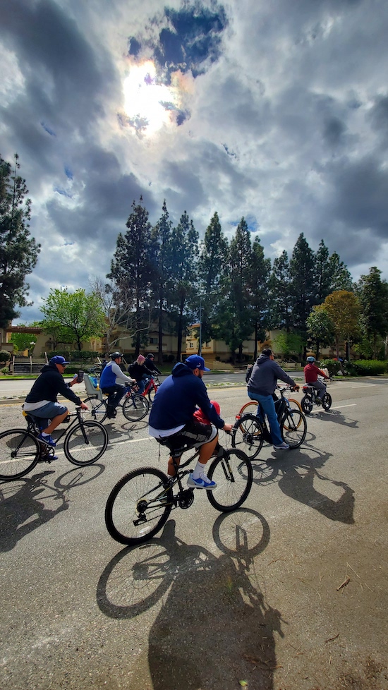
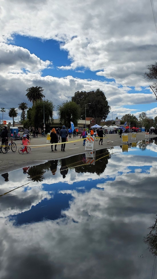
The 46th CicLAvia is upon us this Sunday, the fourth of eight such open streets events in 2023, and this is the first, and perhaps only all-new route in this year's lot that doesn't include a portion or alteration of a previous CicLAvia route. At 6.2 miles, its one of the longest CicLAvias this year (especially since last month's CicLAmini edition in Watts was so dang short...). This time, we head deep down Vermont from the 30s to the 90s-numbered streets. It was a corridor which was quite a happening place back in the 1930s-1940s, and some of the vestiges of that era remain in buildings with Art Deco and Streamline Moderne architecture, and some very unique business signage (Forgive the lateness of this Epic CicLAvia Tour Guide post - Life and The Metro Regional Connector opening got in the way...It's going on 6 a.m. Saturday morning as he's typing this and The Militant is looking forward to at least a couple hours' sleep...Zzzzz...).
Welp, see you or not see you on the streets this Sunday!
Oh yeah, if you found this Epic CicLAvia Tour guide useful and visit any of these sites, please add the #EpicCicLAviaTour hashtag to any social media post that includes it. The Militant will be glad to re-tweet!
And if you appreciate The Militant's work, kick him a little love via PayPal! He *hates* asking for money, but you know how it is these days...A Militant's gotta pay his bills! He sacrifices a lot of his time to do this! Your support is much appreciated!
Support The Militant Angeleno!
https://www.paypal.com/donate/?hosted_button_id=K5XC5AM9G33K8

1. Lucas Museum of Narrative Art
2025
Vermont Avenue and 39th Street, Exposition Park
Taking shape on west side of Exposition Park like a Naboo Royal Starship is the George Lucas Museum of Narrative Art (or, "The Luke," as The Militant would like to call it), a state-of-the-art visual, cinematic and interactive museum founded by 'Star Wars' creator and filmmaker George Lucas and his wife Mellody Hobson. The site, located in close proximity to Lucas' alma mater, USC, beat out other site proposals in San Francisco (home of Lucasfilm, Ltd) and Chicago (Lucas' birthplace) when it was announced in 2017. Originally intended to open in 2021, it was delayed to 2025 due to the COVID-19 pandemic and various construction delays.

1923
3911 S. Figueroa Street, Exposition Park
You all know this sports venue. Chances are you've been to a sporting event, concert or other gathering here at last once in your life. Opened on May 1, 1923 - 100 years ago - in honor of the local soldiers who died in World War I (hence the "Memorial" in the name), it is THE home of Los Angeles sports. It was designed by Los Angeles icon architects, the father-and-son team of John and Donald Parkinson. At one time or another, it has been the home turf of the Rams, Raiders, Chargers, Dodgers, UCLA Bruins and USC Trojans (who still play there today). Its iconic peristyle torch tower lets you know that it has hosted two Olympic Games (1932 and 1984, with a third in 2028), one World Series (1959) and two Super Bowls - including the first-ever (1967, and later 1973). And there's been so many more. Happy 100th to the Coliseum!

1910
4131 S. Vermont Avenue, Exposition Park
Built in 1910, it is the oldest high school in the Los Angeles Unified School District still standing on its original site (Los Angeles HS moved from Downtown to Mid-City in 1917 and Polytechnic HS moved from Downtown to Sun Valley in 1957). It suffered serious damage in the 6.4 1933 Long Beach Earthquake, and its buildings were rebuilt through the mid-1930s, this time in its current WPA Streamline Moderne style, designed by none other than John and Donald Parkinson. Notable alumni include film director Frank Capra, Jackie Robinson's widow Rachel Robinson and former Los Angeles County Supervisor Yvonne Brathwaite Burke. From 1911-1915, a teacher by the name of Ethel Percy Andrus taught at Manual Arts. In 1916, she moved on to Lincoln High School where she became the first woman in California to become a high school principal. After her retirement, she founded the American Association of Retired Persons (AARP), which also happens to be a major sponsor of CicLAvia. Full circle!

1913
1201 W. 48th Street, Vermont Square
Built at a cost of $35,000 from steel magnate and philanthropist Andrew Carnegie's library fund, Vermont Square was the oldest and first of the Los Angeles Public Library system's 72 branches to be built, and the first library to be owned by the LAPL (the Central Library opened 13 years later and its predecessor was in a leased building). The single-story Italian Renaissance Revival building was designed by architects Hunt & Burns, who also designed the Wilshire Ebell Theatre and the Automobile Club of Southern California headquarters on Figueroa. It was the first of six (and three surviving) such LAPL branches built from the $210,000 Carnegie Libraries grant in the 1910s (the other surviving branches are the Lincoln Heights Branch, and the Cahuenga Branch in East Hollywood). The Militant visited the Vermont Square Branch Library back in 2011.

5. Santa Fe Railway Harbor Subdivision/Metro Rail To Rail Project
1880s/2024
Paralleling Slauson Avenue, South Los Angeles.
The CicLAvia route crosses a set of railroad tracks in the street...but there are no more tracks to the east or west of Vermont Avenue. Whatup with that?! Well, this abandoned railroad right-of-way was an important part of the Atchison, Topeka and Santa Fe Railway (a.k.a. the Santa Fe) and Los Angeles transportation. It was built in the 1880s as the railroad's access to local sea ports (initially Redondo Beach in 1888, and later extended through Torrance to Los Angeles Harbor in the 1920s). It provided freight transport access for local industries - particularly the oil industry in El Segundo, as well as passenger/local commuter rail service up until the early 20th century. The line was abandoned in 2002 with the opening of the Alameda Corridor, providing a shared, direct access to the Harbor for all of the freight railroads. It is now owned by Metro, where a bicycle/pedestrian path currently known as the "Metro Rail to Rail Project" is under construction. The path will start from the K Line Fairview Heights station and head east along the former freight line to the Metro A Line Slauson station. A later phase will continue even father east to the Los Angeles River.

6. The Gage Avenue Bends
1930
Gage Avenue, South Los Angeles
Take a look at 11-mile Gage Avenue on a map and you'll readily notice that the street, which stretches from Bell Gardens in the east to Los Angeles' Hyde Park neighborhood in the west, is not as quite as straight as the other major thoroughfares in the absolute N-S-E-W Jeffersonian Grid dominant in Los Angeles (outside of the angled Spanish Grid of Downtown, of course). Why is this so? Was it a rail line? Not for most of the alignment (there were short sections that bore Los Angeles Railway and freight railroad tracks). The answer lies in how Gage Avenue was created: Named after California governor Henry T. Gage (1852-1924), who served from 1899-1903, the far eastern end of the avenue (where the Gage family hacienda was located) was named "Gage Road" in 1925, presumably in memory of the recently-deceased former governor. In 1930, Gage Avenue was designated, which involved the piecemeal merging of the former 63rd Street, Hyde Park Boulevard, and Baker, Merrill and Irvington avenues. Curved sections of road were carved out of city blocks to create a continuous alignment, and Gage Avenue was born.

7. Congress Theatre
1939
7506 S. Vermont Avenue, Vermont Knolls
Back in the day, this part of town - then known as "Southwest L.A." (hence Los Angeles Southwest College just a few miles away), was a pretty happening place, with numerous shopping destinations and neighborhood theatres. One of them was the Art Deco Congress Theatre, designed by Clarence J. Smale. The architect designed other theatres in Southern California, such as the Hawaii Theater in Hollywood, the Colorado Theatre in Pasadena and the Loyola Theater in Westchester, as well as a number of private homes, such as that of actor Buster Keaton. The 869-seat cinema opened on May 25, 1939 and featured 'Flirting With Fate' and 'Gunga Din' with a few celebrities of the day in attendance. In the 1940s, the theatre was bought by Harry Vinnicof, whose Vinnicof Theatres chain ran a number of other movie houses along Vermont Avenue, such as the Madrid, the Regent, the Temple and the Vermont (no, not the one that exists today - that was called the Campus Theatre). The Congress was popular for screening sci-fi and horror/monster movies. It the last reel rolled in Fall 1960 and a number of churches have used the building ever since.

8. Faith Dome/Site of Original Pepperdine University Campus
1937/1989
7901 Vermont Avenue, Vermont Knolls
This was the original campus of Pepperdine University (a faith-based liberal arts college founded by auto parts magnate George Pepperdine), which opened in September 1937. The 1930s Streamline Moderne structures of the original campus, designed by John M. Cooper (Santa Monica's NuWilshire Theatre, DTLA's Roxie Theatre) are still standing towards the southern and eastern ends of the property.
Pepperdine moved to its current Malibu campus after growing racial tensions between its predominantly White student body and staff and the predominantly Black residents of the surrounding neighborhood tragically culminated in the shooting death of a local teen by a university security guard in 1968. In 1981 the old Pepperdine campus property was purchased by a church called the Crenshaw Christian Center, which built the 10,146-seat Faith Dome (they put the "God" in "geodesic," you could say...) as their primary place of worship in 1989.

9. Hattem's Shopping Center
1931
8039 S. Vermont Avenue, Vermont Knolls
This towering Art Deco delight seems to be out of place on South Vermont. But back in the day, it was just another Art Deco/Streamline Moderne structure on the avenue. Isadore M. Hattem, a Turkish-born Shephardic Jew, was one of the pioneering merchants of the early 20th century, having started out as a produce vendor at Grand Central Market. In 1927, he created the first supermarket in Los Angeles, Hattem's Market, located in a Spanish revival building designed by architect Walter R. Hagedohm (who also designed Newport Beach's Balboa Inn) on Western and 43rd Street. In 1931, Hattem opened a larger 2nd location here on Vermont, called Hattem's Shopping Center, also designed by Hagedohm. It was a 24-hour supermarket that boasted its own parking court and adjoining buildings with other retail spaces. In the 1940s, the market became Allen & Huck Markets, which closed in the early 1960s. It was later purchased by Pepperdine University and functioned as its administration building until they moved out to Malibu in 1969. The building, largely intact and renovated, is now a community center for the Church of Scientology.

10. Vermont Knolls
1928
Area bounded by 79th Street, New Hampshire Avenue, 83rd Street and Normandie Avenue, Vermont Knolls
You might have heard of various knolls - Bixby, Canterbury, Beyoncé...Well this collection of Spanish Colonial Revival and French Revival single-family homes, originally known as Vermont Avenue Knolls was created in the late 1920s in an area then-known as Southwest Los Angeles, marketed a middle-class neighborhood with affordably-priced homes accessible to Downtown by the Los Angeles Railway's F Line on Vermont, but also bearing driveways and detached garages. If you look at a map, you'll see an elliptical pattern formed by 81st Street and 81st Place. Where have we seen those patterns before? Why yes, in Leimert Park. In fact, Vermont Avenue Knolls was developed by The Walter H. Leimert company, at around the same time his larger Leimert Park development was built. The homes are recognized by the City of Los Angeles as the Vermont Knolls Historic District.

11. Balboa Theatre
1926
8713 S. Vermont Avenue, South Los Angeles
South Vermont had no shortage of cinemas. This one such Spanish Churrigueresque movie house, the Balboa Theatre, which seated 1,250, was designed by Lewis A. Smith, who also designed the almost-century-old Vista Theatre in East Hollywood/Los Feliz. Opened on April 6, 1926 as part of the West Coast Theatres chain, it was later part of the Fox Theatres chain and known as the Fox Balboa in the '30s, and later under the ownership of Southside Theatres. Its movie days came to a fin in the 1960s. In the 1980s, the Balboa was revived as a live music venue, specializing in punk and metal concerts (The Dead Kennedys performed here in 1985). In the '90s and '00s, it became a Nation of Islam mosque and is currently known as Pan-Andreas West, a movie production/filming facility.

12. Million Article Thompson Sign
1932
8938 S. Vermont Avenue, South Los Angeles
What is a Million Article Thompson? Who is Million Article Thompson? Was he a prolific journalist who wrote a million articles for some long-gone newspaper (gotta be the evening edition of that paper, perhaps)? Actually, Million Article Thompson was the name of a local hardware store in the below retail space. The store opened in 1932 and they bore a decidedly large neon sign on its roof to tell the whole world who they were. The store closed sometime later, but the sign remained (though its neon tubes long gone due to weather and decay), and is a curious vestige of the aesthetics of the Great Depression/Art Deco/Streamline Moderne/WPA era.

13. Happy Bear Sign
c. 1930s/1940s
9640 S. Vermont Avenue, South Los Angeles
The business currently known as Perfect Paint & Body features a rusted metal silhouette of what looks like a twerking teddy bear holding up some sort of rectangular sign. From the 1920s to 1950s, auto shops across the US had these signs, known as "Happy Bear" or "Laughing Bear" signs. Bear Manufacturing Company of Rock Island, IL was known for producing automobile wheel alignment and diagnostic tools. Auto mechanic shops bearing (no pun intended, but maybe it was) the Happy Bear signs let customers know that the mechanics at the shop were trained by Bear and they were using their tools. Many servicemen returning from World War II in the late 1940s went to train at Bear's mechanic school in Illinois to learn new trades and start their own mechanic shops. Only about three dozen "Happy Bear" signs are still in existence nationwide, most of which are here in Southern California.
 14. Kindle's Donuts/The Original Big Do-Nut
1950
10003 S. Normandie Avenue, Westmont
You might look at this ginormous donut sitting atop a single-story stand and scoff at it being a Bought-on-Wish.com version of Randy's Donuts. But hole on, your mind is in a twist here. You're actually looking at The O.G. Ginormous Donut Stand. Donut entrepreneur Russell C. Wendell opened the first of his Big Do-Nut stands right here in 1950. It was designed by Harry J. Goodwin and featured a ginormous 32-foot gunnite donut atop the retail stand. He opened nine other locations across Southern California, from Bellflower to Reseda. Big Do-Nut lasted for some 25 years, after which the individual locations went independent. The Inglewood Big Do-Nut, in operation since 1953, was bought by Robert Eskow in 1976 and re-named it after his son, Randy. The rest is history. Russell C. Wendell later moved on from donuts to tacos and hot dogs and started a chain called Pup-N-Taco (You might have heard of it). This location was bought by Gary Kindle in 1977. Of the five surviving Big Do-Nut locations, this is the only one to spell "Donut"/"Donuts" as "Do-Nut" from the original name. Definitely try the Texas Glazed here. It's almost as ginormous as the donut on top of the building!

15. Jesse Owens Park
1950
9651 S. Western Avenue, Westmont
The Militant remembers passing by this place during his Lil'Mil days before the 105 Freeway existed, when his family would make that 7-mile surface street trek along Century Boulevard from the 110 to get to LAX. This 20-acre Los Angeles County Regional Park seems to have it all: A gymnasium, a swimming pool (including heated indoor pools), basketball and tennis courts, a Dodgers Field of Dreams baseball diamond, a children's playground, a soccer field and a 9-hole, 3-par golf course. Originally built in the 1950s as Southwest Sportman's Park, it was re-named in 1980 following the death of Olympian Jesse Owens, the Track and Field athlete who won 4 Gold Medals (the first American to do so in that sport) at the 1936 Summer Olympics in Berlin, Germany. As both an American and a Black man, his record-setting performance at the time was a symbolic "up yours" to Adolf Hitler, who was present at the games and attempted to use the Berlin Olympics as a propaganda vehicle for Nazi Germany and the supposed superiority of the Aryan race (Well that didn't quite work out, did it?).
Happy CicLAvia!
BONUS: THE OFFICIAL MILITANT ANGELENO EPIC CICLAVIA TOUR FOOD GUIDE!
1. Mr. Fries Man
3844 S Figueroa Street, Exposition Park
Started in 2016 as a Gardena-based food truck whose loaded fries gained viral popularity via the Instagram platform. The Militant has been to its K-Line accessible Inglewood location. This one is right on the other side of the Coliseum, check it out!
2. Barbeque King
5309 Vermont Avenue, South Los Angeles
The place to go for tri-tip, ribs and links. Burgers also made here as well.
3. Slauson Barbacoa Corridor
All along Slauson Avenue, South Los Angeles
Perhaps one of the biggest hidden food secrets in Los Angeles. For the past few years now on weekends, a number of authentic Mexican barbacoa stands have set up along the abandoned BNSF railroad right of way along Slauson Avenue. Despite the Rail to Rail Project construction, many of them are still around, albeit moved to the other side of the street. The Militant can't recommend any single stand, try any of 'em, or judge them on the size of the lines/crowds. You can't miss here really.
4. Carnitas El Valy
Southeast corner of Vermont and Gage avenues, South Los Angeles
They're only here during the weekends, which is perfect timing for CicLAvia. This stand sells carnitas plates, as well as tacos.
5. Casa Honduras
9131 S. Vermont Avenue, South Los Angeles
In the mood for some Central American cuisine? This is the place for some authentic Honduran dishes.
6. Gorditas Salcido
9715 S. Vermont Avenue, South Los Angeles
Also only open on weekends, this stand sells authentic Mexican gorditas.
7. Kindle's Donuts
10003 S. Normandie Avenue, Westmont
The original Big Do-Nut stand! Try the ginormous Texas Glazed!
8. Dulan's on Century
1714 W Century Blvd, Westmont
Down for some Soul Food? This local institution's main location on Crenshaw is currently closed for renovation, its K-Line close Inglewood location is packed, but this low-key location on Century is just right, especially on CicLAvia Sunday.
1880s/2024
Paralleling Slauson Avenue, South Los Angeles.
The CicLAvia route crosses a set of railroad tracks in the street...but there are no more tracks to the east or west of Vermont Avenue. Whatup with that?! Well, this abandoned railroad right-of-way was an important part of the Atchison, Topeka and Santa Fe Railway (a.k.a. the Santa Fe) and Los Angeles transportation. It was built in the 1880s as the railroad's access to local sea ports (initially Redondo Beach in 1888, and later extended through Torrance to Los Angeles Harbor in the 1920s). It provided freight transport access for local industries - particularly the oil industry in El Segundo, as well as passenger/local commuter rail service up until the early 20th century. The line was abandoned in 2002 with the opening of the Alameda Corridor, providing a shared, direct access to the Harbor for all of the freight railroads. It is now owned by Metro, where a bicycle/pedestrian path currently known as the "Metro Rail to Rail Project" is under construction. The path will start from the K Line Fairview Heights station and head east along the former freight line to the Metro A Line Slauson station. A later phase will continue even father east to the Los Angeles River.

6. The Gage Avenue Bends
1930
Gage Avenue, South Los Angeles
Take a look at 11-mile Gage Avenue on a map and you'll readily notice that the street, which stretches from Bell Gardens in the east to Los Angeles' Hyde Park neighborhood in the west, is not as quite as straight as the other major thoroughfares in the absolute N-S-E-W Jeffersonian Grid dominant in Los Angeles (outside of the angled Spanish Grid of Downtown, of course). Why is this so? Was it a rail line? Not for most of the alignment (there were short sections that bore Los Angeles Railway and freight railroad tracks). The answer lies in how Gage Avenue was created: Named after California governor Henry T. Gage (1852-1924), who served from 1899-1903, the far eastern end of the avenue (where the Gage family hacienda was located) was named "Gage Road" in 1925, presumably in memory of the recently-deceased former governor. In 1930, Gage Avenue was designated, which involved the piecemeal merging of the former 63rd Street, Hyde Park Boulevard, and Baker, Merrill and Irvington avenues. Curved sections of road were carved out of city blocks to create a continuous alignment, and Gage Avenue was born.

7. Congress Theatre
1939
7506 S. Vermont Avenue, Vermont Knolls
Back in the day, this part of town - then known as "Southwest L.A." (hence Los Angeles Southwest College just a few miles away), was a pretty happening place, with numerous shopping destinations and neighborhood theatres. One of them was the Art Deco Congress Theatre, designed by Clarence J. Smale. The architect designed other theatres in Southern California, such as the Hawaii Theater in Hollywood, the Colorado Theatre in Pasadena and the Loyola Theater in Westchester, as well as a number of private homes, such as that of actor Buster Keaton. The 869-seat cinema opened on May 25, 1939 and featured 'Flirting With Fate' and 'Gunga Din' with a few celebrities of the day in attendance. In the 1940s, the theatre was bought by Harry Vinnicof, whose Vinnicof Theatres chain ran a number of other movie houses along Vermont Avenue, such as the Madrid, the Regent, the Temple and the Vermont (no, not the one that exists today - that was called the Campus Theatre). The Congress was popular for screening sci-fi and horror/monster movies. It the last reel rolled in Fall 1960 and a number of churches have used the building ever since.

8. Faith Dome/Site of Original Pepperdine University Campus
1937/1989
7901 Vermont Avenue, Vermont Knolls
This was the original campus of Pepperdine University (a faith-based liberal arts college founded by auto parts magnate George Pepperdine), which opened in September 1937. The 1930s Streamline Moderne structures of the original campus, designed by John M. Cooper (Santa Monica's NuWilshire Theatre, DTLA's Roxie Theatre) are still standing towards the southern and eastern ends of the property.
Pepperdine moved to its current Malibu campus after growing racial tensions between its predominantly White student body and staff and the predominantly Black residents of the surrounding neighborhood tragically culminated in the shooting death of a local teen by a university security guard in 1968. In 1981 the old Pepperdine campus property was purchased by a church called the Crenshaw Christian Center, which built the 10,146-seat Faith Dome (they put the "God" in "geodesic," you could say...) as their primary place of worship in 1989.

9. Hattem's Shopping Center
1931
8039 S. Vermont Avenue, Vermont Knolls
This towering Art Deco delight seems to be out of place on South Vermont. But back in the day, it was just another Art Deco/Streamline Moderne structure on the avenue. Isadore M. Hattem, a Turkish-born Shephardic Jew, was one of the pioneering merchants of the early 20th century, having started out as a produce vendor at Grand Central Market. In 1927, he created the first supermarket in Los Angeles, Hattem's Market, located in a Spanish revival building designed by architect Walter R. Hagedohm (who also designed Newport Beach's Balboa Inn) on Western and 43rd Street. In 1931, Hattem opened a larger 2nd location here on Vermont, called Hattem's Shopping Center, also designed by Hagedohm. It was a 24-hour supermarket that boasted its own parking court and adjoining buildings with other retail spaces. In the 1940s, the market became Allen & Huck Markets, which closed in the early 1960s. It was later purchased by Pepperdine University and functioned as its administration building until they moved out to Malibu in 1969. The building, largely intact and renovated, is now a community center for the Church of Scientology.

10. Vermont Knolls
1928
Area bounded by 79th Street, New Hampshire Avenue, 83rd Street and Normandie Avenue, Vermont Knolls
You might have heard of various knolls - Bixby, Canterbury, Beyoncé...Well this collection of Spanish Colonial Revival and French Revival single-family homes, originally known as Vermont Avenue Knolls was created in the late 1920s in an area then-known as Southwest Los Angeles, marketed a middle-class neighborhood with affordably-priced homes accessible to Downtown by the Los Angeles Railway's F Line on Vermont, but also bearing driveways and detached garages. If you look at a map, you'll see an elliptical pattern formed by 81st Street and 81st Place. Where have we seen those patterns before? Why yes, in Leimert Park. In fact, Vermont Avenue Knolls was developed by The Walter H. Leimert company, at around the same time his larger Leimert Park development was built. The homes are recognized by the City of Los Angeles as the Vermont Knolls Historic District.

11. Balboa Theatre
1926
8713 S. Vermont Avenue, South Los Angeles
South Vermont had no shortage of cinemas. This one such Spanish Churrigueresque movie house, the Balboa Theatre, which seated 1,250, was designed by Lewis A. Smith, who also designed the almost-century-old Vista Theatre in East Hollywood/Los Feliz. Opened on April 6, 1926 as part of the West Coast Theatres chain, it was later part of the Fox Theatres chain and known as the Fox Balboa in the '30s, and later under the ownership of Southside Theatres. Its movie days came to a fin in the 1960s. In the 1980s, the Balboa was revived as a live music venue, specializing in punk and metal concerts (The Dead Kennedys performed here in 1985). In the '90s and '00s, it became a Nation of Islam mosque and is currently known as Pan-Andreas West, a movie production/filming facility.

12. Million Article Thompson Sign
1932
8938 S. Vermont Avenue, South Los Angeles
What is a Million Article Thompson? Who is Million Article Thompson? Was he a prolific journalist who wrote a million articles for some long-gone newspaper (gotta be the evening edition of that paper, perhaps)? Actually, Million Article Thompson was the name of a local hardware store in the below retail space. The store opened in 1932 and they bore a decidedly large neon sign on its roof to tell the whole world who they were. The store closed sometime later, but the sign remained (though its neon tubes long gone due to weather and decay), and is a curious vestige of the aesthetics of the Great Depression/Art Deco/Streamline Moderne/WPA era.

13. Happy Bear Sign
c. 1930s/1940s
9640 S. Vermont Avenue, South Los Angeles
The business currently known as Perfect Paint & Body features a rusted metal silhouette of what looks like a twerking teddy bear holding up some sort of rectangular sign. From the 1920s to 1950s, auto shops across the US had these signs, known as "Happy Bear" or "Laughing Bear" signs. Bear Manufacturing Company of Rock Island, IL was known for producing automobile wheel alignment and diagnostic tools. Auto mechanic shops bearing (no pun intended, but maybe it was) the Happy Bear signs let customers know that the mechanics at the shop were trained by Bear and they were using their tools. Many servicemen returning from World War II in the late 1940s went to train at Bear's mechanic school in Illinois to learn new trades and start their own mechanic shops. Only about three dozen "Happy Bear" signs are still in existence nationwide, most of which are here in Southern California.

1950
10003 S. Normandie Avenue, Westmont
You might look at this ginormous donut sitting atop a single-story stand and scoff at it being a Bought-on-Wish.com version of Randy's Donuts. But hole on, your mind is in a twist here. You're actually looking at The O.G. Ginormous Donut Stand. Donut entrepreneur Russell C. Wendell opened the first of his Big Do-Nut stands right here in 1950. It was designed by Harry J. Goodwin and featured a ginormous 32-foot gunnite donut atop the retail stand. He opened nine other locations across Southern California, from Bellflower to Reseda. Big Do-Nut lasted for some 25 years, after which the individual locations went independent. The Inglewood Big Do-Nut, in operation since 1953, was bought by Robert Eskow in 1976 and re-named it after his son, Randy. The rest is history. Russell C. Wendell later moved on from donuts to tacos and hot dogs and started a chain called Pup-N-Taco (You might have heard of it). This location was bought by Gary Kindle in 1977. Of the five surviving Big Do-Nut locations, this is the only one to spell "Donut"/"Donuts" as "Do-Nut" from the original name. Definitely try the Texas Glazed here. It's almost as ginormous as the donut on top of the building!

15. Jesse Owens Park
1950
9651 S. Western Avenue, Westmont
The Militant remembers passing by this place during his Lil'Mil days before the 105 Freeway existed, when his family would make that 7-mile surface street trek along Century Boulevard from the 110 to get to LAX. This 20-acre Los Angeles County Regional Park seems to have it all: A gymnasium, a swimming pool (including heated indoor pools), basketball and tennis courts, a Dodgers Field of Dreams baseball diamond, a children's playground, a soccer field and a 9-hole, 3-par golf course. Originally built in the 1950s as Southwest Sportman's Park, it was re-named in 1980 following the death of Olympian Jesse Owens, the Track and Field athlete who won 4 Gold Medals (the first American to do so in that sport) at the 1936 Summer Olympics in Berlin, Germany. As both an American and a Black man, his record-setting performance at the time was a symbolic "up yours" to Adolf Hitler, who was present at the games and attempted to use the Berlin Olympics as a propaganda vehicle for Nazi Germany and the supposed superiority of the Aryan race (Well that didn't quite work out, did it?).
Happy CicLAvia!
BONUS: THE OFFICIAL MILITANT ANGELENO EPIC CICLAVIA TOUR FOOD GUIDE!
1. Mr. Fries Man
3844 S Figueroa Street, Exposition Park
Started in 2016 as a Gardena-based food truck whose loaded fries gained viral popularity via the Instagram platform. The Militant has been to its K-Line accessible Inglewood location. This one is right on the other side of the Coliseum, check it out!
2. Barbeque King
5309 Vermont Avenue, South Los Angeles
The place to go for tri-tip, ribs and links. Burgers also made here as well.
3. Slauson Barbacoa Corridor
All along Slauson Avenue, South Los Angeles
Perhaps one of the biggest hidden food secrets in Los Angeles. For the past few years now on weekends, a number of authentic Mexican barbacoa stands have set up along the abandoned BNSF railroad right of way along Slauson Avenue. Despite the Rail to Rail Project construction, many of them are still around, albeit moved to the other side of the street. The Militant can't recommend any single stand, try any of 'em, or judge them on the size of the lines/crowds. You can't miss here really.
4. Carnitas El Valy
Southeast corner of Vermont and Gage avenues, South Los Angeles
They're only here during the weekends, which is perfect timing for CicLAvia. This stand sells carnitas plates, as well as tacos.
5. Casa Honduras
9131 S. Vermont Avenue, South Los Angeles
In the mood for some Central American cuisine? This is the place for some authentic Honduran dishes.
6. Gorditas Salcido
9715 S. Vermont Avenue, South Los Angeles
Also only open on weekends, this stand sells authentic Mexican gorditas.
7. Kindle's Donuts
10003 S. Normandie Avenue, Westmont
The original Big Do-Nut stand! Try the ginormous Texas Glazed!
8. Dulan's on Century
1714 W Century Blvd, Westmont
Down for some Soul Food? This local institution's main location on Crenshaw is currently closed for renovation, its K-Line close Inglewood location is packed, but this low-key location on Century is just right, especially on CicLAvia Sunday.


