Showing posts with label Canoga Park. Show all posts

Monday, February 27, 2023

CicLAvia 43 Report: CiCOLDvia!


This photo seemed to sum up the February 26, 2023 CicLAvia perfectly. Taken at Sherman Way and The Metro G-Line busway station near Canoga Avenue.


Just 84 days after the last one between Exposition Park and Watts, the 2023 CicLAvia season has begun with a return to Sherman Way on Sunday - a re-run of the 5-mile December 8, 2019 route from Reseda to Canoga Park. While that one was wet and mostly rain-dampened, CicLAvia Sunday got a nice day-long respite from our week-long winter storm which brought snow to our local mountains.

Speaking ot The White Stuff, it was very much on the minds of nearly every CicLAvian who arrive on Sunday. For this was the very first CicLAvia where snow covered the nearby mountains not named Baldy, and in fact frosted the peaks of some relatively low-elevation ranges like the Santa Susana Mountains, which was the snowcapped backdrop to Sunday. Even arriving to the San Fernando Valley from The Other Side Of The Hill gave a majestic view from the northbound 405 which made the Valley look more like Salt Lake City.

But despite not having a single drop of rain (thankfully), Sunday's event broke CicLAvia temperature records as the coldest on record - it had a mean temperature of 51º F, beating the previous record of 57º F during the December 5, 2021 South Los Angeles CicLAvia along Crenshaw and Martin Luther King Jr. boulevards. It was so cold, The Militant wore a mask for most of the route - not to protect himself from COVID, but to protect his face from the cold. But then again, The Militant always wears a mask, so, this wasn't really a big deal after all...And FYI, for those keeping track, the hottest temperature during CicLAvia was 95º during the October 5, 2014 Heart of L.A. event (which went from Echo Park to East Los Angeles via Downtown).

Reseda seemed to really take to the Instagrammable landmark thing really well.

The Militant parked in an unspecified nearby residential street off of Sherman Way, unloaded his car bike rack and proceeded to ride westbound along Sherman Way into the chilly winter air. He noticed that the thoroughfare now has these very Instagrammable CicLAvia logoesque blue-and-yellow "Sherman Way RESEDA" welcome signs on the street median (which totally fulfilled their intended purpose by CicLAvians). The signs, along with other pedestrian-friendly improvements along The Way were part of a recent LADOT streetscape project designed by Alta Planning that was implemented in 2021. This Is The Way!

The Militant got to chill with Mr. Miyagi and Daniel-San.

As The Militant headed towards the Tampa Avenue, something clicked - He briefly strayed from the route and headed north a half mile to Saticoy Street, where he knew this was familiar ground - and there it was, just a half-block east of Tampa on 19223 Saticoy - The South Seas Apartments, a.k.a. where Daniel LaRusso and his mom lived and where Mr. Miyagi worked from the classic movie The Karate Kid (NOOO, not that one - THIS ONE!). The Militant kicked himself (from The Crane Position, of course) for not including it on the recent Epic CicLAvia Tour post! NOTE TO SELF: Add it in the next update...

Never fails...


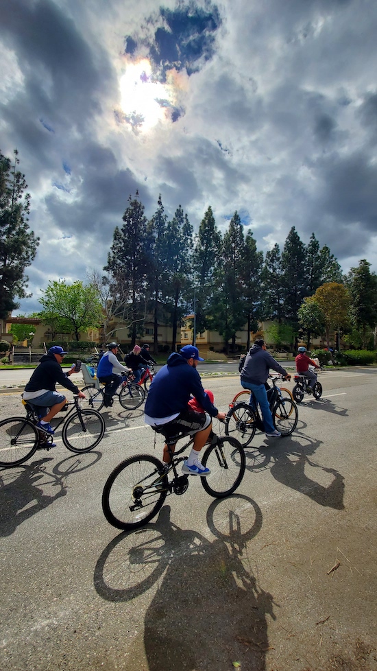
Returning to the route, while The Militant rode somewhere in Winnetka, the clouds briefly parted, the sun shone and proceeded to cast bicycle shadows on the pavement. Though it was a brief show, the 12-plus year axiom still rings true: THE SUN ALWAYS SHINES ON CICLAVIA!

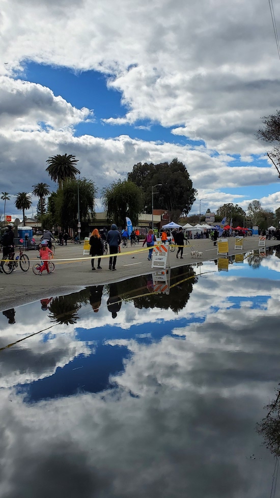
Reaching the end of the route in Canoga Park, there was the mandatory activity hub with a performance stage, a souped-up Metro Art Bus and a Los Angeles Public Library booth that ran out of those much-coveted P-22 memorial library cards during the first 20 minutes of the day, But he did spot this over-filled gutter along Sherman Way that provided a nice reflection:


The subject of food came up. The Militant was getting hungry and the food trucks with the long lines at the activity hubs would not cut it (besides, he's been to many of them before during previous CicLAvias). The Militant tweeted the addresses of various Vietnamese restaurants along the route that specialize in pho - the perfect food for this cloudy, balmy weather), but this nearby Weiler's Deli spot got The Militant contemplating...Ultimately, The Militant chose soup over sammiches and stuck to following his own advice (next time though, Weiler's Deli!) - he chose Pho 21 on Sherman Way between Owensmouth and Canoga avenues. Though not as mind-blowing as the pho he had in Alhambra last month, it nevertheless hit the spot for the time, place and weather.  Cảm ơn, Pho 21!

As soon as The Militant was done, The Po-Po Party Pooper Patrol was slowly making its way east along Sherman Way telling all cyclists to "stay to the right". Ever the straggler, The Militant rode as fast AF to leave them in the dust and rode unencumbered along the rest of The Way.

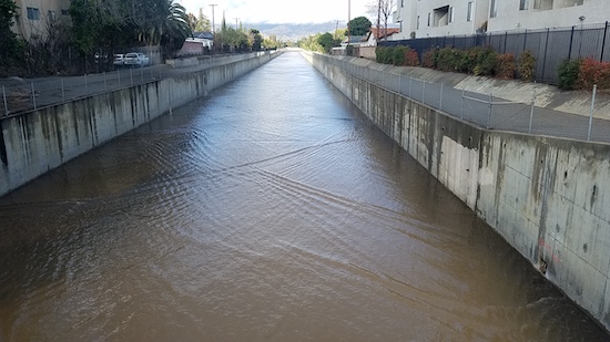
But not before capturing this parting shot of the snow-capped Santa Susana Mountains overlooking a very full Browns Canyon Wash (where this melted snow will end up eventually) along the CicLAvia route. We may or may not ever see a scene like this again from a CicLAvia route!


Only 49 days to go until the next CicLAvia!

Friday, February 24, 2023

The Militant's Epic CicLAvia Tour XLIII!!


Interactive map! Click here for larger version.

We're here in 2023, CicLAvia's 13th year, and as our favorite open streets event enters its raging, hormone-infused, possibly-emo teen years, we're in for a treat as not one, not two, not three, not four, five, six or even seven CicLAvias are in store in the next 10 months, but (count 'em) EIGHT of them are scheduled (well, technically...six full-sized CicLAvias and a pair of CicLAminis)!!!

The 43rd-CicLAvia kicks-off the 2023 season with a return to The 818 - a five-mile straight shot down Sherman Way from Reseda to Winnetka to Canoga Park, which was last done on one particularly rainy Sunday on December 8, 2019. We're also in a seasonal rain spell at this moment, but according to all weather forecasts, CicLAvia Sunday will be the sole day for the next week sans rain! Cloud cover willing, maybe we'll be treated to the sight of snow on the San Gabriel Mountains, or even the Santa Susana Mountains...or maybe even the Santa Monica Mountains! For the past 12-plus years, always remember this: No matter what the weather is, THE SUN STILL ALWAYS SHINES ON CICLAVIA!

So here's a slightly updated list of 14 points of interest along Sunday's Sherman Way CicLAvia. As usual - See you or not see you on the streets!

Oh yeah, if you found this Epic CicLAvia Tour guide useful and visit any of these sites, please add the #EpicCicLAviaTour hashtag to any social media post that includes it. The Militant will be glad to re-tweet/re-whatevertheycallthatonMastadon!

And if you appreciate The Militant's work (this guide still took a lot of time out of The Militant's day re-formatting and updating...argh), kick him a little love via PayPal! He *hates* asking for money, but you know how it is these days...A Militant's gotta pay his bills! Your support is much appreciated! Please Like And Subscribe and Smash That Be...oh wait, we're not quite there yet.

Support The Militant Angeleno's Exploits and Adventures!
https://www.paypal.com/donate/?hosted_button_id=K5XC5AM9G33K8


1. Sherman Way
1911
Sherman Way, Reseda

Named after railroad executive Moses Hazeltine Sherman (you should be familiar with that name from the "Meet The Hollywoods" CicLAvia), who was responsible for bringing his Los Angeles & Pacific Railway (later merged into the Pacific Electric Railway) into the San Fernando Valley. The street was originally a zig-zagging $500,000 grand boulevard built in 1911 along the Red Car right-of-way, stretching from North Hollywood, running west along what is now Chandler Blvd, then north along what is now Van Nuys Blvd, and west along the current Sherman Way. As the SFV farmland gave way to (sub)urbanization and the street grid, Sherman Way was re-aligned and extended eastward as a straight thoroughfare in the 1920s.

2. Site of Sherman Square Roller Rink
1969-2001
18430 Sherman Way, Reseda

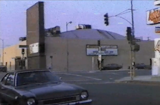
In the 1970s and 1980s, this was The Center of the Universe for many Valley youth: A roller rink during the skating heyday of the '70s (and on Monday nights, the Skataway club, a weekly private hangout for celebrities such as Cher and Jack Nicholson), and also hosted a roller hockey league and a bowling alley. In the '80s it became a popular venue for hip-hop events (an aspiring young rapper named Dr. Dre performed there back in 1985). Towards the '90s, the venue hosted computer shows during the weekends, but was also plagued by gang activity. It was razed in 2001 and replaced by the current Walgreen's pharmacy.


3. Site of Chuck Landis' Country Club

1980-2000
18419 Sherman Way, Reseda

Originally built as a Sav-On Drugs store, Los Angeles nightclub entrepreneur Chuck Landis bought the property in 1979 and converted it to a 1,000-seat concert venue originally intended for country music acts. But the burgeoning local punk, new wave and heavy metal acts of the early 1980s found an ideal venue - artists such as Motley Crue, the Red Hot Chili Peppers, The Bangles, Jackson Browne and Guns N Roses played here in their early years, as well as established acts like B.B. King, The Beach Boys, James Brown, Prince and Tom Petty and the Heartbreakers. U2 played their very first concert in Los Angeles here in 1981. In the mid-'80s, the venue also hosted boxing matches. It petered out in the 1990s and is now the Restauracion Reseda Church.
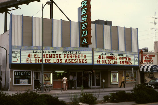

4. Reseda Theatre
1948
18447 Sherman Way, Reseda

The beginnings of the Sherman Way/Reseda intersection becoming the entertainment capital of Reseda started as far back as the 1940s when this S. Charles Lee (You'll recognize his name as architect of many other historic theatres in these Epic CicLAvia Tour guides)-designed Streamline Moderne cinema showed double features to the nearby newly-developed residential community. The theatre closed in 1988, but it gained some notoriety in the 1997 film "Boogie Nights" and is planned to be resurrected as a Laemmle multi-screen cinema after a $5.65 million restoration project.
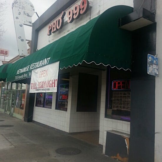

5. Reseda Vietnamese District
c. 1980s
Near Sherman Way & Reseda Blvd, Reseda

Though Westminster, Garden Grove and Los Angeles' Chinatown are more synonymous with the Vietnamese community in Southern California, the largest concentration Viet Americans in the 818 is located right here in Reseda. This mile-long stretch of Sherman Way and adjacent area is home to a good number of Vietnamese eateries, including Pho 999 (7255 Reseda Blvd), Pho So (7231 Reseda Blvd), Sandwich Express (18575 Sherman Way), Vinh Loy Tofu and Bun Bo Hue (18625 Sherman Way), Khuu Bistro (18845 Sherman Way) and Pho Viet Cali (18111 Saticoy St). There are also many more businesses, cultural institutions, organizations and houses of worship with a two-mile radius of Sherman and Reseda.
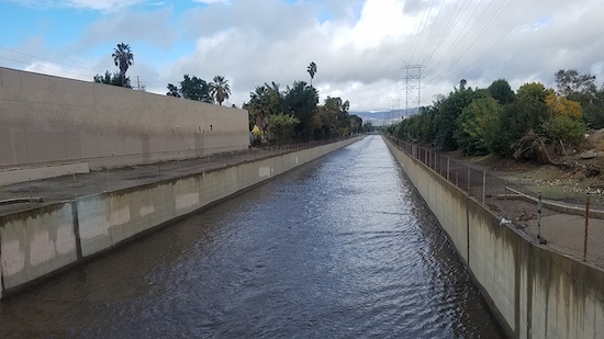


6. Aliso Canyon Wash
Sherman Way between Crebs and Wilbur avenues, Reseda

One of the Los Angeles River's many tributaries, this seasonal wash carries stormwater from Aliso Canyon (yep, that Aliso Canyon) up past Porter Ranch, running due south and joining the Los Angeles River near Yolanda Avenue. Thanks to the recent rainy weather, this wash is gonna be flowin'!
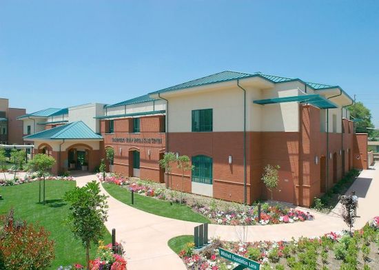


7. Los Angeles Jewish Home

1952
19308 Sherman Way, Reseda

Like many Jewish institutions in Los Angeles, this senior living and health care facility originated in Boyle Heights in 1916, expanding to the SFV in the late 1940s. It's one of three campuses of the Los Angeles Jewish Home - the other nearby on Victory Blvd and another in Playa Vista. This campus, known as the Grancell Village Campus, is home to 1,000 seniors. Wonder if the residents know that the 1952 Spanish Colonial Revival structure on Sherman and Tampa was originally the Lorenzen Mortuary? 


8. Platt Office Building

1981
19725 Sherman Way, Winnetka

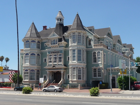
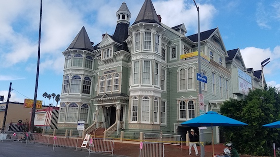
Conceived by carpenter Dennis Platt and designed by T.W. Layman, this office building built in the early 1980s (but meant to look like it was made in the 1880s) contains remnants from the Queen Anne-style Little Sisters of the Poor Rest Home originally located in Boyle Heights and various parts from Victorian homes in Bunker Hill, combined with re-created architectural sections.

9. Site of the Weeks Poultry Colony
1923-1934
Area bordered by Winnetka Ave, Leadwell St, Oso Ave and Lanark St, Winnetka

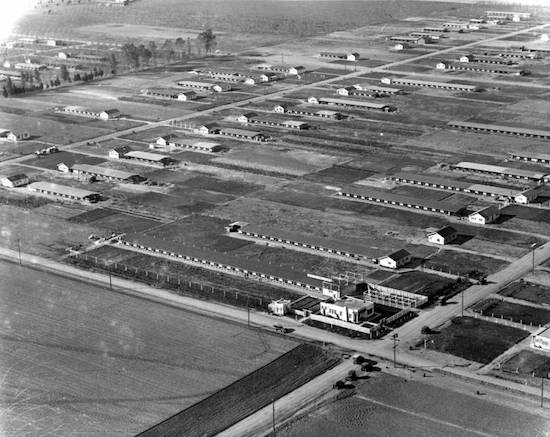
In 1904, an idealistic farm dude named Charles Weeks moved from the Midwest to California, and in 1916 established a utopian poultry farming community named Runnymead in Santa Clara County where families lived on one-acre farms and sustainably raised chickens and eggs, and through that, would establish ideal social structures. He then moved south to the farming community of Owensmouth in the San Fernando Valley and 100 years ago established a similar colony here known as the Weeks Poultry Colony. The Great Depression put the idealistic colony to an end, and Weeks moved to Florida where he lived the rest of his life until his death in the 1960s. The colony is long-gone, but Weeks left his mark on the community which still exists today: The area is now known as Winnetka, named by the remaining colony members after Weeks' Illinois hometown, Runnymede Street and park were named after Weeks' original Nor Cal colony, and nearby Independence Avenue originated from his poultry colony marketing pitch, "One Acre and Independence."


10. Browns Canyon Wash
Sherman Way between Cozycroft and Lurline avenues, Winnetka

Another currently-flowing Los Angeles River tributary runs under Sherman Way, originating in Browns Canyon in the Santa Susana Mountains. It joins The River just west of Mason Avenue.

11. Canoga Park Antique Row
Sherman Way between Canoga and Owensmouth avenues, Canoga Park

This half mile-long stretch of Sherman Way contains at least half a dozen stores selling antiques and collectibles, including Red's Antiques (7221 Canoga Ave), Alabama Antiques and Collectibles (7209 Alabama Ave),  Retro Relics Etcetera (21501 Sherman Way), Antique Store Canoga Park (21507 Sherman Way) and Sherway Jewelry & Loan (21514 Sherman Way).


12. The Source of the Los Angeles River
Owensmouth Avenue, south of Bassett Street, Canoga Park

Take a short ride down Owensmouth Avenue to see where the currently-raging Los Angeles River officially begins, at the confluence of Bell Creek (pictured right), which flows down from the Simi Hills, and Arroyo Calabasas (pictured left), which flows down from the north side of the Santa Monica Mountains. Together they become the Los Angeles River, flowing 51 miles eastward then southward into Long Beach Harbor. 


13. Site of the Pacific Electric Owensmouth Station
1912-1994
Sherman Way and Topanga Canyon Blvd, Canoga Park


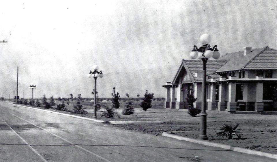
On the northwest corner of this intersection stood the Pacific Electric's Owensmouth (Canoga Park) depot. Built in the days when land companies were promising access to Owens Valley water via the upcoming Los Angeles Aqueduct (despite the fact that its terminus was some 20 miles to the northeast), the area eventually adopted the name of a nearby Southern Pacific Railroad depot, itself named after Canoga, NY. The U.S. Postal Service insisted on adding the word "Park" to lessen confusion with its original East Coast namesake. The Pacific Electric was a Craftsman-style structure that outlived its tenure as a Red Car depot when service ended in 1938. Unfortunately, it burned down in a fire in 1994.


14. Carlson Circle/Proposed PE Extension

c. 1910
Sherman Way at Carlson Circle

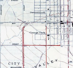
At the southeast corner of Sherman Way and Shoup Avenue is a street called Carlson Circle - a cartographic curiosity that stood out to The Militant. Back in the day, before the SFV conformed to an absolute grid, Sherman Way curved down using this quarter-circular thoroughfare and merged with Shoup Avenue (which, like Sherman Way, was also named after a Pacific Electric Railway executive -- Paul Shoup). The circle also had some connection to the Red Cars: Although there was never track laid on it, it was part of a onetime 1910 proposal to extend the Owensmouth streetcar line to what is now Valley Circle. So who was Carlson? Hugo Carlson was an immigrant from Sweden who settled in Owensmouth in 1912 and was one of the town's pioneers. He owned a 55-acre farm in the area that grew beans and tomatoes, was an active member of the local chamber of commerce and was also instrumental in supporting efforts to build flood control channels in the area. He died in 1958. His old farm, just inside of his eponymous Circle, is now home to the posh Canoga Lakes condo community.


Saturday, December 7, 2019

The Militant's Epic CicLAvia Tour XXXIV!!!!


Click here for larger map!

The 2019 CicLAvia Season has come to an end, and the sixth and final (and 34th ever) open streets course runs through the west San Fernando Valley, this time running on an all-new alignment along perhaps the most boring-shaped CicLAvia route evar (Dude, it's literally a straight line running exactly five miles...), and The Militant was thinking of putting down like half a dozen points of interest on this here Epic CicLAvia Tour guide and calling it a day, but nooooo....Like a Transformer, there's always more than meets the eye when it comes to Los Angeles history, and this route is no exception. Most of you know your SFV history: It was largely open agricultural land, in came the Pacific Electric in the 1910s, selling land tracts, and after World War II - KABOOM - a suburb was born.  The result is 14 points of interest on for this Sunday's CicLAvia route, which is expected to be cold chillin', but not rainy (we hope). But always remember, The Sun Always Shines On CicLAvia, and no matter how overcast the day is, El Sol always finds a way to make a cameo appearance. So here we go (better late than never), and as always...See you or not see you on the streets!

1. Sherman Way
1911
Sherman Way, Reseda

Named after railroad executive Moses Hazeltine Sherman (you should be familiar with that name from the "Meet The Hollywoods" CicLAvia), who was responsible for bringing his Los Angeles & Pacific Railway (later merged into the Pacific Electric Railway) into the San Fernando Valley. The street was originally a zig-zagging $500,000 grand boulevard built in 1911 along the Red Car right-of-way, stretching from North Hollywood, running west along what is now Chandler Blvd, then north along what is now Van Nuys Blvd, and west along the current Sherman Way. As the SFV farmland gave way to (sub)urbanization and the street grid, Sherman Way was re-aligned and extended eastward as a straight thoroughfare in the 1920s.

2. Site of Sherman Square Roller Rink
1969-2001
18430 Sherman Way, Reseda

In the 1970s and 1980s, this was The Center of the Universe for many Valley youth: A roller rink during the skating heyday of the '70s (and on Monday nights, the Skataway club, a weekly private hangout for celebrities such as Cher and Jack Nicholson), and also hosted a roller hockey league and a bowling alley. Towards the '90s, the venue hosted computer shows during the weekends, but was also plagued by gang activity. It was razed in 2001 and replaced by the current Walgreen's pharmacy.

3. Site of Chuck Landis' Country Club
1980-2000
18419 Sherman Way, Reseda

Originally built as a Sav-On Drugs store, Los Angeles nightclub entrepreneur Chuck Landis bought the property in 1979 and converted it to a 1,000-seat concert venue originally intended for country music acts. But the burgeoning local punk, new wave and heavy metal acts of the early 1980s found an ideal venue - artists such as Motley Crue, the Red Hot Chili Peppers, The Bangles, Jackson Browne and Guns N Roses played here in their early years, as well as established acts like B.B. King, The Beach Boys, James Brown, Prince and Tom Petty and the Heartbreakers. U2 played their very first concert in Los Angeles here in 1981. In the mid-'80s, the venue also hosted boxing matches. It petered out in the 1990s and is now the Restauracion Reseda Church.


4. Reseda Theatre
1948
18447 Sherman Way, Reseda

The beginnings of the Sherman Way/Reseda intersection becoming the entertainment capital of Reseda started as far back as the 1940s when this S. Charles Lee (You'll recognize his name as architect of many other historic theatres in these Epic CicLAvia Tour guides)-designed Streamline Moderne cinema showed double features to the nearby newly-developed residential community. The theatre closed in 1988, but it gained some notoriety in the 1997 film "Boogie Nights" and is planned to be resurrected as a Laemmle multiscreen cinema.

5. Reseda Vietnamese District
c. 1980s
Near Sherman Way & Reseda Blvd, Reseda

Thought Westminster and Garden Grove are most synonymous with the Vietnamese community in Southern California, the largest concentration Viet Americans in the 818 is located right here in Reseda. This mile-long stretch of Sherman Way is home to several Vietnamese eateries, including Pho 999 (7255 Reseda Blvd), Pho So (7231 Reseda Blvd), Luc Huyen Cam Cafe (18541 Sherman Way), Sandwich Express (18575 Sherman Way), Vinh Loy Tofu and Bun Bo Hue (18625 Sherman Way).
There are also many more businesses, cultural institutions, organizations and houses of worship with a two-mile radius of Sherman and Reseda.

6. Aliso Canyon Wash
Sherman Way between Crebs and Wilbur avenues, Reseda

One of the Los Angeles River's many tributaries, this seasonal wash carries stormwater from Aliso Canyon (yep, that Aliso Canyon) up past Porter Ranch, running due south and joining the Los Angeles River near Yolanda Avenue.

7. Los Angeles Jewish Home
1952
19308 Sherman Way, Reseda

Like many Jewish institutions in Los Angeles, this senior living and health care facility originated in Boyle Heights in 1916, expanding to the SFV in the late 1940s. It's one of three campuses of the Los Angeles Jewish Home - the other nearby on Victory Blvd and another in Playa Vista. This campus, known as the Grancell Village Campus, is home to 1,000 seniors. Wonder if the residents know that the 1952 Spanish Colonial Revival structure on Sherman and Tampa was originally the Lorenzen Mortuary? 

8. Platt Office Building
1981
19725 Sherman Way

Conceived by carpenter Dennis Platt and designed by T.W. Layman, this office building built in the 1980s (but meant to look like it was made in the 1880s) contains remnants from the Queen Anne-style Little Sisters of the Poor Rest Home originally located in Boyle Heights and various parts from Victorian homes in Bunker Hill, combined with re-created architectural sections.


9. Site of the Weeks Poultry Colony
1923-1934
Area bordered by Winnetka Ave, Leadwell St, Oso Ave and Lanark St, Winnetka

Charles Weeks was a Midwesterner who moved to California in 1904 and in 1916 established a utopian poultry farming community named Runnymead in Santa Clara County where families lived on one-acre farms and sustainably raised chickens and eggs, and through that, would establish ideal social structures. In 1923 he moved south to the farming community of Owensmouth in the San Fernando Valley and established a similar colony here known as the Weeks Poultry Colony. The Great Depression put the idealistic colony to an end, and Weeks moved to Florida where he lived the rest of his life until his death in the 1960s. The colony is long-gone, but Weeks left his mark on the community which still exists today: The area is now known as Winnetka, named by the remaining colony members after Weeks' Illinois hometown, Runnymede Street and park were named after Weeks' original Nor Cal colony, and nearby Independence Avenue originated from his poultry colony marketing pitch, "One Acre and Independence."

10. Browns Canyon Wash
Sherman Way between Cozycroft and Lurline avenues, Winnetka

Another Los Angeles River tributary runs under Sherman Way, originating in Browns Canyon in the Santa Susana Mountains. It joins The River just west of Mason Avenue.

11. Canoga Park Antique Row
Sherman Way between Canoga and Owensmouth avenues, Canoga Park

This half mile-long stretch of Sherman Way contains at least eight stores selling antiques and collectibles, including Red's Antiques (7221 Canoga Ave), Alabama Antiques and Collectibles (7209 Alabama Ave), Galeano's Treasures (7207 Alabama Ave), Retro Relics Etcetera (21501 Sherman Way), Antique Store Canoga Park (21507 Sherman Way), Sherway Jewelry & Loan (21514 Sherman Way), Old Friends Antiques & Restoration (21517 Sherman Way) and Canoga Vintage and Collectibles (21619 Sherman Way).
12. The Source of the Los Angeles River
Owensmouth Avenue, south of Bassett Street, Canoga Park

Take a short ride down Owensmouth Avenue to see where The Los Angeles River officially begins, at the confluence of Bell Creek (pictured right), which flows down from the Simi Hills, and Arroyo Calabasas (pictured left), which flows down from the north side of the Santa Monica Mountains. Together they become the Los Angeles River, flowing 51 miles eastward then southward into Long Beach Harbor. 

13. Site of the Pacific Electric Owensmouth Station
1912
Sherman Way and Topanga Canyon Blvd, Canoga Park

On the northwest corner of this intersection stood the Pacific Electric's Owensmouth (Canoga Park) depot. Built in the days when land companies were promising access to Owens Valley water via the upcoming Los Angeles Aqueduct (despite the fact that its terminus was some 20 miles to the northeast), the area eventually adopted the name of a nearby Southern Pacific Railroad depot, itself named after Canoga, NY. The U.S. Postal Service insisted on adding the word "Park" to lessen confusion with its original East Coast namesake. The Pacific Electric was a Craftsman-style structure that outlived its tenure as a Red Car depot when service ended in 1938. Unfortunately, it burned down in a fire in 1994.

14. Carlson Circle/Proposed PE Extension
c. 1910
Sherman Way at Carlson Circle

At the southeast corner of Sherman Way and Shoup Avenue is a street called Carlson Circle - a cartographic curiosity that stood out to The Militant. Back in the day, before the SFV conformed to an absolute grid, Sherman Way curved down using this quarter-circular thoroughfare and merged with Shoup Avenue (which, like Sherman Way, was also named after a Pacific Electric Railway executive -- Paul Shoup). The circle also had some connection to the Red Cars: Although there was never track laid on it, it was part of a onetime 1910 proposal to extend the Owensmouth streetcar line to what is now Valley Circle. So who was Carlson? Hugo Carlson was an immigrant from Sweden who settled in Owensmouth in 1912 and was one of the town's pioneers. He owned a 55-acre farm in the area that grew beans and tomatoes, was an active member of the local chamber of commerce and was also instrumental in supporting efforts to build flood control channels in the area. He died in 1958. His old farm, just inside of his eponymous Circle, is now home to the posh Canoga Lakes condo community.

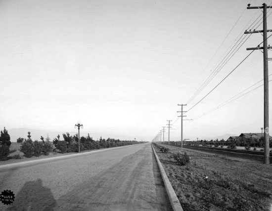
BONUS: And since we've seen some #lasnow on our mountains lately, here's a flashback to 1957 when it snowed in the Canoga Park/Woodland Hills area, just south of Sunday's CicLAvia route. This is Topanga Canyon Blvd at Ventura Blvd:


Monday, September 28, 2015

The Village, People: The Militant Takes On The Village at Westfield Topanga


Ah, the shopping mall. The grand cathedral of consumerism. Like the hamburger and surfing, it wasn’t invented in Los Angeles, but we created the archetype by which it is widely known, as well as an entire culture built around it.

The brand-spanking-new The Village at Westfield Topanga, which opened on September 17, is the latest rookie drafted onto the Southland shopping mall roster. Though technically, it’s an outdoor-centric extension of the existing Westifeld Topanga mall, which stands on the other side of Victory Boulevard.

It’s perhaps one of the few outdoor malls that are not a product of one Rick Caruso (shouting at the sky, shaking fist in the air: “CARUSOOOOOOOOO!!”), although Caruso deserves the credit and/or blame for making them the de facto standard for the modern So Cal shopping center. Instead, this one is owned by the great Australian shopping mall megaconglomerate, Westfield, which runs yet another shopping center directly to the south, the Westfield Promenade.

The Militant decided to take a nice long ride on the Metro Orange Line to Warner Center and check this mutha out.

Located in Woodland Hills' Warner Center district (a.k.a. "The Downtown of The Valley," although The Militant thinks the much-more centralized and pedestrian-oriented Van Nuys is more deserving of that title), named so due to the area (including the land The Village now sits on) once belonging to one of the Warner Brothers (no, it wasn't Wakko or Yakko) as a horse ranch from the 1940s to the 1960s.

The Village's design is very SFV: Low-rise (the tallest building is two stories, not including the parking structure, of course), sprawling, and the architecture harkens back to the agricultural and light industrial structures which where once common in the Valley landscape. The ivory-colored facades look a bit odd, though -- one would assume that every store was either a Banana Republic or Sees Candies.

The SFV backyard aesthetic of The Village at Westfield Topanga's street furniture.
But it's also a very 21st-century setup: Aside from the outdoorsy feel, the place is abound with native and drought-tolerant plants -- no expanses of manicured green grass anywhere in sight (save for  artificial turf). The folksy "street furniture" resembles the type of furniture one would find in a San Fernando Valley backyard. And there are elements of appropriated urban hipsteresque accoutrements: Randomly-placed "little library" book kiosks, bocce ball enclosure, doggie treat/dog waste bar receptacles, and yes, a designated space for food trucks. The drinking fountains even have water bottle dispensers (which have digital counters; The Militant's water bottle was the 970th and 974th bottle filled at this particular dispenser), and he's even heard of a large rainwater capture cistern on the property. Very cool. But The Village succeeds in integrating the outdoor food commons of the Costco (long the hallmark of big box shopping center suburbia) into its outdoor mall layout.

"Look honey, food trucks! I think we should try some of those exotic soft tacos!"
But here's what totally blew The Militant away, and made this otherwise average outdoor mall worthy of mention on This Here Blog: The public art incorporated into the shopping center is very...militant.

It kind of hit him as The Militant walked the long stretch of Owensmouth Avenue after alighting from his Orange Line bus, trying to find out where exactly this new-fangled "Village" place was. He was ready to ask the few people walking along the street where it was when he spotted a large parking structure in the distance and finally saw "The Village at Westfield Topanga" sign on the corner of Owensmouth and Victory (which was a long-ass walk, he'll get to that later).

A dirt hiking trail beckons the militant along the northern (Victory Blvd) side of The Village at Westfield Topanga!
Walking westward on Victory, he saw the dirt hiking path that ran parallel to the sidewalk. Almost luring The Militant in to chose the dirt path option than the sanitary concrete option. So hiking path it was. And then he saw it.

It was a large billboard-sized mural, depicting a very natural San Fernando Valley 300 years ago, with  labeled images of the native flora and fauna of the SFV done in great detail, centered around the he Los Angeles River, depicted in its once-naked glory.

A section of the one of the very militant natural history murals at The Village by artist Elkpen
And then he saw another, which focused on the human history of the San Fernando Valley, depicting a cast of characters from Tongva medicine woman Toypurina (though she was actually a San Gabriel Valley gal), Father Juan Crespi, Isaac Van Nuys, William Mulholland to Amelia Earhart. There's even a little Red Car (labeled "Red Car") in the mural.  Yet another mural explains the importance and relationship of water, and even educates the public on what a watershed is.

"Our thinking about The River is evolving."
Like, whoa.

These murals, which were placed on the outside wall of the new Woodland Hills Costco (part of The Village shopping complex) were done by local muralist Elkpen (a.k.a. Christian Kasperkovitz), who is known for her nature-centric murals with a decidedly educational/awareness bent (see her "Birds of Hollywood" mural on Fountain Avenue). Elkpen's Los Angeles River/SFV History murals are part of a project called "Meet Connect Become" which explores the murals' subject matter in deeper perspective through the medium of the Internet (YOU NEED TO VISIT THIS WEBSITE! THIS IS AN ORDER! http://meetconnectbecome.com/home.html).

In addition, Westfield partnered with UCLA's School of Arts and Architecture for some of The Village's other public arts pieces.

Nova Jiang's "Red Car" sculpture at The Village.

As if The Militant wasn't already blown away by those Elkpen murals, on the Topanga Canyon side, hanging above the 2nd floor rafters above the main plaza was a sculpture of a Pacific Electric Red Car, depicted as an oversized plastic model kit. Very clever. The sculpture was done by UCLA Art school alum Nova Jiang, and a stylized map of the Pacific Electric system (with the San Fernando Valley stops emphasized) dons the wall on the floor below (surrounding the beverage vending machines).

This is like...wow.

The Militant didn't really buy anything at the stores but he was hankering for an ice cream on this 90-degree So Cal Early Autumn night. He found it at Sloan's, which looked exactly like a 6 year-old girl's candy store fantasyland, and a place The Militant would probably feel embarrassed to be in, but dude...it's ice cream, so he got himself a waffle cone full o' dat.

After consuming his cone, he wandered about the rest of The Village. There was a kids' play area, a KCSN-FM studio storefront (no one was inside, the station seemed to be on auto-pilot), and a "trolley" that transports shoppers to the larger Westfield mall on the other side of Victory.

While walking along the Topanga Canyon side of the complex, he spotted this:

From Crate & Barrel to the Los Angeles River.
It's a good mile hike to the Los Angeles River's headwaters on Owensmouth, but props to Westfield for taking this whole Los Angeles River thing seriously. This is amazing.

Now, since The Village has a hiking path along its western and northern perimeter, and they hope to have people hike in the oppressive heat of the San Fernando Valley, you'd think they'd want to make it more transit-friendly. The Village is equidistant from both the Metro Orange Line's Canoga and Warner Center stations (0.7 mile), but who wants to walk nearly a mile when it's 95 degrees outside? Perhaps it might be prudent to have an additional Orange Line station at Owensmouth and Victory, or at least get those cheesy Westfield trolley buses to serve the Orange Line terminus at Warner Center.

But the place is still new, and some of its businesses, most specifically its eateries, are still not yet ready for primetime at the time of this writing (they will be by this weekend). It's just another outdoor mall, really. But do check out those public art pieces. Hopefully people will pay attention and appreciate their Valley on a more deeper level.


Monday, July 30, 2012

Walk A L'Orange

The most interesting thing about the new Metro Orange Line extension is neither buses nor bikes...but pedestrians.


The (M) TAP card $5 daypass is a dangerous thing (in a good way). Provided one has the time, one can go off on an adventure on our transit system, which is exactly what The Militant did on Sunday evening.

Having not yet ridden on the new 4-mile extension of the (M) Orange Line from Canoga Park to Chatsworth, The Militant, bike in tow, set off on an 18-mile trek from North Hollywood just to check it out.

The new north-south bus rapid transit extension, which he had passed by on car just prior to its opening, looked pretty much like the 7-year old east-west line it was supplementing, what with park & ride stations, and a little urban renewal, eliminating some rather blighted, neglected spaces.

The only real unique things about the new extension was the sultry view of the radio tower-topped Oat Mountain, with the setting sun casting sexy shadows of its topography (as sexy as the Santa Susana Mountains can be), and the large, sweeping overpass at the end of the line that runs over the Amtrak/Metrolink/Union Pacific railroad tracks and lands the buses at the Chatsworth depot.

After poking around the area a bit and watching a northbound Pacific Surfliner train roll by, The Militant wanted to try out the bike path portion of the Orange Line.

After finally finding it east of the tracks off of Lassen, The Militant rode on south. It was nice; at one point, you had Canoga Avenue for the cars, a pedestrian path, the bike path, the Orange Line bus right-of-way and the railroad tracks, all running parallel to each other. There was a nascent plantscape with native drought-tolerant plants, and a faux creek with stone-lined bioswales running between the busway and the bike path.

There were few other cyclists at this point. What he did notice the most...were the pedestrians.


First he saw two. Then a group of four. Then a whole family of five, Then people walking dogs, then strollers. It was like a virtual boardwalk in the land-locked SFV. Wait a minute, this is the San Fernando Valley? As in the archetypal suburb?

Apparently so. This was a Sunday evening nearly an hour after sunset. The weather had cooled down considerably. What better thing to do to wrap up your weekend than to take a leisurely stroll along the Orange Line? "Honey, get the kids ready! We're all going for a walk!"

Though darkness grew nigh, the path was well-lit, and unlike its east-west counterpart, it was wide-open, adjacent to a major street, and not the boxed-in cricket jungle atmosphere where lawd-knows who might jump out of the bushes.

A trio of women, each holding water bottles, gossiped in Spanish. Couples, both young and old, walked hand-in-hand. Joggers dashed by, iPod headphones seemingly glowing in the dark.

The Militant unfortunately didn't make a count of all the pedestrians on the Orange Line path for those four miles, but he can clearly remember a dozen or so bikes, including his own. But there were perhaps over 60 people who were walking on this fine Summer evening.

The pedestrian path looked wonderfully safe, although The Militant passed by a police car finishing up its business and heading out, with a young woman walking away, holding a water bottle, nearly in tears. Whether she got a jaywalking ticket (she wasn't holding anything that resembled it) or was a victim of a robbery, is unknown.

After The Militant reached the junctioned Canoga Station, he decided to forge on east and ended up pedaling the 18-mile bike path in its entirety to the North Hollywood station. The entire journey took him almost 2 1/2 hours.


When The Militant started his bike path trek in Chatsworth, he noticed the parallel bike/pedestrian path with their respective icon markings on the pavement. Riding on the O.G. Orange Line path, it was only then did he realize that the same arrangement existed there, too, only not very many people walked that path.

Granted, on a sweltering 105-degree Valley summer day at 130 p.m., you're hardly going to see any pedestrians out on that path, unless they choose to spontaneously combust. But Metro and whoever wants to do any development on Canoga needs to seize upon this newfound pedestrian activity. Maybe a linear farmer's market. Perhaps a designated food truck zone.

 It's 2012 now. People aren't just "Walking in El Lay;" they're walking in the Valley! Who knew?!