Friday, August 19, 2022

The Militant's Epic Militant CicLAvia Tour XL!!


Interactive Map! Click on green points to view hotspots, or click here for larger view.

The second of four CicLAvias in 2022 and the 40th (XL) iteration of Los Angeles' showcase open streets event takes is upon us this Sunday, August 21! This 6.5-mile route is the second time around for this so-called "Meet The Hollywoods" east-west route from West Hollywood to central Hollywood (i.e. Hollywood Hollywood) to East Hollywood (the first one being in August 2019). Only this time, there's a short extension going from Vermont Avenue in the 2019 route farther east to Virgil-Hillhurst avenues.

Since starting this Epic CicLAvia Tour guide, The Militant made a slight design tweak, enlarging the photos (the other reason for the "XL" designation) so they are more mobile-friendly. This also makes things less-complicated from The Militant's end, so, win-win!

Lastly, The Militant would like to thank a few of you who kicked in some support for The Militant's time and endeavors this month, namely:

Collection Studios
Patrick Murray
Ted Rogers
Darla Doxstater
Johannes Haanraadts
Mark Jones

Your support is greatly appreciated and The Militant raises his fist to ya! So here goes the CicLAvia guide for this Sunday. As always, Go Dodgers and see you or not see you on the streets!
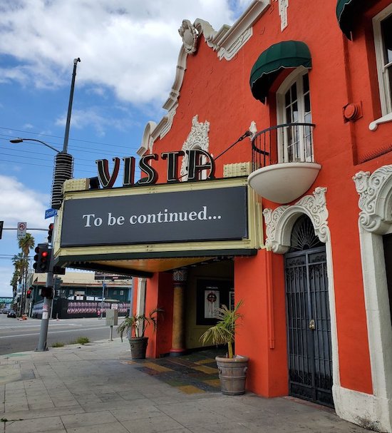


1. Vista Theatre
1923
4473 Sunset Dr, Los Feliz.

Originally known as "Bard's East Hollywood Playhouse" showing live Vaudeville shows, this Spanish-Revival-on-the-outside-Egyptian-on-the-inside single-screen cinema designed by Lewis A. Smith has rolled reels from silent movies, to 2nd-and 3rd-run screenings, to pr0n, to first-run blockbusters. In 2021, film director Quentin Tarantino was turned on by the feet feat of refurbishing this nearly century-old neighborhood cinema gem and is in the process of reopening it with an adjacent arcade and bar in time for its 100th anniversary. HIDDEN EASTER EGG: Look for the monogrammed letter "B" (for "Bard's") emblazoned atop the window above the marquee!

2. The Crazy-Ass 6-Way Intersection
1900
Sunset Boulevard - Sunset Drive, Virgil and Hillhurst avenues and Hollywood Boulevard, East Hollywood

One of the most confusing intersections for motorists, pedestrians and cyclists alike is the six-way intersection consisting of the east-west thoroughfare of Sunset Boulevard and Sunset Drive, the north-south alignment of Virgil and Hillhurst avenues, and the diagonal eastern end of Hollywood Boulevard continuing on towards the southeast as Sunset. The story began in 1900 when a railroad was built to link the burgeoning dusty cow town of Los Angeles with the outlying town of Hollywood, financed by dudes like H.J. Whitley (the dude who founded Hollywood) and Col. Griffith J. Griffith (If that reference isn't a walk in the Park, you still might have Observed that name before...). In 1904, most of that railroad right-of-way was converted into a parallel road named Sunset Boulevard, cutting through mostly agricultural land. In 1910, the town of Hollywood was annexed into the City of Los Angeles and its main drag, Prospect Avenue, was re-named Hollywood Boulevard, which included the diagonal link between Prospect and Sunset. With the diagonal road/streetcar line juxtaposed against the standard Jeffersonain street grid, you have a six-way intersection, complicated further by the fact that it forms the terminus of four of those streets (east end of Hollywood Blvd, south end of Hillhurst Avenue, west end of Sunset Drive and north end of Virgil Avenue). So there you go.


3. Vermont Triangle

1911
Hollywood Blvd, Vermont Ave & Prospect Ave, East Hollywood

A year after the town of Hollywood voted to be annexed by Los Angeles in 1910, the Pacific Electric Railway extended its tracks from Sunset Boulevard to Hollywood Blvd. This triangular space, formed by Hollywood, Vermont and Prospect Avenue (the former moniker of Hollywood Blvd that retains its name eastward of the triangle), became a popular Red Car stop until service here ended in 1954. It maintained its use as a transportation facility, becoming not only a bus stop, but also a taxi layover zone. It became a de facto green space up until the early 21st century, where it turned into a popular locale for homeless encampments, despite the city's efforts to landscape it into a beautified public space.

1921
4800 Hollywood Blvd, East Hollywood

The former residence of oil heiress, proto-feminist, patron of the arts and cultural influencer Aline Barnsdall (pronounced "barns-doll," not "barns-dale"), it was built in 1921 and designed by none other than Frank Lloyd MF'ing Wright. Named after Barnsdall's favorite flower (which forms a design motif around the building), it was borne from much bickering and head-clashing between the architect and client due to the home not being built to her tastes and cost overruns. In 1926 she up and left, sort of, donating the house and most of the property sitting on Olive Hill to the City of Los Angeles for artistic and recreational purposes. Although, she did live in a now-demolished residence on the west side of the park for the last two decades of her life. In July 2019, Hollyhock House was designated as a UNESCO World Heritage Site - the first such in Los Angeles.


5. Mosque Shopping Center/Calmos Gas Station

1923
4982 Hollywood Blvd, East Hollywood

This unassuming L-shaped shopping center on Hollywood and Alexandria sports a pair of towering minarets on top of its roof. Was it a mosque at one time? Was this home of an Islamic community in the past? Actually, no. they're the last vestiges of Calmos Auto Service Center, a gas station built in 1923 that became part of Union Oil's 76 chain. Its architecture reflects the whole Arab/Egyptian aesthetic fetish/appropriation thing back in the '20s, a decade which was marked by the 1921 Rudolph Valentino film, "The Sheik" and the 1922 discovery of King Tut's tomb. As seen in the historic 1924 photo, the dome of the "mosque" was a now-demolished structure that housed the area for the gas pumps.


1615 N. Alexandria Ave., Little Armenia

This K-12 Armenian private school, affiliated with the St. Garabed  Armenian Apostolic Church across the street, is one of the biggest cultural anchors in Little Armenia. Named after its founders, not only is it the alma mater of 3/4ths of the rock band System Of A Down, but its relatively-new library building was designed to resemble Noah's Ark, as it was believed the ark landed in Mt. Ararat, the highest mountain in ancient Armenia and an iconic cultural landmark for the country.


7. Thai Spirit House
1992
5321 Hollywood Blvd, Thai Town


Just to the right of the driveway of the Thailand Plaza shopping center, across from the Buddha shrine, is one of the most tucked-away curiosities in the Hollywood area. Known by the uninitiated as a "doll house," this miniature Siam-style abode serves as a cultural function to the nearby Silom market and the former Jinda Thai restaurant on the premises: Known as a "spirit house," it is built away from a business to ward away evil or mischievous spirits by leading them to an alternate location (plus water/fruit offerings) so their bad juju doesn't affect you.


8. Thai Town Gateway Statues

2007
5448 Hollywood Blvd, Thai Town

This pair of bronze statues on pedestals towering over Hollywood Boulevard function as the gateway of Thai Town. First installed in 2007 and the subject of The Militant's first ever blog post, it depicts a figure known as an apsonsi, a half-angel, half-lion creature from Thai mythology, chosen for its attributes as a protector. The statues were made in Thailand and flown from Bangkok, which, like Los Angeles, is also known as "The City of Angels." Another pair of statues were installed west of Normandie Avenue in 2012.


9. Mayer Building
1928
5504 Hollywood Blvd, East Hollywood

This four-story, Art Deco edifice, also known as the Hollywood Western Building, was designed by S. Charles Lee, who also happened to design many a structure featured in The Militant's Epic CicLAvia Tour guides. Named after its developer Louis B. Mayer (as in Metro Goldwyn Mayer) it served as the first home of the Motion Picture Academy of America (a.k.a. The Ratings People) and Central Casting. More recently, it serves as the local field office of U.S. Congressman Adam Schiff. Be on the look out for one of them trolley wire support rings, still embedded into the side of the building!


10. Hollywood Pantages Theatre
1930
Hollywood Blvd, Hollywood

Opened in 1930, this was actually the second theatre in Los Angeles bearing the Pantages name (the first one, still standing on 7th and Hill streets, opened a decade earlier and was renamed the Warner Theatre in 1929). This was also the last theater built bearing the name of vaudeville promoter Alexander Pantages, who ran a chain of 84 theaters across North America back in the day. The iconic Art Deco venue designed by B. Marcus Priteca (who also drew up the DTLA Pantages, as well as other theaters) actually functioned as a cinema for most of its history until 1977 when it ran the Broadway musical Bubbling Brown Sugar and the rest is Jazz Hands history. But did you know that the building constructed nearly 90 years ago is actually incomplete? It was originally supposed to stand 12 stories tall with offices. There have been recent proposals to complete the structure.


11. Hollywood Brown Derby Site/Metro Bike Hub
1929-1985/2017
1628 N. Vine St, Hollywood

Did you know that Metro's Hollywood Bike Hub facility, which opened in 2017, stands on the very site of the Hollywood Brown Derby restaurant? This was the second location of the legendary local restaurant chain, which began on Wilshire Boulevard. Back in the Hollywood Heyday of the first half of the 20th century, it was like the lunch and dining hotspot for famous film stars and industry moguls. But perhaps the biggest star associated with the Hollywood Brown Derby was the Cobb Salad, invented here circa 1937. Named after Brown Derby co-owner Robert Cobb, it was an improvised mish-mash of leftover salad ingredients, either made for theater mogul Sid Grauman or by Cobb himself as a late-night meal (depending on which version of the legend). The restaurant closed down in 1985 and the iconic Mediterranean-style structure was burned in a fire two years later. It was finally demolished in the mid-1990s after the Northridge Earthquake.


12. Capitol Records Building/Hollywood Jazz Mural
1956
1750 N. Vine St, Hollywood

You may or may not already know that the Capitol Records building is: a) The world's first circular office building (designed by Louis Naidorf of Welton Becket associates -- the same architectural firm that designed the Dorothy Chandler Pavilion; b) Designed like a stack of records; and c) The FAA warning light atop its spire spells "HOLLYWOOD" in Morse Code. What you probably didn't know was that Capitol Records, founded in 1942, was the first major record label headquartered in the West Coast, and that the building was largely financed by the profits made from its premier artist at the time, Nat King Cole. Also, this is one of two skyscrapers in Los Angeles with a spire, the second being the Wilshire Grand Center. And speaking of Nat King Cole, Capitol's classic crooner is depicted front and center in the 88 foot-wide mural facing the building's south parking lot, "Hollywood Jazz, 1948-1972" by African American muralist (and Lynwood native) Richard Wyatt, Jr. painted in 1990 and restored in 2011. If you're into the Walk of Fame stars, all four members of The Beatles, as well as Tejana singer Selena, have their pavement honors in front of the building.
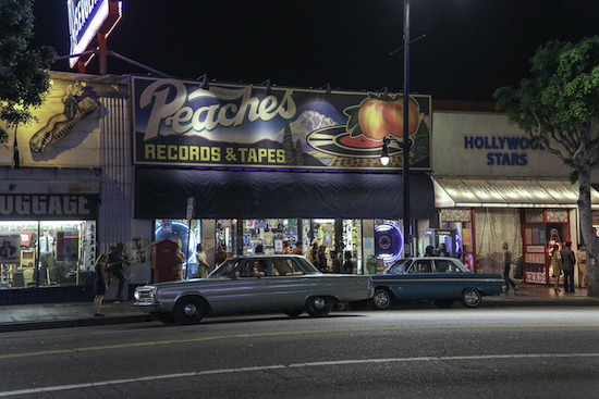

13. 'Once Upon A Time in Hollywood' Filming Locations
2018
Hollywood Blvd between Vine Street and Cherokee Avenue

Location scenes from the 2019 Quentin Tarantino film, "Once Upon A Time In Hollywood" were filmed in summer and winter 2018 on The Boulevard between Vine Street and Cherokee Avenue, which itself became an actor, dressed in late-1960s period signs, ads and aesthetic. The 1923 Guaranty Building on 6331 Hollywood Blvd (now the L.Ron Hubbard Museum) got a retro-look as a Bank of America branch. And up Ivar Street, Joseph's Cafe (1775 Ivar) stood in for the iconic West Hollywood nightclub Pandora's Box.


14. Janes House (Oldest House in Hollywood)

1903
6541 Hollywood Blvd, Hollywood

At the far end of this collection of restaurants and bars stands the oldest extant house in Hollywood -- a Queen Anne/Dutch Colonial Revival abode built in 1903 developed by none other than H.J. Whitley himself (as in the dude who founded Hollywood in 1886). It was owned by members of the Janes family from Illinois for some 80 years and also functioned as a small private school (attended by the children of celebrities) until the mid-1920s. In 1985, the house was moved several yards north to its current location and the Hollywood-facing part of the property was developed. Today it functions as a 1920s-themed speakeasy bar called No Vacancy at Hotel Juniper.

15. Grauman's Egyptian Theatre
1922
6706 Hollywood Blvd, Hollywood

Built in 1922 by cinema mogul Sid Grauman, this was his first venue in Hollywood after opening the Million Dollar Theatre in Downtown Los Angeles. Designed by the team of Gabriel Meyer and Philip Holler (who also designed The Egyptian's younger and more famous sister down the street, The Grauman's Chinese Theatre), it was inspired by the popular "Egypt-mania" sweeping the world following the 1922 discovery of King Tut's tomb. From the 1970s to the 1990s it ran under the Mann Theatres chain (The Militant saw "Return of the Jedi" here during opening weekend in 1983), and was sold to American Cinematheque in 1996, re-opening two years later after a major renovation. In May 2020, it was purchased by Netflix, but American Cinematheque still continues to program screening events there. 

16. Hollywood High School
1903
1521 N. Highland Ave, Hollywood

Originally founded in 1903 as a two-room school a few blocks north above a Masonic Lodge the same year the town of Hollywood was in incorporated, the campus moved to its current location a year later. In the 1920s, its mascot, The Sheik, was named after the hit 1921 Rudolph Valentino movie of the same name. Since then it has boasted a large number of famous alumni, such as Los Angeles Times publisher Norman Chandler (Class of 1917), actress Carole Lombard (1923),  "Looney Tunes" animator Chuck Jones (1930), actress Lana Turner (1936), "People's Court" judge Joseph Wapner (1937), actor Mickey Rooney (1938), actress Judy Garland (1940), Secretary of State Warren Christopher (1940),  actor James Garner (1944), actress/comedian Carol Burnett (1951), actor/singer Ricky Nelson (1958), actor John Ritter (1966), actor Laurence Fishburne (1980), actress Sarah Jessica Parker (1983) and R&B singer Brandy (1996). A large mural outside the school's auditorium depicts famous alums as well as other celebrities.

17. Highland Avenue
1900
Highland Avenue, Hollywood

Highland Avenue was not named after the Scottish Highlands, nor any other geography or topography, but in memory of a local woman named Highland Price. Her best friend and neighbor, Mary Penman Moll, who lived where the Hollywood Roosevelt Hotel now stands, donated a strip of property to be built as a road. She named it in memory of Price, who passed away at the time and was the first person interred at Hollywood (now Hollywood Forever) Cemetery in 1900. The street became an important north-south thoroughfare, especially one connecting directly with the San Fernando Valley via the Cahuenga Pass. From 1911 to 1952, it carried the Pacific Electric Railway lines between Los Angeles and the SFV.


18. Formosa Cafe/PE Red Car 913
1925
7156 Santa Monica Blvd, West Hollywood

This iconic restaurant, bar and Hollywood hangout (just across the street from the Samuel Goldwyn Studio) opened in 1925 by former boxer Jimmy Bernstein, who used an old Pacific Electric Red Car. The adjoining building was built in 1939. In the 1940s, Hong Kong-born chef Lem Quon was hired to cook at the Formosa and later became Bernstein's business partner, taking over ownership after his death in 1976. Quon died in 1993, with family members taking over ownership afterward. Threatened with demolition several times, the Formosa persevered. It was featured in the 1990s movies "L.A. Confidential" and "Swingers." In the 2010s decade, after various remodeling and re-remodeling, it was purchased by the 1933 Group in 2017 and re-opened this year with the Red Car (#913, in full view on Formosa Avenue) re-painted and the establishment restored to its Golden Era charm.


9. Plummer Park

1937
7377 Santa Monica Blvd, West Hollywood

In 1874, Anglo-Mexican couple Capt. John and Maria Cecila Plummer purchased a ranch formerly part of Rancho La Brea (bounded by present-day Santa Monica Blvd, La Brea Ave, Fountain Ave & Gardner St) to raise their sons Juan and Eugenio and grow vegetables to sell to residents of nearby Los Angeles. The Plummers were good friends with the Leonis family, who had a ranch of their own way over the hill in present-day Calabasas. After John and Maria died, the ranch was divided and plots sold off, with Los Angeles County purchasing a large portion in 1937 to use as a public park, with new facilities being built as part of FDR's Works Progress Administration projects. Eugenio lived in the 1877 family house until his death in 1943. The Plummer House was the oldest house in Hollywood until it was moved in 1983 to the grounds of the Leonis Adobe in Calabasas, whereby the 1903 Janes House (See #12) took the crown as the oldest Hollywood home.

20. Crescent Heights Triangle/Quint Cutoff
1900
Santa Monica Blvd & Crescent Heights Blvd, West Hollywood

Have you ever wondered why there's a "triangle" at the corner of Santa Monica and Crescent Heights boulevards? It's a remaining vestige of a half-mile railroad line known as the Quint Cutoff built in 1900 connecting a rock quarry west of Laurel Canyon with the railroad tracks along Santa Monica Boulevard. The "triangle" section is known in railroad terms as a "wye," which enables a locomotive to reverse direction without the use of a turntable. Another "wye" was built at the opposite end of the line where it meets Sunset Boulevard. The Pacific Electric Railway briefly took over this railroad line in 1911 until it was dismantled shortly after that year, but the
alignment of the "wye" tracks on both ends were built into the modern street grid.

21. Sal Guarriello Veterans' Memorial
2003
Santa Monica Blvd & Holloway Dr

Salvatore "Sal" Guarriello was an Italian American WeHo resident who was best known as serving on the West Hollywood City Council from 1990 to 2009, and served as mayor four times during that tenure. During World War II, he served in the U.S. Army as a combat medic in Italy and established the West Hollywood Veterans' Memorial in Holloway Park in 2003. After his death in 2009, the City of West Hollywood re-dedicated their civic veterans' monument as the Sal Guarriello Veterans' Memorial in honor of its most respected veteran and civic official.


22. Site of La Cienega Lanes/Flippers Roller Boogie Palace
1946-1981
8491 Santa Monica Blvd, West Hollywood

What stands as a CVS Pharmacy with a concave facade was a popular youth recreational venue for various generations. In 1946, TV host Art Linkletter established Art Linkletter's La Cienega Lanes bowling alley, becoming a popular place to roll strikes during the golden era of bowling in the post-World War II era. From 1979 to 1981, the alley became Flippers Roller Boogie Palace, a popular roller skating rink and music venue during the influential post-disco new wave/punk era of Los Angeles. Local bands like The Plimsouls, Berlin and the Go-Gos, as well as up-and-coming popular acts like The Talking Heads and Prince performed there. In 1984, the building became the Esprit clothing flagship store.


23. Tail O' The Pup
1946/2022
8512 Santa Monica Blvd, West Hollywood

Don't call it a comeback! In a town known for Dodger Dogs, Pink's, Bacon-wrapped street cart dogs, and the birthplace of the Wienershnitzel chain, this hot dog icon of hot dog icons has come to re-claim its place. Originally opened in 1946, nearly a mile south at 311 N. La Cienega Blvd, this mimetic novelty hot dog stand, designed by Milton J. Black, found its way over the years into films, TV shows, commercials, music videos and as a celebrity hang. In the 1980s, TOTP moved a few yards to 329 N. La Cienega Blvd, where it remained until 2005. The stand had an Angels Flight-like afterlife existing in storage, eventually being donated to the Valley Relics Museum in 2017. A year later, the 1933 Group (who also owns the Formosa Cafe - see #19 on this list) purchased it with plans for a serious reopening, and lo and behold, TOTP re-materialized (with an extensive menu, separate kitchen building and indoor/outdoor eating areas) in July, 2022. BONUS: This site was also the location of The Doors' recording studio, where they recorded their 'L.A. Woman' album in 1970.

24. Site of Pacific Electric Sherman Yard/Pacific Design Center
1896-1954; 1975
8687 Melrose Ave, West Hollywood

West Hollywood was originally known as Sherman, named after Moses Hazeltine Sherman, land developer and railroad executive (Yes, the SFV's Sherman Way and Hazeltine Ave were named after him) who co-founded the Los Angeles Pacific Railway, linking Santa Monica with Los Angeles. The area on the former Rancho La Brea land that sat midway between the two cities was chosen as the site of a railroad yard, and a settlement named after Sherman developed around it. In 1925, the town on unincorporated Los Angeles County land chose to re-name itself "West Hollywood" to closer associate with Tinseltown. Because it was on County land, and thus patrolled by the Sheriff's Department, it began to attract gay and lesbian residents during the Prohibition Era due to the Los Angeles Police Department's frequent raids of gay and lesbian establishments in Los Angeles city (whereas the Sheriff's Department was much more tolerant). The Los Angeles Pacific Railway became part of the Pacific Electric Railway starting in 1911, and the yard became the main facility for its Western District, until the last Red Car in the area rolled in 1954. Southern Pacific freight trains took over the tracks on Santa Monica Boulevard, though not as frequently, and in 1974, the yard was demolished to make room for the sprawling Pacific Design Center, which opened the year later. The PDC was designed by the late Argentinian architect Cesar Pelli, who also designed Downtown Los Angeles' 777 Tower.


25. Norma Triangle

Santa Monica Blvd/Doheny Dr/Sunset Bl-Holloway Dr, West Hollywood

Our CicLAvia tour begins with one triangle, and ends with another: The right-triangle formed by Doheny Drive, Sunset Boulevard/Holloway Drive and Santa Monica Boulevard features one of West Hollywood's biggest residential and commercial districts. Norma Triangle was named not after actress Norma Talmadge, but after the wife or child of a Los Angeles Pacific Railroad executive during the area's days as Sherman, as many streets were named at the time. Featuring the famed Sunset Strip on its north side, and the LGBT-oriented "Boys Town" nightclub district on the south, the area also includes the former residence and studio of architect Lloyd Wright (son of Hollyhock House designer (See #2) Frank Lloyd MF'ing Wright, and who also assisted designing Barnsdall residence himself - see how things tie together on these CicLAvia guides?) on 858 N. Doheny Drive.

Happy CicLAvia on Sunday! Don't forget to share this guide with a friend!


Sunday, July 3, 2022

The Militant's Epic Militant CicLAvia Tour XXXIX!


 Interactive Map! Click on green points to view hotspots, or click here for larger view.

After a half-year of no CicLAvias, the first open streets event of 2022 has finally arrived, albeit in the second half of the year. This 39th iteration of CicLAvia takes us back to South Los Angeles - the same region where the last one was on December 5, 2021, but this time on a totally new route - a three-mile straight stretch of Western Avenue from Exposition Boulevard to Florence Avenue. This is the 6th unique route under the CicLAvia South L.A. name.

As "CicLAvia South L.A." is not just one route, but many, so is the area itself. South Los Angeles is not just a community, but a collection of several communities and neighborhoods. This time, we trek through Jefferson Park, King Estates, Chesterfield Square, Harvard Park and the Florence corridor to give you 14 points of interest along the CicLAvia route.

For the casual observer, Western Avenue might seem "boring" or "uninteresting," but dig deeper and you'll find a lot more (a typical Militant theme here...). The area encompassed by this CicLAvia route gave the world such people as poet Amanda Gorman (who grew up going to St. Brigid Catholic Church on Western and 52nd), pioneering animator and filmmaker Ray Harryhausen and MLB All-Stars (and early '90s Dodgers players) Darryl Strawberry and Eric Davis. It also was where a legendary burger chain began, and where - up until a decade ago - your Twinkies were baked. And a popular 1990s motion picture which garnered a couple Oscar nominations was filmed here. So there's a lot more goin' on than meets the eye.

As usual...stay safe, stay healthy and see you or not see you on the streets this Sunday!

1. Site of the Original Fatburger
1947
3021 S. Western Ave, Jefferson Park

The legendary Fatburger chain started at this very location by a Black woman entrepreneur named Lovie Yancey, who operated a three-stool hamburger stand. Originally named "Mr. Fatburger," the salutation was dropped in 1952 and a legend was born, propelled to fame by Black celebrities such as Red Foxx and Ray Charles. Yancey sold Fatburger to an investment firm in 1990 but retained control of the O.G. location until 2007, when it was sold to a developer which built the existing surrounding apartment complex. Yancey died in 2008 at the age of 96, but in 2009 the original stand was preserved to its original 1950s-era look by the Los Angeles Community Redevelopment Agency. The Militant paid a visit to the stand, pre-redevelopment, back in January 2008.

2. South LA Cafe

2019
1700 Browning Ave, King Estates

Opened in November 2019 by owners Celia Ward-Wallace and her husband Joe - both longtime residents of the area - to address food inequality (they also own the South L.A. Market on the other side of the minimall) and create a cultural hub in the neighborhood, South L.A. Cafe not only sells caffeinated fare and pastries, but also provides a venue for open mic and poetry performances. The cafe also sells various clothing which bears "South L.A." and "South Central" for locals who wish to represent with neighborhood pride (or for those from outside the area who just want to front).

3. Civil Defense Air Raid Siren #60
1940
1662 W Martin Luther King Jr Blvd, King Estates.

If the Russians ever invade Los Angeles, just know that we have 179 Civil Defense air raid sirens in place around the City (which may or may not still work...), like this one along the CicLAvia route, which is identified as Civil Defense Siren #60 at Martin Luther King Jr. Blvd and Western Avenue. Built in 1940, this siren is classified as a Federal Model SD-10, or the "Wire Spool" style.

4. Tejuinos El Pichirilo

2022
4245 S. Western Avenue, Chesterfield Square.

Rolling down Western Avenue, this bright yellow plywood shack stands out from the urban landscape and only bears the words, "Tejuinos El Pichirilo" and a drawing of a smiley face. Tejuinos, a cold fermented beverage made from masa (corn dough, as in the stuff that tortillas and tamales are made out of), are popular drinks from western Mexico that have recently gotten some attention. They taste like a butterscotch-lime margarita (the drink is non-alcoholic, but can be upgraded with tequila (sorry, not provided by Tejuinos El Pichirilo). The proprietor, a gentleman named Elias, told The Militant that he originally started a tejuinos cart in 2020 and later decided to go brick-and-mortar - or rather, plywood and nails - on the corner of Western and 42nd Place in March of this year. Elias hails from Guadalajara, and makes his drink in his regional style, with more of a lime flavor to it. He sells tejuinos and only tejuinos in 24-oz ($5) and 32-oz ($7) sizes and is open from Tuesday to Sunday, from 12 noon until 5-ish p.m., or until he runs out. Sunday is his busiest day, but he already knows about CicLAvia and will stock accordingly.

5. Ray Harryhausen's Childhood Home

1913
4822 Cimarron Street, Chesterfield Square
(Private residence, do not disturb occupants)

Influential animator/filmmaker and Los Angeles native Ray Harryhausen (1920-2013) grew up in this very house in the 1920s and '30s. Upon watching the 1933 film, 'King Kong' he was inspired to create his own stop-action animation. Though his career, Harryhausen befriended the likes of Ray Bradbury and Frank Capra and is known for bringing fantasy, prehistoric and mythological creatures to life in films like 'Jason and the Argonauts' (1963) and the 'Clash of the Titans' (1981), influencing everyone from Steven Spielberg to Tim Burton to George Lucas.

6. Russell Westbrook Why Not? High School

2021
1755 W 52nd St, South Los Angeles

Okay, okay, stop your snickering, Lakers fans. This is an actual place, and for a good cause. This school, established in 2021, which utilizes the brick-and-mortar facilities (Hey now, no '"brick" jokes, okay?) of the now-closed St. Brigid Catholic School campus (built in 1960), is a partnership of the L.A. Promise Fund and Russell Westbrook's Why Not? Foundation to provide transformative educational opportunities for youths in the South Los Angeles area. It is the second educational academy founded by an active NBA player for underserved youth (the other was founded by Westbrook's Lakers teammate LeBron James in his native Akron, Ohio).

7. Chesterfield Square Park/Los Angeles Railway 8 Line
1910s
1950 W. 54th Street, Chesterfield Square.

Developed in the 1910s by brothers R.D. and Charles List, this neighborhood, in what was then a newly-annexed part of Los Angeles, took on the Anglophilic moniker of "Chesterfield Square" (to blend in with the decidedly British-named communities of Hyde Park, Windsor Park and Manchester Avenue). The characteristic Craftsman homes and Washingtonia palms were planted along its streets during its new home construction heydey of the 1920s, and the rest is history. This park, which features a pair of diagonally-crossed walk paths (a la O.G. Pershing Square in DTLA), was part of the original neighborhood layout, and was constructed alongside 54h Street - once a very transit-oriented street, as it was the western leg of the Los Angeles Railway's 8 Line.  Just a few blocks west is Metro's Division 5 Arthur Winston Bus Yard, which is the direct descendant of the Los Angeles Railway's Division 5 streetcar yard on the same location.

Los Angeles Railway 8 Line Yellow Car on 54th Street in 1955.


8. Slauson Super Mall

1986
1600 W. Slauson Avenue, Harvard Park.

Name-checked by nearby area native rapper Nipsey Hussle in his 2018 song, "Checc Me Out," this gigantic indoor urban bazaar, which opened in 1986 (in a former storage warehouse building built in 1957) features over 100 vendors selling everything from clothing to shoes (which may or may not be legit brands), to mobile phones and accessories, to bicycles, to sporting goods, to...well, just about anything.

9. Santa Fe Railway Harbor Subdivision

1880s
Paralleling Slauson Avenue and Hyde Park Boulevard, South Los Angeles.

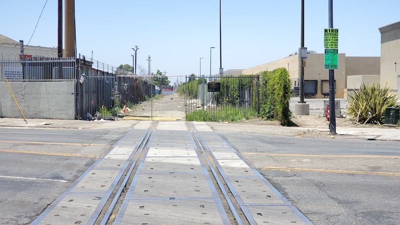
Just south of Slauson Avenue, the CicLAvia route crosses a set of railroad tracks...but there are no tracks to the east or west of Western Avenue. Whatup with that?! Well, this abandoned railroad right-of-way was an important part of the Atchison, Topeka and Santa Fe Railway (a.k.a. the Santa Fe) and Los Angeles transportation. It was built in the 1880s as the railroad's access to local sea ports (initially Redondo Beach in 1888, and later extended through Torrance to Los Angeles Harbor in the 1920s). It provided freight transport access for local industries - particularly the oil industry in El Segundo, as well as passenger/local commuter rail service up until the early 20th century. The line was abandoned in 2002 with the opening of the Alameda Corridor, providing a shared, direct access to the Harbor for all of the freight railroads. It is now owned by Metro, where parts of it are already being used for the Crenshaw/LAX light rail line (Metro K Line), and a future extension to the South Bay. The eastern segment of the line along Slauson is slated to become a bicycle/pedestrian path.

10. 'Boyz N The Hood' Filming Locations

1990
5900 Block of S. Cimarron St, Chesterfield Square.
(Private residences, do not disturb occupants)

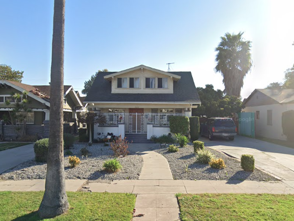
Three 1923-built houses on this block just a few blocks west of the CicLAvia route were location shoots for the iconic 1991 John Singleton movie, 'Boyz N The Hood.' Filmed in October and November 1990, the locations include Brandi's house (5906 S. Cimarron St.), Doughboy's and Ricky's house (5911 S. Cimarron St.) and Furious Styles' house (5918 S Cimarron St.). Do not bother the residents, but if you do run across a resident on the block named Valerie Wilson, she'd be more than happy to talk about the movie with you.

11. Site of Hostess Bakery Complex

1924
6007 S. St. Andrews Place, South Los Angeles.

A block west of the CicLAvia route, in a decidedly industrial area, was the regional bakery for Hostess Brands, which, for 88 years, baked Twinkies, Sno-Balls and Cupcakes and other Hostess goods for the area spanning from Mexico to Central California. Established in 1924, the complex contains seven buildings built between the 1920s and 1960s, with the largest being the Mid-Century Modern bakery building built in 1952. A railroad spur behind the building serving the bakery from the nearby Santa Fe Railway's Harbor Subdivision was built to ship in raw ingredients and ship out baked goods. Operations shut down in November 2012 when the parent company, Continental Baking Company, declared bankruptcy. Part of the factory is now used by Art'isan Bakery.

12. Harvard Park

1535 West 62nd St., Harvard Park.

Officially known as the Jackie Tatum/Harvard Recreation Center (Tatum being the first Black woman to become General Manager of the City of Los Angeles' Department of Recreation and Parks, circa 1990s), this large green space and athletic facility was where countless neighborhood youth played and became active in organized athletics. Two of them - former Major League Baseball (and Los Angeles Dodgers) players Darryl Strawberry and Eric Davis - played here in the park's baseball diamonds as kids in the early 1970s for a youth league team called the Compton Moose. The park and its influence on the two MLB stars was the subject of the 2012 documentary film, 'Harvard Park.'

13. Tipu Street Trees

c. 1990s
Western Avenue between Slauson and Florence avenues.

It's no secret that higher-income neighborhoods have more tree cover than their lower-income counterparts, so to combat this in the early-mid 1990s (most likely to address inequities of the 1992 Riots), shade-bearing street trees were planted along Western as a community improvement project. The majority of them are Tipu (Tipuana tipu) trees, which are Bolivian tropical shade trees, which bear feathery, yellow flowers that are currently in bloom. The tipus are common sights all over this area, perhaps being the South Los Angeles equivalent to the jacarandas of central Los Angeles.

14. Florence and Normandie

Florence and Normandie avenues, South Los Angeles.

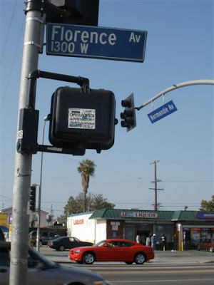
Everybody knows the flashpoint of the Los Angeles Riots erupted on this intersection on the afternoon of April 29, 1992. It's just a half-mile east of the southern terminus of CicLAvia. If you've never been here before, here's your chance. Though this corner has not changed much over the past 30 years, it bears a mundane, laid-back vibe that contrasts its stigmatized reputation to those outside the neighborhood. Unfortunately, the crown jewel of Flo-No, Art's Chili Dogs, an 80-year institution, closed down in March 2020 (unrelated to the Pandemic). But in its place is a new eatery called The Breakfast Shack (unfortunately closed on Sundays).

In 2009, the Militant paid a visit to Florence and Normandie. Other than the hot dog stand, it hasn't changed much since then.


Enjoy CicLAvia again and STAY MILITANT!

Tuesday, December 21, 2021

32 More Suburbs in Search of Their Names: An Etymology of Cities in the Inland Empire


Wow, it's been a while since The Militant did something like this. Er, not just post something on This Here Blog Site that has nothing to do with an Epic CicLAvia Tour, but making a post about the name origins of places in Southern California.

It all started in November 2013, when The Militant made a pretty epic post about how all 88 of Los Angeles County's incorporated cities got their names. He then decided to follow it up in April 2014 with the name origins of Orange County's 34 incorporated cities (do read those if you missed them the first time...).

This time around, for some odd reason, he wanted to take on the Inland Empire, which is not a county per se, but a region of varying sizes and definitions. Most define the Inland Empire as two counties, some folks include parts of five. Since one of those counties includes the largest county in the United States in terms of geographical size (though the state of Alaska has county-like bodies called "boroughs" which are even larger), The Militant doesn't want to bother with having to go all the way out to MF'ing Zzyzx, so for the sake of this, and the relevancy to his (greater) Los Angeles jurisdiction, The Militant will define "Inland Empire" as "The parts of San Bernardino and Riverside counties that exist within the Los Angeles Basin and the greater Los Angeles Metropolitan Area that are not situated in the Mojave or Colorado deserts." So...Palm Springs, Victorville - you cool, but sorry, you ain't part of this.

The Inland Empire, a.k.a. The I.E. was actually known for years as "The Orange Empire," being part of a large swath of Southern California that included the San Gabriel Valley and Orange County known for its orange groves and citrus production. A regional annual citrus-themed fair called the National Orange Show has been taking place in San Bernardino since 1889. But the dynamics of the area had evolved over the years, as Los Angeles became more urbanized and the mass media market defined by radio, television, newspapers, transportation infrastructure and professional sports teams blanketed the region, the Orange Empire became more known as a suburb.

On November 14, 1992, a large part of the 714 telephone area code split off and became the 909 area code. That gave the suburban region east of Los Angeles anchored by the twin cities of San Bernardino and Riverside a much stronger regional identity, and the term "Inland Empire," (which dates back to 1914 as documented in the old Riverside Enterprise newspaper) garnered more usage locally and nationally (especially since a neighboring region had already gained more association with the name "Orange").

So while The Militant's previous two lists were limited to incorporated cities within counties, due to the nature of the I.E., this list will also include unincorporated areas and notable communities of incorporated cities. Because the Inland Empire is like that. Also, since Lake Arrowhead and Big Bear Lake are not topographically part of the Inland Empire, because of their recreational nature, they are just as connected to the Metropolitan Los Angeles area as the towns down below, so they made the list.

As typical with Southern California place names, there's a lot of Español, especially in terms of Mexican Rancho origins, as well as names of white dudes who founded that particular place, but there are also names of French, Italian and Danish origin, as well as indigenous origin, from the three Native American tribes in the region (as well as one well outside the I.E.).

So without further delay, and after much Militant research, here it is, the etymology of 32 places in the Inland Empire, in alphabetical order:

Big Bear Lake – The California grizzly bears that once lived in the area.

Chino - Originally part of the Mexican land grant Rancho Santa Ana del Chino (“Ranch of St. Anne of the Curls”); the “curls” refer to the curly grama grasses that grow in the valley.

Chino Hills – See Chino.

Colton – David Colton, vice president of the Southern Pacific Railroad, the company that built a large railroad yard in the city that remains in operation today.

Corona – Spanish for “crown”; the nickname of the one-mile diameter circular road (Grand Blvd) in the town’s center.

Etiwanda – The Etiwanda Native American tribe, which lived on the shores of Lake Michigan.

Fontana – Italian for “fountain” or “water source”; located near the Santa Ana River.

Hemet – Named after the Lake Hemet Land Company. There are several competing origins on the name “Hemet,” including the local Native American word for “box,” and the Hemmet Brothers, Scandinavian immigrants who settled in the area.

Highgrove – Originally named East Riverside, was renamed in 1897 after the local orange groves and to give it a separate identity from Riverside.

Highland – The area east of San Bernardino, higher in elevation (300’) than the rest of the city.

Jurupa Valley – Originally part of the Rancho Jurupa Mexican land grant.

Lake Arrowhead – Originally named “Little Bear Lake” (in reference to its fellow alpine reservoir to the east), it was re-named by the Arrowhead Lake Company after the natural rock outcropping overlooking San Bernardino that visually resembles an arrowhead.

Lake Elsinore – [Competing origins] 1) After the Danish city of Helsingør in William Shakespeare’s Hamlet; 2) Anglicization of Spanish “El señor”.

Loma Linda – Spanish for “pretty hill.”

Ontario – The Canadian province of Ontario, where city founders and brothers George, William and Charles Chaffey originated from.

Menifee – Luther Menifee Wilson, a miner who discovered quartz in the area in the 1880s.

Mentone – The town of Menton in southeastern France.

Montclair – Originally named “Monte Vista” in 1900, was officially named “Montclair” in 1958 as a result of a request by the US Postal Service to avoid confusion with the Monte Vista in northern California; also as a phonetic reference to neighboring Claremont.

Moreno Valley – Spanish for “brown;” a reference to Frank Brown, the co-founder of Redlands.

Murrieta – Brothers Juan and Ezequiel Murrieta, co-owners of the Rancho Temecula Mexican land grant.

NorcoNorth Corona Land Company, which first developed the town.

Perris – Fred T. Perris, chief engineer (as in designer, not train operator) of the Atchison, Topeka and Santa Fe Railway, who oversaw construction of the transcontinental railroad line between Chicago and Los Angeles along the Cajon Pass in 1885.

Rancho Cucamonga – The Tongva village of Kukamogna ("Place of the sand").

Redlands – The color of the local reddish soil, used for making adobe.

Rialto – The Ponte di Rialto (Rialto Bridge) in Venice, Italy.

Riverside – Alongside the Santa Ana River.

Romoland – Originally named Romola Farms, the name was changed due to a request by the US Postal Service to avoid confusion with Ramona, CA.

San Bernardino – San Bernardino de Siena Asistencia (or Estancia) (St. Bernardine of Siena homestead), an outpost of San Gabriel Mission established by Spanish settlers.

TemeculaTemeekunga, meaning “place of the sun” in the language of the indigenous Luiseño/Payómkawichum people.

Upland – The area north, or “up land” of Ontario; also a reference to the height of nearby Mt. San Antonio (a.k.a. Mt. Baldy).

Wildomar – Portmanteau of the names of the town’s founders: William Collier, Donald Graham and Margaret Collier Graham.

YucaipaYukaipa’t, meaning “green valley” in the language of the indigenous Serrano/Taaqtam people.

Saturday, December 4, 2021

The Militant's Epic Militant CicLAvia Tour XXXVIII!


Interactive Map! Click on green points to view hotspots, or click here for larger view.


Looks like we made it - Sunday's "South L.A." CicLAvia is the third and last CicLAvia of 2021, a year that seemed to go by oh so fast. But it was great to return to the open streets this year, wasn't it? This time around, the 38th edition of Los Angeles' open streets event features a modified version of the December 7, 2014 CicLAvia. Instead of running down Central Avenue (the historic Main Street of Black Los Angeles), we have a 5.3-mile route that begins at Central and heads west along Dr. Martin Luther King Jr. Boulevard. Instead of running south towards Leimert Park, we head north on Crenshaw Boulevard (the contemporary Main Street of Black Los Angeles). The 23-mile street was named in 1904 after banker and developer George Lafayette Crenshaw, who developed the Lafayette Square and Wellington Square neighborhoods near Washington Blvd and his namesake thoroughfare. In addition to being the center of Los Angeles' modern-day Black community, particularly in Leimert Park, Crenshaw once was home to a Japanese American community. The exceptional width of both Martin Luther King and Crenshaw boulevards has supported automobiles, streetcars (and soon, light rail) and even a space shuttle. And now, it'll host bicycles, skateboards, scooters, wheelchairs, strollers, runners and pedestrians. Hopefully if The Rona doesn't get out of control next year, we'll have more of these again in '22.

Stay safe, stay healthy and see you or not see you on the streets this Sunday!


1. Ralph J. Bunche House
1919
1221 E. 40th Place, South Los Angeles

The Central Avenue corridor was home to Los Angeles' black community, primarily due to the racial covenants that restricted them from owning homes elsewhere in the city. But great things can come from places of injustice. Ralph J. Bunche was a teenager arriving with his family from Detroit, by way of Ohio and New Mexico, who attended nearby Jefferson High School and went to UCLA, graduating as the valedictorian at both schools. He went on to Harvard, where he earned his Ph.D in Political Science (the first African American to receive a doctorate in PoliSci from a U.S. university), and later was one of the founders of the United Nations. In 1950, due to his diplomatic work in the negotiations that ended the 1948 Arab-Israeli War, he won the Nobel Peace Prize -- the first nonwhite person to ever win the esteemed award. And he once lived right here, just two blocks east of the CicLAvia route.

2. Masjid Bilal Islamic Center/Site of Elks Lodge
1929
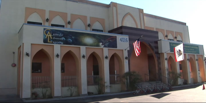
4016 S. Central Ave, South Los Angeles

This mainstay of the local Muslim community since 1973 also has a deep history in the local black community. The building was originally built in 1929 as the home of the local Elks club. But it was no ordinary Elks Club (who discriminated against black membership). It was run by the Improved and Benevolent Protective Order of Elks of the World, an African American-run organization founded in Cincinnati, Ohio in 1898 that functioned as a fraternal order for people of color. Though obviously not directly affiliated with the white Elks club, it is run with the otherwise identical customs and traditions, and with nearly half a million members worldwide, is the largest black fraternal organization in the world.

3. Site of Wrigley Field
1925  (demolished 1969)
Avalon Blvd & 42nd Place

Just a few blocks south of the CicLAvia route is Gilbert W. Lindsay Park, named after Los Angeles' first African American city councilman. But years ago, this was the place where home runs, strikeouts and 7th Inning Stretches took place in the City of Angels. And yes it was a city of Angels, as the Los Angeles Angels of the Pacific Coast League made the 22.000-capacity Wrigley Field (named after the chewing gum magnate, who had several stakes in Southern California, including Catalina Island) its home. And as any truly militant Angeleno knows, the ivy-and-brick Chi-town tourist trap, though 11 years older, was originally called Weeghman Park and wasn't dubbed Wrigley Field until 1927, which made Los Angeles' Wrigley Field the first Wrigley Field ever. The stadium also was popular with TV and movie shoots, such as Damn Yankees and The Twilight Zone. In 1961, it literally went Major League as the American League expansion team Los Angeles Angels of Los Angeles played its home games there before moving to Dodger Sta, er, Chavez Ravine for the next four seasons, and then finally moving down the 5 to Anaheim. Wrigley Field was also home of the Los Angeles White Sox, a club in the short-lived, 6-team West Coast Negro Baseball Association, a Black minor league co-founded by Olympic gold medalist Jesse Owens which lasted but a single season in 1946. Yes, there's a baseball field in the park, but it's not the same location as the original diamond.

4. Banc of California Stadium
2018
3939 S. Figueroa St, Exposition Park

Home of the MLS' Los Angeles Football Club soccer team, this $350 million, 22,000-seat venue is the first open-air stadium to be built in the City of Los Angeles since Dodger Stadium opened in 1962. It was built on the former site of the 16,000-seat Los Angeles Memorial Sports Arena (1959-2016), which was the first Los Angeles home of the Lakers (1960-1967), the Clippers (1984-1999) and hosted the Boxing matches during the 1984 Olympics. In 2022, Banc Stadium will also become the home venue of the Angel City FC National Women's Soccer League team in 2022 and host the Men's and Women's Soccer tournaments during the 2028 Olympics.

5. Historic Southern Pacific Palm Tree
 Re-planted 1914
3901 S. Figueroa St, Exposition Park

Back in the late 1800s-early 1900s, the Southern Pacific Railroad operate out of a train station called the Arcade Station, on 5th and Alameda streets. A lone palm tree stood outside the station and functioned as a landmark for arriving passengers coming in from San Francisco or points east. In 1914 (dude, a hundred years ago) the Arcade Station was demolished (no, it wasn't consumed by a fire) to make way for a more modern station, called Central Station, and the palm tree had to go. So sentimental was the palm tree, instead of being cut down, it was moved to Exposition Park, where it has stood ever since. Like its neighbor the Space Shuttle Endeavour, it was a popular icon back in its day, and it's probably safe to assume that its transport through town was an event in itself. A little-known historic market at the base of the tree tells the whole story. So if you want to see a palm tree that was planted there over 100 years ago, there you go.

6. Community Services Unlimited Urban Garden
2003
Bill Robertson Lane and Martin Luther King Jr Blvd, Exposition Park

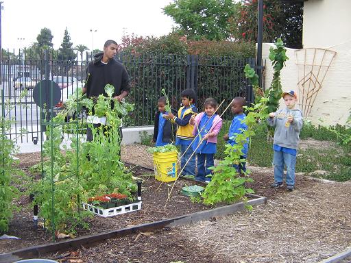
Did you know there's an urban garden along the CicLAvia route? Local nonprofit Community Services Unlimited (an organization that, interestingly enough, originated from the Black Panther Party's community outreach programs in the 1970s) grows their own organic fruits and vegetables in this Exposition Park urban garden that they sell and distribute in this predominantly food desert area to help local residents gain access to fresh, healthy produce. They sell this produce at a stand outside the LA84/John C. Argue Swim Stadium next door on Thursday afternoons from 3 to 6 p.m.

7. Los Angeles Swimming Stadium
1932
Bill Robertson Drive & Park Lane, Exposition Park

The Coliseum's little brother, the Los Angeles Swimming Stadium was the 10,000-seat venue for the 1932 Olympic swimming, diving and water polo competitions, as well as the aquatic portions of the pentathlon event. Olympians such as Buster Crabbe swam in its waters. After the games, it became a public pool, and in the '50s, USC's swim team used it as their training and competing venue. After over a half century of wear, and damage from the 1994 Northridge Earthquake, the swim stadium was renovated in 2002 and operates today as the LA84 Foundation/John C. Argue Swim Stadium.
Marco...Polo!

8. George Lucas Museum of Narrative Art
2023
Vermont and 39th St, Exposition Park

Taking shape on west side of Exposition Park like a Naboo Royal Starship is the George Lucas Museum of Narrative Art (or, "The Luke," as The Militant would like to call it), a state-of-the-art visual, cinematic and interactive museum founded by 'Star Wars' creator and filmmaker George Lucas and his wife Mellody Hobson. The site, located in close proximity to Lucas' alma mater, USC, beat out other site proposals in San Francisco (home of Lucasfilm, Ltd) and Chicago (Lucas' birthplace) when it was announced in 2017. Originally intended to open this year, it was delayed to 2023 due to the COVID-19 pandemic.

9. Celes King III Bail Bonds
1949
1530 Martin Luther King Jr Blvd, Vermont Square

Why is a Bail Bonds joint listed in the Militant's CicLAvia tour? WTF? Well, before 1983, this street was known as Santa Barbara Avenue. Celes King III was the person who lobbied to change the name of the street to Martin Luther King Jr (no relation) Blvd. A real estate broker, bail bondman, outspoken Republican, former Tuskeegee Airman, failed City Council candidate, co-founder of the Brotherhood Crusade and founder of the Kingdom Day Parade, he successfully lobbied the L.A. City Council in 1983 to re-name Santa Barbara Ave. after the slain civil rights leader -- albeit not without controversy. Some of his critics accused him of doing it to irritate then-Mayor Tom Bradley, one of his political enemies, and others have criticized CK3 of conflict of interest (his residence (he lived in the apartment upstairs) and his bail bonds business were located on Santa Barbara Ave after all) and even ego trippin' (the short-hand street signs say "King Bl"-- the same as his own last name). Whether this was a self-aggrandizing stunt or a genuine tribute to an American hero, we will never know: Celes King III died in 2003. But here's one interesting CicLAvia route fact: His father, Celes King, Jr was the owner of Central Avenue's Dunbar Hotel back in its heyday.

10. Worldwide Tacos
 [Year Unknown]
2419 Martin Luther King Blvd, Leimert Park

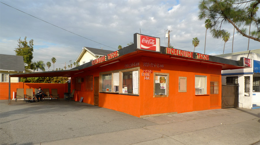
The Militant loves tacos, as you may or may know. But along the CicLAvia route is perhaps one of the most unusual taco joints around. Worldwide Tacos makes over 150 types of tacos, in chicken, beef, lamb, chicken, duck, turkey, pastrami, shrimp, fish and vegetarian varieties, all freshly-made and cooked to order. Prices range from $2.50 to $8.50 each. But that's not the catch. The catch is that the wait time ranges from 15 minutes to two hours. The Militant has not tried Worldwide Tacos (nor has he waited for one), but his operatives who have (and endured the long wait, though you can just leave them your cellphone number and they'll call you when they're ready) say they're pretty bomb-diggity. Hmmm...


11. Yellow Car Right Of Way

1902
Leimert Blvd between Martin Luther King Jr Blvd and Vernon Avenue

See that nice, wide, landscaped median branching south of MLK through Leimert Park? Could you ever guess what it used to be? Yup, it was the right-of-way for the Yellow Car trolleys of the Los Angeles Railway, part of  The 5 Line, which ran from Eagle Rock (ya, rly) to Hawthorne. Actually The CicLAvia route from the 110 Freeway to Leimert Avenue was part of the 5 Line, and because of that Leimert Park was originally planned as a transit-oriented community (it was also originally planned as a whites-only community, but so much for that, eh?) Incidentally, part of this same historic Yellow Car Line, along both Crenshaw Blvd and Florence Avenue, will soon be re-used for rail transit as part of Metro's under-construction Crenshaw Line.

12. Baldwin Hills Crenshaw Plaza
1947
3650 Martin Luther King Jr Blvd, Crenshaw District

Originally known as the Broadway-Crenshaw Center, it opened on November 21, 1947 as one of the first auto-centric regional shopping centers in the US. The Streamline Moderne shopping center, designed by Albert B. Gardner, was home to a 5-story Broadway department store, a Vons supermarket and a Woolworth's discount store. In 1949, a Silverwoods clothing store opened, and the landmark bridge over MLK (then known as Santa Barbara Avenue) was built to connect with the existing 1947 May Company building on the north side of the street. Today's version of the shopping center came about during a late 1980s remodel. If you drop by the mall, The Militant highly recommends checking out the cupcakes at Southern Girl Desserts!

13. Sanchez Adobe
1791
3725 Don Felipe Drive, Baldwin Hills

In the streets behind the Baldwin Hills Crenshaw Plaza stands what may or may be the oldest building in Los Angeles. The crown was long believed to belong to the 203 year-old 1818 Avila Adobe on Olvera Street, but further historical research in 2012 revealed that this structure, originally part of Rancho La Cienega o Paso de la Tijera, dates back some 50 years prior to when it was deeded to Don Vicente Sanchez in 1843, making it around 230 years old.  The building was later owned by Baldwin Hills' namesake Elias Jackson "Lucky" Baldwin, who brought freed slaves to work in his homestead after the Civil War. The historic structure - 30 feet wide and two stories tall - has been integrated into a large single-story building built in 1927. It is currently home to Agape Church of Los Angeles.


14. Black Dahlia Body Site
1947
3825 S. Norton Ave, Crenshaw District

On the morning of January 15, 1947, the body of 22 year-old waitress Elizabeth Short, a.k.a. "The Black Dahlia" - the victim of arguably the most famous unsolved murder case in Los Angeles history - was discovered on this site (at the time an empty lot; the house was not built until 1956) by a local woman walking with her young daughter. Short, a transplant from Boston who was reportedly an aspiring actress, was missing the week prior to the discovery of her body, and the case garnered national headlines due to the gory details of her murder. The LAPD's investigation yielded over 150 suspects but no arrests. The cultural intrigue surrounding Short's death became a huge influence on the 1940s 'Los Angeles Noir' phenomenon.

15. Ken Clark Pontiac/Majestic Pontiac Sign
1952
3740 Crenshaw Blvd, Crenshaw District

Although Crenshaw supported a streetcar line south of Vernon, the thoroughfare north of it had always been auto-centric in nature and design. From the late 1930s to 2000, The 'Shaw was once home to an auto row, boasting car dealerships such as Crenshaw Ford, Harry Mann Chevrolet (once the largest Corvette dealer in the US), O'Connor Lincoln-Mercury and Peterson Oldsmobile. The last of the lot, so to speak, was Majestic Pontiac, at Crenshaw and Coliseum. Originally Ken Clark Pontiac from 1952 to 1960, the business was sold and became Majestic Pontiac. The dealership's telltale neon sign with the Pontiac Indian logo was an icon on the boulevard, much like how Felix Chevrolet's cartoon cat smiles over Figueroa today. The dealership closed for good in 2000 and the lot was converted into a shopping center soon afterward. But the original 1952 sign still remains, Pontiac Indian head intact, this time adapted to bear the signage of Big 5 Sporting Goods and Goodwill Industries.

16. Obama Boulevard
2019
Obama Boulevard between Martin Luther King Jr. Blvd and Gramercy Pl

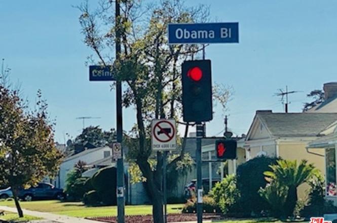
Originally named Rodeo Road in 1911, presumably to honor the history of cattle ranchers of the area, most specifically those of nearby Rancho La Brea. After living in the confusing shadow of the more opulent Rodeo Drive in Beverly Hills since the 1920s, the street was officially re-named and re-dedicated "President Barack Obama Boulevard" in a public ceremony and festival on May 4, 2019, in honor of the 44th (and first African American) president of the United States, who made one of his first presidential campaign appearances at Rancho Cienega Park on February 20, 2007. The street is nestled south of Washington, Adams and Jefferson boulevards, and intersects with Martin Luther King Jr. Blvd. It joins 16 other thoroughfares nationwide named after Obama.


Enjoy CicLAvia again and STAY MILITANT!