Showing posts with label Culver City. Show all posts

Saturday, March 2, 2019

The Militant's Epic Militant CicLAvia Tour XXIX!!!


For larger version of map, click here.


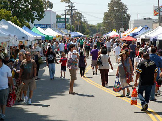
The first CicLAvia of 2019 is the earliest calendar date CicLAvia event and the second during the Winter season. And with a high temperature of 61 degrees, this will beat out the last CicLAvia in December in terms of coldest to date.

This is the 29th iteration of CicLAvia, with a 5.8-mile route that is a truncated version of the March 2017 "Culver City Meets Venice" course, and parts of which were also covered in the August 2015 and April 2013 open streets events.


You should know the drill by now, Share this link on your Facebooks, Twitters and Instagrams, visit the sights yourselves -- and if you do, use the hashtag, #EpicCicLAviaTourAnd here...we...go!


1. Site of King's Tropical Inn
1930
5879 Washington Blvd, Culver City

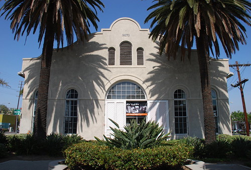
The sight of this Byzantine domed structure will strike a chord in many older Angelenos. Established in 1925 by restaurateur John G. King, in the era before Zankou, Koo-Koo-Roo, Pioneer Chicken or even Knott's Chicken Dinners, this was the place for a chicken dinner in the Los Angeles area. King's wooden tropical-style hut burned down in a 1930 fire, but was replaced later that year by the familiar domed building that featured an exotic koi goldfish pond in the front. The Southern-style chicken and jumbo squab (that's roast pigeon) dinners were still legendary and the place remained popular through the 1940s and '50s. The restaurant closed down in the mid-1960s and was eventually repurposed as tire and auto body shop in the 1980s. It was demolished in 1994 following damage from the Northridge Earthquake. A Culver City historical marker is placed at the location and the archway of the modern shopping center at Washington and La Cienega pays architectural homage to the dome.
2. Syd Kronenthal Park
1940
3459 McManus Ave, Culver City

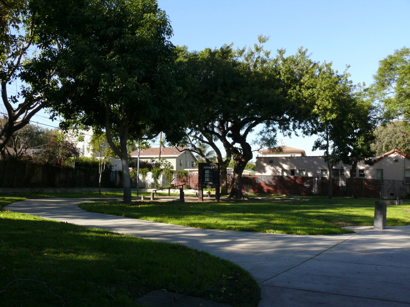
This six-acre park on the northeast corner of El Ciudad de Culver is in a unique location: Los Angeles-adjacent, situated along the banks of Ballona Creek, it opened in 1940 as McManus Park where Pacific Electric Red Cars sped by for the next 13 years. In 1992 the park was re-named after longtime Culver City municipal employee "Uncle" Syd Kronenthal (1923-2015) who, during his 52-year tenure, helped develop the city's Recreation and Parks department and established 14 parks in the Heart of Screenland. Today, the park, just two blocks south of the CicLAvia route, is also accessible via the Expo Line Bike Path and the Ballona Creek Bike Path.

3. Hayden Tract
1986
Area bounded by National Blvd, Ballona Creek, Higuera St and Hayden Ave, Culver City

This tell-tale set of architecturally-unique buildings makes up Culver City's Hayden Tract, a collection of offices, art galleries, design firms and entertainment and tech industry studios. What was once Culver City's oldest industrial district, architect Eric Owen Moss and developers Frederick and Laurie Samitaur Smith created the Hayden Tract in 1986 as a redevelopment project and economic development engine fueled by arts and design. The result is buildings known as "The Beehive," "The Stealth" and "The Umbrella," a dance studio known as Conjuntive Points, Moss' own design studio and one of Los Angeles' most innovative design centers.

4. Helms Bakery
1931
8758 Venice Blvd, Los Angeles

From 1931 to 1969, Angelenos knew their bread, and it came from blue-and-yellow delivery trucks from the legendary Helms Bakery, founded at this site, with eventual satellite bakeries in Montebello and San Bernardino. It was the official bread of the 1932 Olympic Games here in Los Angeles, and the bread was so renowned, it was provided to the U.S. Olympic teams in subsequent Olympiads. It was even the first bread eaten on The Moon, as part of the Apollo 11 astronauts' food rations. But you couldn't buy the bread in any store, it was only from their delivery trucks (yes, the food truck craze is not new round here) with their tell-tale "TOOT! TOOT!" whistle. Ultimately, after an era where people bought food from delivery trucks, the Helms brand succumbed to the rise of the supermarket. This building and its trademark neon sign stand, adaptively reused, as a testament to its history and impact on Southern California. But everything old is new, and the Helms Bakery plans to re-open again!


5. Culver City Metro Expo Line Station/Site of Culver Junction
2012
Venice and National boulevards, Culver City

You may or may not have arrived at CicLAvia via the Metro Expo Line, which is the modern reincarnation of the Pacific Electric Santa Monica Air Line. Not only can you experience Los Angeles' transportation present, but you're also in the clear presence of its past -- this area was also the site of Culver Junction, where not one, not two, but three Pacific Electric Red Car lines converged, going to Santa Monica, Venice and Redondo Beach. TIP: Make sure you buy a Day Pass or that your TAP card is well-loaded before CicLAvia, so you don't have to queue at the ticket machines! The Militant says "You're Welcome."


6. Ince Boulevard/The Culver Studios
1918
Ince Blvd & Washington Ave, Culver City

As you make your first turn going westbound on the CicLAvia route, take note of the street name: Ince.

If you know your Culver City history, the town was a planned community built by landowner Harry H. Culver, a Spanish-American war veteran who worked for SFV pioneer Isaac N. Van Nuys and purchased a large section of the old Rancho La Ballona. In 1913 he established the town and filmmaker Thomas Ince moved his operation here from Pacific Palisades (via his Triangle Studios down the street -- more on this later...) and bought this section of land from Culver himself to establish the Ince Studio, which featured a large mansion fashioned after George Washington's Mt. Vernon residence, that remains in full view today. Ince's studio was sold to Cecil B. DeMille after his mysterious death and had changed hands and names over the years, finally adopting its current name of The Culver Studios in 1970. Legendary Hollywood films were shot this studio, including Gone With The WindKing KongE.T. and The Matrix.

7. Pacific Electric Ivy Substation
1907
Venice and Culver boulevards, Palms

Downtown  Culver City is already rich in retail and artistic activity, and has a bevy of well-known eateries, like the popular Father's Office. The Militant can cover that in its own post (and kinda already did before). But welcoming people to Downtown Culver City along Venice Blvd (though technically located in the Los Angeles neighborhood of Palms), a block from the Culver City station is an appropriate link to the past - the Ivy Substation. The single-story Mission Revival-style structure served as a powerhouse for the Pacific Electric Railway from 1907 to 1953, when the Expo Line's predecessor, the Santa Monica Air Line, ceased operation. Today, it's a 99-seat venue for The Actor's Gang theatre company, renovated in the early 1990s. How interesting that a building originally built for transportation infrastructure was repurposed into a building for the arts, which in turn attract people using the new transportation infrastructure.


8. Culver Hotel
1924
9400 Culver Blvd, Culver City

This 6-story triangular building, originally named Hotel Hunt, opened in 1924 as Culver City's first skyscraper (it was the tallest building between Downtown Los Angeles and Venice)  and housed Harry Culver's personal office on the second floor. Numerous Hollywood stars have stayed here, such as Joan Crawford, Clark Gable, Greta Garbo and Ronald Reagan, and most notably the little people actors who played the Munchkins in The Wizard of Oz during its filming down the street. Actor John Wayne was one of the later owners, and it was fully restored in the 1990s.

9. The Washington Building
1927
9718 W. Washington Blvd, Culver City

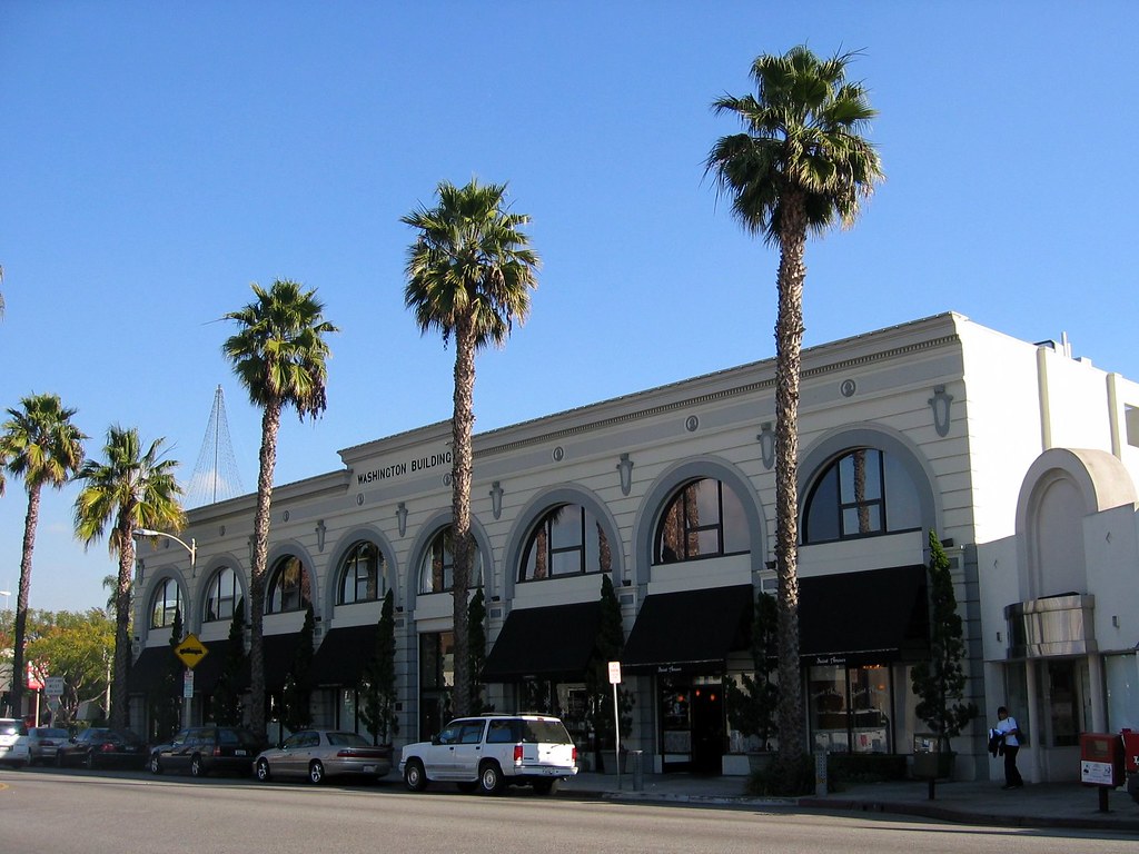
Culver City's other 1920s-era triangular building is just down the street from The Culver Hotel. Built by Charles E. Lindblade, a business associate of Harry Culver who also bears a city street name of his own, this Beaux Arts-style building was designed by Arthur D. Scholz and Orville L. Clark. As it is today, the building housed numerous retail and office businesses over the years, including the Culver City post office, the MGM Studios Fan Club and Lindblade's real estate company.


10. Kirk Douglas Theatre/Culver Theatre
1946
9820 W Washington Blvd, Culver City

Built in 1946 as The Culver Theatre, a 1,100-seat Streamline Moderne cinema designed by Karl G. Moeller that screened 20th Century Fox films as part of the Fox West Coast Theatres chain.
It was later operated by the National General and Mann Pictures chains, and finally as an independent theatre. It was split into three screens circa 1970s, and closed in 1989. In 1994, it suffered damage from the 1994 Northridge Earthquake and underwent a major $8 million renovation later in the '90s, re-opening in 2004 as The Kirk Douglas Theatre (with Spartacus himself as a the major contributor in the renovation), operated by Center Theatre Group. It currently features two stages, one seating about 300 and a smaller stage seating around 100.

11. Sony Pictures Studios/MGM Studios
1915
10202 West Washington Boulevard, Culver City

One can't mention Culver City without mentioning its massive movie lot, originally Thomas Ince's (remember him?) Triangle Studios operation until he moved to the Culver Studios property and sold this site to D.W. Griffith and Mack Sennett.  In 1918, the studio was sold to Samuel Goldwyn, which became Metro Goldwyn Mayer in 1924 (following the merger of Metro Pictures, Goldwyn Studios and Louis B. Mayer Productions). It became the Columbia Pictures studios in 1989 and Sony Pictures Studios from 1992 to the present. On this lot was filmed a countless list of Hollywood productions, most notably The Wizard of Oz in 1939 (you will be riding next to the actual Land of Oz, think about that...), and currently, TV shows like Jeopardy! and Wheel Of Fortune. Not to be outdone by Universal and Warner Brothers, but you can also take a tour of this studio lot (weekdays only).

If heading northwest along Motor Avenue, please skip to #21.


12. La Ballona Elementary School
1865
10915 W Washington Blvd, Culver City

This local school is literally some old school Culver City right heah! Established in 1865, it's one of the oldest schools in Los Angeles County still in operation. Back in the day, it had an enrollment of 158 pupils between the ages of 5-15, being taught by one teacher, a Miss Craft who made $50 a month, and the school year lasted seven months, since it revolved around the agricultural calendar of the surrounding area.
When it was established, it was in an unincorporated area that eventually became Palms, which was annexed to the City of Los Angeles in 1914. When Culver City was founded the year before, it had no schools within its boundaries, so another school was built in the area in 1916. Eventually La Ballona was annexed into Culver City in 1920.

13. King Fahad Mosque
1995
10980 Washington Boulevard, Culver City

This Islamic house of worship was built in 1995 as a gift from Saudi Prince Abdulaziz bin Fahad to serve the growing community of Muslims in the Westside, named after the king of Saudi Arabia at the time. Its facade features hand made marble tiles from Turkey, and a 72 foot-high minaret topped with a gold leaf crescent.


14. Tellefson Park/Rollerdrome Site
1976/1928
1105 W. Washington Pl, Culver City

There's a designated activity hub here at this 1.5-acre Culver City park, which was dedicated in 1976 as part of the U.S. Bicentennial celebrations. It was named after former Culver City councilman and city attorney Mike Tellefson, who served the city for 31 years. In 2013, the body of a suicide victim was discovered in the park.

But longtime Culver Citizens remember this site as a legendary roller skating rink called The Rollerdrome,  a wooden structure which opened in 1928 and had a characteristic rounded roof. Roller skating events were centered around the rink's organ, which was played by a live organist, and provided memorable evenings for local families and youths. It was torn down in 1970, which was a shame, since roller skating enjoyed a renaissance of sorts in the '70s.

15. Tito's Tacos
1959
11222 Washington Pl, Culver City

Many Angelenos already know of this longtime Westside (American) taco joint known as Tito's Tacos, which as we all know, was founded in 1959 by a businessman who may or may not be an actual Mexican guy named Tito. Everyone has their opinion on Tito's, but three things are indisputable truths: 1) It's a Culver City Institution; 2) It's not authentic Mexican food and 3) People come here for the nostalgia anyway.

During the "Culver City Meets Venice" CicLAvia in August 2015, a minor controversy erupted when the restaurant's owner threatened to sue Culver City government for potential lost revenue due to the CicLAvia route, and everyone, including The Militant got all in on that, but ultimately, cooler heads prevailed, and after an intervention by the CicLAvia organization, Tito's Tacos warmed up to the route, and likely did a 180 once crowds queued up along their sidewalk service windows. Titogate 2015 was now history. All is good now, and Tito's is a mainstay of every Culver City CicLAvia. The moral of the story? Never fear CicLAvia, and a little communication and understanding goes a long way.

16. The Oval District/Palm Place
1912
Area within Washington Place, McLaughlin Ave, Venice Blvd & Inglewood Blvd, Mar Vista

You might not see much from the street level, but this neighborhood just north of the CicLAvia route, a Historic Preservation Overlay Zone known as "The Oval District" is one of the first automobile-oriented property tract developments in Southern California.

When seen from a map or an aerial view. the streets of this 200-unit housing development of predominantly 1- and 2-story homes resembles an hourglass shape with an oval road in the center (which caught The Militant's eye and caused him to investigate the history of the place).

The 137-acre neighborhood was developed in 1912 by a Lillian Charnock Price (there is a "Charnock Road" two blocks north of Venice, BTW) who hired renowned landscape architect and urban planner Wilber David Cook, Jr. (who worked for legendary late 19th/early20th-century landscape architect Frederick Law Olmsted to design an "Aristocratic Suburb" marketed as “Palm Place."

The large-sized lots were unique, and park-like in their large setback from the street and the palm tree-lined parkways, but only a small number of homes were built. Price sold the development to Robert Sheman, who was the stepson of Moses Sherman, the developer of the Los Angeles and Pacific Railway, which built the original rail line on nearby Venice Boulevard. What was originally intended to be the first car-oriented development was going to be a transit-oriented development!

But those didn't sell either. The lots were still too large and pricey. So Sherman sold it to a financier group that marketed it as "Marshall Manor" in 1920 and interest began to pick up. But it wasn't until after World War II, when suburbanization was in vogue and Los Angeles' Westside development boom commenced, that the rest of the lots got built.

17. Mar Vista Hill (a.k.a. The 'Mar Vista' in Mar Vista)
1924
Centinela Ave & Rose Ave, Mar Vista

Everyone know that "Mar Vista" is EspaƱol for "sea view." But riding along Centinela or Venice during CicLAvia, you can't even see the sea. Where is it?

Well, The Militant will tell you where to see the "Mar Vista" in Mar Vista. He implores you to take a short detour from the CicLAvia route and continue north along Centinela Avenue, switch your gears (or pedal harder, you fixie heads), and go up the hill (Mar Vista Hill) until you reach Rose Avenue. Then turn right and go  up the hill to the open space that contains the baseball field and community garden. Look to the west, stand on top of the telephone poles laying on the ground in front of the small parking lot, and you can have a semi-unobstructed (damn you, DWP power lines!) view of Santa Monica Bay from the Palos Verdes peninsula to the Santa Monica Mountains.

Mar Vista Hill is a 203-foot-above-sea-level promontory that was once a garbage dump, and was later the site of the Venice Reservoir in 1940 (smart, huh). The reservoir was decommissioned in the 1960s and replaced with the baseball fields you see today.

So come on up to Mar Vista Hill, where you can see the sea, to see all that you can see!

Go visit Mar Vista Hill and tweet a pic of the ocean with the hashtag #EpicCicLAviaTour!


18. State Route CA 187
1964
Venice Boulevard between Lincoln Blvd and the 10 Freeway

You may or may not know that Venice Boulevard, in addition to being a two-time CicLAvia route, was also a Pacific Electric Red Car line, but did you know it's also a designated California State Highway? In 1964, CalTrans designated State Route 187 starting at the Pacific Ocean. In 1994, it was shortened to the 5.4 miles from Lincoln Boulevard to the 10 Freeway. The number "187" also happens to be a reference to the California Penal Code designation for murder, which is most likely why a young, '90s-era, pre-commercialized Snoop Dogg is standing by the sign in this photo.

19. Mario's Brothers Market
12904 Venice Blvd, Mar Vista

No deep history behind this neighborhood Mexican corner market on Venice and Beethoven, but the name caught The Militant's eye. He's seen some of you CicLAvians ride in CicLAvia in Mario/Nintendo cosplay, so this would be a perfect photo/selfie opportunity.

While you're here, support the business and buy something inside. Maybe it really is owned by a Mario. Or a Luigi. Ask where The Princess is. If they're successful enough, they might move to a larger location and rename themselves "Super Mario's Brothers." Tweet a pic of yourself (or your group) in front of Mario's Brothers with the hashtag "#EpicCicLAviaTour"!


20. Venice High School
1920
13000 Venice Blvd, Venice

Venice's namesake secondary school was one of three on-location sites for Rydell High in the 1978 motion picture Greaseand was the school scene in the Britney Spears video for her debut hit, "...Baby One More Time." The main Moderne-style school buildings, built in 1935-37  were designed by local architects John C. Austin and Frederick M. Ashley, who also designed the Griffith Observatory. The campus is also famous for its statue of legendary Hollywood actress and famous alumna Myrna Loy at the front of the school. Other famous alumni include Beau Bridges, Crispin Glover, the late Ivory Queen of Soul, Teena Marie and In-N-Out Burger founder Harry Snyder. Go Gondoliers!

Motor Avenue Branch:21. Digital Imaging Center
10354 Venice Blvd, Culver City

Not historic, but this is The Militant's go-to place for making physical prints of his digital photographs. Nice folks, nice prices and quick service!


22. The Original Location of Versailles Cuban Restaurant
1981
10319 Venice Blvd, Palms

Home of their legendary garlic chicken and black beans, among other menu items, this restaurant was founded at this location by Cuban immigrant Orlando Garcia in 1981 after opening a restaurant called El Rincon Criollo near Downtown Los Angeles in the late 1970s. So why is does an iconic Cuban restaurant bear the name of a historic palace in France? Originally to be named "El Rincon Criollo #2," it was named "Versailles" at the urging of his son and current owner William Garcia, who recalls visiting a fishing village called Versailles during his youth with his father, and stayed at Miami's Versailles hotel after his own wedding. And during his honeymoon, the cruise ship's dining room was also called Versailles. So his geographical leitmotif won out. The restaurant, now a local chain, eventually grew to five locations, but three (including locations in Encino and near Beverly Hills) operate today.

23. The Guy on Motor and Venice
2002
3771 Motor Ave, Palms

While waiting for his digital prints at Digital Imaging Center and after shopping for the latest camo threads at The Surplus Store across the street, The Militant stumbled on this rather random, eclectic and interesting thrift/antique store, which, depending on your tastes and interests, is either The Most Awesome Place Evar or a total P.O.S.  -- you decide. The guy is one Rick Lamb, who has run this place since 2002 and donates the proceeds of his sales to the organization Friends of Animals.


24. Iman Cultural Center
2006
3376 Motor Ave, Palms

This cultural center, school and house of worship for Los Angeles' Iranian American Shia Muslim community, most of which live in the Westside. Unlike the immigrants from Iran who identify as Persians (who are mostly Jewish) or other Muslims (who are mostly Sunni Muslims, the majority sect of Islam that has had a 1,387-year tiff with the Shiites) this minority-within-a-minority community holds this venue in high regard. And it's expected to be kickin' in a few weeks when it hosts the Nowruz, or Persian New Year festival on March 21.

25. The National Bend
National Blvd & Rose Avenue, Palms

Whatup with National Boulevard? It is perhaps one of the most perplexing throughfares in all of Los Angeles with its constant, excessive twists, turns and bends. But alas, our Freeway Culture is to blame: Before the late 1950s, National was a somewhat more straightforward street but was consequently chopped up and made into a crooked mess due to the construction of the Santa Monica Freeway. This sharp turn near Rose Avenue features an eclectic, multicultural array of restaurants, markets and shops usually not found in the Westside, such as the Simpang Asia Indonesian market, Madre Oaxacan Restaurant, Hu's Szechuan Restaurant, The Vegan Joint, and just around the corner, Mama's Pizza and the Irish Times pub. The Militant covered this curious corner back in 2007.

See you or not see you on the streets this Sunday! Low chance of rain in the morning, but always remember - THE SUN ALWAYS SHINES ON CICLAVIA! Happy CicLAvia!

Thursday, March 23, 2017

The Militant's Epic Militant CicLAvia Tour XX!!


Interactive map - click and zoom! Click here to view the map separately!


Ahhh, Spring is finally in the air. A time for more daylight, colorful native floral blooms, Dodgers baseball and...CicLAvia! The first Cicla of 2017 brings us back to a virtual re-run of the August 2015 "Culver City Meets Venice" route from The Heart of Screenland (which will be celebrating its 100th birthday this September) to Abbot Kinney's canal city via Mar Vista - although there's a minor modification - the addition of two streets and an alleyway forming a pedestrian zone in Mar Vista between Centinela and Grand View avenues.

This is the 20th iteration of CicLAvia, and The Militant still has yet to miss a single one. So for those of you 20-timers who will be on the streets this Sunday, The Militant will celebrate by pouring a Dos Equis at an unspecified bar or restaurant along the route. If you happen to spot him (not very likely, but who knows?) Then drinks are on The Militant!

You should know the drill by now, Share this link on your Facebooks and Twitters, visit the sights yourselves -- and if you do, Tweet with the hashtag, #EpicCicLAviaTour to stroke The Militant's ego and make him feel like his several days of staying up late at night to research and write all this was worth his while. And most of all, Stay Militant and Enjoy CicLAvia this Sunday! See you or not see you on the streets!

1. Culver City Metro Expo Line Station/Site of Culver Junction
2012
Venice and National boulevards, Culver City

You may or may not have arrived at CicLAvia via the Metro Expo Line, which is the modern reincarnation of the Pacific Electric Santa Monica Air Line. Not only can you experience Los Angeles' transportation present, but you're also in the clear presence of its past -- this area was also the site of Culver Junction, where not one, not two, but three Pacific Electric Red Car lines converged, going to Santa Monica, Venice and Redondo Beach. TIP: Make sure you buy a Day Pass or that your TAP card is well-loaded before CicLAvia, so you don't have to queue at the ticket machines! The Militant says "You're Welcome."

2. Ince Boulevard/The Culver Studios
1918
Ince Blvd & Washington Ave, Culver City

As you make your first turn going westbound on the CicLAvia route, take note of the street name: Ince.

If you know your Culver City history, the town was a planned community built by landowner Harry H. Culver, a Spanish-American war veteran who worked for SFV pioneer Isaac N. Van Nuys and purchased a large section of the old Rancho La Ballona. In 1913 he established the town and filmmaker Thomas Ince moved his operation here from Pacific Palisades (via his Triangle Studios down the street -- more on this later...) and bought this section of land from Culver himself to establish the Ince Studio, which featured a large mansion fashioned after George Washington's Mt. Vernon residence, that remains in full view today. Ince's studio was sold to Cecil B. DeMille after his mysterious death and had changed hands and names over the years, finally adopting its current name of The Culver Studios in 1970. Legendary Hollywood films were shot this studio, including Gone With The WindKing KongE.T. and The Matrix.

3. Pacific Electric Ivy Substation
1907
Venice and Culver boulevards, Palms

Downtown  Culver City is already rich in retail and artistic activity, and has a bevy of well-known eateries, like the popular Father's Office. The Militant can cover that in its own post (and kinda already did before). But welcoming people to Downtown Culver City along Venice Blvd (though technically located in the Los Angeles neighborhood of Palms), a block from the Culver City station is an appropriate link to the past - the Ivy Substation. The single-story Mission Revival-style structure served as a powerhouse for the Pacific Electric Railway from 1907 to 1953, when the Expo Line's predecessor, the Santa Monica Air Line, ceased operation. Today, it's a 99-seat venue for The Actor's Gang theatre company, renovated in the early 1990s. How interesting that a building originally built for transportation infrastructure was repurposed into a building for the arts, which in turn attract people using the new transportation infrastructure.

4. Culver Hotel
1924
9400 Culver Blvd, Culver City

This 6-story triangular building, originally named Hotel Hunt, opened in 1924 as Culver City's first skyscraper (it was the tallest building between Downtown Los Angeles and Venice)  and housed Harry Culver's personal office on the second floor. Numerous Hollywood stars have stayed here, such as Joan Crawford, Clark Gable, Greta Garbo and Ronald Reagan, and most notably the little people actors who played the Munchkins in The Wizard of Oz during its filming down the street. Actor John Wayne was one of the later owners, and it was fully restored in the 1990s.

5. The Washington Building
1927
9718 W. Washington Blvd, Culver City

Culver City's other 1920s-era triangular building is just down the street from The Culver Hotel. Built by Charles E. Lindblade, a business associate of Harry Culver who also bears a city street name of his own, this Beaux Arts-style building was designed by Arthur D. Scholz and Orville L. Clark. As it is today, the building housed numerous retail and office businesses over the years, including the Culver City post office, the MGM Studios Fan Club and Lindblade's real estate company.

6. Kirk Douglas Theatre/Culver Theatre
1946
9820 W Washington Blvd, Culver City

Built in 1946 as The Culver Theatre, a 1,100-seat Streamline Moderne cinema designed by Karl G. Moeller that screened 20th Century Fox films as part of the Fox West Coast Theatres chain.
It was later operated by the National General and Mann Pictures chains, and finally as an independent theatre. It was split into three screens circa 1970s, and closed in 1989. In 1994, it suffered damage from the 1994 Northridge Earthquake and underwent a major $8 million renovation later in the '90s, re-opening in 2004 as The Kirk Douglas Theatre (with Spartacus himself as a the major contributor in the renovation), operated by Center Theatre Group. It currently features two stages, one seating about 300 and a smaller stage seating around 100.


7. Sony Pictures Studios/MGM Studios
1915
10202 West Washington Boulevard, Culver City

One can't mention Culver City without mentioning its massive movie lot, originally Thomas Ince's (remember him?) Triangle Studios operation until he moved to the Culver Studios property and sold this site to D.W. Griffith and Mack Sennett.  In 1918, the studio was sold to Samuel Goldwyn, which became Metro Goldwyn Mayer in 1924 (following the merger of Metro Pictures, Goldwyn Studios and Louis B. Mayer Productions). It became the Columbia Pictures studios in 1989 and Sony Pictures Studios from 1992 to the present.

On this lot was filmed a countless list of Hollywood productions, most notably The Wizard of Oz in 1939 (you will be riding next to the actual Land of Oz, think about that...), and currently, TV shows like Jeopardy! and Wheel Of Fortune.

8. La Ballona Elementary School
1865
10915 W Washington Blvd, Culver City

This local school is literally some old school Culver City right heah! Established in 1865, it's one of the oldest schools in Los Angeles County still in operation. Back in the day, it had an enrollment of 158 pupils between the ages of 5-15, being taught by one teacher, a Miss Craft who made $50 a month, and the school year lasted seven months, since it revolved around the agricultural calendar of the surrounding area.
When it was established, it was in an unincorporated area that eventually became Palms, which was annexed to the City of Los Angeles in 1914. When Culver City was founded the year before, it had no schools within its boundaries, so another school was built in the area in 1916. Eventually La Ballona was annexed into Culver City in 1920.


9. King Fahad Mosque
1995
10980 Washington Boulevard, Culver City

This Islamic house of worship was built in 1995 as a gift from Saudi Prince Abdulaziz bin Fahad to serve the growing community of Muslims in the Westside, named after the king of Saudi Arabia at the time. Its facade features hand made marble tiles from Turkey, and a 72 foot-high minaret topped with a gold leaf crescent.


10. Tellefson Park/Rollerdrome Site
1976/1928
1105 W. Washington Pl, Culver City

There's a designated activity hub here at this 1.5-acre Culver City park, which was dedicated in 1976 as part of the U.S. Bicentennial celebrations. It was named after former Culver City councilman and city attorney Mike Tellefson, who served the city for 31 years. In 2013, the body of a suicide victim was discovered in the park.

But longtime Culver Citizens remember this site as a legendary roller skating rink called The Rollerdrome,  a wooden structure which opened in 1928 and had a characteristic rounded roof. Roller skating events were centered around the rink's organ, which was played by a live organist, and provided memorable evenings for local families and youths. It was torn down in 1970, which was a shame, since roller skating enjoyed a renaissance of sorts in the '70s.

11. Tito's Tacos
1959
11222 Washington Pl, Culver City

Many Angelenos already know of this longtime Westside (American) taco joint known as Tito's Tacos, which as we all know, was founded in 1959 by a businessman who may or may not be an actual Mexican guy named Tito. Everyone has their opinion on Tito's, but three things are indisputable truths: 1) It's a Culver City Institution; 2) It's not authentic Mexican food and 3) People come here for the nostalgia anyway.

During the last "Culver City Meets Venice" CicLAvia in August 2015, a minor controversy erupted when the restaurant's owner threatened to sue Culver City government for potential lost revenue due to the CicLAvia route, and everyone, including The Militant got all in on that, but ultimately, cooler heads prevailed, and after an intervention by the CicLAvia organization, Tito's Tacos warmed up to the route, and likely did a 180 once crowds queued up along their sidewalk service windows. Titogate 2015 was now history. The moral of the story? Never fear CicLAvia, and a little communication and understanding goes a long way.

12. The Oval District/Palm Place
1912
Area within Washington Place, McLaughlin Ave, Venice Blvd & Inglewood Blvd, Mar Vista

You might not see much from the street level, but this neighborhood just north of the CicLAvia route, a Historic Preservation Overlay Zone known as "The Oval District" is one of the first automobile-oriented property tract developments in Southern California.

When seen from a map or an aerial view. the streets of this 200-unit housing development of predominantly 1- and 2-story homes resembles an hourglass shape with an oval road in the center (which caught The Militant's eye and caused him to investigate the history of the place).

The 137-acre neighborhood was developed in 1912 by a Lillian Charnock Price (there is a "Charnock Road" two blocks north of Venice, BTW) who hired renowned landscape architect and urban planner Wilber David Cook, Jr. (who worked for legendary late 19th/early20th-century landscape architect Frederick Law Olmsted to design an "Aristocratic Suburb" marketed as “Palm Place."

The large-sized lots were unique, and park-like in their large setback from the street and the palm tree-lined parkways, but only a small number of homes were built. Price sold the development to Robert Sheman, who was the stepson of Moses Sherman, the developer of the Los Angeles and Pacific Railway, which built the original rail line on nearby Venice Boulevard. What was originally intended to be the first car-oriented development was going to be a transit-oriented development!

But those didn't sell either. The lots were still too large and pricey. So Sherman sold it to a financier group that marketed it as "Marshall Manor" in 1920 and interest began to pick up. But it wasn't until after World War II, when suburbanization was in vogue and Los Angeles' Westside development boom commenced, that the rest of the lots got built.

13. The Mar Vista Pedestrian "Canals"
2017
CicLAvia route between Centinela and Grand View avenues

The end of the CicLAvia route might be more associated with canals, but this newly-added section of the course features a pedestrian-friendly (a.k.a. Dismount City, folks!) zone of activities in the Mar Vista area. The zone includes the Mar Vista Farmers' Market, a couple cafes, a yoga studio and a pet store that features a pet adoption event (on National Puppy Day Weekend, no less).

14. Mar Vista Hill (a.k.a. The 'Mar Vista' in Mar Vista)
1924
Centinela Ave & Rose Ave, Mar Vista

Everyone know that "Mar Vista" is EspaƱol for "sea view." But riding along Centinela or Venice during CicLAvia, you can't even see the sea. Where is it?

Well, The Militant will tell you where to see the "Mar Vista" in Mar Vista. He implores you to take a short detour from the CicLAvia route and continue north along Centinela Avenue, switch your gears (or pedal harder, you fixie heads), and go up the hill (Mar Vista Hill) until you reach Rose Avenue. Then turn right and go  up the hill to the open space that contains the baseball field and community garden. Look to the west, stand on top of the telephone poles laying on the ground in front of the small parking lot, and you can have a semi-unobstructed (damn you, DWP power lines!) view of Santa Monica Bay from the Palos Verdes peninsula to the Santa Monica Mountains.

Mar Vista Hill is a 203-foot-above-sea-level promontory that was once a garbage dump, and was later the site of the Venice Reservoir in 1940 (smart, huh). The reservoir was decommissioned in the 1960s and replaced with the baseball fields you see today.

So come on up to Mar Vista Hill, where you can see the sea, to see all that you can see!

Go visit Mar Vista Hill and tweet a pic of the ocean with the hashtag #EpicCicLAviaTour!


15. State Route CA 187
1964
Venice Boulevard between Lincoln Blvd and the 10 Freeway

You may or may not know that Venice Boulevard, in addition to being a two-time CicLAvia route, was also a Pacific Electric Red Car line, but did you know it's also a designated California State Highway?

In 1964, CalTrans designated State Route 187 starting at the Pacific Ocean. In 1994, it was shortened to the 5.4 miles from Lincoln Boulevard to the 10 Freeway.

The number "187" also happens to be a reference to the California Penal Code designation for murder, which is most likely why a young, '90s-era, pre-commercialized Snoop Dogg is standing by the sign in this photo.

16. Mario's Brothers Market
12904 Venice Blvd, Mar Vista

No deep history behind this neighborhood Mexican corner market on Venice and Beethoven, but the name caught The Militant's eye. He's seen some of you CicLAvians ride in CicLAvia in Mario/Nintendo cosplay, so this would be a perfect photo/selfie opportunity.

While you're here, support the business and buy something inside. Maybe it really is owned by a Mario. Or a Luigi. Ask where The Princess is. If they're successful enough, they might move to a larger location and rename themselves "Super Mario's Brothers."

Tweet a pic of yourself (or your group) in front of Mario's Brothers with the hashtag "#EpicCicLAviaTour"!


17. Venice High School
1920
13000 Venice Blvd, Venice

Venice's namesake secondary school was one of three on-location sites for Rydell High in the 1978 motion picture Greaseand was the school scene in the Britney Spears video for her debut hit, "...Baby One More Time." The main Moderne-style school buildings, built in 1935-37  were designed by local architects John C. Austin and Frederick M. Ashley, who also designed the Griffith Observatory.
The campus is also famous for its statue of legendary Hollywood actress and famous alumna Myrna Loy at the front of the school. Other famous alumni include Beau Bridges, Crispin Glover, the late Ivory Queen of Soul, Teena Marie and In-N-Out Burger founder Harry Snyder. Go Gondoliers!

18. Old Venice Civic Center
1911
681-685 Venice Blvd, Venice

Venice, originally founded as part of Santa Monica, seceded from that city in 1911 and for the next 15 years, functioned as an incorporated city. In 1926, due to political mismanagement and crumbling infrastructure, it was annexed into the City of Los Angeles. Its vestigial remnants of its civic government still remain, though. The old Venice City Hall still stands at 685 Venice Blvd (pictured), now the venue for Beyond Baroque Theatre. Next door on 681 Venice Blvd is the old Venice Police Station, now the home of the Social Public Arts Resource Center (SPARC), the community arts nonprofit that spearheaded the modern urban mural movement. It's interesting to note that both of these government buildings were adaptively re-used for arts purposes. The Militant is looking at the old LAPD Parker Center in DTLA and wonders if it could make some sort of badass performing arts venue...

19. Electric Avenue
1905
Electric Ave and Venice Blvd, Venice

No, '80s singer Eddy Grant didn't rock down to this street to take it higher (VROOOM!) But this street was so-named because it was one of the old Pacific Electric Red Car rights-of-way, which included Pacific Avenue (of course) and Venice Blvd. The railway, of course, was built to serve (and sell property in and around) Abbot Kinney's Venice of America development. Rock on to Electric Avenue towards Brooks Avenue and look to your left for actual remnants of Pacific Electric tracks at Millwood Avenue, Westminster Avenue and Broadway. If that kind of stuff excites you, be on the look out for The Militant's upcoming Pacific Electric Archaeology Map (view the preview edition map here, including Venice sites). And then we take it higher (Oh yeah)!

20. Abbot Kinney Blvd
1992
Abbot Kinney Blvd between Washington Blvd and Main Street

New arrivals to Los Angeles are likely oblivious to the fact that Venice's upscale arts and boutique corridor is technically one of its newest streets. Until 1992, that stretch was confusingly known as West Washington Blvd, which, along with Washington Street and Washington Way, was a source of disorientation among motorists. A small group of business owners lobbied to re-name the stretch after the community's founder. Ignorance of local history was so bad back then, that then-City Councilman Zev Yaroslavsky, who grew up in the Westside, asked aloud at a Los Angeles City Council committee meeting, "Who is Abbot Kinney?" (Really, Zev?!?!) Thankfully, due to a street name change, and other things, we're a lot better at our Los Angeles history.

21. Venice Of America Centennial Park
2005
Venice & Abbot Kinney boulevards

This park, which neighbors the Venice-Abbot Kinney Memorial Branch Library and built for Venice's centennial year of 2005,  was made on the very same median that carried the Pacific Electric Railway tracks, and in honor of that, the design on the park's paving resembles that of railroad tracks. The Militant went there in a famous bike ride to Venice Beach in 2008 and encountered a bunch of ducks walking in this park.

22. Venice Traffic Circle and the Lost Canals
1929
Grand and Windward avenues, Venice

Traffic circles, or "roundabouts" as they're known in Britain, are not a common sight in the US, much less Los Angeles, though a dozen or so are known to exist here (more in a future post). So what up with this one? This part of Venice was part of Abbot Kinney's original "Venice of America," replete with its own canals. But unlike their Italian counterpart, these canals were not physically connected to the ocean, and the water had gone stagnant and kinda gross. By the 1920s, the Venice city infrastructure was falling apart (which meant little resources or political will to maintain the canals), and the automobile had started to conquer the streets of the Southland. So they were filled in circa 1929. The CicLAvia course on Grand Avenue was once the Grand Canal, and the traffic circle was formerly the location of a large saltwater swimming lagoon. The surviving canals, located south of Venice Blvd, were built by a different developer a couple years after Kinney's canals opened.

23. Windward Hotel/Pacific Electric Station
1905
Windward and Pacific avenues, Venice

The Windward Hotel, now a traveler's hostel, is not only the oldest hotel building in Venice, but its eastern ground floor entrance also functioned as Venice's Pacific Electric station. For the first half of the 20th Century, Venice was a popular western destination for the Red Cars, and the preferred way to go. North of Windward Way, there was no Pacific Avenue, but a dedicated "Trolleyway" for the Red Cars. When passengers disembarked at the Venice station before 1929, they were treated to an awe-inspiring view of the large lagoon (now the traffic circle) and canals just across the street, welcoming them to Venice of America. Now, for CicLAvia, when you arrive here, use your imagination and pretend to be transported back to a time when you didn't need cars to get around. On this day, it won't be that hard.

24. Pacific Electric Grand Canal Bridge
1905
Grand Canal at Venice Blvd, Venice


Ride just a few blocks down Pacific Avenue to Venice Boulevard to see Venice's characteristic namesake -- it's system of canals, built in 1905 by the aforementioned Mr. Kinney. The ornate concrete bridge spanning two side of the Los Angeles City parking lot near the Grand Canal is the original bridge that carried the Pacific Electric Venice Short Line tracks until 1950.

Saturday, August 15, 2015

Ask The Militant: Alsace and Alla That

Whatup, readers! The Militant is proud to debut what may or may not be the first installment of a new feature of The Militant Angeleno blog called, "Ask The Militant," an interactive post where interested readers query The Militant himself on their questions about Los Angeles.

First off, The Militant thought he first did this a long time ago, but after searching the blog archives, he probably didn't after all. See, people ask him questions all the time and he keeps promising to reply to them via a blog post. Guess it never happened after all.

Anyways, no time like the present, right? This particular question was originally asked back in 2012, but it wasn't until doing research on an upcoming epic Pacific Electric project recently that this email popped back into The Militant's consciousness and he finally had a definitive answer. So without much ado, [drum roll] Tun-ta-ru-run! At long last, heere is "Ask The Militant!"

Hello Militant Angeleno,

Relatively short time reader of your blog - only been following for the past [couple years] or so. I know you're interested in finding hidden/lost things in Los Angeles, and there are a few little L.A. mysteries in my area myself that I've been trying to figure out, but without much success. I thought you might enjoy trying to figure them out since you seem to be pretty good at it.

The first are mystery towns of "Alla" and "Alsace" that appear on Google Maps:


These also have corresponding entries in Wikipeadia, but with no information:
Alsace: http://en.wikipedia.org/wiki/Alsace,_California
Alla: http://en.wikipedia.org/wiki/Alla,_California

Pretty boring, but then you get into abandoned rails in LA and you start seeing these names as stations on routes.


Here is mention of Alla and Alasce on the Inglewood Line: http://www.erha.org/pewil.htm
Here is mention of Alla on the Culver to Alla line: http://www.abandonedrails.com/Culver_Junction_to_Alla
And here they are both mentioned again on the inglewood line: http://www.abandonedrails.com/Inglewood_Branch

Additionally, there is a park called Glen Alla Park right in the area: http://www.laparks.org/dos/parks/facility/glenAllaPk.htm

So the questions are, were these simply just stations? Were they small towns that didn't end up making it that were annexed by LA or other cities? Who was Glen Alla and why are there things named after him? And where does the name Alasce come from?

Anyways, I hope you find this interesting enough to look into, and even more hopefully you can find out some information about it. I think it would be a great post for your blog.

Cheers,
Joe Nascenzi
Playa Vista

Whatup Joe!

Thanks for emailing The Militant. First off, he apologizes for taking so long to respond. But hey, it's new to the readers of this blog!

The reason why you find these obscure names in Google Maps is because Google initially populated the maps using multiple map data sources, including historical and old railroad survey maps. As Google Maps became more commonly used, certain places got updated due to user feedback. So for "Alla" and "Alsace," they likely used this historical data to put in names of areas, that have been unknowingly long been out of use.

Anyways, "Alla," as you may or may not have found out already, is short for "Glen Alla." The name "Glen Alla" is not of a person, but a valley in County Donegal, in north Ireland.

Back then, that part of the Westside was basically nothing but marshes and wetlands (the Marina didn't even exist until the 1950s), but if there was something, like the few scattered houses and farms, there was a need to give the surrounding vicinity a name. Naming places after where the property owner came from was popular, like Los Angeles Harbor founder Phineas Banning naming Wilmington after his Delaware hometown. Don't know who exactly named it "Glen Alla," but it most likely was an Irishman (nope, not William Mulholland; he was an Eastside vato) who owned some land out there.

Alla Road street sign (Hey look, it's a 1985 Trapezoid Style!) in Del Rey.

The Pacific Electric Railway made an "Alla" a passenger stop and a junction, right where their Inglewood and Redondo-Del Rey lines met, approximately where Alla Road and Culver Boulevard intersect today. When the old PE right-of-way in the middle of Culver Boulevard was converted into a bicycle path in the late 1990s, the old rail property, which was sold by the Southern Pacific Railroad to the Los Angeles County Transportation Commission (now part of Metro), was referred to as the PE "Alla Branch."

Glen Alla Park, with the Del Rey Farmers' Market on Friday afternoons.
Today, "Alla" is now considered part of the Los Angeles city neighborhood of Del Rey, home of Glen Alla Park and its Del Rey Certified Farmers' Market on Friday afternoons from 2 to 7 p.m.

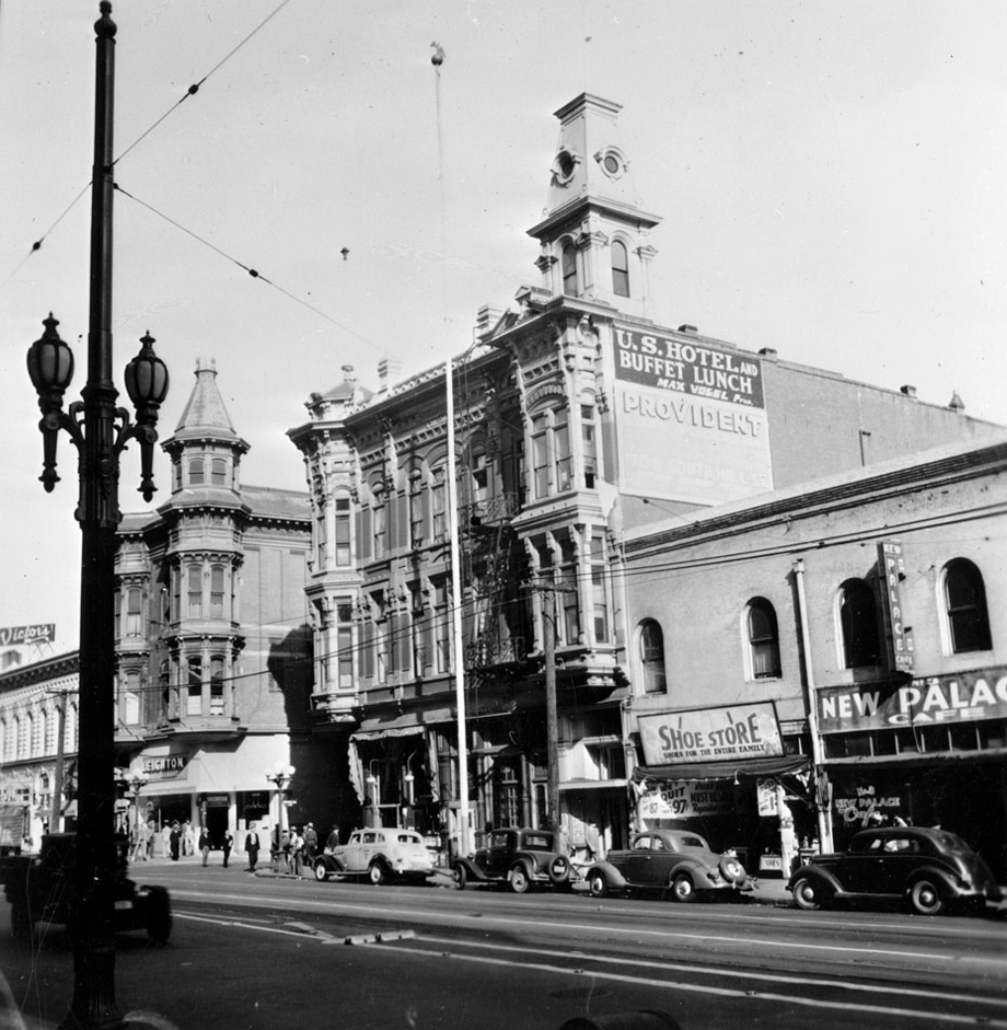
"Alsace" is also a European location, named after a region in northeastern FranceLouis Mesmer (1829-1900), an early American-era Los Angeles land pioneer was a man who came from the Alsace region of France and first worked here as a baker, later making money in real estate, most notably owning the old U. S. Hotel which once stood on 170 N. Main Street in Downtown Los Angeles (It's now the area between City Hall East and the old Parker Center), and playing a key role in the construction of the St. Vibiana Cathedral (now the Vibiana event center). He also bought land in what is now around the West Los Angeles/Culver City/Del Rey area. He was one of the people who first envisioned building a port near the Playa Del Rey/Ballona delta area, which eventually became realized as Marina Del Rey, nearly a century later.

Mesmer City, the town that never was.

In the 1920s, a developer had large plans for a failed project called "Mesmer City" in that area, and a street named "Mesmer Avenue" remains there, west of the 405.

The area you found as "Alsace" is directly adjacent (west) of this "Mesmer City" development. In fact, on the Pacific Electric's Inglewood Line, heading east, it was the stop after Alla and before Mesmer. So it's safe to assume "Alsace" was named by Louis Mesmer, perhaps because the broad plain surrounding Ballona Creek might have resembled the Rhine River plain of his homeland.

Alsace in 1972, when Hughes Airport stood there.

In 1940, 20th century tycoon Howard Hughes purchased 380 acres of the wetland area known as Alsace to build the privately-owned Hughes Airport for his Hughes Aircraft company. Famous former Long Beach resident, the Spruce Goose airplane, was built on those grounds.


Alsace in 2015 (Jefferson Blvd, looking east). Louis Mesmer would like totally trip.

Today. historic Alsace is now Playa Vista (where you live now!), the planned residential and commercial community that was developed in 2002 along the westernmost stretch of Jefferson Boulevard.

So now you know! You can now say that you're a proud resident of Alsace!

Stay Militant!
MA

If you have a historical, cultural, current curiosity or any sort of question regarding Los Angeles people, places or things, shoot The Militant Angeleno an email at militantangeleno [at] gmail [dot] com (make sure you put "Ask The Militant" in the Subject: line) and he may or may not answer you!