Monday, August 10, 2015

10 Reflections on Sunday's "Culver City Meets Venice" CicLAvia


The Militant so far has a perfect 14 out of 14 CicLAvia attendance record, and having gone though this thing that many times, it can certainly feel nearly routine. He most certainly had a wonderful time (most likely because he showed up at the route relatively early and did not have to "rush the route" as he had to do in the past), but a certain well-publicized controversy that got diffused in time probably added some tension and drama to the mix, along with a Hollywood Happy Ending. And this CicLAvia was also great due to the fact that, hey, we were all headed to the beach again.

And sure, the day began cloudy and overcast, but by the afternoon, the day of the week lived up to its name for the 14th consecutive time, burning off the clouds to reveal a virtually cloudless, blue Summer sky, which wasn't even that hot for an August day.

The Militant hates clickbaitey listicles, but most people don't read stuff on the Internet these days that's not formatted in list form, so, he grudgingly presents these Ten Reflections on this past Sunday's "Culver City Meets Venice" CicLAvia:


1. Let's TACO Bout This

Certainly what would have been the proverbial Elephant In The Room was the much-publicized ranting of Tito's Tacos that doth protested the CicLAvia route running in front of their front door, only to do an about-face two days before the event, because maaaaybe they suddenly discovered that the negative backlash would cost them business either way.  At any rate, despite people not getting the update and still sharing two-days-old news articles on their social media feeds, Señora Lynne Davidson did not sue Culver City and the event went on without a hitch.

And as you can see by the photo above and below, the crowd was, at worst, equivalent to a normal weekend day there without an open streets event.


There were bike racks provided by "Some Non-Profit Organization" on the Tuller Avenue cul-de-sac adjacent to the Westside crunchy taco institution, as well as signs on Sepulveda directing regulars on cars to the alley to access the Tito's parking lot (like they never used the alley before).


Sra. Davidson's fears of not only a lack of customers (their parking lot was just as full as it is during the other 364 days of the year that there is no CicLAvia on Washington Place), but of customers not purchasing insanely mass quantities of tacos in those cardboard boxes, were unfounded, as many CicLAvians arrived in groups of their own and purchased tacos in mass quantities.

Twitter user @fig4all Tweeted this pic of Sra. Davidson being interviewed by KABC-TV's Eyewitness News crew, apparently showing her eating humble pie next to CicLAvians ordering their crunchy tacos:

However, upon watching the KABC news report, they quoted Sra. Davidson as having a "let's wait and see" attitude regarding the raw numbers from Sunday. Hmph.

You know, in a way, The Militant is kind of glad Titogate happened, because it set a clear precedent for a well-known local institution (that no doubt has name recognition) having initial concerns about not being able to get customers during CicLAvia. Granted, her initial impression of the event probably resembled a marathon or a bike race, not the reality of CicLAvia that we all know and love. But perhaps from here on out, this well-publiczed precedent set by Tito's Tacos can be shown clear to any future local institutions that find themselves on future CicLAvia routes.

And who knows, after all the numbers come in, Señora Davidson will sue on the grounds that the next CicLAvia route won't be going in front of her eatery.


2. Both Sides Now

Remember back in April, 2013 when we had that big-ass 17-mile CicLAvia where we all rode from Downtown to Venice Beach? And how, despite how totally awesome that was, that it kinda sucked because CicLAvians were only allowed to use the Westbound lanes of Venice Boulevard?

This time around, CicLAvians got to use BOTH sides of Venice Boulevard (mostly), eliminating that crazy bottleneck of traffic for most of the route. Of course, west of Lincoln, it was the same old thing as two years ago, though at least for just a short segment of the route:


3. Stand Up And Be Counted

Did you see these things along the route?


Since these instruments did not appear to be releasing poisonous chemicals designed to kill every CicLAvian on the route (removes tinfoil hat), these appeared to be counting devices of some sort to count how many participants were on the streets at CicLAvia, to be compiled later by some expensive Beverly Hills accounting firm (or most likely by CicLAvia themselves, in cooperation with UCLA or another local educational institution). We wait the number for this one!

4. Just A Lot More Bikes

CicLAvia The Organization likes to stress the fact that the event is not just for bicycles, and smaller routes like Wilshire Boulevard and the short-but-sweet Pasadena route last May certainly brought out more non-cyclists, but the non-bike minority seemed even smaller this time around.


5. People On Skates Pushing Strollers At CicLAvia Are A Thing

For the non bicycle-riding CicLAvians, The Militant did notice a number of people pushing strollers while wearing rollerblades or roller-skates like this dude above along Washington Place. The Militant has never really seen that many people do that in previous CicLAvias. Count it as a thing now.


6. That Taco Tuesdays Song

Twice during CicLAvia, The Militant happened to ride near the Midnight Ridazz Taco Tuesdays ride contingent, which featured a trailer adorned with a sugar skull y corazon y sound system blasting their Taco Tuesdays Theme Song, which The Militant can't seem to get out of his head.

7. Abbot Kinney - The CicLAvia-Adjacent Corridor

Arriving at Venice Beach, The Militant met up with one of his operatives at the route's end, wanted to get something to eat, but they were local enough not to fall into the tourist trap that is the Venice Beach Boardwalk. So they opted for Abbot Kinney Boulevard, just a short distance east. Although this street was not part of the CicLAvia route and had normal automobile traffic (as well as detoured Metro Bus lines), it might as well have been as the street was crowded with CicLAvians also patronizing their restaurants and shops. Certainly, past CicLAvias have had participants spill over into non-route streets, but this was the first time The Militant has seen this phenomena in such an obvious form. Be on the look out for more of these in the future.


8. Big Media Companies Along CicLAvia Are Weird

Thousands of people rode by Sony Picture Studios in Culver City, and the corporation gets props for being listed as one of the event's sponsors, but The Militant didn't see much participation from the media giant beyond that. No Sony employees riding the route? No celebrities? Not even some gratuitous promotion (and maybe some swag) of their films and TV shows? It's strange, stupid, yet totally not surprising for this Los Angeles native to see how disconnected "Hollywood" is from the community.

At the same time, down the street, the NFL Network had a banner saying "The NFL Network Supports CicLAvia, but they were not listed as one of the event's sponsors, nor was there any sort of interactivity from them outside their office (Best practice: Coca-Cola giving away drinks outside their Central Avenue bottling plant in previous CicLAvias). Apparently the NFL Network was special enough to have their own private auto-acces barrier driveway -- the only business along the route to have one. Wait, it's because we don't have an NFL team, right?

9. The #EpicCicLAviaTour

Many of you read The Militant's #EpicCicLAviaTour post from last week to gain knowledge and familiarity with the route, and some of you even tried to visit all 25 sites. And some of you really had fun with that. This makes The Militant smile (behind his bandana mask, of course).

10.  Next Time Around...

The next CicLAvia is just two months away! It's going to be a familiar route for us CicLAveteranos. It's time to flip the scrip. The Militant may or may not try to walk the whole thing. It will also be a celebration of CicLAvia's 5th anniversary. It's definitely a part of our city and it's still growing.

Speaking of which, how bout some new routes? Venice isn't the only beach we have. How about a CicLAvia in San Pedro (how about ending the route at Point Fermin Park)? Or a Beach Cities CicLAvia?

Thursday, August 6, 2015

The Militant's Epic Militant CicLAvia Tour 4.1!!!!


Interactive map - click and zoom! Click here to view the map separately!


So we're already nearly 5 years into the CicLAvia thing, haven't we had enough already?

OF COURSE NOT!

Just when we got over the last CicLAvia, along comes the XIVth edition of America's largest open streets event (Oh you know it, baby), and the third of four this year (But wait a minute, the last Epic Militant CicLAvia Tour was number 10.0, why is this one 4.1? You might ask. Well, The Militant categorizes his CicLAvia routes into unique versions of routes, and since this route is basically a modification of the fourth unique route from April 2013 (The legendary 17-mile "To The Sea" edition), The Militant categorizes Sunday's route as 4.1. Got it?). But even though this one is but a slight change from the Epic Venice Boulevard Route, there's a lot more new sights to see, especially along Washington Boulevard/Washington place, plus some locales he forgot to add during the 4.0 posting. Anyways, you know the drill, Share this link on your Facebooks and Twitters, visit the sights yourselves -- and if you do, Tweet with the hashtag, #EpicCicLAviaTour to stroke The Militant's ego and make him feel like his several days of staying up late at night to research and write all this was worth his while. And most of all, Stay Militant and Enjoy CicLAvia this Sunday! See you or not see you on the streets!

1. Culver City Metro Expo Line Station/Site of Culver Junction
2012
Venice and National boulevards, Culver City

You may or may not have arrived at CicLAvia via the Metro Expo Line, which is the modern reincarnation of the Pacific Electric Santa Monica Air Line. Not only can you experience Los Angeles' transportation present, but you can glimpse its future (Phase 2 of the Expo Line, which opens next year, is clearly visible towards the west), and you're in the clear presence of its past -- this area is also the site of Culver Junction, where not one, not two, but three Pacific Electric Red Car lines converged, going to Santa Monica, Venice and Redondo Beach. TIP: Make sure you buy a Day Pass or that your TAP card is well-loaded before CicLAvia, so you don't have to queue at the ticket machines! The Militant says "You're Welcome."

2. Ince Boulevard/The Culver Studios
1918
Ince Blvd & Washington Ave, Culver City

As you make your first turn going westbound on the CicLAvia route, take note of the street name: Ince.

If you know your Culver City history, the town was a planned community built by landowner Harry H. Culver, a Spanish-American war veteran who worked for SFV pioneer Isaac N. Van Nuys and purchased a large section of the old Rancho La Ballona. In 1913 he established the town and filmmaker Thomas Ince moved his operation here from Pacific Palisades (via his Triangle Studios down the street -- more on this later...) and bought this section of land from Culver himself to establish the Ince Studio, which featured a large mansion fashioned after George Washington's Mt. Vernon residence, that remains in full view today. Ince's studio was sold to Cecil B. DeMille after his mysterious death and had changed hands and names over the years, finally adopting its current name of The Culver Studios in 1970. Legendary Hollywood films were shot this studio, including Gone With The Wind, King Kong, E.T. and The Matrix.

3. Pacific Electric Ivy Substation
1907
Venice and Culver boulevards, Palms

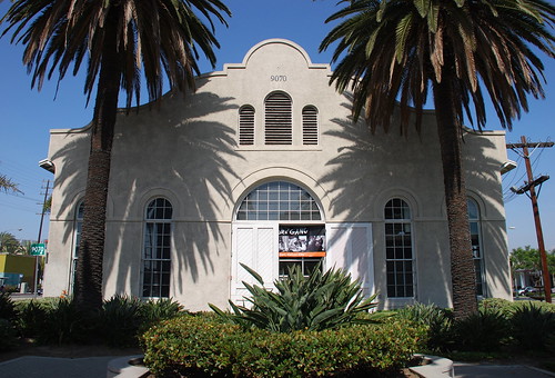
Downtown  Culver City is already rich in retail and artistic activity, and has a bevy of well-known eateries, like the popular Father's Office. The Militant can cover that in its own post (and kinda already did before). But welcoming people to Downtown Culver City along Venice Blvd (though technically located in the Los Angeles neighborhood of Palms), a block from the Culver City station is an appropriate link to the past - the Ivy Substation. The single-story Mission Revival-style structure served as a powerhouse for the Pacific Electric Railway from 1907 to 1953, when the Expo Line's predecessor, the Santa Monica Air Line, ceased operation. Today, it's a 99-seat venue for The Actor's Gang theatre company, renovated in the early 1990s. How interesting that a building originally built for transportation infrastructure was repurposed into a building for the arts, which in turn attract people using the new transportation infrastructure.

4. Culver Hotel
1924
9400 Culver Blvd, Culver City

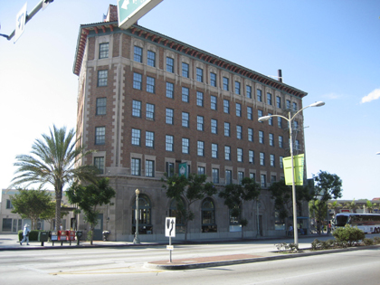
This 6-story triangular building, originally named Hotel Hunt, opened in 1924 as Culver City's first skyscraper (it was the tallest building between Downtown Los Angeles and Venice)  and housed Harry Culver's personal office on the second floor. Numerous Hollywood stars have stayed here, such as Joan Crawford, Clark Gable, Greta Garbo and Ronald Reagan, and most notably the little people actors who played the Munchkins in The Wizard of Oz during its filming down the street. Actor John Wayne was one of the later owners, and it was fully restored in the 1990s.

5. The Washington Building
1927
9718 W. Washington Blvd, Culver City

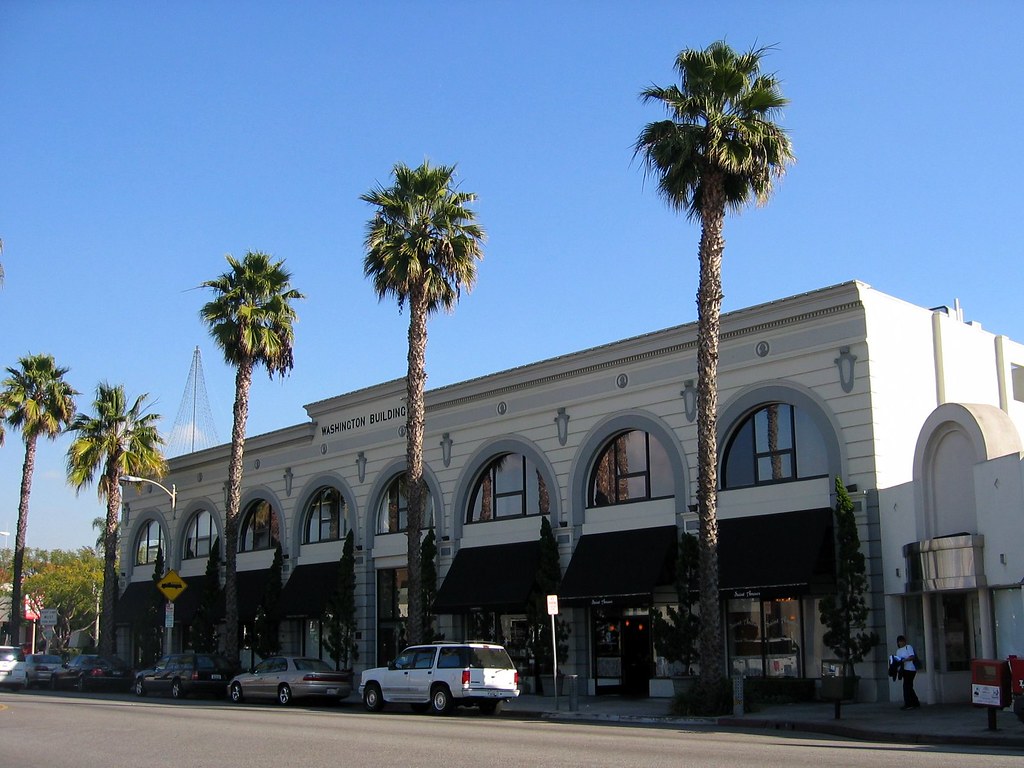
Culver City's other 1920s-era triangular building is just down the street from The Culver Hotel. Built by Charles E. Lindblade, a business associate of Harry Culver who also bears a city street name of his own, this Beaux Arts-style building was designed by Arthur D. Scholz and Orville L. Clark. As it is today, the building housed numerous retail and office businesses over the years, including the Culver City post office, the MGM Studios Fan Club and Lindblade's real estate company.

6. Kirk Douglas Theatre/Culver Theatre
1946
9820 W Washington Blvd, Culver City

Built in 1946 as The Culver Theatre, a 1,100-seat Streamline Moderne cinema designed by Karl G. Moeller that screened 20th Century Fox films as part of the Fox West Coast Theatres chain.
It was later operated by the National General and Mann Pictures chains, and finally as an independent theatre. It was split into three screens circa 1970s, and closed in 1989. In 1994, it suffered damage from the 1994 Northridge Earthquake and underwent a major $8 million renovation later in the '90s, re-opening in 2004 as The Kirk Douglas Theatre (with Spartacus himself as a the major contributor in the renovation), operated by Center Theatre Group. It currently features two stages, one seating about 300 and a smaller stage seating around 100.


7. Sony Pictures Studios/MGM Studios
1915
10202 West Washington Boulevard, Culver City

One can't mention Culver City without mentioning its massive movie lot, originally Thomas Ince's (remember him?) Triangle Studios operation until he moved to the Culver Studios property and sold this site to D.W. Griffith and Mack Sennett.  In 1918, the studio was sold to Samuel Goldwyn, which became Metro Goldwyn Mayer in 1924 (following the merger of Metro Pictures, Goldwyn Studios and Louis B. Mayer Productions). It became the Columbia Pictures studios in 1989 and Sony Pictures Studios from 1992 to the present.

On this lot was filmed a countless list of Hollywood productions, most notably The Wizard of Oz in 1939 (you will be riding next to the actual Land of Oz, think about that...), and currently, TV shows like Jeopardy! and Wheel Of Fortune.

10. La Ballona Elementary School
1865
10915 W Washington Blvd, Culver City

This local school is literally some old school Culver City right heah! Established in 1865, it's one of the oldest schools in Los Angeles County still in operation. Back in the day, it had an enrollment of 158 pupils between the ages of 5-15, being taught by one teacher, a Miss Craft who made $50 a month, and the school year lasted seven months, since it revolved around the agricultural calendar of the surrounding area.
When it was established, it was in an unincorporated area that eventually became Palms, which was annexed to the City of Los Angeles in 1914. When Culver City was founded the year before, it had no schools within its boundaries, so another school was built in the area in 1916. Eventually La Ballona was annexed into Culver City in 1920.

9. NFL Network
2003
10950 W. Washington Blvd, Culver City

Well, well well. The TV network and web site run by the National Football League is based in an area that hasn't had a football team since 1994. Let that irony sink in for a second.

10. King Fahd Mosque
1995
10980 Washington Boulevard, Culver City

This Islamic house of worship was built in 1995 as a gift from Saudi Prince Abdulaziz Bin Fahd to serve the growing community of Muslims in the Westside, named after the king of Saudi Arabia at the time. Its facade features hand made marble tiles from Turkey, and a 72 foot-high minaret topped with a gold leaf crescent.


11. Tellefson Park/Rollerdrome Site
1976/1928
1105 W. Washington Pl, Culver City

There's a designated activity hub here at this 1.5-acre Culver City park, which was dedicated in 1976 as part of the U.S. Bicentennial celebrations. It was named after former Culver City councilman and city attorney Mike Tellefson, who served the city for 31 years. In 2013, the body of a suicide victim was discovered in the park.

But longtime Culver Citizens remember this site as a legendary roller skating rink called The Rollerdrome,  a wooden structure which opened in 1928 and had a characteristic rounded roof. Roller skating events were centered around the rink's organ, which was played by a live organist, and provided memorable evenings for local families and youths. It was torn down in 1970, which was a shame, since roller skating enjoyed a renaissance of sorts in the '70s.

12. Tito's Tacos
1959
11222 Washington Pl, Culver City

Many Angelenos already know of this longtime Westside (American) taco joint known as Tito's Tacos, which as we all know, was founded in 1959 by a businessman who may or may not be an actual Mexican guy named Tito. Everyone has their opinion on Tito's, but three things are indisputable truths: 1) It's a Culver City Institution; 2) It's not authentic Mexican food and 3) People come here for the nostalgia anyway. But this small business, currently owned by Señora Lynne Davidson, which makes roughly $310,000 in profits annually, has been in the news recently, and not in a good way to us CicLAvians.
See, Señora Davidson is threatening to sue Culver City government for lost revenue because the CicLAvia route will cut off access to her customer base (which crowd the tiny parking lot and forces motorists to circle the block and/or shortcut the lot from the little alley). The pro-CicLAvia city council has assured her she be trippin' over nothin' and everything will be aite, but she ain't got no time for dat.

So, CicLAvians, we've all heard this before. Business "A" is pissed at CicLAvia for "shutting down their business" during CicLA-Sunday. But CicLAvians swarm the place and the said business makes a lot of moolah. It's tempting to boycott, but it's perhaps a more powerful and more noble thing to prove Señora Davidson that she's just plain loca. So what else can you do?

You can also try their delicious burritos, chips and salsa -- enchiladas ooh, because the only thing better than a Tito's Taco, is two. Again -- the only thing better than a Tito's Taco, is two.

But seriously, Señora Davidson, you have no reason to fear CicLAvia this Sunday. Because we are coming. And you will get A LOT of business. And you can be rest assured that unlike your car-oriented customers, we won't be crashing into your wall. [MIC DROP]

UPDATE: It seems that Titogate has attracted a lot of negative press for the 56 year-old Culver City institution. However, The Militant is happy to report that as of early Friday afternoon, Tito's Tacos has changed their tune (no, not their catchy jingle, that should never change) and has worked things out with the CicLAvia organization, who is providing support for Tito's bicycle and automobile customers alike. So drop the Tito's hate everyone, they cool now:


13. The Oval District/Palm Place
1912
Area within Washington Place, McLaughlin Ave, Venice Blvd & Inglewood Blvd, Mar Vista

You might not see much from the street level, but this neighborhood just north of the CicLAvia route, a Historic Preservation Overlay Zone known as "The Oval District" is one of the first automobile-oriented property tract developments in Southern California.

When seen from a map or an aerial view. the streets of this 200-unit housing development of predominantly 1- and 2-story homes resembles an hourglass shape with an oval road in the center (which caught The Militant's eye and caused him to investigate the history of the place).

The 137-acre neighborhood was developed in 1912 by a Lillian Charnock Price (there is a "Charnock Road" two blocks north of Venice, BTW) who hired renowned landscape architect and urban planner Wilber David Cook, Jr. (who worked for legendary late 19th/early20th-century landscape architect Frederick Law Olmsted to design an "Aristocratic Suburb" marketed as “Palm Place."

The large-sized lots were unique, and park-like in their large setback from the street and the palm tree-lined parkways, but only a small number of homes were built. Price sold the development to Robert Sheman, who was the stepson of Moses Sherman, the developer of the Los Angeles and Pacific Railway, which built the original rail line on nearby Venice Boulevard. What was originally intended to be the first car-oriented development was going to be a transit-oriented development!

But those didn't sell either. The lots were still too large and pricey. So Sherman sold it to a financier group that marketed it as "Marshall Manor" in 1920 and interest began to pick up. But it wasn't until after World War II, when suburbanization was in vogue and Los Angeles' Westside development boom commenced, that the rest of the lots got built.

14. Mar Vista Hill (a.k.a. The 'Mar Vista' in Mar Vista)
1924
Centinela Ave & Rose Ave, Mar Vista

Everyone know that "Mar Vista" is Español for "sea view." But riding along Centinela or Venice during CicLAvia, you can't even see the sea. Where is it?

Well, The Militant will tell you where to see the "Mar Vista" in Mar Vista. He implores you to take a short detour from the CicLAvia route and continue north along Centinela Avenue, switch your gears (or pedal harder, you fixie heads), and go up the hill (Mar Vista Hill) until you reach Rose Avenue. Then turn right and go  up the hill to the open space that contains the baseball field and community garden. Look to the west, stand on top of the telephone poles laying on the ground in front of the small parking lot, and you can have a semi-unobstructed (damn you, DWP power lines!) view of Santa Monica Bay from the Palos Verdes peninsula to the Santa Monica Mountains.

Mar Vista Hill is a 203-foot-above-sea-level promontory that was once a garbage dump, and was later the site of the Venice Reservoir in 1940 (smart, huh). The reservoir was decommissioned in the 1960s and replaced with the baseball fields you see today.

So come on up to Mar Vista Hill, where you can see the sea, to see all that you can see!

Go visit Mar Vista Hill and tweet a pic of the ocean with the hashtag #EpicCicLAviaTour!


15. State Route CA 187
1964
Venice Boulevard between Lincoln Blvd and the 10 Freeway

You may or may not know that Venice Boulevard, in addition to being a two-time CicLAvia route, was also a Pacific Electric Red Car line, but did you know it's also a designated California State Highway?

In 1964, CalTrans designated State Route 187 starting at the Pacific Ocean. In 1994, it was shortened to the 5.4 miles from Lincoln Boulevard to the 10 Freeway.

The number "187" also happens to be a reference to the California Penal Code designation for murder, which is most likely why a young, '90s-era, pre-commercialized Snoop Dogg is standing by the sign in this photo.

17. Mario's Brothers Market
12904 Venice Blvd, Mar Vista

No deep history behind this neighborhood Mexican corner market on Venice and Beethoven, but the name caught The Militant's eye. He's seen some of you CicLAvians ride in CicLAvia in Mario/Nintendo cosplay, so this would be a perfect photo/selfie opportunity.

While you're here, support the business and buy something inside. Maybe it really is owned by a Mario. Or a Luigi. Ask where The Princess is. If they're successful enough, they might move to a larger location and rename themselves "Super Mario's Brothers."

Tweet a pic of yourself (or your group) in front of Mario's Brothers with the hashtag "#EpicCicLAviaTour"!


18. Venice High School
1920
13000 Venice Blvd, Venice

Venice's namesake secondary school was one of three on-location sites for Rydell High in the 1978 motion picture Greaseand was the school scene in the Britney Spears video for her debut hit, "...Baby One More Time." The main Moderne-style school buildings, built in 1935-37  were designed by local architects John C. Austin and Frederick M. Ashley, who also designed the Griffith Observatory.
The campus is also famous for its statue of legendary Hollywood actress and famous alumna Myrna Loy at the front of the school. Other famous alumni include Beau Bridges, Crispin Glover, the late Ivory Queen of Soul, Teena Marie and In-N-Out Burger founder Harry Snyder. Go Gondoliers!

19. Old Venice Civic Center
1911
681-685 Venice Blvd, Venice

Venice, originally founded as part of Santa Monica, seceded from that city in 1911 and for the next 15 years, functioned as an incorporated city. In 1926, due to political mismanagement and crumbling infrastructure, it was annexed into the City of Los Angeles. Its vestigial remnants of its civic government still remain, though. The old Venice City Hall still stands at 685 Venice Blvd (pictured), now the venue for Beyond Baroque Theatre. Next door on 681 Venice Blvd is the old Venice Police Station, now the home of the Social Public Arts Resource Center (SPARC), the community arts nonprofit that spearheaded the modern urban mural movement. It's interesting to note that both of these government buildings were adaptively re-used for arts purposes. The Militant is looking at the old LAPD Parker Center in DTLA and wonders if it could make some sort of badass performing arts venue...

20. Electric Avenue
1905
Electric Ave and Venice Blvd, Venice

No, '80s singer Eddy Grant didn't rock down to this street to take it higher (VROOOM!) But this street was so-named because it was one of the old Pacific Electric Red Car rights-of-way, which included Pacific Avenue (of course) and Venice Blvd. The railway, of course, was built to serve (and sell property in and around) Abbot Kinney's Venice of America development. Rock on to Electric Avenue towards Brooks Avenue and look to your left for actual remnants of Pacific Electric tracks at Millwood Avenue, Westminster Avenue and Broadway. If that kind of stuff excites you, be on the look out for The Militant's upcoming Pacific Electric Archaeology Map (view the preview edition map here, including Venice sites). And then we take it higher (Oh yeah)!

21. Abbot Kinney Blvd
1992
Abbot Kinney Blvd between Washington Blvd and Main Street

New arrivals to Los Angeles are likely oblivious to the fact that Venice's upscale arts and boutique corridor is technically one of its newest streets. Until 1992, that stretch was confusingly known as West Washington Blvd, which, along with Washington Street and Washington Way, was a source of disorientation among motorists. A small group of business owners lobbied to re-name the stretch after the community's founder. Ignorance of local history was so bad back then, that then-City Councilman Zev Yaroslavsky, who grew up in the Westside, asked aloud at a Los Angeles City Council committee meeting, "Who is Abbot Kinney?" (Really, Zev?!?!) Thankfully, due to a street name change, and other things, we're a lot better at our Los Angeles history.

22. Venice Of America Centennial Park
2005
Venice & Abbot Kinney boulevards

This park, which neighbors the Venice-Abbot Kinney Memorial Branch Library and built for Venice's centennial year of 2005,  was made on the very same median that carried the Pacific Electric Railway tracks, and in honor of that, the design on the park's paving resembles that of railroad tracks. The Militant went there in a famous bike ride to Venice Beach in 2008 and encountered a bunch of ducks walking in this park.

23. Venice Traffic Circle and the Lost Canals
1929
Grand and Windward avenues, Venice

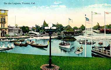
Traffic circles, or "roundabouts" as they're known in Britain, are not a common sight in the US, much less Los Angeles, though a dozen or so are known to exist here (more in a future post). So what up with this one? This part of Venice was part of Abbot Kinney's original "Venice of America," replete with its own canals. But unlike their Italian counterpart, these canals were not physically connected to the ocean, and the water had gone stagnant and kinda gross. By the 1920s, the Venice city infrastructure was falling apart (which meant little resources or political will to maintain the canals), and the automobile had started to conquer the streets of the Southland. So they were filled in circa 1929. The CicLAvia course on Grand Avenue was once the Grand Canal, and the traffic circle was formerly the location of a large saltwater swimming lagoon. The surviving canals, located south of Venice Blvd, were built by a different developer a couple years after Kinney's canals opened.

24. Windward Hotel/Pacific Electric Station
1905
Windward and Pacific avenues, Venice

The Windward Hotel, now a traveler's hostel, is not only the oldest hotel building in Venice, but its eastern ground floor entrance also functioned as Venice's Pacific Electric station. For the first half of the 20th Century, Venice was a popular western destination for the Red Cars, and the preferred way to go. North of Windward Way, there was no Pacific Avenue, but a dedicated "Trolleyway" for the Red Cars. When passengers disembarked at the Venice station before 1929, they were treated to an awe-inspiring view of the large lagoon (now the traffic circle) and canals just across the street, welcoming them to Venice of America. Now, for CicLAvia, when you arrive here, use your imagination and pretend to be transported back to a time when you didn't need cars to get around. On this day, it won't be that hard.

25. Pacific Electric Grand Canal Bridge
1905
Grand Canal at Venice Blvd, Venice

Ride just a few blocks down Pacific Avenue to Venice Boulevard to see Venice's characteristic namesake -- it's system of canals, built in 1905 by the aforementioned Mr. Kinney. The ornate concrete bridge spanning two side of the Los Angeles City parking lot near the Grand Canal is the original bridge that carried the Pacific Electric Venice Short Line tracks until 1950.
Tuesday, July 14, 2015

The Militant's 25th Anniversary Ultimate (M) Blue Line Tour!

Happy 25th Birthday, you Millennial, you!
Today marks the 25th Anniversary of Los Angeles' Metro Rail system, which began with the July 14t, 1990 opening of the Metro Blue Line, Los Angeles County's first modern train transit system, and the first rail line to serve the area in nearly 30 years.

You may or may be familiar with The Militant's Angeleno's award-winning Epic CicLAvia Tour posts, highlighting various points of interest along the various open streets routes, but did you know The Militant has done the same for the Los Angeles-to-Pasadena Metro Gold Line and the Metro Expo Line?

This time around, to celebrate a quarter century of Metro Rail, The Militant offers his Epic 25th Anniversary Metro Blue Line Tour, which points out historic, surprising, and off-the-beaten-path locations on or very near our first light rail route. Even if you've been a regular Blue Line commuter for the past 25 years, if you think you know the Blue Line, guess again!


1. 7th St/Metro Center Countdown Clock
1993
7th St./Metro Center Station,  Downtown Los Angeles

Riders waiting at the outbound platform at the 7th Street/Metro Center station may or may not have noticed a peculiar digital countdown clock situated on a pole in the middle of the tracks. It seems to count down regardless of whether there’s a train or not. What is it for?

In 1993, to speed up Blue Line travel times, the street signals along Flower Street and Washington Blvd. were synchronized to give priority to light rail trains along those streets. This timer clock allows train operators to time their exact departures in accord with the street signal synchronization, so that when the white light under the clock is lit and the train begins to depart under normal operating speed, the train will encounter a continuous series of green lights.

2. Pico Station
1990
Pico and Flower Streets, Downtown Los Angeles

Pico Station is where it all began; it was the first operational station in the history of Metro Rail. The station was the site of a public dedication ceremony kicking off the opening of the line (See The Militant's exclusive archived video of the event here). The Blue Line on opening day in 1990 was somewhat shorter than the line we ride today. For the first two months of operation, the Blue Line only ran from Pico Station to the Anaheim St. Station.

Back then, it was just located in a far-flung region of Downtown. It wasn’t until the late 1990s when the Staples Center was built that the South Park section of Downtown started to become revitalized. Today, the recent upgrades of the Blue Line stations have also given the station a minor facelift.

The station also has the shortest name of any Metro Rail station in the entire system (Well, okay, it's tied for 1st place along with Soto and Lake).

3. Flower Junction
2010
Flower Street and Washington Blvd, Downtown Los Angeles

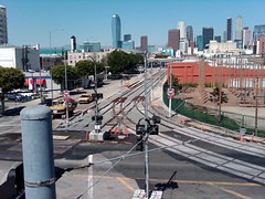
The first surface-level "junction" track that switches trains among the Blue and Expo lines is located here. A few months after the Expo Line opened, the California Public Utilities Commission ordered Metro to replace a section of rail within the switch track that would potentially cause derailments.

The other junction track on the Metro Rail system is the one north of the Wilshire/Vermont subway station. Future junction tracks will be built west of the Metro Green Line Aviation Station (serving the Green and Crenshaw lines) and another switch track as part of the Regional Connector under Little Tokyo.

4. Olympic Auditorium
1924
1801 S. Grand Ave., Downtown Los Angeles

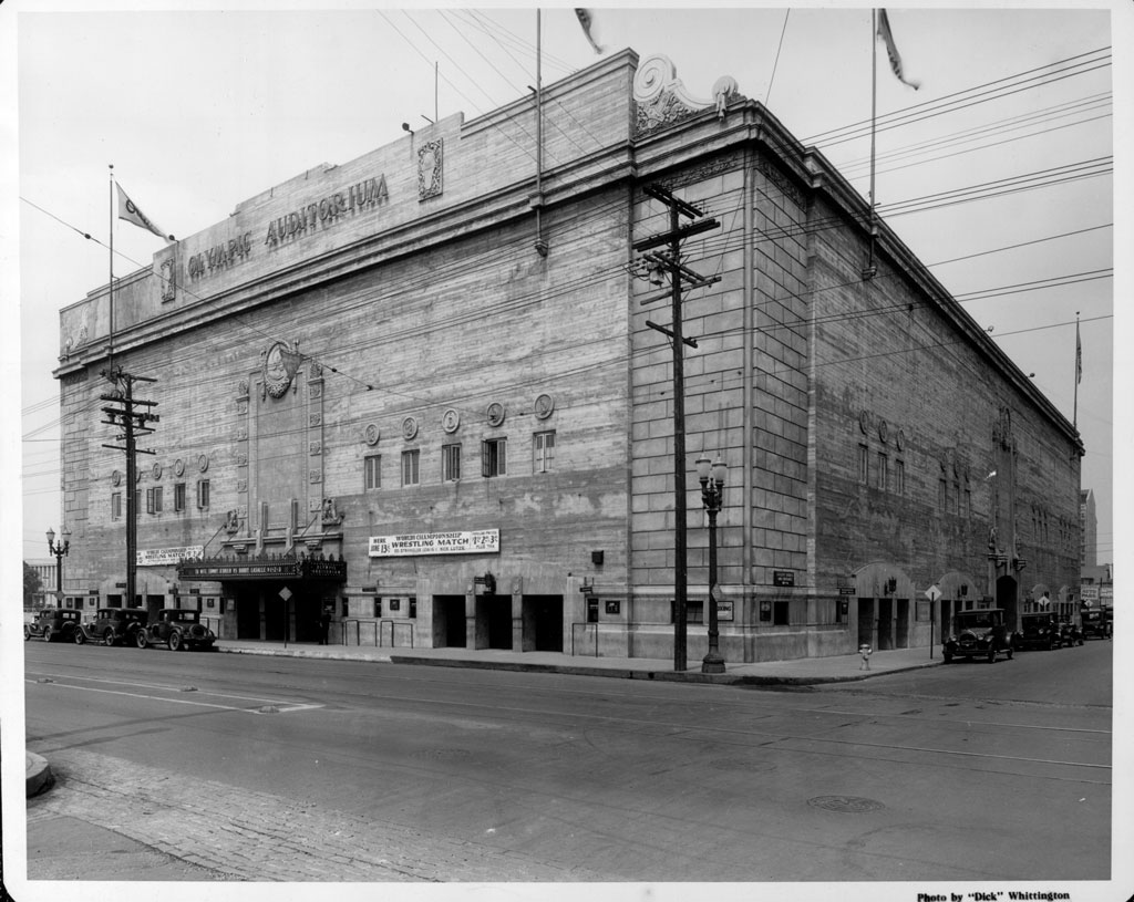
This historic venue through the years, easily seen from the nearby Blue Line Grand station, has hosted boxing matches (including the boxing competitions for the 1932 Olympic Games), wrestling bouts, roller derby events and concerts. The match sequences from the original Rocky movie was filmed here, as well as Bon Jovi's "Livin' On A Prayer" and Janet Jackson's "Control" music videos.

For the past decade the venue has been owned by a Korean Christian Church known as Glory Church of Jesus Christ (hence the large Jesus mural on its south wall).

5. Site of Washington Park and Chutes Park
1893
Washington Blvd and Hill Street, Downtown Los Angeles

The first permanent baseball field in Los Angeles isn't Dodger Stadium, nor was it South Los Angeles' Wrigley Field nor the Fairfax District's Gilmore Field. It was here at Washington Park, located near Washington and Hill, where the Pacific Coast League Los Angeles Angels of Los Angeles played from 1893 to 1925 (the first Washington Park stood from 1893 to 1912; the second was in use from 1912 to 1925. It was torn down in the 1950s. William Wrigley, the team's owner, left Washington Park after he was denied permission to build an underground parking garage. He then moved his Angels to his own Wrigley Field in 1925. Washington Park it was also one of the home venues of the USC Trojans football team before the Coliseum. Adjacent to Washington Park was an amusement park named Chutes Park that stood on the land where the municipal courthouse now stands.

6. Tacos El Gavilan/Site of 1st McDonalds in Los Angeles
1957
1900 S. Central Ave, South Los Angeles

What is currently a taco stand at the southeast corner of Central and Washington was once the first McDonalds in the city of Los Angeles (and the 11th McDs in the entire chain) which opened in 1957. As you may or may not know, McDonalds originated in San Bernardino in 1940 by the McDonald brothers, and was later taken over by Illinois businessman Ray Kroc, who turned the unique Southern California hamburger chain into the gargantuan unhealthy corporate chain we know today. The trademark side arches were present on this building (and a single arch present on the corner sign) up until the early 2000s. But hey, tacos are more healthy for you than McDonalds junk, so eat up.

7. Washington Blvd Buddha
c. 1941
1600 E. Washington Blvd, South Los Angeles

On your southbound Blue Line ride, look to the right just before the train curves towards the Washington Station and look for the "Hanson Tank" sign. To the left of the sign, and right above the main doorway is a tiny cubby-hole featuring a Buddha statue. Years ago, a Militant Elder told The Militant Angeleno that the buddhas were placed there to give Japanese Buddhists a clandestine place to worship after December 7, 1941. The Militant covered this location in an early MA blog post in October 2007.


8. Washington Tail Track
1989
Washington Blvd and Long Beach Avenue, South Los Angeles

Due across the street and due north of the Blue Line's Washington Station, there's a stretch of track that diverges from the Blue Line route that seems to head off into oblivion. The track is one of several along the Blue Line route that function as an emergency storage track for broken trains or so-called "gap" trains to replace trains that have been taken out of service due to technical issues.

The tracks follow the original Pacific Electric 4-track "speedway" alignment that led to the Pacific Electric Building at 6th and Main streets in Downtown Los Angeles. In fact if you follow the Washington Tail Track north to 16th Street, you can still see the old Pacific Electric tracks partially buried under the pavement!

The Washington Tail Track is rarely used nowadays, though in March the track was used to temporarily store the new Kinkisharyo light rail vehicle which was being tested on the Blue and Expo lines at the time.

9. Amoco Junction
1904 (discontinued early 1980s)
Long Beach Ave., south of 25th Street, South Los Angeles

About 6 blocks south of the Washington Station, look to your right and you'll see tracks in the street mysteriously end at the fence that protects the Blue Line tracks. Look westward and you'll see an abandoned rail right-of-way. That was, until 1958, the Pacific Electric Air Line trackage which went all the way to Santa Monica (and until the early 1980s as Southern Pacific freight track), and functions today west of Figueroa Street as the Metro Expo Line. During the Pacific Electric era, the Downtown-bound trains from Santa Monica headed all the way to Amoco Junction (named after the American Olive Company factory nearby) to join the 4-track "Speedway" trunk line and head north.

10. Site of South Central Farm
1994 (demolished 2006)
41st St between Long Beach Ave and Alameda St, South Los Angeles

This large, empty plot of land just east of the Blue Line tracks, a half-mile north of the Vernon Station was home to the 14-acre South Central Farm run by community members between 1994 and 2006. Acquired by the City of Los Angeles in 1986 via eminent domain from private landowners, it was originally slated for use as an incinerator site, a plan dropped due to community opposition. The City allowed the neighboring nonprofit Los Angeles Regional Foodbank to run the site as a community garden. Over 300 low-income families from nearby communities turned the land into one of the largest urban farming projects in America over 12 years. But in 2001, the land's former owner sued the City for breach of contract, because the incinerator plant was never built. Eventually the City settled with the landowner in 2003 and they began the process of re-claiming the plot, eventually evicting the farm in 2006. To this day, the land lies vacant.

The controversy attracted the support of various celebrities, public officials and philanthropic organizations, including a failed attempt by The Annenberg Foundation to purchase the land, but it did galvanize the community and led to the rise in urban farming activism, especially in the South Los Angeles area.

11. Augustus F. Hawkins Natural Park
2000
5790 Compton Ave, South Los Angeles

A few blocks west of the Blue Line's Slauson Station lies one of the best-kept secrets in South Los Angeles -- Augustus F. Hawkins Natural Park, an 8.5-acre surreal green oasis in the 'hood, featuring ponds, native plants, hiking trails, picnic areas and even wildlife. This former DWP pipe yard was converted into a re-created natural park, named after the late African American congressman who represented the area for 28 years, in 2000 by the Santa Monica Mountains Conservancy, which trucked in actual dirt from Malibu mudslides to the site to form the park's terrain. The park is popular with local residents seeking refuge from urban life, and the park is also popular with members of the local Audubon Society, who frequent the park to do bird sightings and bird counts.

12. Slauson Junction
1904
Slauson Ave and Randolph St, South Los Angeles

When passengers rode the Blue Line for the first time in July 1990, they were thrilled to have the train suddenly shoot up the elevated structure, with a towering view of the area below as the train stopped at the Slauson Station. While stopped here, you can see a piece of the Blue Line's Pacific Electric heritage by just looking to the east: The unmistakable curved "wye" tracks heading eastward formed another major junction to the PE's Long Beach Line trunk, as the place where trains bound for Fullerton, La Habra and Whittier diverged from the quadruple-tracked "Speedway."

Francis Nixon, the father of President Richard Nixon, was once a Pacific Electric motorman who navigated his Whittier-bound trains through this very junction.

13. Col. Leon H. Washington Park
8908 S. Maie Avenue, South Los Angeles

There are many parks that line the Blue Line route, but this one is unique for two reasons. As you head southbound and depart the Firestone Station, look immediately to your right and you'll see a park and recreation center. It's a Los Angeles County-run park called Colonel Leon H. Washington Park, named after the founder of the Los Angeles Sentinel newspaper (originally called The Eastside Shopper), the city's premier publication in the black community. The other reason is that the rec center here is a popular spot for NBA stars such as Kobe Bryant, Lebron James, Kevin Durant and others to play pick-up games and compete in the Nike-sponsored Drew League, a weekend summertime program where the biggest stars in basketball play with and against locals from the community.

14. Watts Pacific Electric Station
1904
1686 E. 103rd Street, Watts

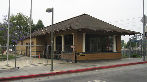
Adjacent to the Blue Line's 103rd St/Watts Towers station is a mustard-colored building that was once the Pacific Electric's Watts depot. A popular stop along the old PE Long Beach Line, the building survived not only the PE's abandonment, but was the only wooden structure that was not set on fire during the 1965 Watts Riots. After a renovation project in the 1980s, the Watts Station has functioned since 1989 as a Los Angeles Department of Water and Power customer service center.

15. Dominguez Junction/Watts Towers
1903
Graham Ave and 105th Street, Watts

In the Pacific Electric era, this junction, where the overhead pedestrian bridge is located today, marked the end of the four-track "Speedway" which had express trains from 9th and Hooper streets in Downtown Los Angeles go to/from Watts in the center tracks, while the outer tracks handled local stops Dominguez Junction is where trains along the Long Beach trunk line headed west to Torrance, southwest to San Pedro and southeast to Santa Ana via Bellflower.

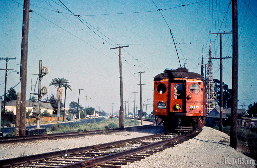
Directly adjacent to the former Santa Ana tracks are the famed Watts Towers, built by Italian immigrant Simon Rodia (who actually called his sculpture "Nuestro Pueblo") between 1921 and 1954. There is definitely a direct relationship to the Pacific Electric: Rodia used the rails on the PE Santa Ana tracks as a fulcrum to bend his steel bars into shape, enabling him to build his masterpiece.

16. Metro Rail Operations Center/Connector Track
1990
Willowbrook Ave at the 105 Freeway, Willowbrook

At the nexus of the Blue and Green Lines, just east of the Willowbrook Station is Metro's Rail Operations Center (ROC), where all of the 87-mile rail system's signaling, dispatching and security systems are manned and monitored. The building also houses a Los Angeles County Sheriff's Department station, as part of their Metro system security operations.

Adjacent to the ROC is a non-revenue connector track that allows light rail vehicles to transfer between the Blue and Green lines for emergency or service purposes. The single track also allows light rail vehicles based out of the Metro Green Line yard in Torrance to move to the Long Beach yard, which houses a paint shop and heavier maintenance facilities. But in case you're wondering, the track is not equipped to handle revenue service from, say Long Beach to Redondo Beach.

The Willowbrook Station is due for a major renovation in the near future.

17. Blue Line Farmers' Market
2013
275 N. Willowbrook Ave, Compton

If you're a regular Blue Line commuter and need your fill of fresh, locally-grown produce, get off at the Compton Station on Thursdays from 3 to 7 p.m. and visit the weekly certified Blue Line Farmers' Market. Started in September 2013 to combat food desert concerns in the local community, the market has become a hit with locals and commuters alike.

There are currently 24 weekly certified farmers' markets at or near Metro Rail stations, visit them regularly!

18. Compton Creek and Rancho Dominguez Adobe Museum

The first waterway the Blue Line crosses isn't the Los Angeles River, but one of its tributaries, Compton Creek. You can see the 8-mile stream before approaching the Artesia Station and immediately east of the Del Amo Station. Be on the look out for horses, as there's an equestrian trail alongside it. The equestrian and cowboy culture of Compton actually predates its street gang reputation by several decades, and in fact lives on today in the form of a youth equestrian program called the Compton Jr. Posse.

Also located along Compton Creek, midway between the Artesia and Del Amo Stations east of the Blue Line tracks is the Rancho Dominguez Adobe Museum, highlighting the Spanish-era land grant roots and early California history of the Compton and Carson areas. Worth a bike ride from either of those stations!

19. Alameda Corridor
2002
Along South Alameda Street

Midway between the Artesia and Del Amo Stations is what appears to be a highway, which is actually Alameda Street. adjacent to it are a set of railroad tracks -- both the street and the tracks form the Alameda Corridor, a ground transportation system opened in 2002 that allows trucks and trains to easily access the Ports of Los Angeles and Long Beach -- important gateways for importing and exporting for not just Southern California, but the entire United States. Toys from China and cellphones from Korea pass through the Alameda Corridor in the form of intermodal shipping containers en route to Chicago or other U.S. destinations. The corridor began construction in 1997 as a way to consolidate the Union Pacific and BNSF railroads onto a unified, high-capacity, mostly grade-separated track to and from the port area. North of here, the tracks run in a trench alongside Alameda Street to railroad yards  southeast of Downtown Los Angeles.

20. Blue Line Yard
1989
4350 E. 208th St., Long Beach

Sandwiched between the 710 Freeway and the Los Angeles River is the Metro Blue Line Yard and Shops, otherwise known as Metro Division 11. It is here where Blue and Expo Line cars make their home and are cleaned, painted and serviced. Cars from other light rail lines also visit this yard for work that can't be performed at their respective home yards. Blue Line trains also stop near the yard regularly on a mini-platform to allow operator crew shift changes.

21. Pacific Electric Abutments
1901
East Bank of Los Angeles River, North Long Beach

As soon as your Long Beach-bound Blue Line train crosses the Los Angeles river, look to the right side of your train and you'll see about four concrete abutments next to the tracks. Those were part of the Pacific Electric Long Beach Line infrastructure -- the abutments supported the old Long Beach Line bridge that crossed the Los Angeles River.

22. North Long Beach Junction
1904
Long Beach Blvd, north of Willow Street

Look to the left after your train leaves the Willow Station and you'll easily see the now-paved-over right-of-way that diverged from here that formed Pacific Electric's Newport-Balboa Line, which reached the PE's southernmost point in Balboa Island. The line today supports parks and bikeways, as well as this bridge in Long Beach that still exists today, which The Militant covered in 2011.

23. Long Beach Loop
1990
Long Beach Blvd, 1st Street, Pacific Avenue and 8th Street, Downtown Long Beach

The first "extension" of the Metro Blue Line opened in September 1990 when the Long Beach Loop was completed, allowing Blue Line trains to run in a clockwise-loop around Downtown Long Beach before heading north to Los Angeles (Before September 1990, Long Beach Transit shuttle buses painted like Blue Line trains provided interim service on the Long Beach Loop). Early operation scenarios for the Blue Line planned for "Loop Only" trains (the original rolling head signs of Blue Line trains had such a designation) that ran continuously through the Long Beach Loop, but in reality they never had a need to happen.

24. Long Beach Bikestation
1996
223 E. 1st St, Downtown Long Beach

In 1996 the nation's first-ever Bikestation opened here in Downtown Long Beach, just yards away from what was then called the Transit Mall Station (now the Downtown Long Beach Station). It was a one-stop facility for bicycle commuters and recreational cyclists alike, as a place to park, maintain, rent or purchase bike accessories. In 2011, the operation moved into its current, very orange, expanded facility. The Bikestation was a pillar of Long Beach's bike community and bicycling infrastructure, which includes protected cycle track bike lanes, bike paths and several marked bike lanes across town.

25. Pacific Ave. Tail Track
1990
Pacific Avenue and 8th Street, Downtown Long Beach

Here is the southern-end counterpart to the aforementioned Washington Tail Track. This track was also designed to temporarily store bad-order or malfunctioning trains, as well as supplemental trains to fill in service gaps made from out-of-commission trains. It is also rarely used.