Showing posts with label West Adams. Show all posts

Thursday, June 27, 2019

The Militant's Epic Militant CicLAvia Tour XXXI!!!


Click here to view larger map!

Happy Summer, everyone! The third (of six!) CicLAvia of 2019 and the 31st iteration of Los Angeles' open streets event is here again, this time running through the southern end of Central Los Angeles. While technically not a new route (The first "To The Sea" CicLAvia alignment in April, 2013 ran through the Venice Boulevard section of this route), this does bring the communities of Los Angeles' Mid-City into the CicLAvia fold for the first time. Sandwiched between Hancock Park/Koreatown to the north and South Los Angeles al sur, the Mid-City neighborhoods feature a diverse mix of African American, Latín, Immigrant African, Korean and Caribbean residents.

It's an area that was an "urban suburb" of streetcar corridors (The Pacific Electric on Venice, the Los Angeles Railway on Washington), houses, shops and houses of worship in popular early 20th-century aesthetic styles, with well-defined artistic pockets, both historic and contemporary. So, see you or not see you on the streets this Sunday! And here we go...

1. Powers Place - Shortest Street in Los Angeles
1904
Powers Place and Alvarado Terrace, Pico-Union

You all know the longest street in Los Angeles, right? It's Sepulveda Boulevard. But what's the shortest street in the city? It's right here! It's Powers Place, a whopping 30 feet in length! Named after Los Angeles City Council president Pomeroy Powers, who spearheaded the effort to create a city park (originally named Terrace Park) at the neighborhood of Craftsman, Tudor and Victorian-style houses built in the early 1900s decade. All six historic houses along Alvarado Terrace were designated by the City as Historic-Cultural Monuments in 1971.

2. Iglesia Adventista Central/1st Church of Christ, Scientist
1912
1366 S. Alvarado Street, Pico-Union

Currently the site of a 7th Day Adventist Church catering to a Latín congregation, this 107-year old Mediterranean Romanesque Revival house of worship has changed owners, and even denominations, and has had a long, and even dark, history behind it. Built in 1912 as the 1st Church of Christ, Scientist, it served its Christian Science congregation for six decades, before it became a Jewish synagogue for a few years. In the mid-1970s, it became the Los Angeles location of The People's Temple, the cult founded by Jim Jones, who infamously led over 900 his followers to live in a commune in Jonestown, Guyana, and consequently, to die in the largest mass-suicide in history (which spawned the euphemism, "Don't drink the Kool-Aid"). The current Adventist church has been there since the late 1970s, since, Jim Jones uh...couldn't really use it anymore. The church structure was inducted into the National Register of Historic Sites in 1984.

3. Hoover Street - Original City Boundary
1850
Hoover Street, Pico-Union

CicLAvia only runs for a few yards on this street, but note how all the streets east of Hoover run in a diagonal fashion, and all the streets west run perfectly east-west. Yes, Virginia, Los Angeles was not always big and sprawled. From 1850 to 1896, Hoover was the original western boundary of the City of Los Angeles, which meant that over 120 years ago, you'd be on the Westside. On April 2, 1896, the "Western Addition" was annexed into the City, extending the boundaries a few miles west to Arlington Avenue (more on this latter...)
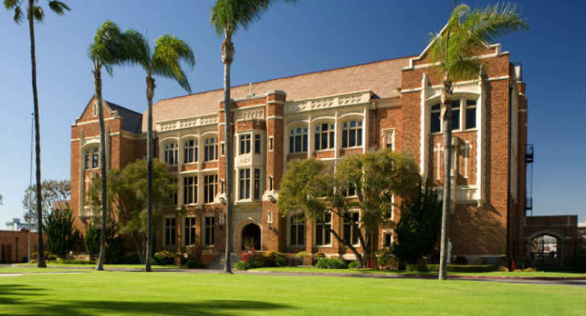
4. Loyola High School
1917
1901 Venice Blvd, Byzantine-Latino Quarter

Founded in 1865 at St. Vincent Court off of 7th Street in Downtown (a spot on the "Heart of LA" CicLAvia Tour), this Jesuit-run Catholic boys' high school is the oldest continuously-running educational institution in Los Angeles. The school moved to its current location in 1917 after splitting from the affiliated Loyola Marymount University, and after Irish philanthropist Thomas P. Higgins (who owned the Higgins Building on 2nd and Main in Downtown) donated land in what was then the southwestern corner of the city. Home of the Cubs, the school celebrated its sesquicentennial in 2015. Famous alums include volleyball great Sinjin Smith, Vons grocery founder Wilfred Von der Ahe, broadcaster Stan Chambers and holy Homeboy Fr. Greg Boyle.

5. Angelus-Rosedale Cemetery
1884
1831 W. Washington Blvd, West Adams

This 65-acre memorial park, originally established as Rosedale Cemetery, has been serving Los Angeles for the past 135 years, and is the final resting place of a number of historic Angelenos, such as Port of Los Angeles founder Phineas Banning, the City of Burbank's namesake Dr. David Burbank, jazz legend Eric Dolphy, actress Hattie McDaniel and mayors George Alexander, Arthur C. Harper, Owen McAleer, John G. Nichols, Frank Rader and Frederick T. Woodman. One of the most notable graves is that of Catalina Island developer George Shatto, who is interred in a pyramid!

6. Westmoreland Heights Tract Monument
1902
Westmoreland Avenue and Venice Boulevard, Harvard Heights

In an era before cities erected standard street signs on corners, tract home developments established concrete or masonry monuments bearing the name of the development as well as the street. This one bears the name of the Westmoreland Heights tract, established in 1899, featuring homes built in the Craftsman, Tudor/Craftsman and American Foursquare styles. Many of the residents were the owners of large local businesses. If you notice, the sign facing Venice Blvd bears the name "16th Street." West of Downtown, 16th Street is nowhere to be found on any maps (not even in La Guía de los Hermanos Tomas) - that's because 16th Street was re-named Venice Boulevard in 1932.

7. Ray Charles RPM International Studios
1964
2107 W. Washington Blvd, Harvard Heights.

This 11,488 square foot, two -story building, designed by Joe Adams and Ray Charles himself opened in 1964 as the legendary musician's personal recording studio and offices (he lived in nearby Leimert Park at the time). One of his biggest hits, "Georgia On My Mind" was recorded here, as well as his 2004 Grammy-winning swan song album, Genius Loves Company. It was designated as a Historic-Cultural Monument by the City of Los Angeles in 2004, just prior to Charles' death and since 2010 functions as the Ray Charles Memorial Library, a museum dedicated to the singer's career, featuring free tours of the facility (by appointment) on Mondays thru Wednesdays.

8. Arlington Ave - Old City Boundary
1909
Arlington Ave, Arlington Heights

Continuing the Los Angeles City Boundary history, Arlington Avenue was once the westernmost border of the City from 1896 to 1909, when the Colegrove Addition (which stretched north towards Hollywood) was annexed into the City. Note how the street dramatically widens west of Arlington - that, of course, was to accommodate both automobiles and the Pacific Electric Red Car tracks, which run the rest of the way along Venice Blvd.

9. Washington Square Market/Swap Meet
1964
4060 Washington Blvd, Mid-City

This shopping center, built in the mid-1960s used to feature a Ralphs supermarket (hence the vestigal red oval sign) and local shops. Since the 1980s the shopping center has hosted an indoor swap meet, akin to the large Slauson Swap Meet in South Los Angeles and the soon-to-close Union Discounts in East Hollywood, an indoor bazaar featuring clothing, shoes, sporting goods, repair/service stalls, salons and eateries owned by upstart immigrant entrepreneurs.

10. St. Paul's Catholic Church
1937
4120 Washington Blvd, Mid-City

Originally established on the site of a convent in 1917 among bean fields and oil derricks, the current Romanesque church building (inspired by the Basilica Papale San Paolo fuori le Mura in Rome) was built 20 years later and designed by famed Los Angeles architects John C. Austin and Frederick Ashley, who also designed the Griffith Observatory (which opened two years earlier). Today, St. Paul's serves a Spanish, English and Korean-speaking congregation. Their annual Parish Festival also happens to be scheduled concurrently with CicLAvia, so one can check out the rides, games and food in their parking lot.

11. Wellington Square
1914
Victoria Avenue, Wellington Road, Virginia Road and Buckingham Road (south of Washington Boulevard), Mid-City

Developed by M.J. Nolan on land formerly owned by George L. Crenshaw (Yup,, that Crenshaw), this four-block neighborhood features over 200 Spanish Colonial, Tudor, French Norman, Craftsman and Revival-style residences. Today, the neighborhood is starting to get Capital "G," but you can check out their weekly Farmers' Market on the parking lot at Wellington Road and Washington Boulevard, also happening on Sunday between 9 a.m. and 1 p.m.

12. First Presbyterian Church of Los Angeles
1924
1809 West Boulevard, Mid-City

This Presbyterian church community, which moved several times around Los Angeles in its 132-year history, settled at this location in 1924. The congregation became predominantly African American in makeup in the 1960s, which it remains today, although the church shares the building with a separate Korean church. This Gothic Revival church structure was also designed by John C. Austin and Frederick Ashley (architects of St. Paul's down the street, remember?), along with Frederic Roehrig, who designed Pasadena's iconic Hotel Green. Check out the old-school incinerator chimney facing Washington Blvd!

13. Nate Holden Performing Arts Center/Ebony Showcase Theater
2004/1950
4718 Washington Blvd, Mid-City

Named after the longtime African American Los Angeles city councilman (1987-2002), this City-owned facility, which opened in 2004, hosts community-based performing arts and arts education programs. It was built on the site of the Ebony Showcase Theater, the first African American-owned theater building in Los Angeles, which was founded in 1950 by actor Nick Stewart (who voiced Brer Bear in Disney's "Song of the South") and his wife Edna. That theater featured community-based performing arts programs which ran until the 1998, when the City's Community Redevelopment Agency took over the Northridge earthquake-damaged building by eminent domain.

14. Trabue Pittman Building/Willing Workers Building
1931
4801 Washington Blvd, Mid-City

This Art Deco structure, built in 1931 at the northwest corner of Washington and Rimpau (where the Los Angeles Railway's W Line ended) was designed by celebrated architect S. Charles Lee. Owned by the Tabue Pittman Corporation, it was leased to various businesses over the years, including an F.W. Woolworth's store and a Bank of America branch. Today it is the home of Willing Workers, Inc, a non-profit that trains developmentally-disabled adults for workforce employment.

15. St. Elmo Village
1969
4830 St. Elmo Drive, Mid-City

This unique artists community was founded by the late African American artist Rozzell Sykes and his nephew Roderick, who purchased several homes in the neighborhood to save them from demolition and create a multicultural artists' community as an urban experiment. The community organizes the annual St. Elmo Festival every May to celebrate the arts. Fifty years later, now run by Roderick Sykes, the community is still going strong.
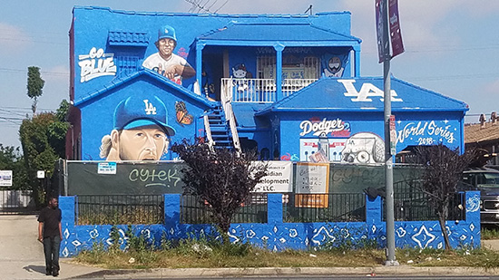
16. Dodgers Mural House
2018
1626 S. La Brea Ave, Mid-City

This unoccupied single-story house built in 1927 awaiting rehabilitation became a canvas for muralist and Dodger fan Hector "Tetris" Arias to celebrate the team's appearance in the 2018 World Series. Painted blue and featuring legendary lefties Fernando Valenzuela and Clayton Kershaw, the mural garnered media attention last Fall. The artist also painted a mural of third baseman Justin Turner on a condemned house near 62nd and Broadway in South Los Angeles prior to the team's 2017 World Series appearance, but that has been since demolished and a new structure has taken over. This mural, like the likelhood of the Dodgers' appearing in the next World Series, still remains, so expect the artist to simply upgrade the year on the mural.
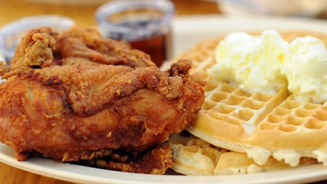
17. Roscoe's House of Chicken & Waffles (New Location)
2019
Washington Boulevard and La Brea Avenue, Mid-City

Roscoe's House of Chicken & Waffles, which was founded by Herb Hudson (no one actually knows who "Roscoe" is...) and first opened on Gower Street in Hollywood in 1975, needs no introduction. But the so-called flagship location on Pico Boulevard (visited by President Barack Obama in 2011) a half-mile north, is slated to be replaced with this new location, opening sometime this Summer, once all the permits are approved and Hudson finally pays off his Chapter 11 debt.

18. U.S. Post Office, West Adams Ray Charles Station
1983
4960 W. Washington Blvd, Mid-City

This post office building, which opened in 1983 and serves the 90016 ZIP code, was dedicated as the Ray Charles Station U.S. Post Office in August 2005, in memory of the one of neighborhood's most prominent figures, whose RPM International Studios is located just a mile and a half east. The post office joins other facilities named after legendary musical artists, such as Nat King Cole on Western and 3rd (seen in last August's "Celebrate LA" CicLAvia Tour) and Marvin Gaye, on Vermont and 35th,  dedicated earlier this month.

Happy CicLAvia!

Thursday, April 18, 2013

The Militant's Epic Militant CicLAvia Tour 4.0!!!!


View The Militant Angeleno's CicLAvia Tour 4.0! in a larger map


This Sunday's CicLAvia route, the sixth iteration of the car-free, open-streets event, and the first of three planned for this year, will be the longest and most ambitious to date. Adventurous Angelenos can bike, skate, walk or run for the 16 miles from Downtown Los Angeles to Venice Beach. Only time will tell if five all-too-quick hours is enough time for people to make it from end-to-end and back.

Already sporting bicycle lanes, Venice Boulevard is all-too familiar for cross-town cyclists. It's also the location where Mayor Villaraigosa got his legendary cycling injury in July 2010 and where The Militant biked to Venice Beach two years before then. But this time, you ain't restricted to no 4-foot bike lane!

In the spirit of CicLAvia, as a way for us to appreciate our City a little more in a different way, The Militant has been writing these guides from the beginning to help you learn a little more about our town. So here it is, for your reading (and discovering) pleasure, listed from from east to west, the 32 points of interest of The Militant's Epic Militant CicLAvia Tour 4.0!!!!


1. Italian Hall
1908
622 1/2 North Main Street, Downtown

This 105-year old building is the oldest vestige of what was once Los Angeles' Little Italy neighborhood. Built as a cultural center to serve the ethnic community, which has been present in the city since the 1820s, today, the well-restored structure, part of the El Pueblo De Los Angeles Historical Monument (a historical tour destination unto itself), is the site of Los Angeles' Italian American Museum, which will display artifacts and exhibits from the Little Italy district and the contributions of Italian Angelenos.

2. The Plaza
1825
You Can't Miss It

Los Angeles has (long exhale) often been criticized for not having a "center," The Militant countered with both an ancient center and a regional center. But The Plaza, for nearly two centuries (longer than any one of us has been here, right?), functioned as the undisputed Center of Los Angeles. Forever standing in the shadow of its tourist-heavy younger cousin Olvera Street (which you've all been to, so The Militant isn't adding it to his Epic CicLAvia Tour), The Plaza was really Los Angeles' own town square.

What's historic is not the hexagonal, wrought-iron bandstand (known as the Kiosko) -- that was built in the late 1940s as part of an urban renewal project for the El Pueblo district -- but the circular space itself, which was built in 1825 and actually functioned part-time as Los Angeles' first-ever sporting venue (bullfights were staged there in the 1800s). This was actually the third location of The Plaza. It was first established at the time of Los Angeles' founding 231 years ago, but much closer to The River. Flooding in the 1810s forced The Plaza to re-locate twice to higher ground. Hey, the third time's the charm...

3. Site of Los Angeles' French Quarter
c. 1830s-1960s
Aliso Street and Arcadia Street, Downtown

In addition to an Italian community, beleive it or non, Los Angeles had a French ethnic enclave, called The French Quarter. Before today's Hollywood Freeway trench and nearby parking lots was a bustling community of Franco-American businesses and institutions. When Frenchman Jean-Louis Vignes bought up land on the Yangna village site a few blocks east on Aliso Street, he essentially became the anchor of our French community. In 1912, businessman Marius Taix opened the Champ D'Or Hotel on Commercial Street and then opened his namesake restaurant in the same building in 1927. But the most famous constibution to our French Quarter was Philippe Mathieu's restaurant, which opened in various locations in the area. In 1918, his restaurant on 246 Aliso Street gave birth to The French Dip sandwich. But urban development (and cultural assimilation by the community) destroyed the French Quarter. In 1951, Philippe's moved a few blocks north to their present location on Alameda Street due to Hollywood Freeway construction, and Monsieur Taix's restaurant moved a decade later to Echo Park.

4. Triforium
1975
Main and Temple Streets, Downtown

This $925,000 light-and-sound public art sculpture was designed by artist Joseph Young in the mid '70s as "a tribute to the unfinished, kaleidoscopic nature of Los Angeles." Intended to be Los Angeles' own iconic answer to the Eiffel Tower or The Statue of Liberty, it was also originally planned to be equipped with motion sensors and skyward-aiming laser beams. Budget constraints put a stop to that. Despite its shortcomings, it was the world's first public sculpture to integrate light and sound by use of a computer, something us 21st century types take for granted every day (cough LA Live cough).

Though it's somewhat dated in its '70s-impression-of-the-future asesthetic (But hey, so is Star Wars), all it really needs to be hip to today's standards (it's already got its own Facebook page) is an iPod interface. Cultural Affairs Department, are you listening?

The Triforium's lights are on daily from 6-8 a.m. and from 5-7 p.m. (6-8 p.m. PDT).

5. Los Angeles Sister Cities Monument
Circa late 1980s
1st and Main streets, Downtown

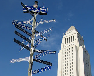
On the northeast corner of 1st and Main streets stands a pole bearing signs (in the "Blue Blade" style, no less) for every one of Los Angeles' 25 Sister Cities, each pointing towards their location. The signs range from Lusaka, Zambia (the farthest sister city, 10,017 miles) to Vancouver, Canada (the nearest, 1,081 miles) and everywhere in between. Nagoya, Japan is Los Angeles' oldest sister city (1959); Yerevan, Armenia is the newest (2007). Los Angeles, an Olympic host city (1932, 1984) also has that in common with sister cities Athens (1896, 2004), Berlin (1936), Mexico City (1968) and Vancouver (2010). Okay, the Militant is just filling up this paragraph with mindless trivia.

6. Farmers and Merchants Bank Building
1905
401 S. Main Street, Downtown

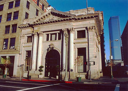
When they say "The Old Bank District," they're probably talking about this one. One of Los Angeles' early financial institutions, and also an example of historic preservation, this early 1900s Classical Revival building served as the home for Isaias Hellman's Farmers and Merchants Bank, which helped Harrison Gray Otis establish the Los Angeles Times and Edward Doheny drill for oil in the Westside. The building is used for events and filming today, and is on both the National Register of Historic Places and the Los Angeles Historic-Cultural Monument list.

7. Pacific Electric Building
1905
6th and Main streets, Downtown

Before 7th Street/Metro Center, before Union Station, was Los Angeles' O.G. transit hub, the grand headquarters of the Pacific Electric Railway. At one point the largest building in Los Angeles, the facility served trains coming in on street level along Main Street, as well as a larger elevated multi tracked platform area on the east side of the building. From here, you could take trains to all points south and east, such as San Pedro, Long Beach, Santa Ana and Huntington Beach. And the upper floors contained offices and executive lounges. The building went vacant following the fall of the P.E. in the 1960s but now lives on today as loft apartments. The 1908 Cole's P.E. Buffet restaurant (a.k.a. Philippe's bitter rival in terms of the French Dip sammich), on the north side of the building, is still in operation today.

8. St. Vincent Court
1868
St. Vincent Ct and 7th Street, Downtown

You'd hardly knew it was there, but this alley nestled between Broadway and Hill (blink and you'll miss it!), with its decorative brick pavement and European decor, seemingly belongs to another world. Originally the site of a Catholic college that was the predecessor of today's Loyola Marymount University, today it's a unique food court featuring Armenian and Middle Eastern eateries. The Militant calls it, "Littler Armenia." Check out this Militant Angeleno post on St. Vincent Court from 2008 for more info!

9. Wilshire Grand Hotel
1952
7th and Figueroa streets, Downtown

What we see today as the Wilshire Grand Hotel is the latest in a long lineage of hotels that operated from that building. Originally built as the Los Angeles Statler Hotel (one of a dozen nationwide in that chain) in 1952, it became the Statler Hilton, then the Los Angeles Hilton, then the Omni Los Angeles Hotel, and finally the Wilshire Grand. Take a good look at this hotel, though - the hotel's owner, Korean Air Lines, is in the process of demolishing it to put up the next tallest building in Los Angeles.

10. City View Lofts/Young's Market Company Building
1924
1610 W. 7th St., Pico-Union

Ever wondered what's the deal with this 4-story Italian Renaissance-style building? It was built in 1924 as a liquor warehouse and original headquarters for Young's Market Company, which still operates today as the largest liquor distributor in the West. This building features actual marble columns and a decorative frieze made of terra cotta. The company, in the roaring, pre-depression 1920s, just felt like it. The building was looted and burned in the 1992 Riots and was rehabbed in 1997 to become the City View lofts. The building is in the National Register of Historic Places.

11. Gen. Douglas MacArthur Monument
1955
Southeast corner of MacArthur Park, Westlake

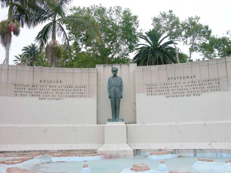
It's sort of strange how a monument to the park's namesake seems almost invisible (Gen John Pershing, MacArthur's WWI counterpart, could totally identify). In fact, most people don't know it's even there, but on the southeast shore of the lake is a dormant memorial fountain featuring a statue of the WWII general overlooking a model of the Pacific theatre (no, not that one) where he led allied forces to eventual victory. It was designed and built in 1955 by Roger Noble Burnham, who previously sculpted the Tommy Trojan statue on the USC campus and taught at the Otis Art School, formerly located nearby.

12. Casas Alicia Restoration Project
1904/1908 (Project began 2010)
1115 S. Alvarado Street, Pico-Union

Breaking up the commercial bustle of Alvarado Street in the Pico-Union District is a pair of old-school historic homes - the Casas Alicia Restoration Project of the Pico Union Housing Corporation. A pair of historic houses were moved from nearby streets onto Alvarado, which will be restored for community use. These are not just any old-school Los Angeles homes though -- The Jevne Residence (1904) was home of grocery company owner Jesse A. Jevne, who was also director of First National Bank and Southern California Savings Bank. The Colonial Revival Foursquare house was designed by Frederick Roehrig who also crafted Pasadena's Hotel Green. The other house was the Harris Newmark Residence (1908), once home of the very influential Angeleno who was one of the founding members of such institutions as the Los Angeles Chamber of Commerce, the Los Angeles Public Library, The Southwest Museum and the B'nai B'rith Congregation, of which he was considered the patriarch of our City's Jewish community. The Craftsman house was designed by Summer P. Hunt, one of the architects of the Automobile Association of Southern California building on Figueroa and Adams.

13. Iglesia Adventista Central/1st Church of Christ, Scientist
1912
1366 S. Alvarado Street, Pico-Union

Currently the site of a 7th Day Adventist Church catering to a Latino congregation, this 101-year old Mediterranean Romanesque Revival house of worship has changed owners, and even denominations, and has had a long, and even dark, history behind it. Built in 1912 as the 1st Church of Christ, Scientist, it served its Christian Science congregation for six decades, before it became a Jewish synagogue for a few years. In the mid-1970s, it became the Los Angeles location of The People's Temple, the cult founded by Jim Jones, who infamously led over 900 his followers to live in a commune in Jonestown, Guyana, and consequently, to die in the largest mass-suicide in history (which spawned the euphemism, "Don't drink the Kool-Aid"). The current Adventist church has been there since the late 1970s, since, Jim Jones uh...couldn't really use it anymore. The church structure was inducted into the National Register of Historic Sites in 1984.

14. Hoover Street (City Boundary)
1850
Hoover Street, Pico-Union

CicLAvia only runs for a few yards on this street, but note how all the streets east of Hoover run in a diagonal fashion, and all the streets west run perfectly east-west. Yes, Virginia, Los Angeles was not always big and sprawled. From 1850 to 1896, Hoover was the original western boundary of the City of Los Angeles, which meant that 120 years ago, you'd be on the Westside. On April 2, 1896, the "Western Addition" was annexed into the City, extending the boundaries a few miles west to Arlington Avenue (more on this latter...)

15. Angelus-Rosedale Cemetery
1884
1831 W. Washington Blvd (Venice Blvd and Normandie Avenue)

This 65-acre memorial park, originally established as Rosedale Cemetery, has been serving Los Angeles for the past 129 years, and is the final resting place of a number of historic Angelenos, such as Port of Los Angeles founder Phineas Banning, the City of Burbank's namesake Dr. David Burbank, jazz legend Eric Dolphy, actress Hattie McDaniel and mayors George Alexander, Arthur C. Harper, Owen McAleer, John G. Nichols, Frank Rader and Frederick T. Woodman. One of the most notable graves is that of Catalina Island developer George Shatto, who is interred in a pyramid!

16. Arlington Avenue (City Boundary)
1909
Arlington Ave, Arlington Heights

Continuing the Los Angeles City Boundary history, Arlington Avenue was once the westernmost border of the City from 1896 to 1909, when the Colegrove Addition (which stretched north towards Hollywood) was annexed into the City. Note how the street dramatically widens west of Arlington - that, of course, was to accommodate both automobiles and the Pacific Electric Red Car tracks, which run the rest of the way along Venice Blvd.


17. Victoria Park
1908
North of Venice Blvd, between Crenshaw Ave and West Blvd

This semi-gated community is come to a unique collection of craftsman homes built in the early 1900s decade, arranged on the circular Victoria Park Place. All of the homes are about a century old and are listed on the National Register of Historic Places or are recognized as Los Angeles City Historic-Cultural Monuments. The only entry, though, is on Windsor Drive, off of Pico Blvd. If you're into old-timey homes, this is one of the true hidden jewels of Los Angeles.

18. Site of Vineyard Junction
1901-1963
Venice and San Vicente boulevards

You'll know you've arrived when you cross under the bridge that crosses over Venice Blvd. The north side of the street once carried three streetcar tracks, and the south side carried automobile traffic, while a different set of tracks diverged along San Vicente Blvd. Covered in a July, 2007 Militant Angeleno blog post, this area, now occupied by the Midtown Crossing shopping center, was a crossing of a different kind a century ago when it functioned as a major junction and transfer facility for the Pacific Electric Railway and the Los Angeles Railway streetcars. It was the site of the worst accident in the history of the Red Car system a century ago, killing 14 and injuring 200, and was once planned as the western terminus of a proposed Pacific Electric subway line from the Ambassador Hotel. The Los Angeles Railway's "P" line ended at Pico and Rimpau in a famous loop, and several bus lines terminated here as well. Pacific Electric service ended here in 1950, while the Yellow Cars last ran here in 1963.


19. Ballona Creek
Chochran Ave at Venice Blvd

When you cross Chochran, pull over to the south side of Venice Blvd and you'll see the visible start of Ballona Creek. Of course, the creek does not actually begin here, but is the result of a confluence of various long-lost creeks (now entombed underground) such as the Arroyo de los Jardines and Sacatela Creek both famously blogged about by The Militant back in 2008. Like Venice Blvd itself, Ballona Creek ends up in the sea, and continuing west, we'll encounter another creek that flows into the Ballona.

20. Former Site of KHJ Radio Towers
1938-2013
Venice Blvd at Fairfax Avenue

for 75 years, this field on the northwest corner of Venice Blvd and Fairfax Avenue were the site of twin radio towers and the studios that powered KHJ 930AM, and, later on, KRTH 101.1 FM. Radio personalities such as Robert W. Morgan and "The Real" Don Steele made their names on KHJ-AM, which was, during the 60s, one of the most popular radio stations in town. Elvis Presley even visited this site. Now, the station is operated by Spanish station La Ranchera and off-site transmitters were adopted. Sadly, the landmark radio towers were demolished in late February of this year.

21. Santa Monica Freeway Bridge
1994
10 Freeway at Venice Blvd, Los Angeles

On January 17, 1994, the 6.8 Northridge Earthquake, the most recent major quake to strike Los Angeles, caused this section of the Santa Monica Freeway - some 20 miles south of the epicenter - to collapse, resulting in the closure of one of the most-traveled sections of our freeway system (and yes it was one muther clusterfugger to get around to the Westside back then). But heeeey, less than three months later (and 74 days ahead of schedule), and at a cost of $30 million, the freeway was re-opened. Who'dve thunk it?

22. Helms Bakery
1931
8758 Venice Blvd, Los Angeles

From 1931 to 1969, Angelenos knew their bread, and it came from blue-and-yellow delivery trucks from the legendary Helms Bakery, founded at this site, with eventual satellite bakeries in Montebello and San Bernardino. It was the official bread of the 1932 Olympic Games here in Los Angeles, and the bread was so renowned, it was provided to the U.S. Olympic teams in subsequent Olympiads. It was even the first bread eaten on The Moon, as part of the Apollo 11 astronauts' food rations. But you couldn't buy the bread in any store, it was only from their delivery trucks (yes, the food truck craze is not new round here). Ultimately, after an era where people bought food from delivery trucks, the Helms brand succumbed to the rise of the supermarket. This building and its trademark neon sign stand, adaptively reused, as a testament to its history and impact on Southern California. But everything old is new, and come this Fall, a resurrected Helms Bakery will be baking again!

23. Culver City Metro Expo Line Station
2012
Venice and National boulevards

Speaking of everything old is new again, The Metro Expo Line, the modern reincarnation of the Pacific Electric Santa Monica Air Line, is here to serve you. Feel free to browse the under-construction segments of Phase 2 of the Expo Line (soon the tracks will cross over Venice Blvd), opening in three years, which will reach  Santa Monica. Of course, if you want to make your way back Downtown, you're gonna have to hop on board this station. TIP: Make sure you buy a Day Pass or your TAP card is well-loaded, so you don't have to queue at the ticket machines! The Militant says "You're Welcome."

24. Pacific Electric Ivy Substation
1907
Venice and Culver boulevards

Downtown  Culver City is already rich in retail and artistic activity, and has a bevy of well-known eateries, like the popular Father's Office. The Militant can cover that in its own post (and kinda already did before). But welcoming people to Downtown Culver City along Venice Blvd, a block from the Culver City station is an appropriate link to the past - the Ivy Substation. The single-story Mission Revival-style structure served as a powerhouse for the Pacific Electric Railway from 1907 to 1953, when the Expo Line's predecessor, the Santa Monica Air Line, ceased operation. Today, it's a 99-seat venue for The Actor's Gang theatre company, renovated in the early 1990s. How interesting that a building originally built for transportation infrastructure was repurposed into a building for the arts, which in turn attract people using the new transportation infrastructure.

25. Brazilian Mall
1990
10826 Venice Blvd, Palms

Don't be afraid to get your samba on during CicLAvia! For here's a building where you can enjoy Brazilian-style pizza and shop for groceries, Belo Horizonte style. The Palms/Culver City area has been home to an enclave of Brazilians for the past 40 or so years, and other Brazilian restaurants and shops can be found just blocks away on Venice Boulevard. This place will surely by hot next year during the 2014 World Cup and two years after that for the 2016 Olympics in Rio de Janeiro. For more information, read The Militant's blog post from last year about the Brazilian Mall.

26. Sepulveda Channel
McLaughlin Ave and Venice Blvd, Mar Vista

Yet another flood control channel, this actually collects water from Westwood Creek and Stone Canyon Creek (one of the "Lost Rivers of UCLA" covered in a famous 2011 Militant Angeleno blog post) and takes it, where? Yes, good old Ballona Creek. Pretty much every place between the beach and DTLA and south of the Santa Monica Mountains belongs to the Ballona Creek watershed, and though encased in concrete,  is still part of the functioning riparian system that exists today. Of course, it would be much better if at one point, one day, some of those creeks could be daylighted and some of the concrete removed to bring them back to their natural state. A Militant can dream...

27. Venice High School
1920
13000 Venice Blvd, Venice

Venice's namesake secondary school was one of three on-location sites for Rydell High in the 1978 motion picture Grease, and was the school scene in the Britney Spears video for her debut hit, "...Baby One More Time." But it's also famous for its statue of legendary Hollywood actress and famous alumna Myrna Loy at the front of the school. Other famous alumni include Beau Bridges, Crispin Glover, the late Ivory Queen of Soul, Teena Marie and In-N-Out Burger founder Harry Snyder. Go Gondoliers!

28. Old Venice Civic Center
1911
681-685 Venice Blvd, Venice

Venice, originally founded as part of Santa Monica, seceded from that city in 1911 and for the next 15 years, functioned as an incorporated city. In 1926, due to political mismanagement and crumbling infrastructure, it was annexed into the City of Los Angeles. Its vestigial remnants of its civic government still remain, though. The old Venice City Hall still stands at 685 Venice Blvd (pictured), now the venue for Beyond Baroque Theatre. Next door on 681 Venice Blvd is the old Venice Police Station, now the home of the Social Public Arts Resource Center (SPARC), the community arts nonprofit that spearheaded the modern urban mural movement. It's interesting to note that both of these government buildings were adaptively re-used for arts purposes. The Militant is looking at the old LAPD Parker Center in DTLA and wonders if it could make some sort of badass performing arts venue...

29. Electric Avenue
1905
Electric Ave and Venice Blvd, Venice

No, '80s singer Eddy Grant didn't rock down to this street to take it higher (VROOOM!) But this street was so-named because it was one of the old Pacific Electric Red Car rights-of-way, which included Pacific Avenue (of course) and Venice Blvd. The railway, of course, was built to serve (and sell property in and around) Abbot Kinney's Venice of America development.

30. Abbot Kinney Blvd
1992
Abbot Kinney Blvd between Washington Blvd and Main Street

New arrivals to Los Angeles are likely oblivious to the fact that Venice's upscale arts and boutique corridor is technically one of its newest streets. Until 1992, that stretch was confusingly known as West Washington Blvd, which, along with Washington Street and Washington Way, was a source of disorientation among motorists. A small group of business owners lobbied to re-name the stretch after the community's founder. Ignorance of local history was so bad back then, that then-City Councilman Zev Yaroslavsky, who grew up in the Westside, asked aloud at a Los Angeles City Council committee meeting, "Who is Abbot Kinney?" (Really, Zev?!?!) Thankfully, due to a street name change, and other things, we're a lot better at our Los Angeles history.

31. Venice Traffic Circle and the Lost Canals
1929
Grand and Windward avenues, Venice

Traffic circles, or "roundabouts" as they're known in Britain, are not a common sight in the US, much less Los Angeles, though a dozen or so are known to exist here (more in a future post). So what up with this one? This part of Venice was part of Abbot Kinney's original "Venice of America," replete with its own canals. But unlike their Italian counterpart, these canals were not physically connected to the ocean, and the water had gone stagnant and kinda gross. By the 1920s, the Venice city infrastructure was falling apart (which meant little resources or political will to maintain the canals), and the automobile had started to conquer the streets of the Southland. So they were filled in circa 1929. The CicLAvia course on Grand Avenue was once the Grand Canal, and the traffic circle was formerly the location of a large saltwater swimming lagoon. The surviving canals, located south of Venice Blvd, were built by a different developer a couple years after Kinney's canals opened.

32. Windward Hotel/Pacific Electric Station
1905
Windward and Pacific avenues, Venice

The Windward Hotel, now a traveler's hostel, is not only the oldest hotel building in Venice, but its eastern ground floor entrance also functioned as Venice's Pacific Electric station. For the first half of the 20th Century, Venice was a popular western destination for the Red Cars, and the preferred way to go. North of Windward Way, there was no Pacific Avenue, but a dedicated "Trolleyway" for the Red Cars. When passengers disembarked at the Venice station before 1929, they were treated to an awe-inspiring view of the large lagoon (now the traffic circle) and canals just across the street, welcoming them to Venice of America. Now, for CicLAvia, when you arrive here, use your imagination and pretend to be transported back to a time when you didn't need cars to get around. On this day, it won't be that hard.

To download and print a copy of this tour guide or send to your unspecified tablet computing device to take with you on your ride on Sunday, please click here! (Go to File -> Print (PDF) in the Google Docs window)

Friday, October 5, 2012

The Militant's Epic Militant CicLAvia Tour 3.0!!!


View The Militant Angeleno's CicLAvia Tour 3.0!!! in a larger map

The Militant doesn't have to tell you what CicLAvia is. You know it already. And even if you haven't yet experienced the sheer joy of walking or biking on car-free streets in Los Angeles under a glorious sunny Sunday (like maybe you were out of town, or in jail, or live in f'ing Rancho Cucamonga or Fontana something), at least you've heard of it before, or at least seen your Facebook feed filled with pics people on bikes with huge smiles on their faces, posing in front of the Downtown skyline on the 4th Street Bridge.

If still not, then you're a lost cause.

Anyways, the classic CicLAvia route has had its first major change. No more are the Hel-Mel Bike District or Hollenbeck Park the termini for the route. CicLAvia has grown up and stretched out into some new territory. The Militant brought you his Epic Militant CicLAvia Tour before, now it's time for version 3.0.


1. Soto Street
1890
Soto Street (duh), Boyle Heights

It's one of the main thoroughfares of the Eastside - after all, Cheech Marin gave the street a shout-out in his hit 1985 parody, "Born In East L.A." It runs  from Lincoln Heights in the north to Huntington Park in the south. The street was not named after the late Mexican American State Assemblyman Phil Soto, as local lore has it (Though he was a native of Boyle Heights, the street was first paved when he was but one year old).

2. The Hollenbeck Bend
Circa 1900s
1st St and Chicago St, Boyle Heights

Notice how 1st Street zig-zags a little in this section of Boyle Heights? It's the neighborhood's town square, where the original LAPD Hollenbeck Police Station was located (now located just yards west) with a public plaza/green space out front and the LAPL's Benjamin Franklin Branch Library across the street.

3. Eastside Luv
2006 (Built 1940)
1835 E. 1st St, Boyle Heights

One of The Militant's favorite hangouts in the Eastside, this bar, started by a bunch of friends who grew up in nearby City Terrace, took over the former Metropolitan bar six years ago and updated it to a more contemporary Eastside-style flavor. Don't call it gentrification, call it gentefication.

4. Mariachi Plaza
1889
1st St and Boyle Ave, Boyle Heights

This is the new town square for Boyle Heights, anchored by the historic 1889 Boyle Hotel on the historic Cummings Block, where Mariachi musicians have been hanging out to get picked up for since the 1930s. The Kiosko, or bandstand, that sits in the plaza is actually not that historic. It was given as a gift from the Mexican state of Jalisco, who literally shipped it over in 1998 where it was assembled in place. But it only gets used once a year for the Santa Cecilia Festival around every November 21.
The plaza is also home of the Metro Gold Line station of the same name, which opened in 2009. The unique lending library Libros Schmibros relocated here earlier this year. This place could warrant a Militant blog post in itself -- no, an entire week of posts!

5. Simon Gless Farmhouse
1887
131 S. Boyle Ave., Boyle Heights

Back in the totally radical '80s...That's the 1880s, Boyle Heights was an open, rural area and French Basque immigrant Simon Francois Gless built a Queen Anne style house on his sheepherding farm at this location. Today, the house is a City Historic Cultural Monument and is a home that's rented out to -- Mariachi musicians! Just a few blocks west of here is Gless Street, and you might have heard of Simon's great-granddaughter -- actress Sharon Gless, who starred in the series Cagney and Lacey, which aired a century after her arrière-grand-père first settled in Boyle Heights.

6. Neighborhood Music School
1947 (Built 1890s)
358 S. Boyle Ave, Boyle Heights

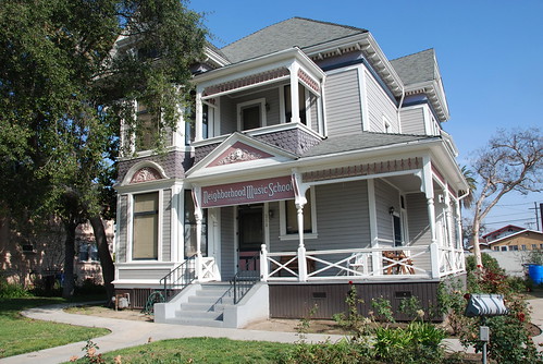
The Neighborhood Music School is exactly what it is. But it's also a Boyle Heights institution. Originally founded 98 years ago when it was located on Mozart Street (orchestral rimshot), the school moved to this Victorian home in 1947 where it still offers music lessons to local youth and the public can drop by on weekends to attend free recital concerts.

7. Keiro Retirement Home/Jewish Home For The Aging
1974/1916
325 S. Boyle Ave, Boyle Heights

With Boyle Heights being a historically Jewish and Japanese community, how's this for an ultimate Boyle Heights institution? This property was originally built in 1916 as the Jewish Home for the Aging (now operating in Reseda), and in 1974, the Keiro Senior Health Care organization, basically their Japanese American counterpart. With the Hollenbeck Palms retirement home just down the street (and site of the John Edward Hollenbeck Estate, remember?) Boyle is a popular corridor for Senior Livin.'


8. Metro Division 20 subway car yard and site of old Santa Fe LaGrande Station
1992 / 1893
320 S. Santa Fe Ave (visible from the 4th Street Viaduct), Arts District

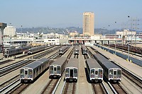
Take a break from riding/walking/skateboarding/pogo-sticking/etc. and take a glance off the north side of the bridge from the west bank of the River. This facility is where the 104 Italian-built subway cars of the Metro Red and Purple line cars are stored, repaired, serviced and cleaned. This was also the temporary storage and repair site of the Angels Flight railway cars after the fateful 2001 accident. The Militant actually visited this facility back in May 1992.

The subway cars are also serviced on the site of the old Santa Fe Railway La Grande Station (hence the name of the street) that was on Santa Fe and 2nd. Built in 1893, it was precisely where midwestern transplants arrived in Los Angeles after paying their $1 train ticket from Chicago. In 1933, the landmark dome was damaged by the Long Beach Earthquake and subsequently removed. In 1939, it was rendered obsolete by the opening of the new Los Angeles Union Passenger Terminal a few blocks north.

9. Site of Quaker Dairy, Original Little Tokyo Restaurant
1890
304 E. 1st St., Little Tokyo

On the southeast corner of 1st and San Pedro streets once stood the Quaker Dairy, a restaurant started on this site in 1890 by Sanshichi Akita, an immigrant from Japan. Though preceded five years earlier by another restaurant on First St (location unknown), this is the oldest traceable location of a Little Tokyo business. By the end of the 19th century, there were over 16 Japanese-owned restaurants in this stretch of 1st Street, creating what we know as Little Tokyo.

10. Los Angeles Sister Cities Monument
Circa late 1980s
1st and Main streets, Downtown

On the northeast corner of 1st and Main streets stands a pole bearing signs (in the "Blue Blade" style, no less) for every one of Los Angeles' 25 Sister Cities, each pointing towards their location. The signs range from Lusaka, Zambia (the farthest sister city, 10,017 miles) to Vancouver, Canada (the nearest, 1,081 miles) and everywhere in between. Nagoya, Japan is Los Angeles' oldest sister city (1959); Yerevan, Armenia is the newest (2007). Los Angeles, an Olympic host city (1932, 1984) also has that in common with sister cities Athens (1896, 2004), Berlin (1936), Mexico City (1968) and Vancouver (2010). Okay, the Militant is just filling up this paragraph with mindless trivia.

11. New Los Angeles City "Chevy Logo" Street Signs
2009
Various locations along 1st Street, Downtown

Speaking of Blue Blades, and since you're on 1st Street, don't forget to see Los Angeles' new street signs! Featuring a reflective background and typeface, the City Seal and shaped like the Chevrolet logo, these were the subject of The Militant's now-legendary recent post on Los Angeles street signs. Now you can see them for yourself!

12. Los Angeles Police Administration Building
2009
100 W. 1st St, Downtown

Having opened just three years ago to replace the old Parker Center down the street, and featuring large open public spaces surrounding it, there's nothing really historic about this building, but do stop and take a picture of City Hall's reflection from the facade's glass panel. It's like, the thing to do.

13. Old State Office Building Foundation
1931 (Demolished 1971)
1st and Spring streets, Downtown

Ever wonder about that park-like area across the street from City Hall, and why there appears to be a foundation but no building? It was once the site of the State Office Building (pictured left, looking north on Spring), which was built in 1931. Forty years later, the 6.4 Sylmar Earthquake rendered it unsafe, and it was demolished. The land was once an openly-accessible parkspace; the Militant remembers going to a demonstration there as a child (Oh this Militant stuff sure started early...)

NOTE: If going on the northern leg to Chinatown, skip down to 22.

If continuing south on Spring Street, read on:


14. Site of the Wilcox Building, First National Bank
1896
2nd and Spring streets, Downtown

John Edward Hollenbeck of Boyle Heights fame made some  serious bank! No, really, he literally did. He founded a bank called the First National Bank of Los Angeles, which made its original home here on the southeast corner of 2nd and Spring in what once stood the Wilcox Building. Check this out: First National Bank merged with the Farmers and Merchants Bank to become the Security-First National Bank, which became Security Pacific National Bank (1967), and was eventually purchased by Bank of America in the 199os.

15. Site of Hollenbeck Hotel
1884
2nd and Spring streets, Downtown

Man, this Hollenbeck dude got around! We're not quite through with him yet. Directly across Spring Street from the bank (on what is now a parking lot) stood the Hollenbeck Hotel, a pretty swanky, bougie inn back in the day. He owned not just the hotel, the entire block the hotel stood on (He sooo money!). As more hotels were being built in Downtown, this one eventually lost ground to its competitors and was demolished in 1933.

16. Site of Original Ralphs Supermarket
1873
6th and Spring streets, Downtown

Before the Hotel Hayward building was built in 1905, George A. Ralphs (see, that's why there's no apostrophe) and his brother Walter B. started the Ralphs Bros. Grocers on the southwest corner of 6th and Spring. Their company still continues to this day, and in 2007, the company that started in DTLA returned to the area after some 50 years.

17. St. Vincent Court
1868
St. Vincent Ct and 7th Street, Downtown

You'd hardly knew it was there, but this alley nestled between Broadway and Hill (blink and you'll miss it!), with its decorative brick pavement and European decor, seemingly belongs to another world. Originally the site of a Catholic college that was the predecessor of today's Loyola Marymount University, today it's a unique food court featuring Armenian and Middle Eastern eateries. The Militant calls it, "Littler Armenia." Check out this Militant Angeleno post on St. Vincent Court from 2008 for more info!

18. Wilshire Grand Hotel
1952
7th and Figueroa streets, Downtown

What we see today as the now-closed Wilshire Grand Hotel is the latest in a long lineage of hotels that operated from that building. Originally built as the Los Angeles Statler Hotel (one of a dozen nationwide in that chain) in 1952, it became the Statler Hilton, then the Los Angeles Hilton, then the Omni Los Angeles Hotel, and finally the Wilshire Grand. Take a good look at this hotel, though - the hotel's owner, Korean Air Lines, will soon demolish it and put up a big-ass hotel with crazy-ass LED advertisements on the building in the next few years.


NOTE: If going on the southern leg to Exposition Park, skip down to 27.

If continuing west on 7th Street, read on:


19. City View Lofts/Young's Market Company Building
1924
1610 w. 7th St., Pico-Union

Ever wondered what's the deal with this 4-story Italian Renaissance-style building? It was built in 1924 as a liquor warehouse and original headquarters for Young's Market Company, which still operates today as the largest liquor distributor in the West. This building features actual marble columns and a decorative frieze made of terra cotta. The company, in the roaring, pre-depression 1920s, just felt like it. The building was looted and burned in the 1992 Riots and was rehabbed in 1997 to become the City View lofts. The building is in the National Register of Historic Places.

20. Gen. Douglas MacArthur Monument
1955
Southeast corner of MacArthur Park, Westlake

It's sort of strange how a monument to the park's namesake seems almost invisible (Gen John Pershing, MacArthur's WWI counterpart, could totally identify). In fact, most people don't know it's even there, but on the southeast shore of the lake is a dormant memorial fountain featuring a statue of the WWII general overlooking a model of the Pacific theatre (no, not that one) where he led allied forces to eventual victory. It was designed and built in 1955 by Roger Noble Burnham, who previously sculpted the Tommy Trojan statue on the USC campus and taught at the Otis Art School, formerly located nearby.

21. Gen. Harrison Gray Otis Statue
1920
Northeast corner of Wilshire and Park View, Westlake

Gen. Otis is perhaps the most visible statue at the park, which predates MacArthur's WWII service. This general served in the Spanish-American and Philippine-American wars, and also fought as a Union soldier in the Civil War. But in Los Angeles, he is most known for being the founder, owner and publisher of the Los Angeles Times.

So why is he here? His Wilshire Blvd mansion, called The Bivouac, was located across the street, was later donated to Los Angeles County and became the original campus of Otis Art Institute. It's thought that his statue is pointing to the site of the Elks Lodge, but he's probably just pointing to his old house.


NEW! Northern Leg (To Chinatown):


22. Grand Park
1960, 2012
Open space between Grand Avenue and Spring Street, Downtown

The Militant was there on its opening day back in July, which was only the opening of half of the new park, which isn't really a new park, but a renovation and re-branding of what used to be the Los Angeles County Mall. But the eastern half opens the day before CicLAvia, so many Angelenos will get to enjoy this part of the park for the first time. And those Occupy folks will have an entirely new place to camp out in. Did The Militant just say that? Mic Check...1-2...Hello, is this thing on?


23. Site of Los Angeles' French Quarter
c. 1830s-1960s
Aliso Street and Arcadia Street, Downtown

Beleive it or non, Los Angeles had a French ethnic enclave, called The French Quarter. Before today's Hollywood Freeway trench and nearby parking lots was a bustling community of Franco-American businesses and institutions. When Frenchman Jean-Louis Vignes bought up land on the Yangna village site a few blocks east on Aliso Street, he essentially became the anchor of our French community. In 1912, businessman Marius Taix opened the Champ D'Or Hotel on Commercial Street and then opened his namesake restaurant in the same building in 1927. But the most famous constibution to our French Quarter was Philippe Mathieu's restaurant, which opened in various locations in the area. In 1918, his restaurant on 246 Aliso Street gave birth to The French Dip sandwich. But urban development (and cultural assimilation by the community) destroyed the French Quarter. In 1951, Philippe's moved a few blocks north to their present location on Alameda Street due to Hollywood Freeway construction, and Monsieur Taix's restaurant moved a decade later to Echo Park.


24.  Buu Dien
c. 1990s
642 N. Broadway (Facing New High St, south of Ord), Chinatown

If you're ever in some TV trivia contest on your way to being a millionaire and the host asks you, "What is the Militant Angeleno's favorite Vietnamese banh mi place west of the Los Angeles River?" you won't need to call a lifeline, because the answer is Buu Dien. When the Militant has only $4 in his pocket and wants to get a meal in Downtown, this is his go-to joint. A literal hole in the wall in every regard, this place serves bomb-ass (do people still use that phrase) Viet sammiches for less than $3 a pop. And the bread is awesome. And nice and warm. Plus they also serve up spring rolls, desserts, pastries, Vietnamese coffee and pho (never had it here yet, but The Militant's favorite pho WOTLAR is Pho 79 just up the street). People complain about parking in his micro-mini mall, but this is CicLAvia!

25. Capitol Milling Co.
1883
1231 N. Spring St, Chinatown

One of the last visible vestiges of Los Angeles' agricultural industry, this family-owned flour mill operated from 1831 to 1997, before moving its operation to a much larger facility in Colton. The facility that still stands today was built in 1883. The mill supplied flour to clients such as Ralphs, Foix French Bakery and La Brea Bakery. In 1999, the family-owned operation was purchased by industry giant Con-Agra Co.


The historic building, built even before the railroads arrived in Los Angeles, still has a horse-tethering ring, back to the days when grain was hauled by horse carriage from farms in the San Fernando Valley.


26. Old (New?) Chinatown Central Plaza
1937
Gin Ling Way between Broadway and Hill, Chintown

The new northern terminus of CicLAvia is no stranger to public events; it was made for them. In the Summer it hosted three very popular Chinatown Summer Nights events. But don't let the "Old Chinatown" neon sign fool you -- This is actually Los Angeles' new Chinatown, which dates back to the 1930s. The real Old Chinatown was several blocks south, where a thriving community of Cantonese-speaking immigrants

lived near the river, north of Aliso Street. Of course, they were kicked out in the early '30s to make room for Union Station. So they moved a few blocks north, in the former Little Italy, and they've been there ever since. Well, not really, since some of them moved east to the San Gabriel Valley and were supplemented with Mandarin-speaking immigrants from Taiwan and Mainland China. But you get the idea.

NEW! Southern Leg (to Exposition Park): 

27. Original Pantry Cafe
1950
877 S. Figueroa St, Downtown

Y'all know this establishment for its coffee, its cole slaw and its current owner, former mayor Richard Riordan. It was one of DTLA's first 24-hour restaurants when it opened in 1924 and hasn't closed since. But did you know it was originally located a block away? Its original location was 9th and Francisco streets, which had to be torn down to make room for a Harbor Freeway off-ramp in 1950. Today it remains a Downtown institution, popular for dining after nearby sporting events, clubbing or drunken bar-hopping.


28. Convention Center/Site of Georgia St. Streetcar Facility
1901
Georgia St and 11th St, Downtown

This site is home of today's Convention Center and what may or may not be tomorrow's Farmers Field, but it was also the Georgia Street Shops - a major streetcar maintenance facility in yesterday's world serving trolleys for the old Los Angeles Railway (Yellow Cars). After the system ended in 1963, the large swath of land became a prime location for the city's Convention Center, once proposed to be located where Dodger Stadium now stands.


29. The Cathedrals at Figueroa & Adams
c. 1920s
Figueroa St and Adams Blvd, West Adams

At the intersection of Figueroa and Adams stands three cathedrals built in the 1920s - Two to Christendom and one to the automobile. On the northwest corner is the Churrigueresque-style (Think Million Dollar Theater)  St. Vincent de Paul Catholic Church, built in 1923 and designed by local architect Albert C. Martin, Sr., who also designed today's Los Angeles City Hall. On the southeast corner is the Neo-Romanesque St. John's Episcopal Cathedral (1925; designed by brothers Pierpont and Walter Davis) and on the southwest corner is the Automobile Club of Southern California's Spanish Colonial Revival headquarters, built in 1922 and designed by Summer P. Hunt and Silas R. Burns, who also designed the Southwest Museum.


30. Felix Chevrolet
1957
3330 S. Figueroa St, University Park

This long-standing automobile dealership has stood at Figueroa and Jefferson since the late 1950s, Named after founder Winslow Felix, who originally established his dealership at 12th and Grand in 1921, the famous cartoon cat became part of the branding image of the car lot thanks to Felix's friend, Pat Sullivan, the animator who created the animated feline.


31. USC Widney Alumni House
1880
Childs Way and Pardee Way, west of Figueroa St, University Park

The original building of one of Los Angeles' most prominent institutions of higher learning (one of the schools which The Militant may or may not have graduated from) stands just yards from the Expo Park/USC station at the relatively new entrance of the University of Southern California, on Exposition Blvd and Pardee Way. The Widney Alumni House is the oldest building on campus, built when the university was founded in 1880. Though it has moved a few times from its original location, it's considered a sacred historical artifact by the university.

32. Exposition Park
1872
Exposition Blvd, Figueroa St, Martin Luther King Jr Blvd and Vermont Ave, Exposition Park

Built in 1872 as "Agricultural Park" (when much of Los Angeles was farmland), it was given its present name a century ago. Not because it hosted a World's Fair/World Expo (it never did), but because it was part of the late 1800s-early1900s "City Beautiful Movement" urban planning philosophy that created beautified streetscapes and monumental structures in cities across North America. The 160-acre park in its present form began with the establishment of the Museum of Science and Industry (now California ScienCenter - soon to be the new home of the Space Shuttle Endeavour, arriving next weekend), the National Armory, the Natural History Museum and the Rose Garden (at one time the largest rose garden in the world).

33. Los Angeles Memorial Coliseum
1923
3939 S. Figueroa St, Exposition Park

You already know this venue as Los Angeles' most revered and historic, yet most neglected, athletic stadia. It's the only building in the world to host The Olympics (twice, in fact), the Super Bowl and The World Series. It's served as home base for the Rams, the Chargers, the Raiders, the Trojans, the Bruins, the Dodgers and even the now-defunct Aztecs and Xtreme. The Lakers, Kings and Clippers also played on the Coliseum grounds. The Militant was personally there to see the world's largest-attended baseball game evar and the Lakers' 2009 championship celebration. This is the home of Los Angeles sports, baby.

It's also hosted everything from religious ceremonies to porno videos, from motocross to concerts (This was where, in 1981, the opening act for The Rolling Stones was boo'ed offstage by the crowd...it was some dude named Prince).

That said, it's in desperate need of new seats.

But from now on, you have absolutely no need to park at or near the Coliseum for any of its events!

34. Historic Southern Pacific Palm Tree
Re-planted 1914
3939 S. Figueroa St, Exposition Park

A palm tree. So what. We got a lot of 'em round here.

Well, this one is different. Back in the late 1800s-early 1900s, the Southern Pacific Railroad operate out of a train station called the Arcade Station, on 5th and Alameda streets. A lone palm tree stood outside the station and functioned as a landmark for arriving passengers coming in from San Francisco or points east. In 1914 the Arcade Station was demolished (no, it wasn't consumed by a fire) to make way for a more modern station, called Central Station, and the palm tree had to go. So sentimental was the palm tree, instead of being cut down, it was moved to Exposition Park, where it has stood ever since. Like its soon-to be neighbor the Space Shuttle Endeavour, it was a popular icon back in its day, and it's probably safe to assume that its transport through town was an event in itself. A little-known historic market at the base of the tree tells the whole story.

Here's' a picture of the tree in its younger days, in front of the old Arcade Station.

Enjoy CicLAvia and Stay Militant!